logo

1766. Carte Nouvelle d'Amerique : pour les premières ètudes . . . 1766

  • Carte Nouvelle d'Amerique : pour les premières ètudes . . . 1766

Carte Nouvelle d'Amerique : pour les premières ètudes . . . 1766 information:

Year of creation: 
Resolution size (pixels): 
 9745x6749 px
Disk Size: 
 11.8337MiB
Number of pages: 
 1
Place: 
 Paris

Print information. Print size (Width x height in inches):
Printing at 72 dpi 
  135.35 х 93.74
Printing at 150 dpi 
 64.97 х 44.99
Printing at 300 dpi 
 32.48 х 22.5

An example of detailing the file of this map of in a printable high-resolution:

Click to open in high resolution (open in new tab).
Attention! this is just the central piece (central area 960x960 px) of the map file!
This is an example, so that you can see and study the level of detail of a given map. The entire Map will be fully available after payment!

Carte Nouvelle d'Amerique : pour les premières ètudes . . . 1766

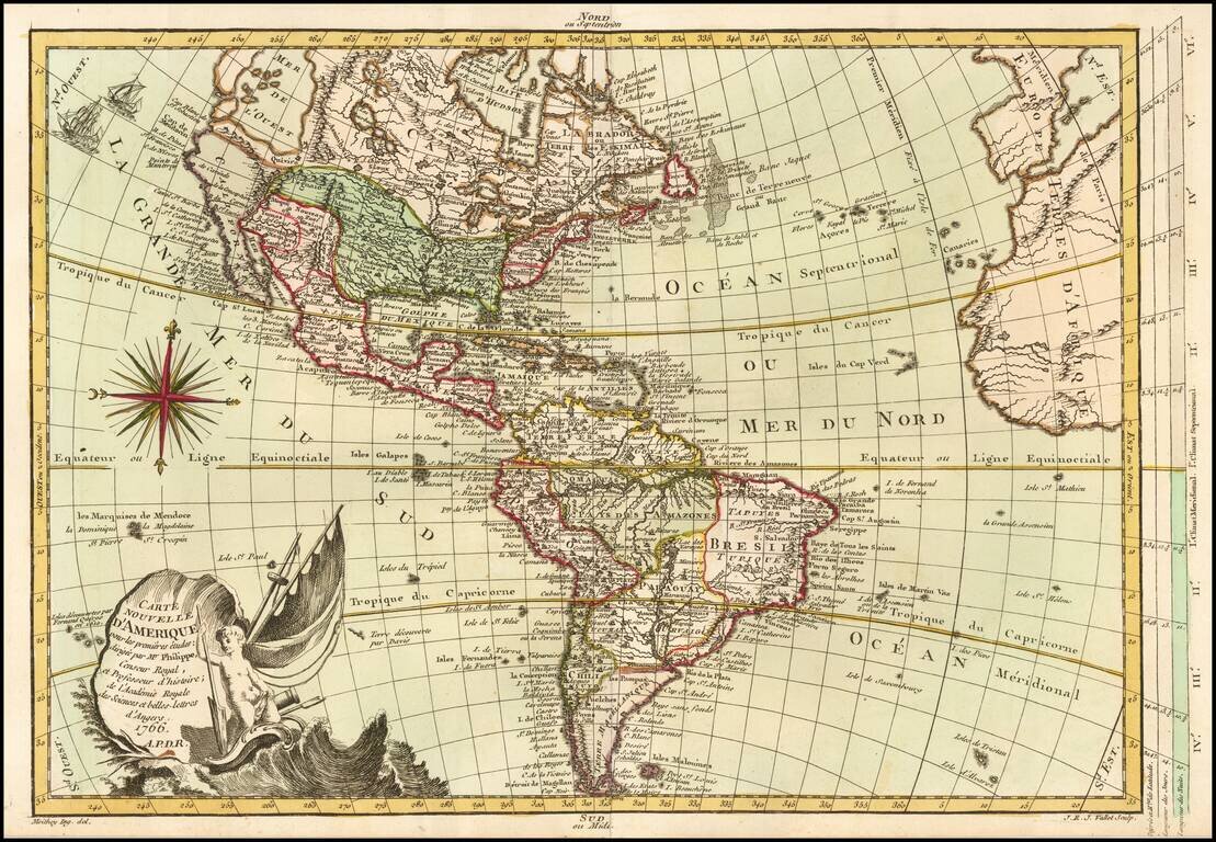
Fine old color example of the first state of this scarce map of America, published in Paris.

Includes a massive Bay of the West, curious depiction of Florida and an unusual wide projection of North America.

California is still baed upon de L'Isle's maps.

Includes and elaborate compass rose.


Special conditions for students!

If you are a student, write to us in telegram: @antiquemaps and indicate what material you need and for what work you need a map in high detail. We are ready to provide material on special terms. For students only!

Item information:

Year of creation:
Size:
9745x6749 px
Disk:
11.8337MiB
Number of pages:
1
Place:
Paris
Author:
Etienne-Andre Philippe De Pretot.
$14.99

Related item