logo

1750. Amerique

  • Amerique

Map size in jpg-format: 20.0933MiB

Download "Amerique", in high resolution.

Amerique information:

Year of creation: 
Resolution size (pixels): 
 11602x7651 px
Disk Size: 
 20.0933MiB
Number of pages: 
 1
Place: 
 Paris
Author: 

Print information. Print size (Width x height in inches):
Printing at 72 dpi 
  161.14 х 106.26
Printing at 150 dpi 
 77.35 х 51.01
Printing at 300 dpi 
 38.67 х 25.5

An example of detailing the file of this map of in a printable high-resolution:

Click to open in high resolution (open in new tab).
Attention! this is just the central piece (central area 960x960 px) of the map file!
This is an example, so that you can see and study the level of detail of a given map. The entire Map will be fully available after payment!

Amerique

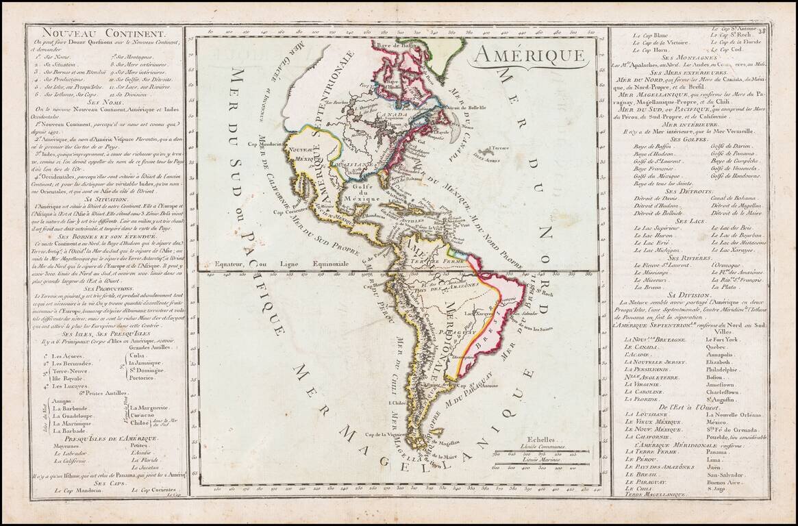
Interesting map of America from the mid-18th Century.

The map illustrates the state of America on the eve of the Seven Years (French & Indian) War.


Special conditions for students!

If you are a student, write to us in telegram: @antiquemaps and indicate what material you need and for what work you need a map in high detail. We are ready to provide material on special terms. For students only!

Item information:

Year of creation:
Size:
11602x7651 px
Disk:
20.0933MiB
Number of pages:
1
Place:
Paris
Author:
Anonymous.
$14.99

Related item