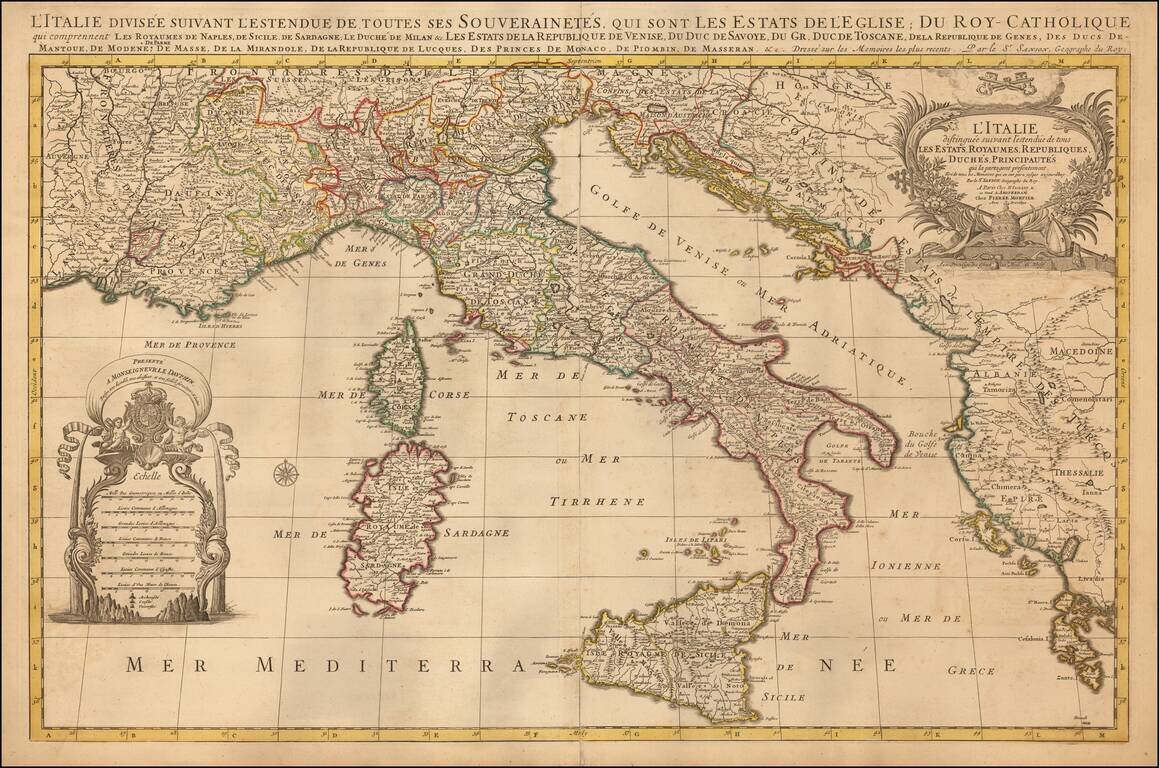
Striking large and highly detailed map of Italy and the Adriatic, published in Amsterdam by Mortier. Includes two decorative cartouches.
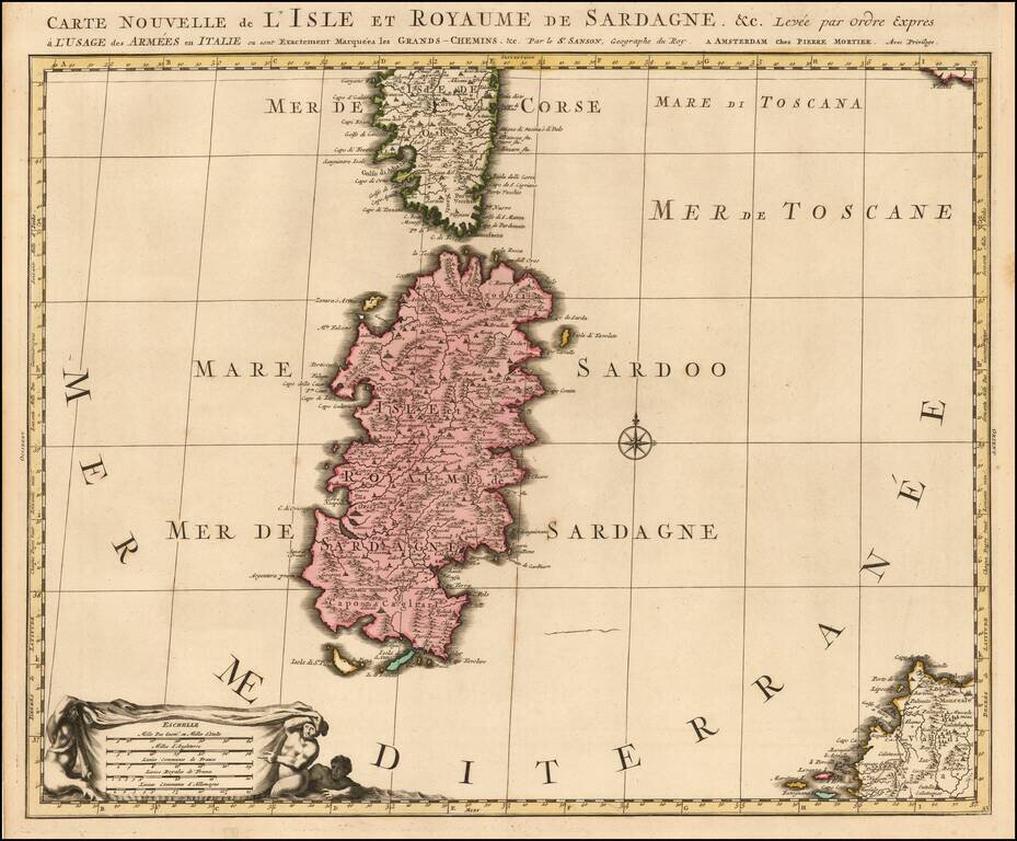
Early state of the Mortier map of Sardinia. The map would later be re-issued by Coven & Mortier, with a number of ships and battle scenes.
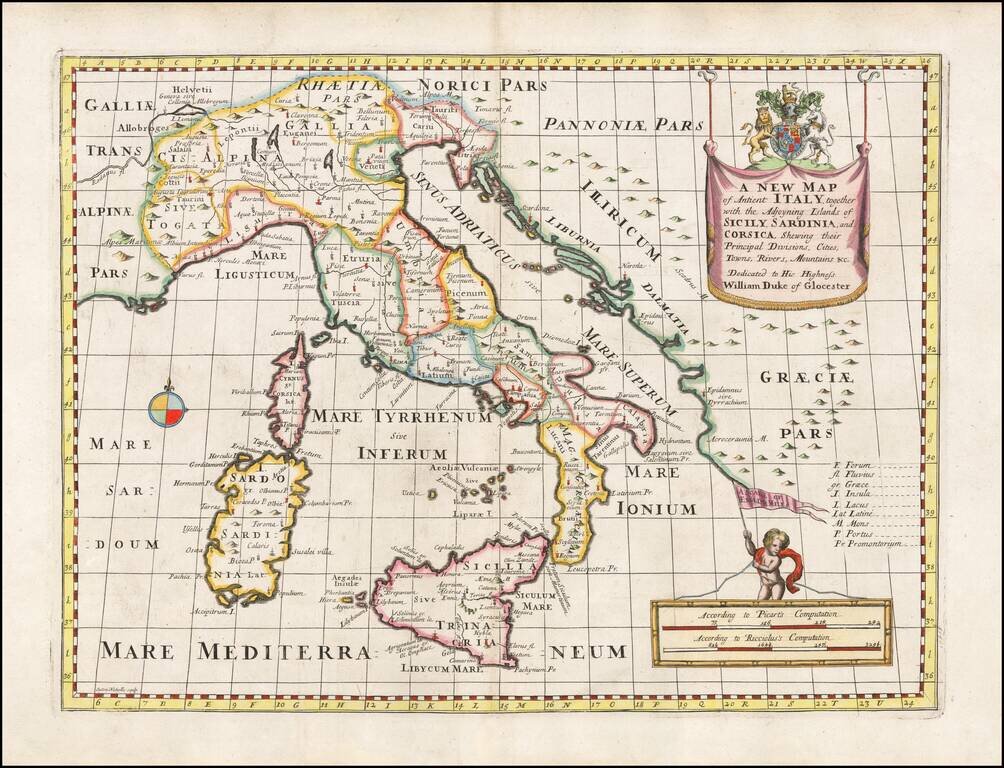
Decorative anicent map of Italy at the beginning of the 18th Century. This map was part of an atlas dedicated to the Duke of Glocester, who was then and 11 year old student attending school in Oxford.
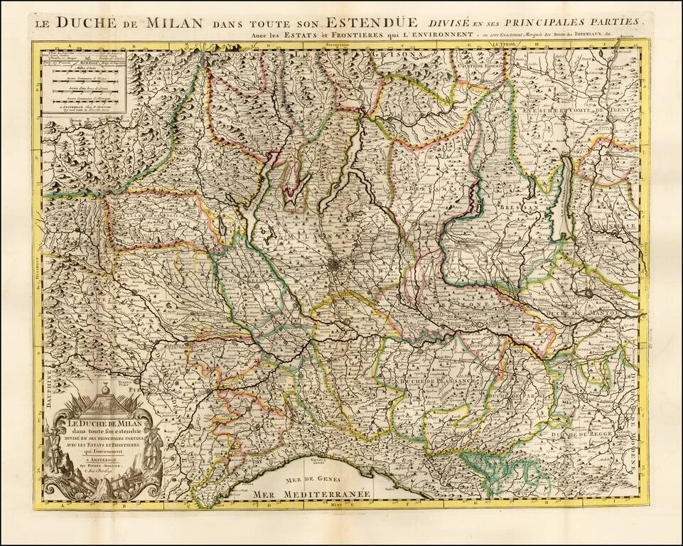
Highly detailed map of the Duchy of Milan, published by Pierre Mortier. The map is centered on Milan and shows the region from Genoa to Lago di Como, Lago Magiore, Lago di Garda and the Swiss Alps.
![[Corsica, Sardinia, Northern Italy]](/map/small/56055.jpg)
Striking large and highly detailed map of the North part of Italy, with Corsica and Sardinia.
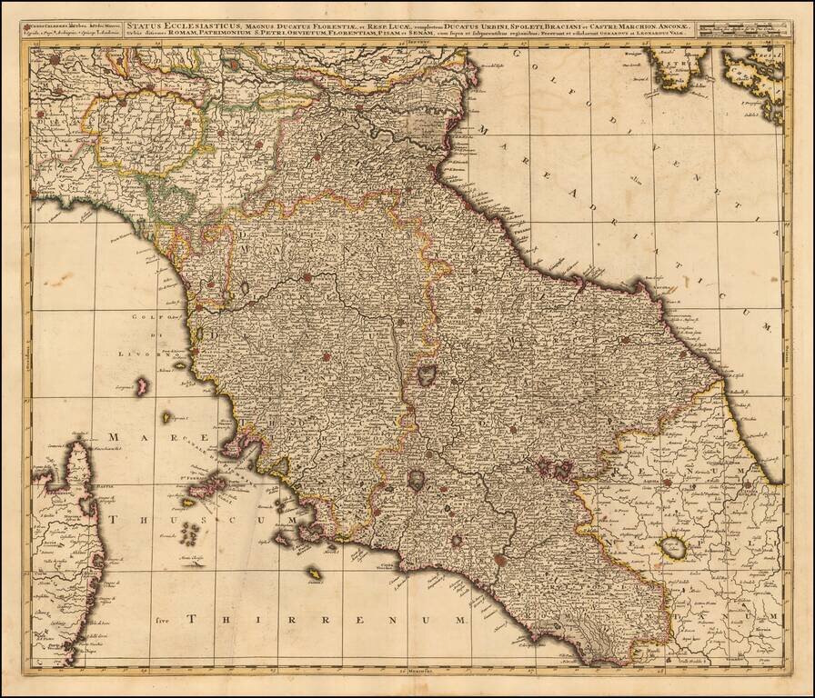
Striking map of Central Italy, from Milan, Mantua and Rvigo in the North to Rome, Aquila and Civita in the South and including a portion of Sardinia and various islands in the region.
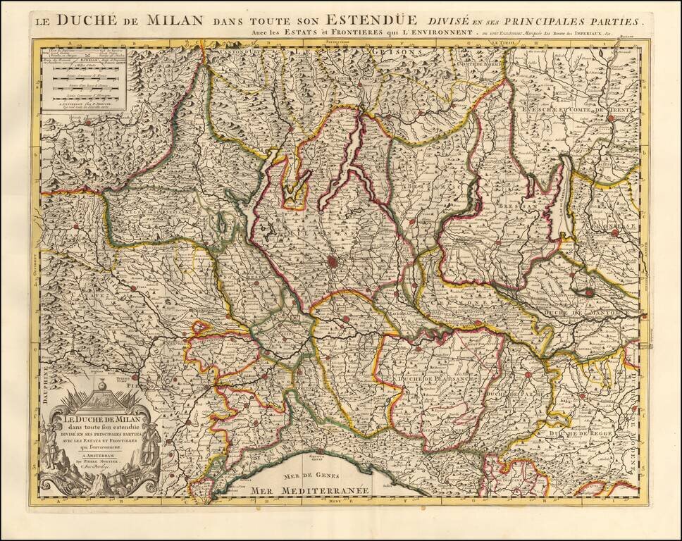
Highly detailed map of the Duchy of Milan, published by Pierre Mortier. The map is centered on Milan and shows the region from Genoa to Lago di Como, Lago Magiore, Lago di Garda and the Swiss Alps. The map features a decorative cartouche in the lower...
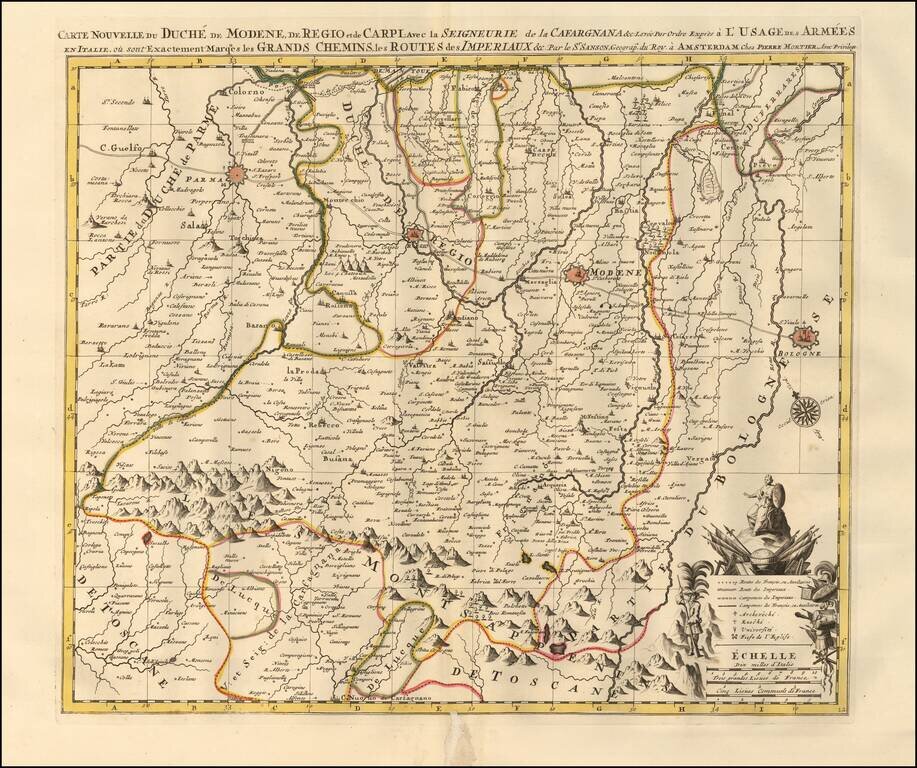
Map showing the Duchy of Modena, Reggio and Carpi in northern Italy, illustrating the roads and pathways utilized by the Italian and French armies throughout the region. The map highlights key fortified zones in and around Modena, Reggio, Parma, and...
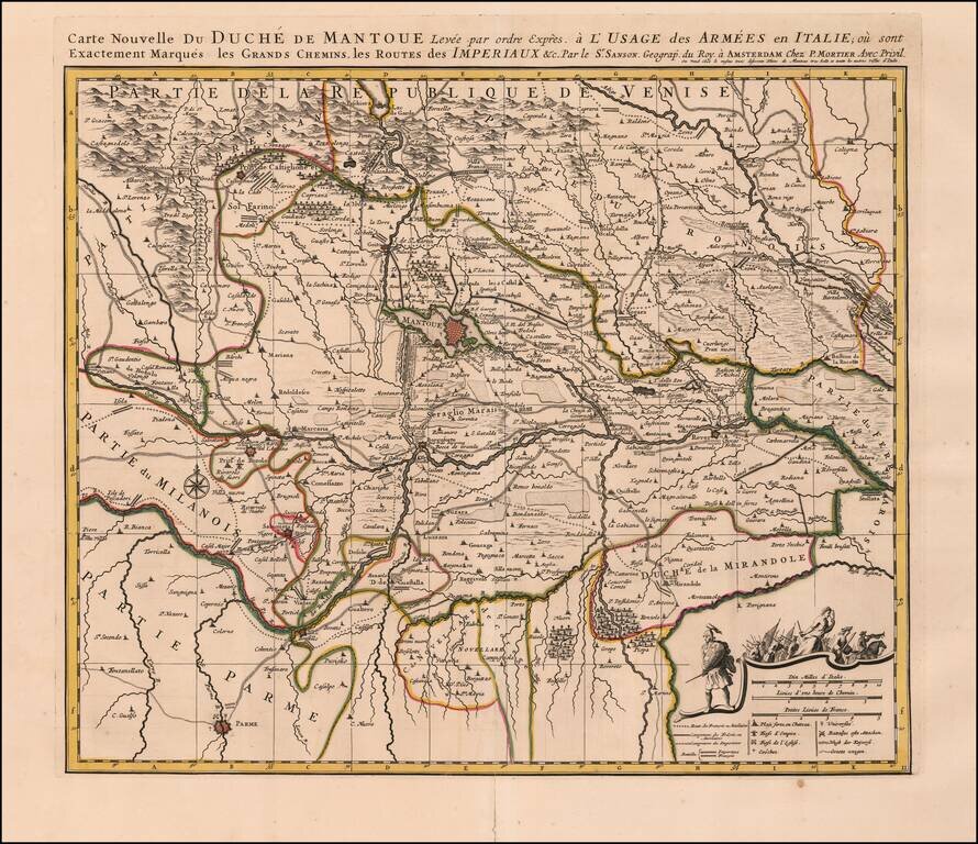
Detailed map of the Duchy of Mantua in Italy. Includes roads, pathways, mountainous regions and forests the Italian and French armees used to navigate through the region. The map also illustrates fortified zones colored in red, such as Mantua, Rever,...
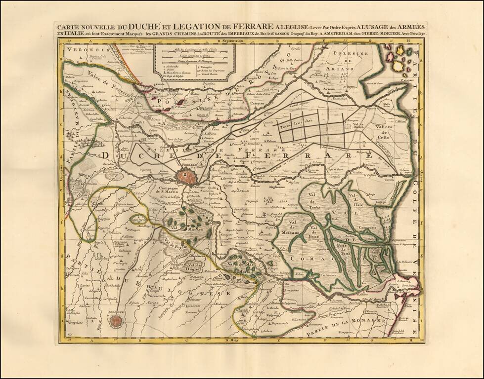
Detailed map of the Duchy of Ferrara in Italy. Includes major roads, pathways, and valleys the Italian and French armees used to navigate through the region. The map also illustrates fortified zones in Ferrare and Bologna. The map features...
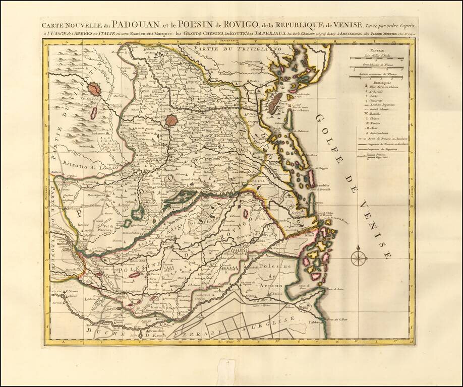
Detailed map of Padua, Italy. Includes the Province of Rovigo and the Gulf of Venice. The map illustrates the islands, roads, pathways, valleys, mountainous regions, forests and waterways the Italian and French armees used to navigate through the...
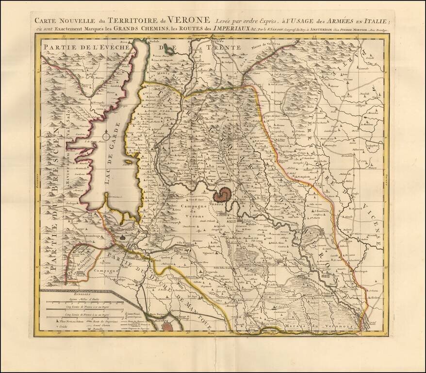
Detailed map centered on Verona, Italy. Published in Amsterdam, circa 1700. The map illustrates roads, lakes, mountain ranges, and plains the armees traveled through the region. Lago Di Garda is prominently featured along with the mountain ranges of...
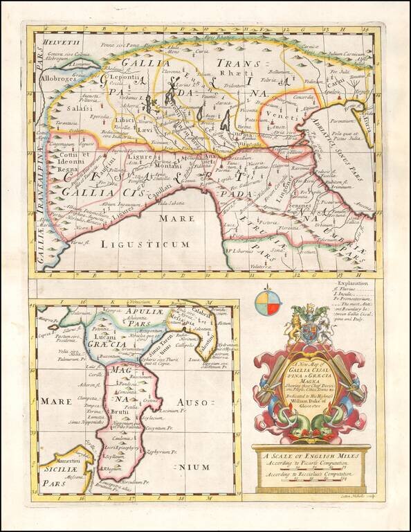
Decorative map of parts of France and Northern Italy and a second map of Southern Italy, with a decorative cartouche. From a special geographical text prepared for William, Duke of Glouchester, during his time at Oxford.
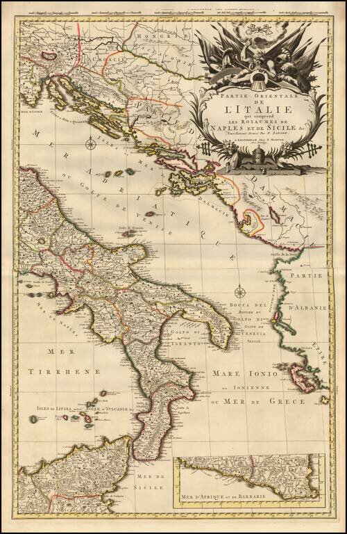
A fine example of Pieter Mortier's map of Eastern Italy which includes the Kingdoms of Naples and Sicily. The map details the surrounding areas of Italy such as the Dalmatian Islands in the Adriatic, the Aeolian Islands north of Sicily in the...
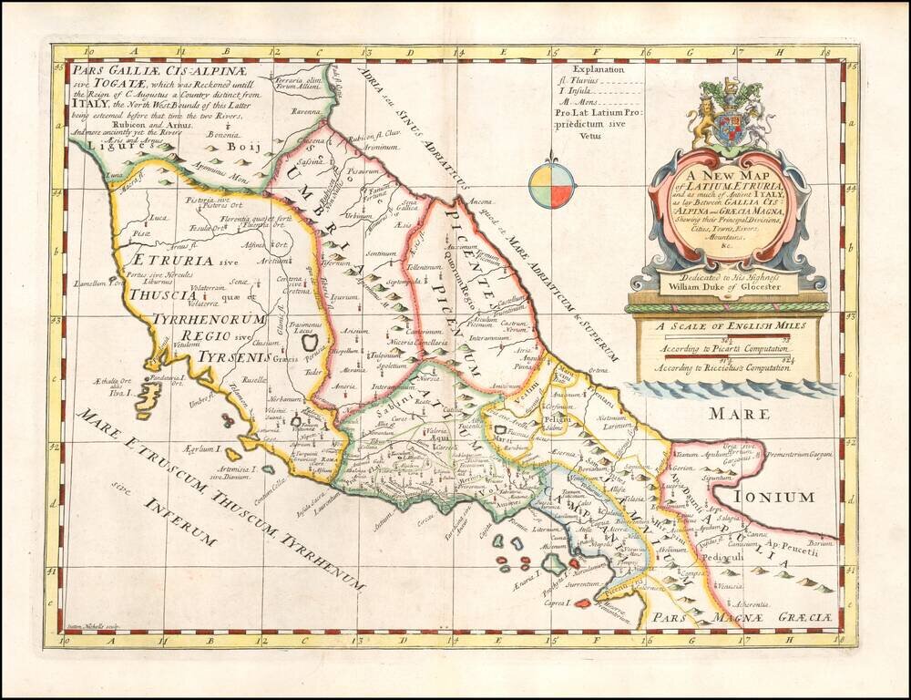
Decorative regional map of the Central and Southen Regions of Italy, as known in ancient times. This decorative map was part of a set of 22 maps dedicated to William, Duke of Glouchester, who was then an 11 year old student at Oxford.
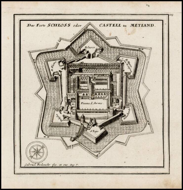
Detailed plan of the Castle of Milan, published by Gabriel Bodenehr.