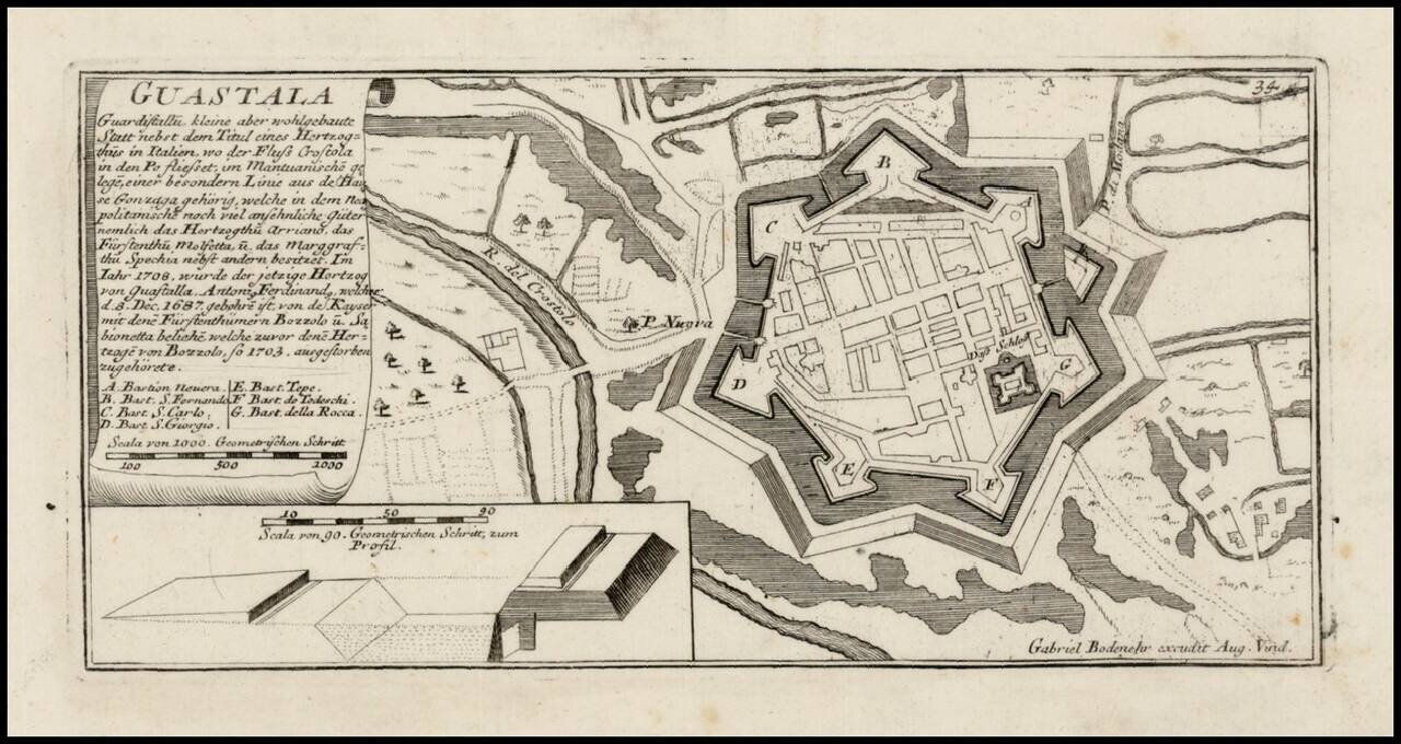
Detailed view and plan of the fortifications of the City of Verona, published by Gabriel Bodenehr.
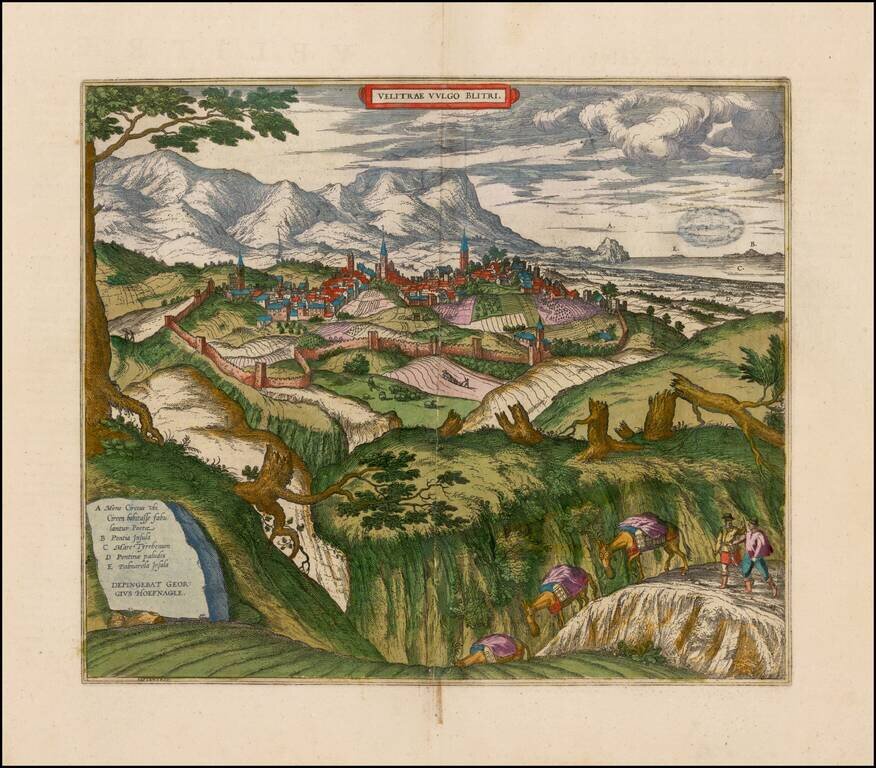
Decorative birdseye view of Velletri from Braun & Hogenberg's Civitatus Orbis Terrarum. Fine view from the northwest of Velletri and the hills around Coru. On the right the Pontine marshes (D) can be seen, and in the distance Capo Circeo (A) and...
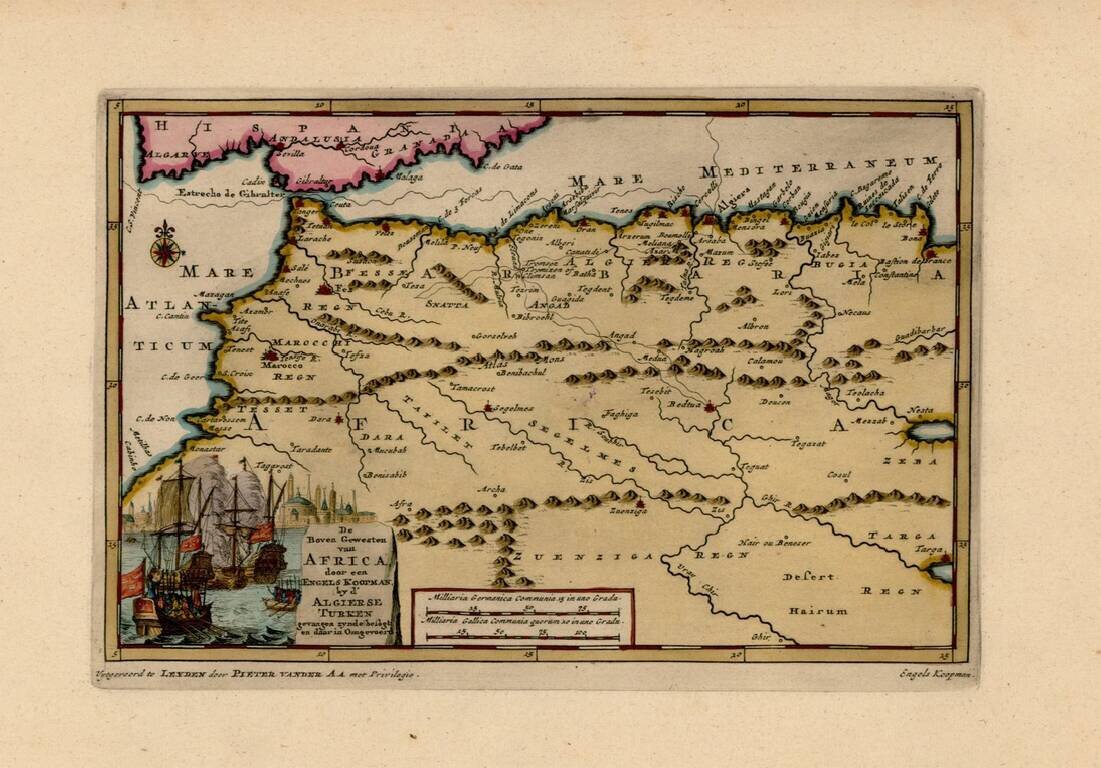
Interesting map of the Western Mediterranean and contiguous parts of Spain and North Africa, showing the tracks of Engels Koopman in 1648. The map offered here was used by Vander Aa to illustrate a Dutch Translation of Koopman's travels in the region...
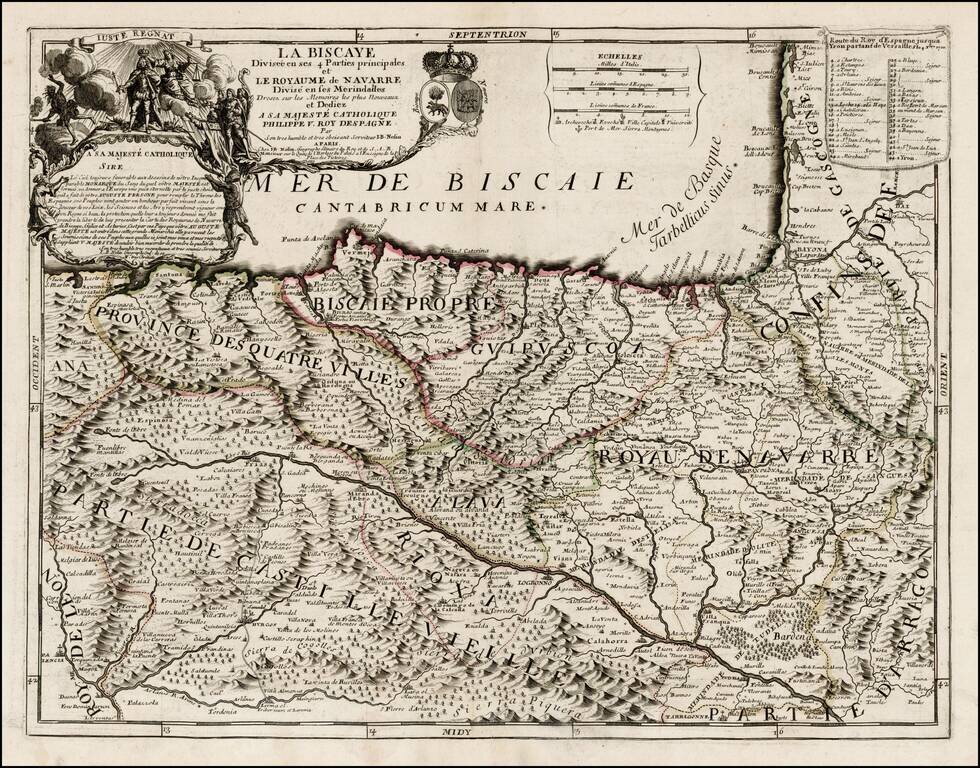
First state of this rare map of Biscaya and Navarra, likely offered originally as a separately issued map and primarily bound into composite atlases of the period. Includes a striking dedication cartouche to Philip V of Spain, with the young King shown...
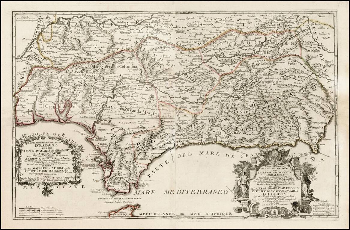
First edition of Nolin's rare 2 sheet map of southern Spain, published in Paris. Two title cartouches, with titles in French and Spanish, coats of arms, etc. Includes fantastic topographical detail. Later editions were issued until about 1760.
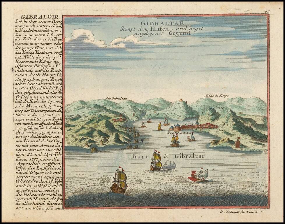
Detailed view and plan of the the Harbor and Fortifications at Gibraltar, published by Gabriel Bodenehr.
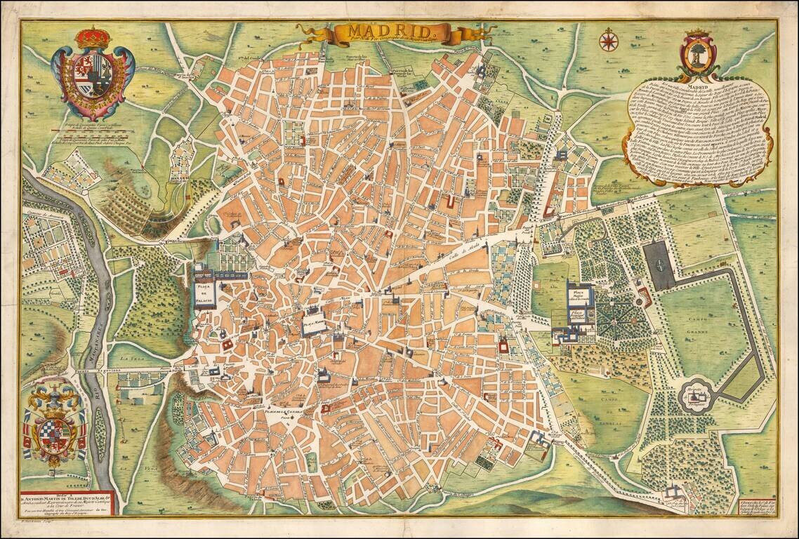
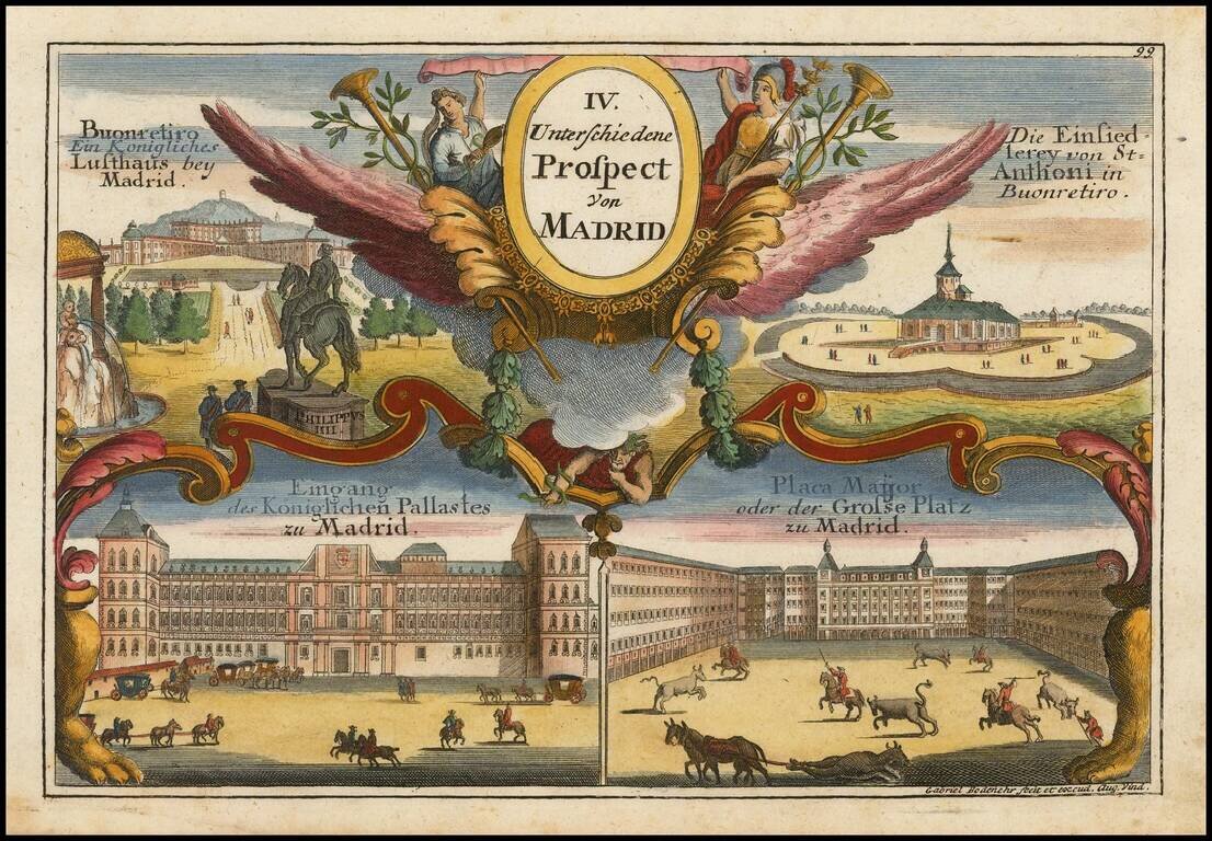
Rare first edition of Nicolas De Fer's plan of Madrid, with a key showing 26 places of interest. Early 18th Century plans of Madrid are relatively uncommon. Nice dark impression. From the first edition of De Fer's Atlas Curieux.
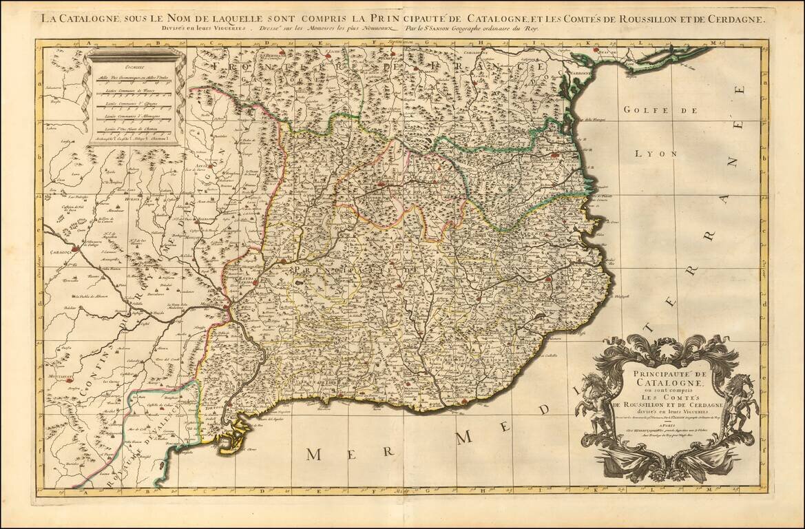
Striking large and highly detailed map of Catalonia, with a large decorative cartouche and a scale of distance. In addition, there are 4 separate sheets, each with an accompanying set 8 town plans and birdseye views, including Roussilon, Perpignan...
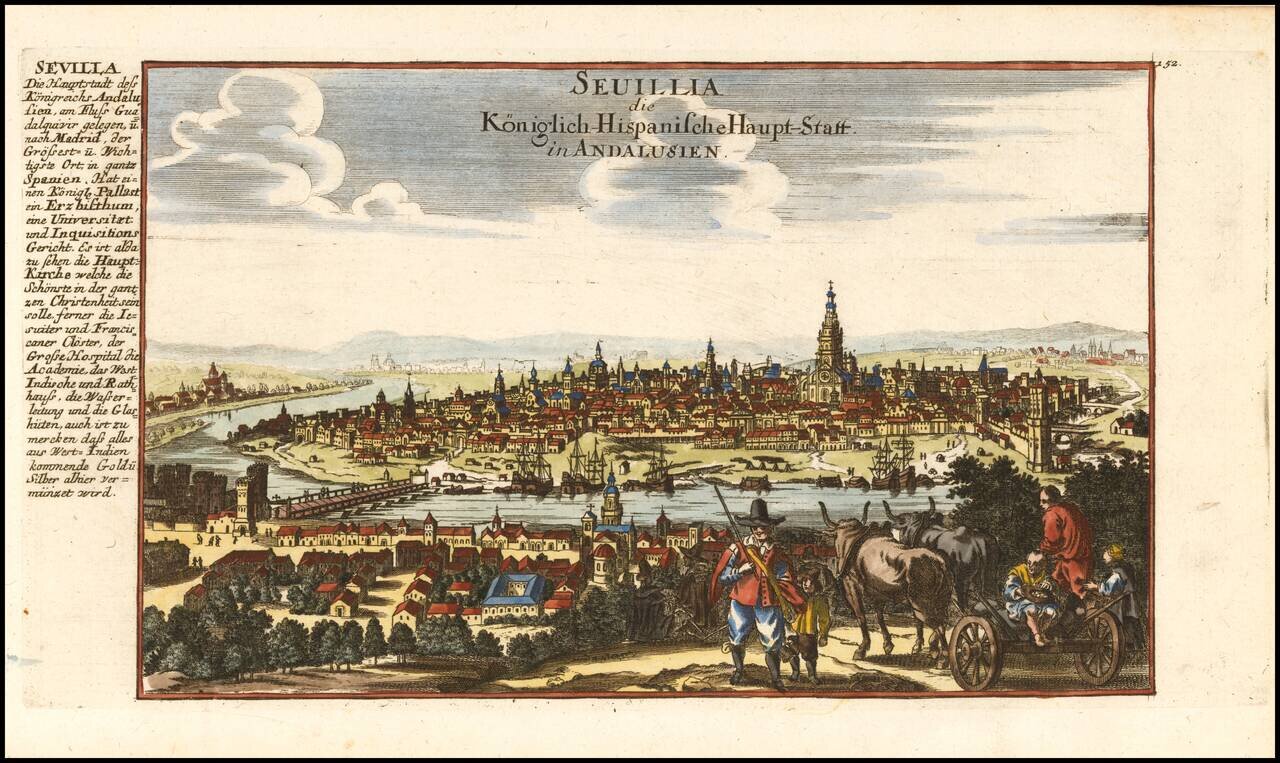
Decorative view of the city of Sevilla in Andalucia, published by Gabriel Bodenehr.
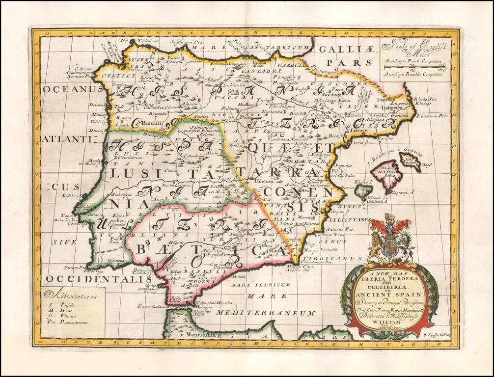
Decorative map of the Iberian Peninsula, colored by regions. This decorative map was part of a set of 22 maps dedicated to William, Duke of Glouchester, who was then an 11 year old student at Oxford.
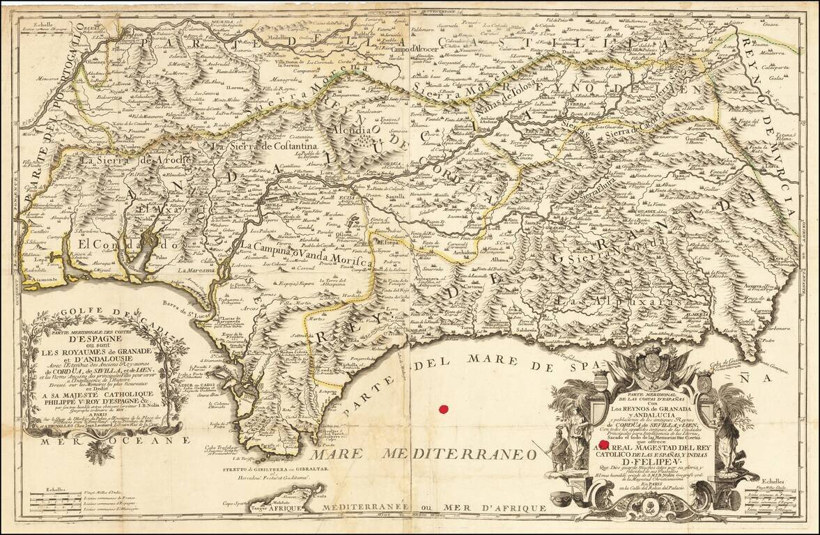
Rare early edition of Jean Baptiste Nolin's map of southern Spain, centered on Andalusia and Granada, published in Paris by Nolin, with a second address in Brussels (Jean Leonard). The map is exceptionally detailed and includes extensive topographical...
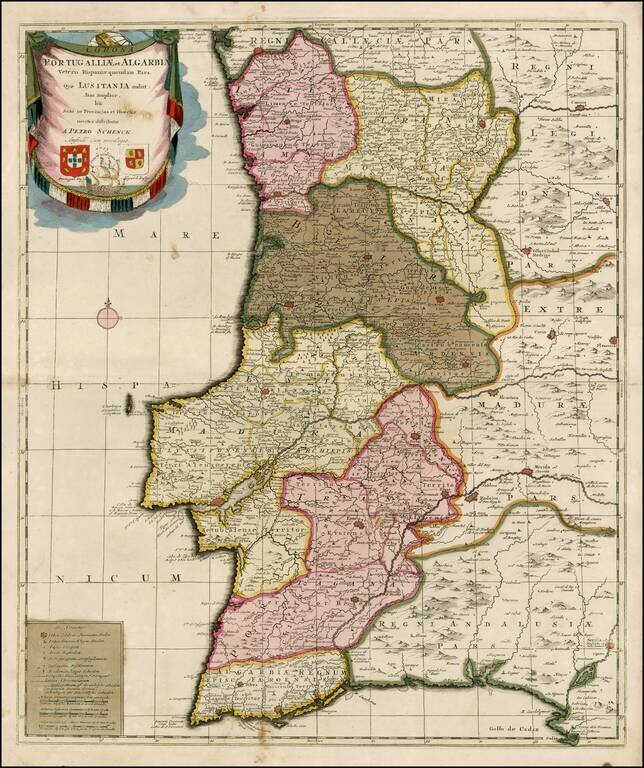
Striking old color example of Schenk's rare map of Portugal, with the coats of arms of Portugal, Algarbia and a Spanish sailing vessell in the cartouche. The map is in fine old color and printed on double thick paper, from a composite atlas of the period.
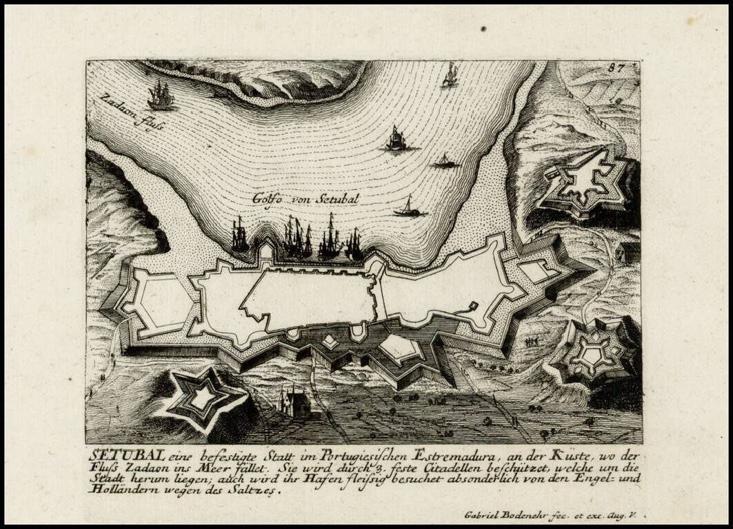
Detailed view and plan of the fortifications of the City of Setubal, published by Gabriel Bodenehr.
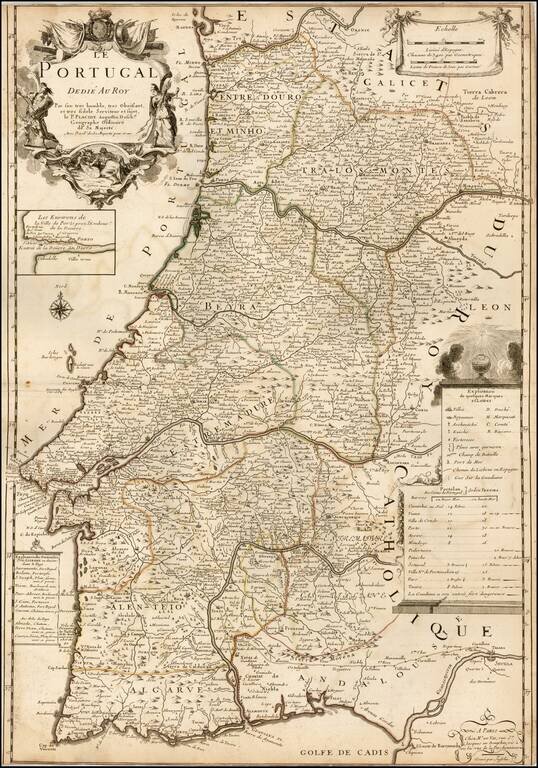
Decorative map of Portugal by Le Père Placide de Sainte-Hélène, the brother-in-law of the famous French mapmaker Pierre Duval. The map provides a large detailed treatment of Portugal, with an inset of the area around Porto on the Douro River.
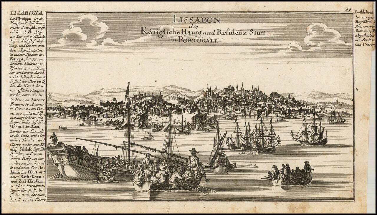
Fine view of Lisbon, published by Gabriele Bodenhr in his Atlas Curieux.