Rare and decorative map, showing allegorical representations of the continents in the lower corners. The panoramic view at the bottom depicts the IJ River, filled with sailing ships, based upon Jochem Bormeester's view of 1685. The plan shows...
![[Southern Netherlands]](/map/small/63488.jpg)
Detailed map of the Southern part of Holland, published in Amsterdam circa 1700. This is the lower half of a 2 sheet map of Holland.
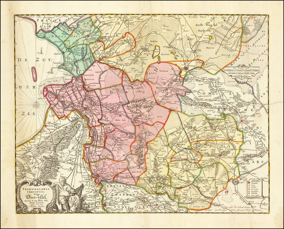
Nice map of Overijssel, published in Amsterdam by Visscher. Major cities include Deventer, Kamen, Zwolle, Almelo, Hengelo and Enschede.
Highly detailed map shows the land development in Gelderland, Holland, near the Zuyder Zee. The map shows Amsterdam, Gouda, Schoonhoven, Buren, Wageningen, Arnhem, Sevener, Doesburg, Zutphen and the Yssel River, centered on Amersfoort, and also...
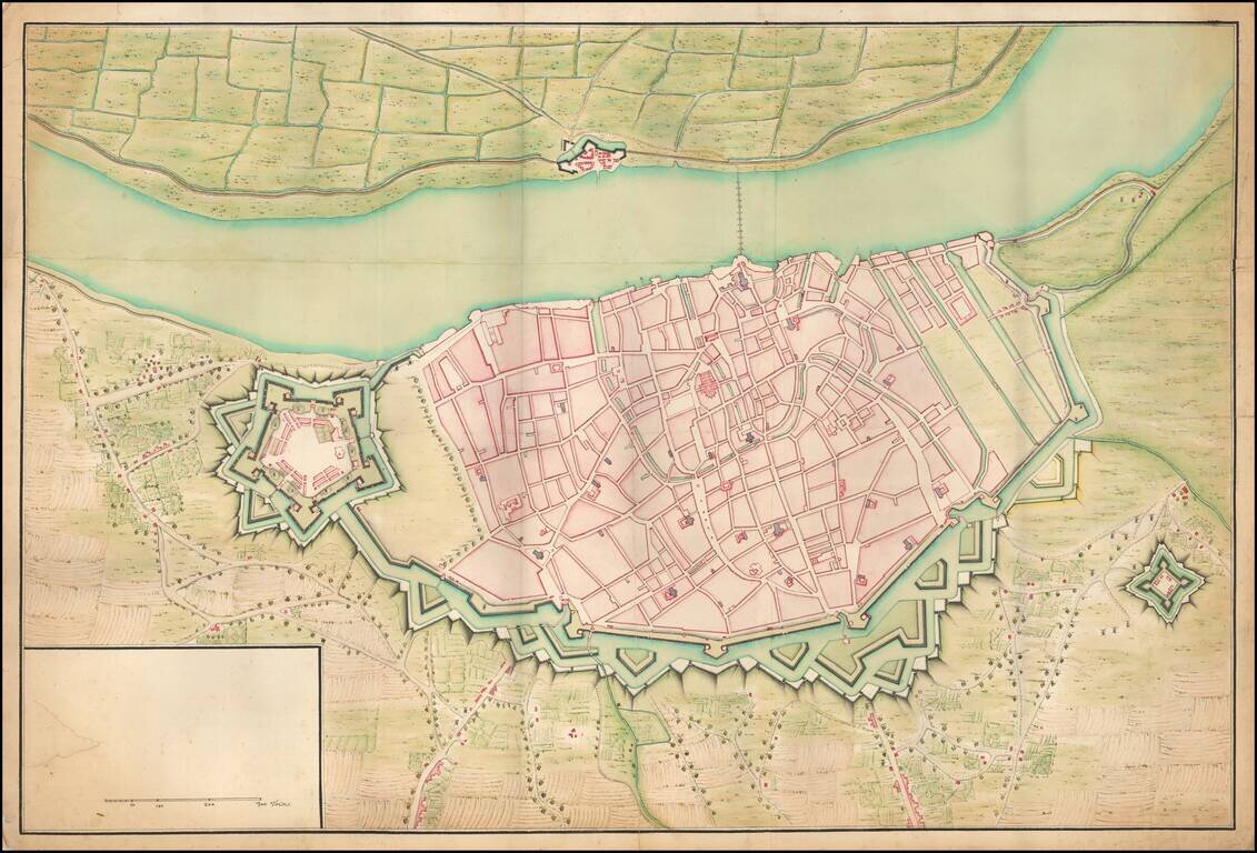
Manuscript Plan of Antwerp and Environs. Detailed hand drawn plan of Antwerp, focusing on its fortifications in the Vauban style. The plan is unfinished, with no place names given or information in the title cartouche. The town name is written in...
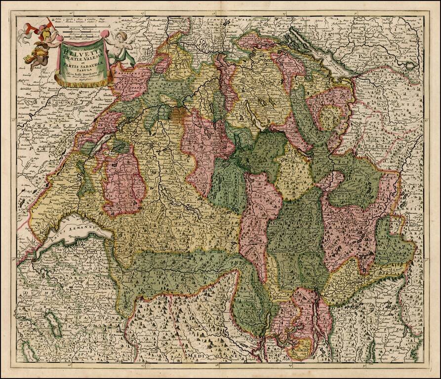
Decorative map of Switzerland, the Lake Geneva area and the areas around Lago Magiore, Lugano and Lago di Como and Bergamo. Includes a decorative title cartouche.
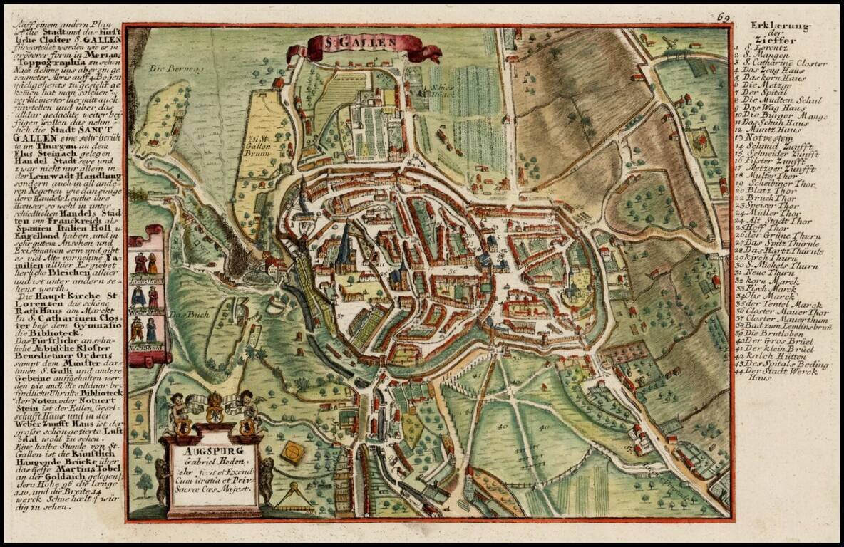
Scarce detailed town plan of St. Gallen and vicinity, published by Bodenehr. Bodenehr did a second view of the City, which is more focused on the town within its fortified walls: /gallery/enlarge/30360
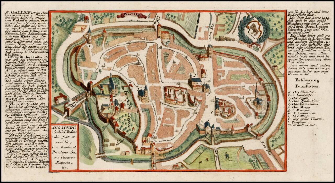
Scarce detailed town plan of St. Gallen, published by Bodenehr. Bodenehr did a second view of the City, which shows a broader area: /gallery/detail/30360
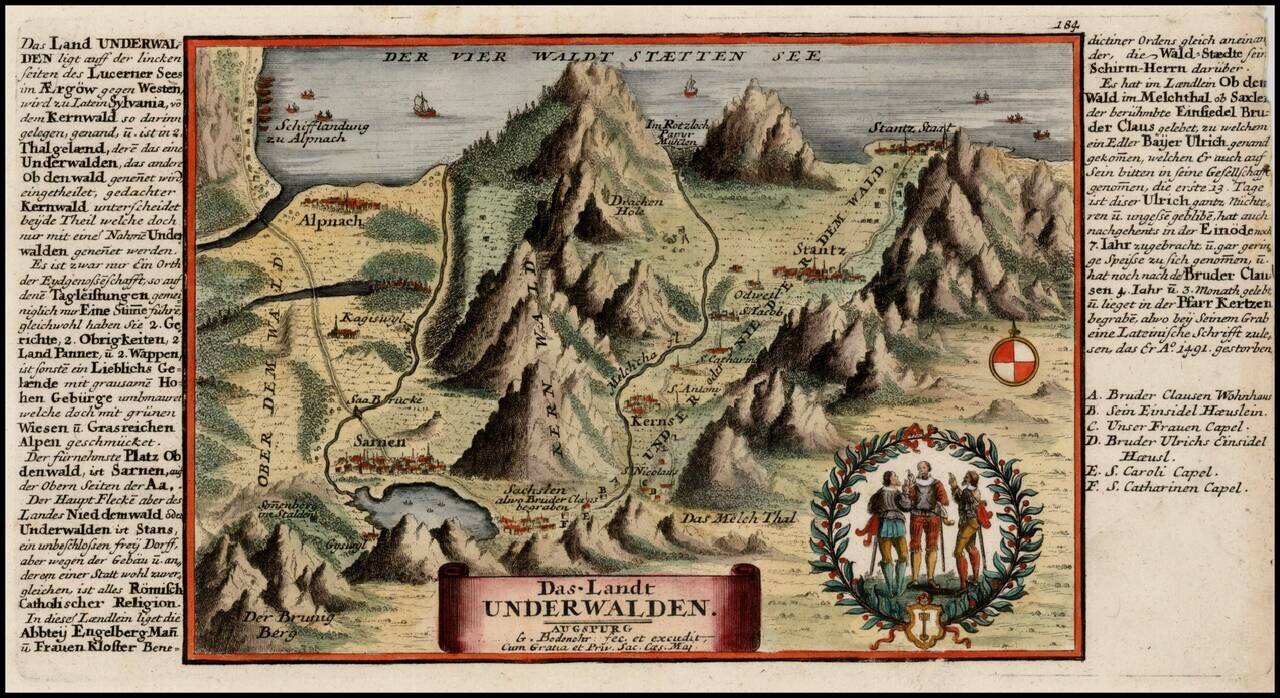
Decorative map showing the region along the southern part of Lake Lucerne, from Stansstad to Kerns and Sarnen, published by Bodenehr.
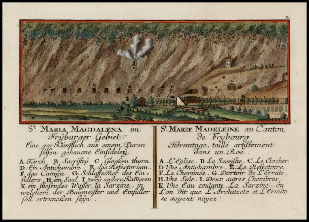
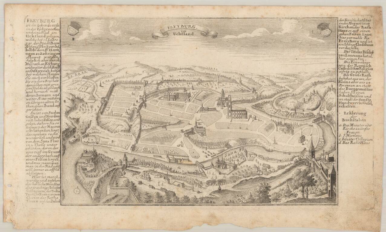
Scarce detailed map of St. Mary Madaline's Convent near Freybourg, published by Bodenehr.