logo

1700. Carte Nouvelle de L'Isle et Royaume de Sardagne &c.

  • Carte Nouvelle de L'Isle et Royaume  de Sardagne &c.

Carte Nouvelle de L'Isle et Royaume de Sardagne &c. information:

Year of creation: 
Resolution size (pixels): 
 14913x12322 px
Disk Size: 
 30.2521MiB
Number of pages: 
 1
Place: 
 Amsterdam
Author: 

Print information. Print size (Width x height in inches):
Printing at 72 dpi 
  207.13 х 171.14
Printing at 150 dpi 
 99.42 х 82.15
Printing at 300 dpi 
 49.71 х 41.07

An example of detailing the file of this map of in a printable high-resolution:

Click to open in high resolution (open in new tab).
Attention! this is just the central piece (central area 960x960 px) of the map file!
This is an example, so that you can see and study the level of detail of a given map. The entire Map will be fully available after payment!

Carte Nouvelle de L'Isle et Royaume  de Sardagne &c.

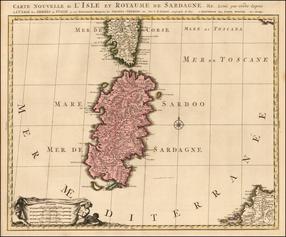
Early state of the Mortier map of Sardinia.

The map would later be re-issued by Coven & Mortier, with a number of ships and battle scenes.

Pierre, or Pieter, Mortier (1661-1711) was a Dutch engraver, son of a French refugee. He was born in Leiden. In 1690 he was granted a privilege to publish French maps in Dutch lands. In 1693 he released the first and accompanying volume of the Neptune Francois. The third followed in 1700. His son, Cornelis (1699-1783), would partner with Johannes Covens I, creating one of the most important map publishing companies of the eighteenth century.


Special conditions for students!

If you are a student, write to us in telegram: @antiquemaps and indicate what material you need and for what work you need a map in high detail. We are ready to provide material on special terms. For students only!

Item information:

Year of creation:
Size:
14913x12322 px
Disk:
30.2521MiB
Number of pages:
1
Place:
Amsterdam
Author:
Pieter Mortier.
$14.99

Related item