Map size in jpg-format: 7.19116MiB
Click to open in high resolution (open in new tab).
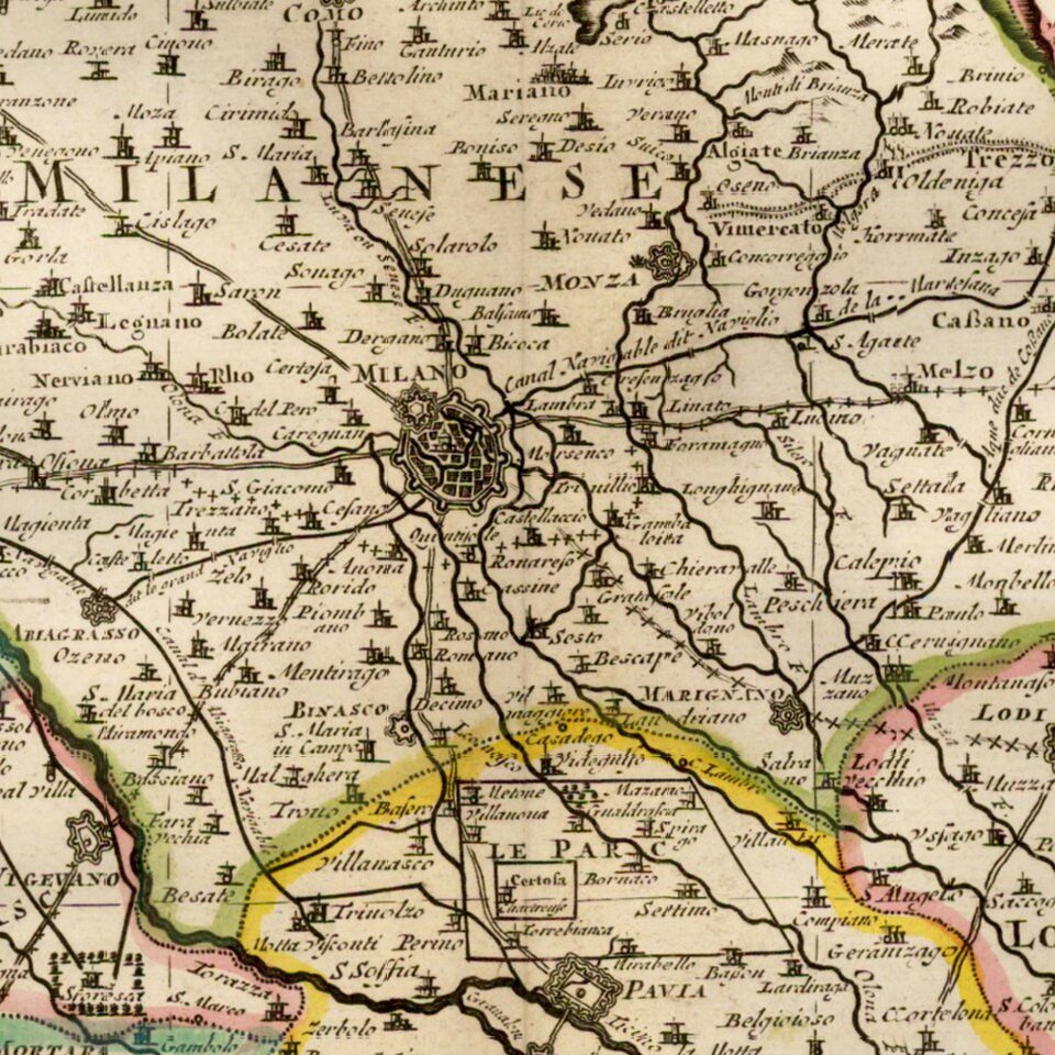
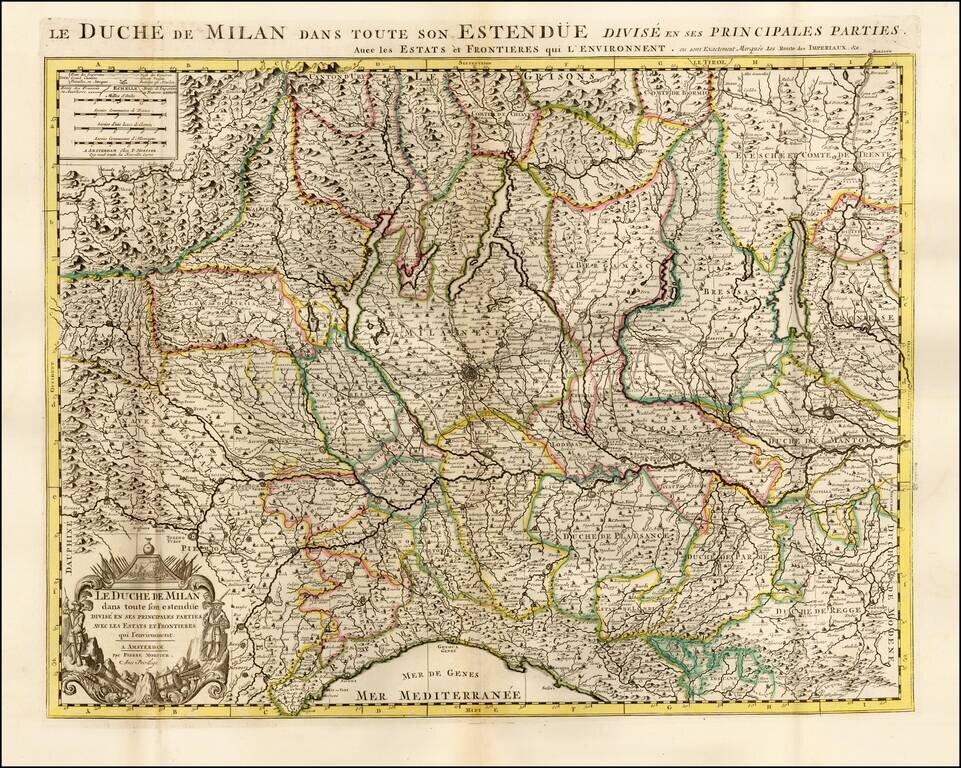
Highly detailed map of the Duchy of Milan, published by Pierre Mortier.
The map is centered on Milan and shows the region from Genoa to Lago di Como, Lago Magiore, Lago di Garda and the Swiss Alps.
Pierre, or Pieter, Mortier (1661-1711) was a Dutch engraver, son of a French refugee. He was born in Leiden. In 1690 he was granted a privilege to publish French maps in Dutch lands. In 1693 he released the first and accompanying volume of the Neptune Francois. The third followed in 1700. His son, Cornelis (1699-1783), would partner with Johannes Covens I, creating one of the most important map publishing companies of the eighteenth century.
If you are a student, write to us in telegram: @antiquemaps and indicate what material you need and for what work you need a map in high detail. We are ready to provide material on special terms. For students only!


