
Highly detailed map of the region including a striking old colored cartouche. Cities shown on the map include Frankfurt, Maintz, Coblentz, Nassau, Waldek, Cassel, Eysenach, Erfurt, Hirschfelt, Fuld, Schwinfurt, Bamberg, Wurtzburg, Wertheim. The map...
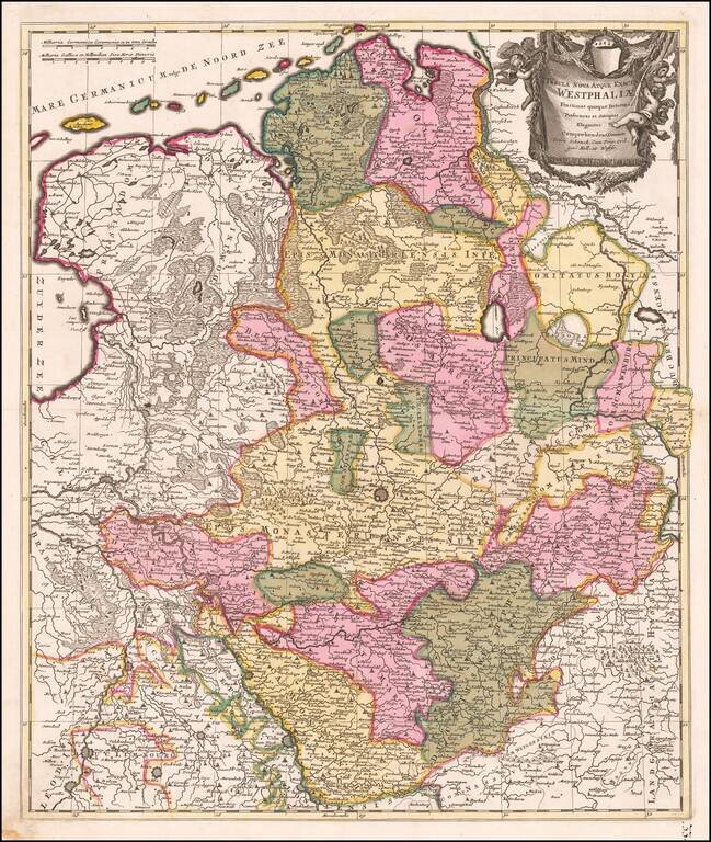
Fine old color example of Schenk's map of the northwestern part of Germany. The map is centered on Munster and extends south to the area arould Cologne, east to the Bishoprick of Paterborn and north to the North Sea.
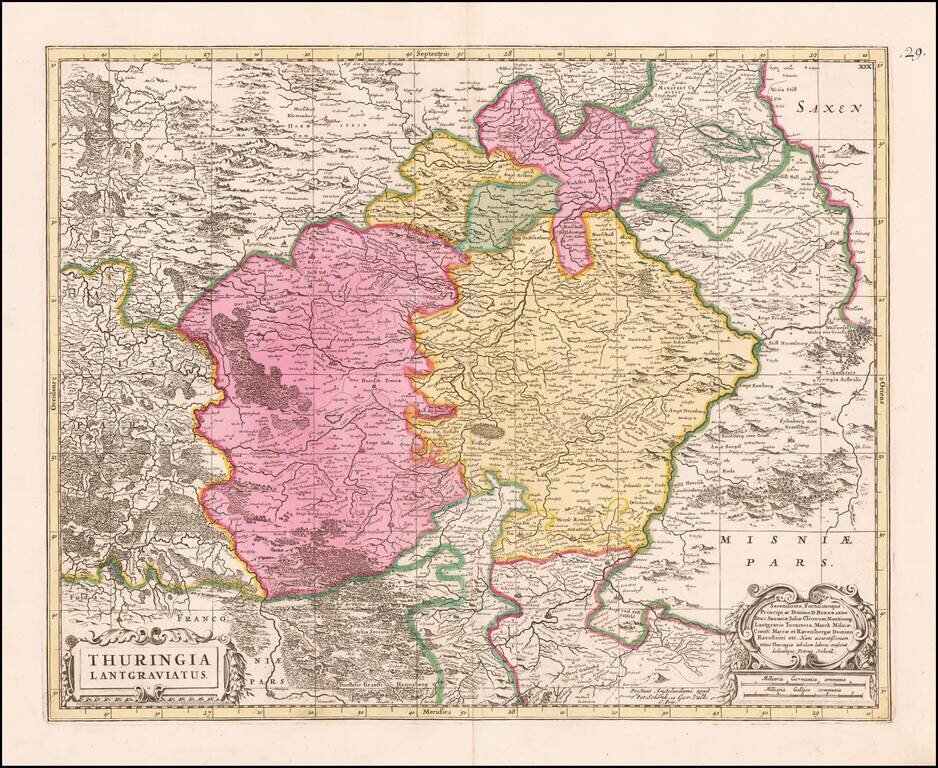
Detailed map of the region centered on Erfurt. Also includes Gotha, Weimar, Schwartzburg, Halle, Jena, Mulhausen, etc.
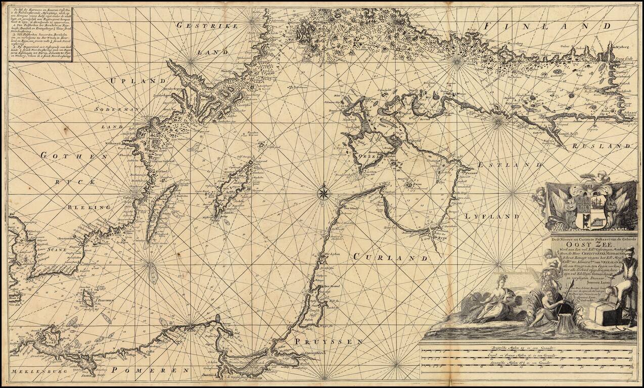
Extremely rare over-sized sea chart of the Baltic, published by Johannes Loots. Loots chart of the Baltic Sea extends from Copenhagen and Rostock in the west, to Wyborg, Narva and Ryga in the east, showing the region in exceptional detail, including...
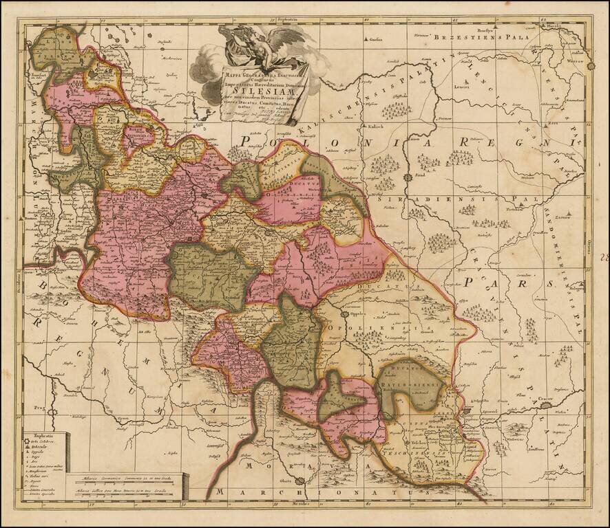
Scarce map of Silesia, in Poland, engraved in Amsterdam by Peter Schenk. The map shows Silesia at the end of the 17th century under Habsburg Rule.
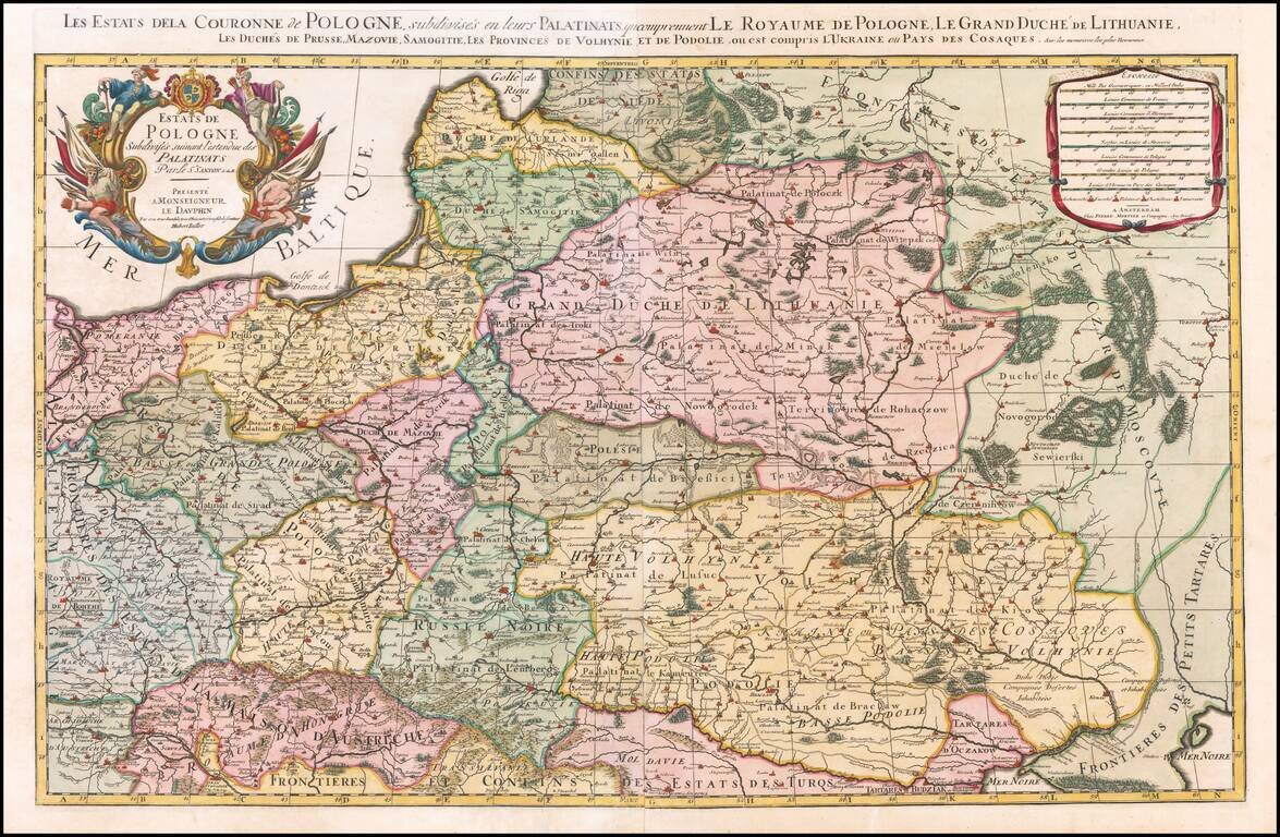
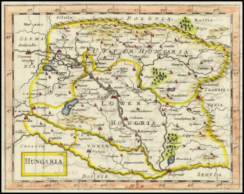
Nice example of the Pierre Mortier edition of this large format map of Poland, Lithuania, the Ukraine and part of Russia, first published by Hubert Jaillot in Paris, in 1679. One of the largest atlas maps of the late 17th Century to focus on Poland,...
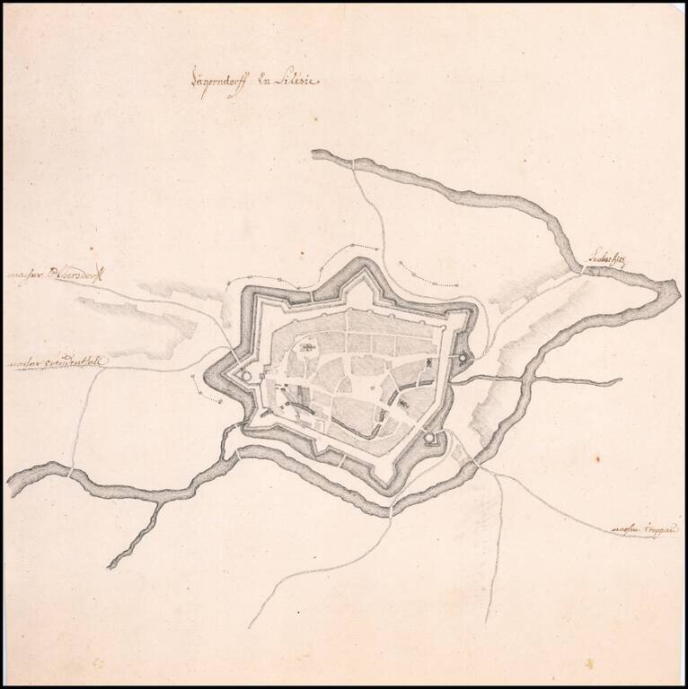
Fine Manuscript Plan of the Walled City of Krnov Striking, finely drawn map of Old City of Krnov, now in the Czech Republic, and previously a part of Austrian Silesia. It shows the walled portion of the city, which sits at the conjunction of two...
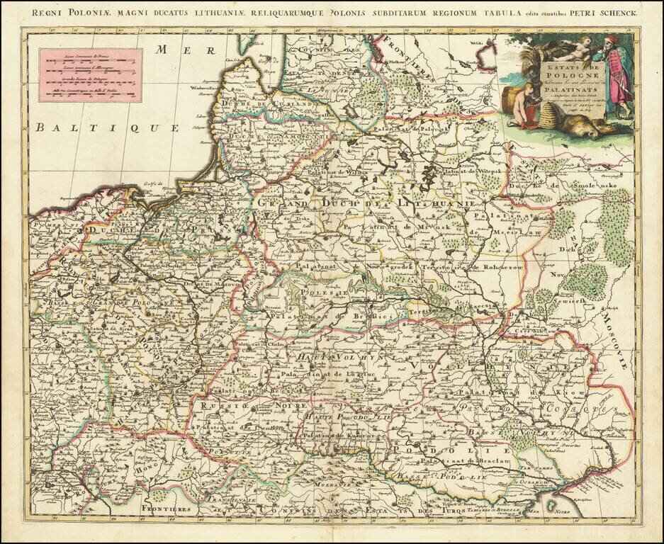
A scarce Pieter Schenk map of Poland, which is attributed to an earlier map published by Sanson. The map extends to the Black Sea and Vienna in the south and to Estonia in the north. The work is a prime example of Schenk's strong engraving style,...
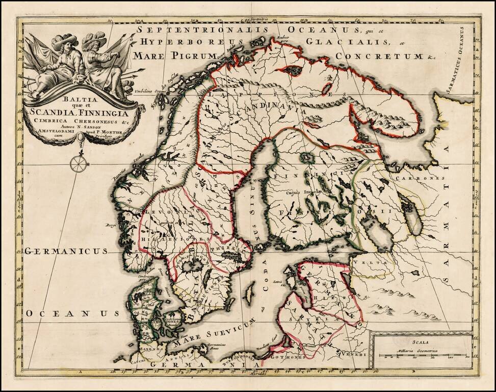
Scarce map of Scandinavia, the Baltic Region and contiguous parts of Finland and Russia. The map appeared in Mortier's Atlas Antiquus, based upon the work of Nicolas Sanson.
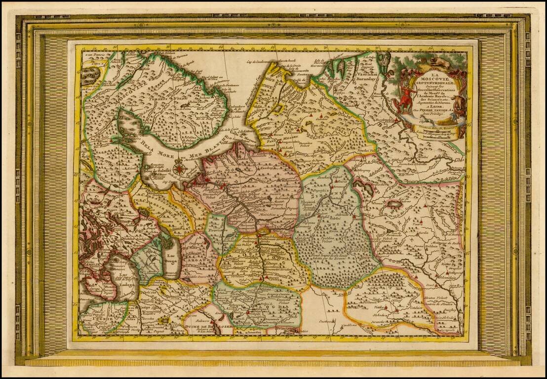
Decorative example of Vander Aa's map of the northern part of European Russia. Nice example, with the picture frame border, which appeared in Vander Aa's Nouvelle Theatre Du Monde, published in 1713.
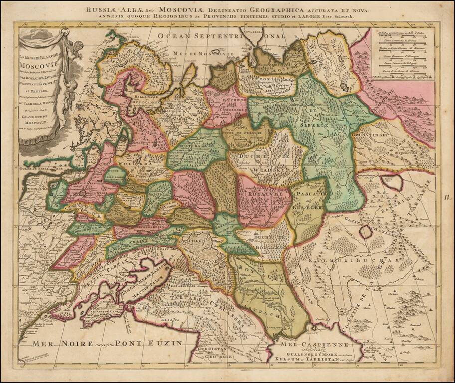
Scarce map of White Russia or Moscovy, published in Amsterdam by Schenk. The map shows the extent of the Czar's Russian Empire in Europe. The political divisions are delineated and the forested areas are graphically shown. Cherubs hang from the...
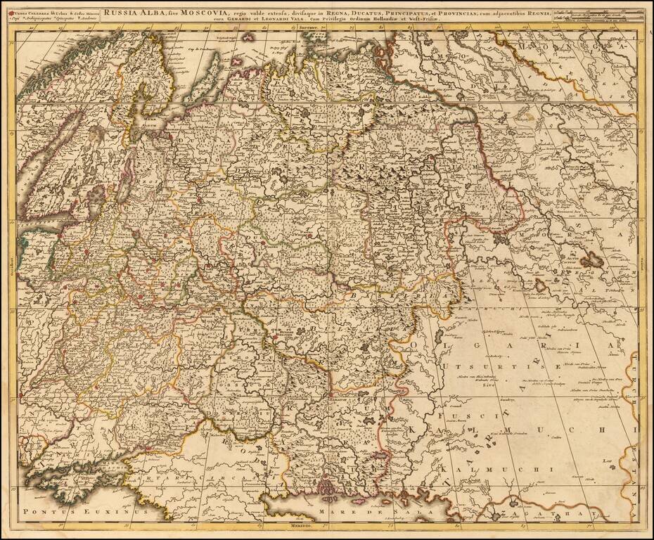
Scarce map of Russia and Ukraine, hand colored by political subdivisions, by Gerard and Leonard Valk. The map extends far to the east, showing some portion of the Tartar and Mongol regions.
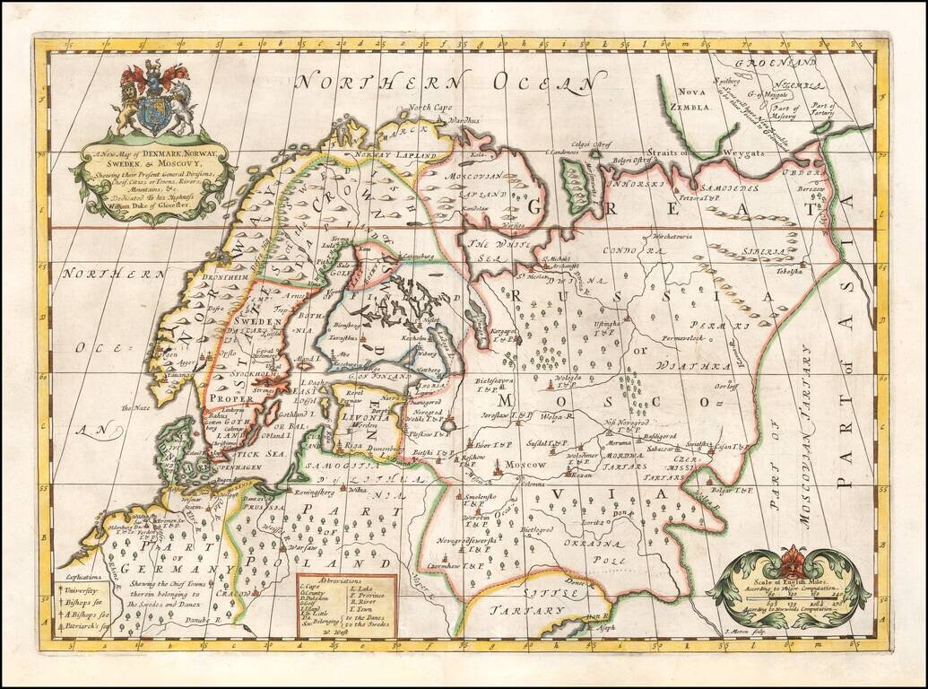
Decorative map of Scandinavia and Russia at the beginning of the 18th Century. This map was part of an atlas dedicated to the Duke of Glocester, who was then attending school in Oxford. English coat of arms and decorative cartouche.
![[Narva] Entsatz der Stadt Narva und der Moscowitzer grosse Niederlage den 20, 21, des Novembermonats 1700 Zum Ersten Theile Leben K. Karl XII auf der 221:under folgen der Seite](/map/small/28095.jpg)
Rare separately issued battle plan of the Siege of Narva, engraved by Fritzsch, based upon original drawings by Zacharias Wolf, a Swedish Engineer and Officer who was present at the battle and would go on to have a distinguished career as a military...
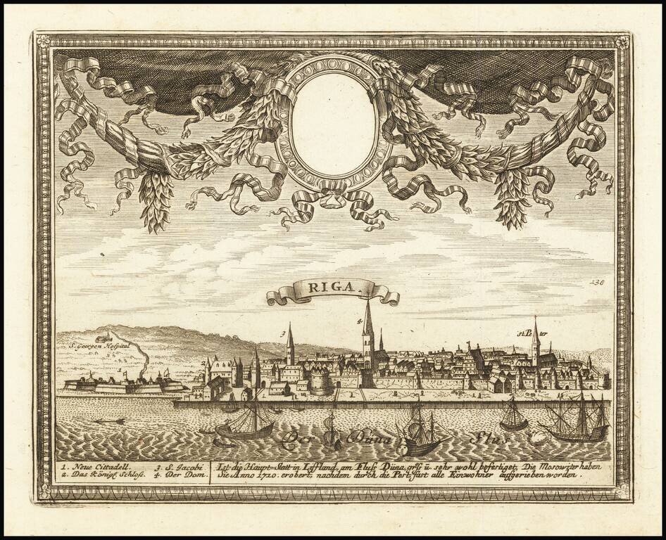
Finely engraved view of Riga, published in Augsburg. Includes key at the bottom locating points of interest.