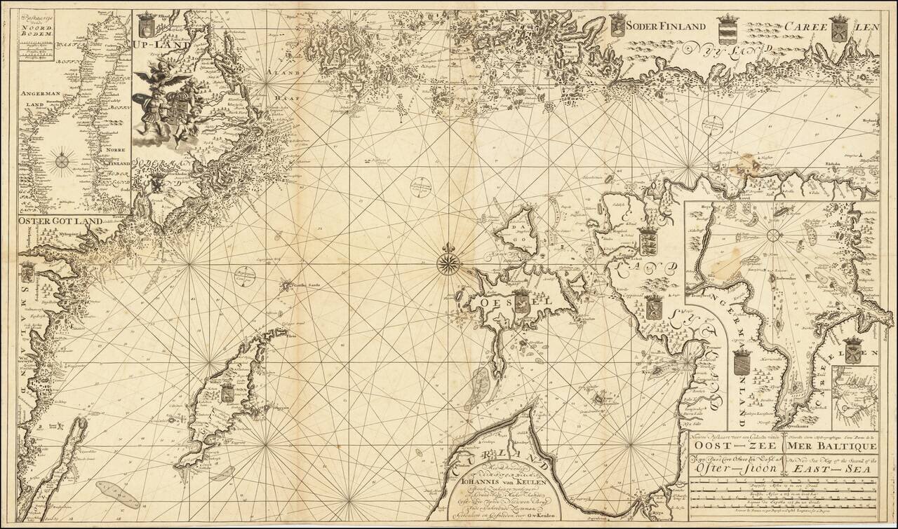
Scarce Dutch sea chart of the Baltic Sea, published by the Van Keulen firm, the leading Dutch sea chart publishers of the 18th century. The map covers much of the Baltic Sea, the Swedish coast around Stockholm, the Gulf of Riga and West Estonian...
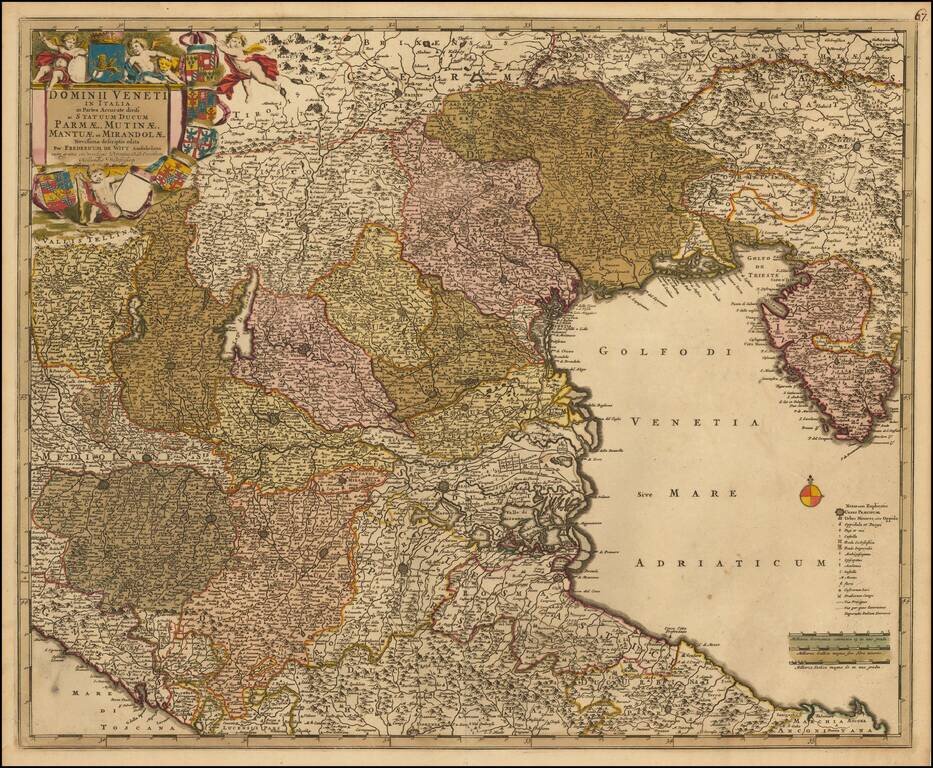
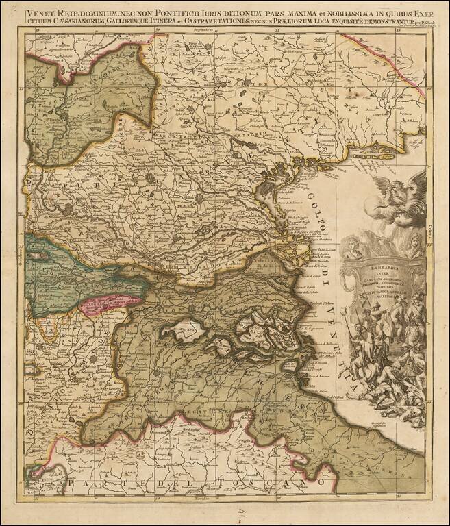
Nice old color example of this decorative map of the region, including much of Northeastern Italy and the Gulf of Venice. Extends from Istria and Ancona to the Gulf of Spezia and the Tirol and Bergamo. Includes Lago di Garda, Verona, Vicenza and...
![Constantinoplen en Egypten door Nicolaus Schmidt in enn zes Jarige Reystogt uyt Duytsland [shows Cyprus]](/map/small/57615.jpg)
Decorative map of the region bounded by Italy, Corsica, Sardinia and Sicily in the west and extending to Cyprus, Asia Minor and the Holy Land in the east. Centered on Greece and the Balkans. The map was engraved to illustrate a Dutch translation of...
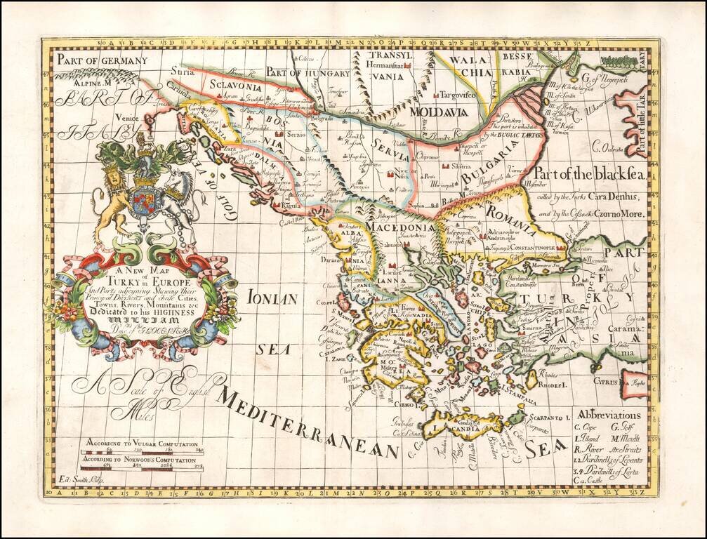
Decorative map of Turkey and the Balkans, colored by regions. This decorative map was part of a set of 22 maps dedicated to William, Duke of Glouchester, who was then an 11 year old student at Oxford.
![Le Cours Du Po . . . [Eastern Sheet--Gulf of Venice, Padua, Vincenz, Feltre, Friouli, Carniola, Istria]](/map/small/58163.jpg)
Striking map of the Course of the Lower Po River, showing the Theater of War in Italy. Nolin's map was first issued in 1702 and corrected in 1703. The map was probably made to illustrate all the territories of the War of Spanish Succession in northern...
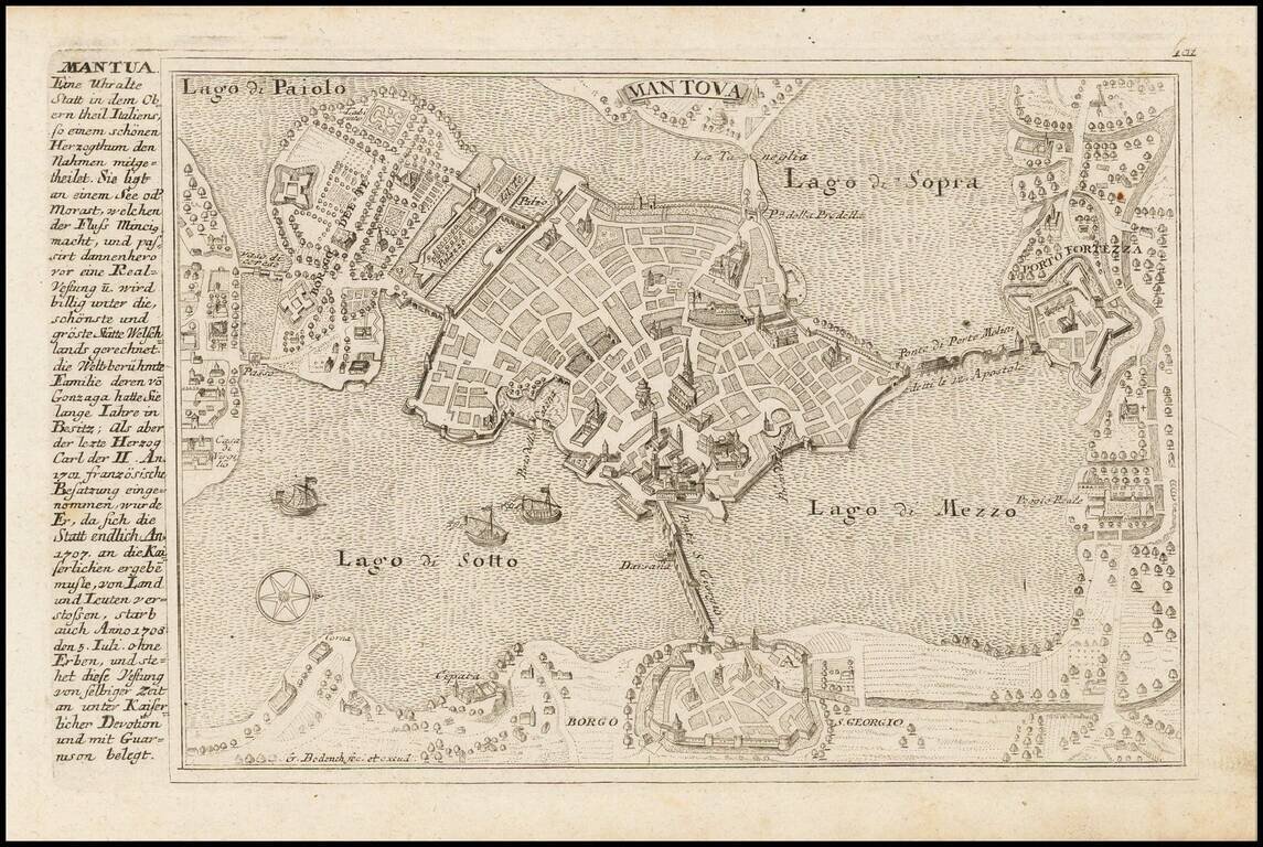
Detailed view and plan of the fortifications of the town of Mantova, published by Gabriel Bodenehr.
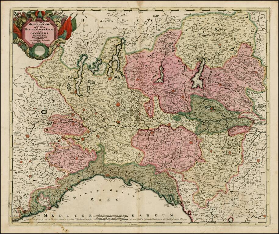
Striking old color example of Valk's scarce map of Northern Italy. The map is in fine old color and printed on double thick paper, from a composite atlas of the period.
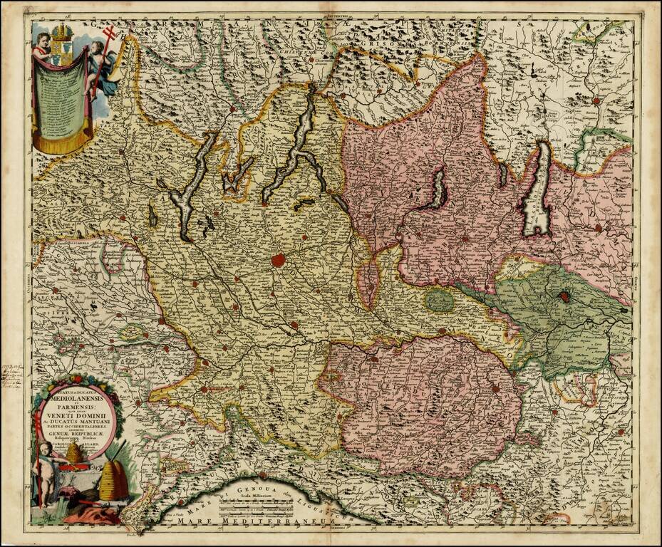
Striking regional map of Northwestern Italy, from the Lake Districts and the Coast of Liguria to Mantua and Modean, centered on Milan and Lago di Como. Includes 2 striking cartouches. Shows roads, rivers, mountains, lakes and many other details.
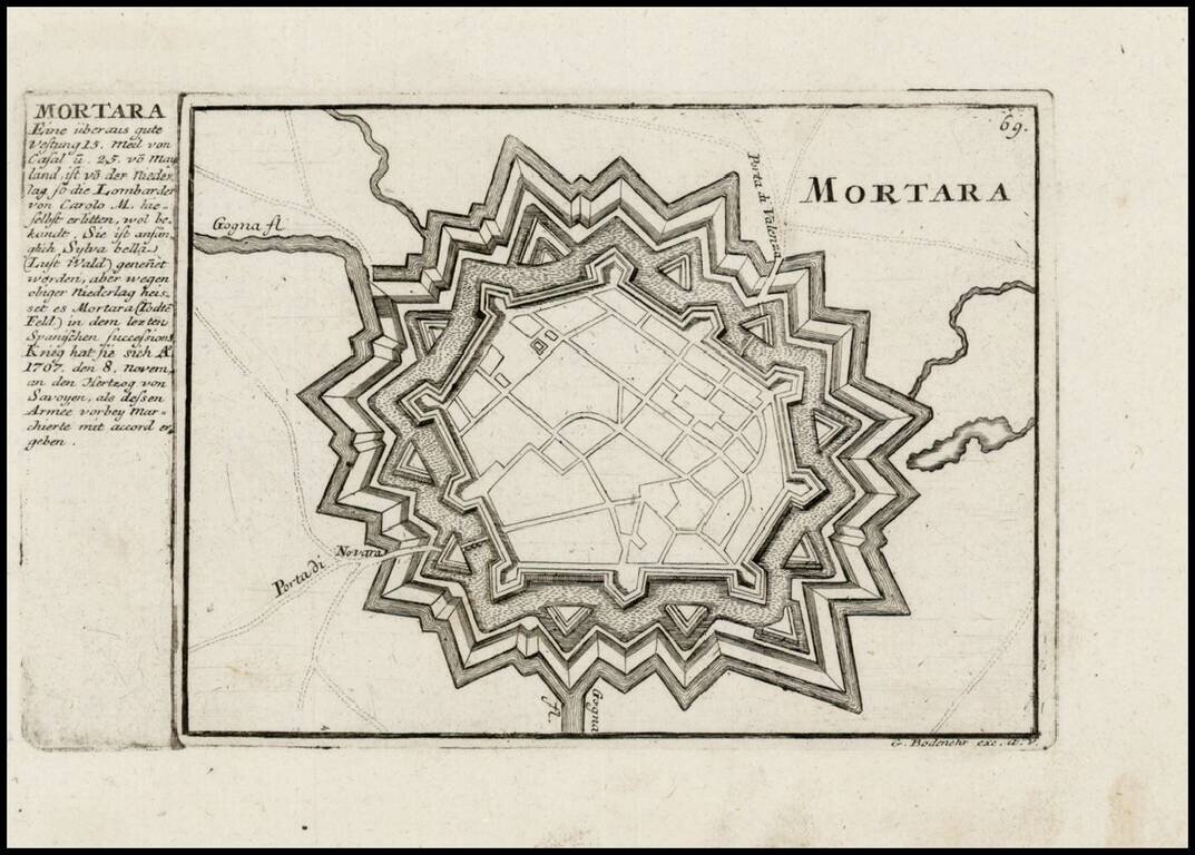
Detailed view and plan of the fortifications of the town of Mortara (southwest of Milan), published by Gabriel Bodenehr.
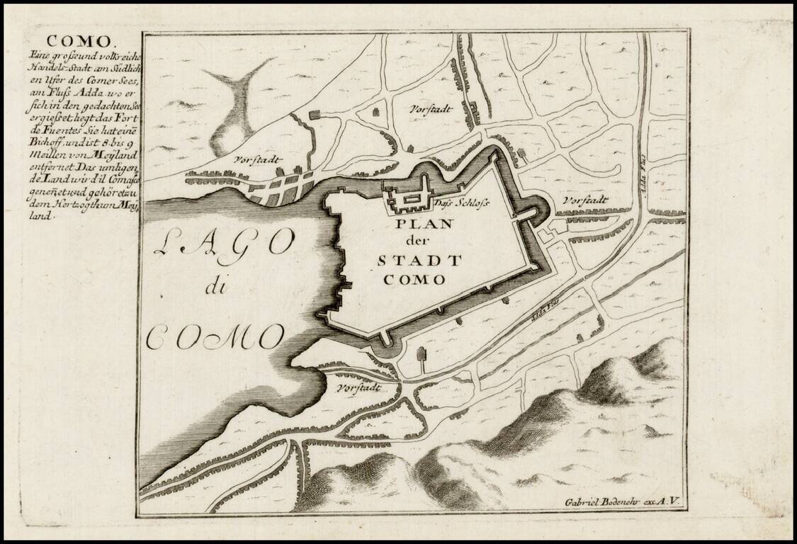
Detailed view and plan of the fortifications of the town of Como on the edge of Lago di Como, published by Gabriel Bodenehr.
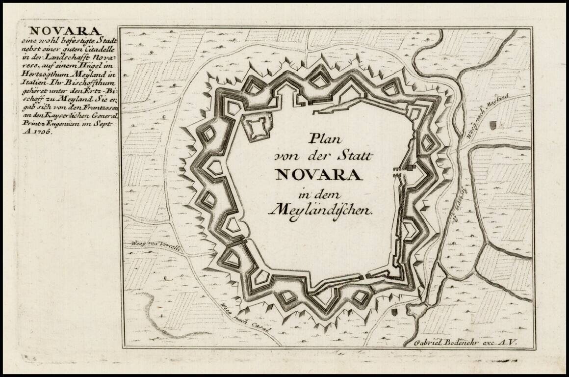
Detailed view and plan of the fortifications of the City of Novara, published by Gabriel Bodenehr.
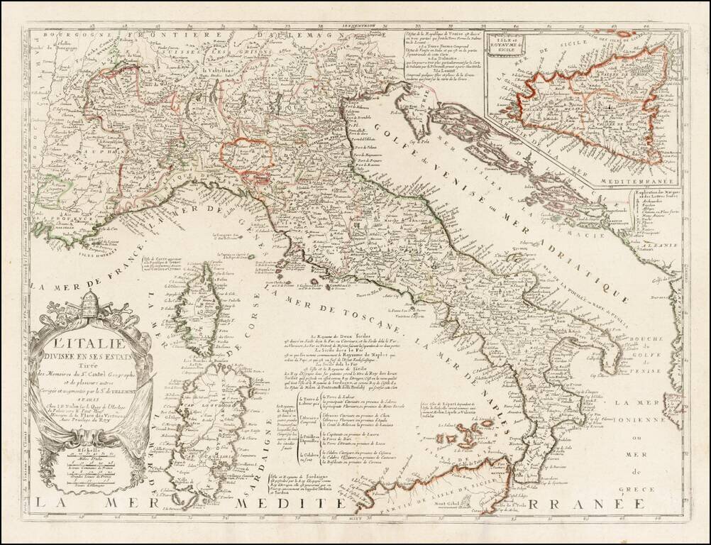
Rare variant edition of Nolin's map of Italy, with a large inset of Sicily. This edition has Nolin's address as "le Quay de l'Horloge du Palais vers le Pont Neuf ". An earlier edition of the map shows the address at "le Quay de l'Horloge du Palais...
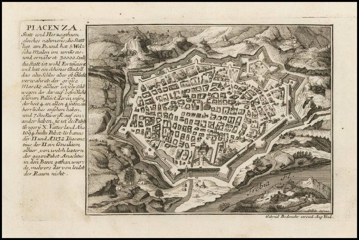
Detailed plan of the fortifications of the town of Piacenza, published by Gabriel Bodenehr.
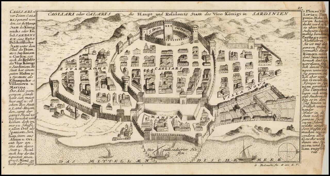
Detailed view and plan the town, harbor and fortifications of Cagliari, one of the capital cities of Sardinia, published by Gabriel Bodenehr.
Scarce map of Northeatern Italy, published in Amsterdam by Peter Schenk. The map extends from the Venice area in the east to Belluno and Trento in the north, Reggio and Verona in the west and the northern part of Tuscany.
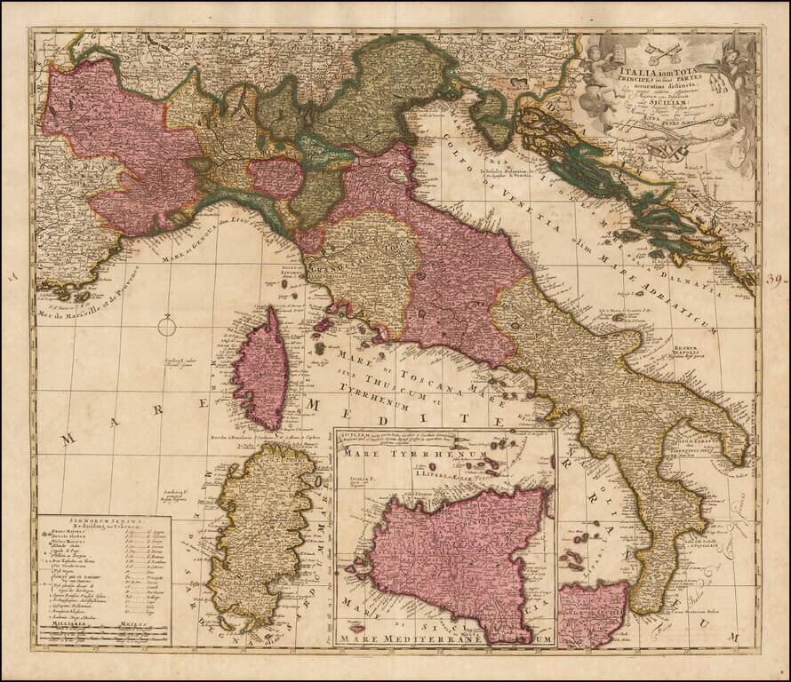
Scare map of Italy, with a large inset map of Sicily, published in Amsterdam by Schenk. Includes a table showing symbols and abbreviations.