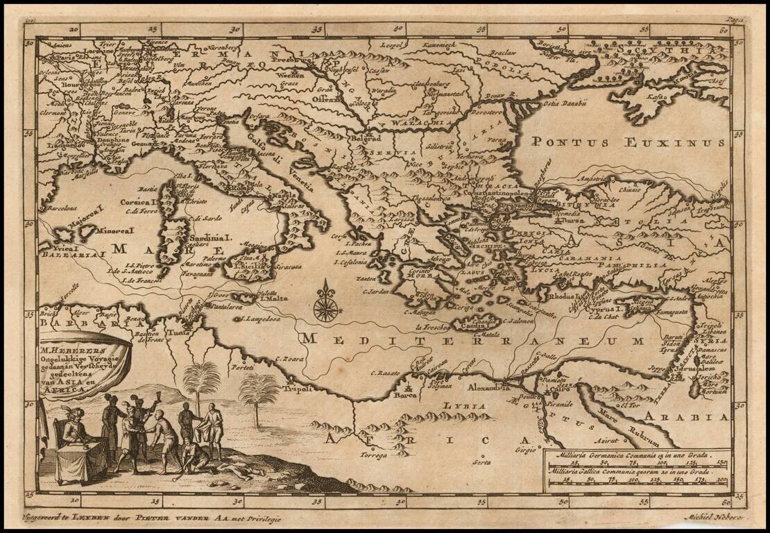
Decorative map of the Mediterranean and contiguous lands. The map was used to illustrate the Dutch translation of the travel narrative of German explorer, Michiel Heberer. Heberer (1560-1623/33?) has been called der pfälzishe Robinson, or Robinson...
Detailed map of Greece and neighboring islands, engraved in Amsterdam by Valk.
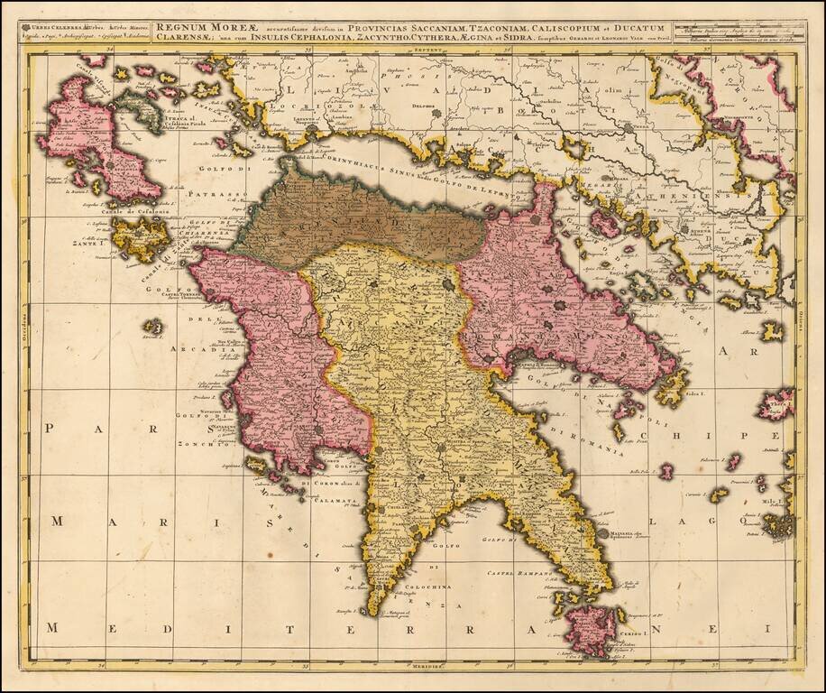
Detailed map of Morea and neighboring islands, engraved in Amsterdam by Valk.
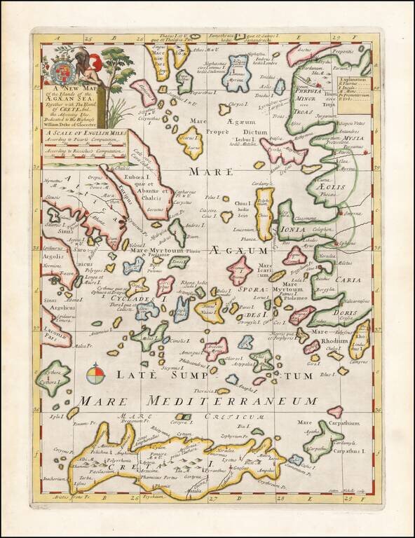
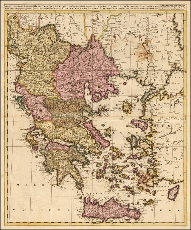
Decorative map of the Aegean Islands. This decorative map was part of a set of 22 maps dedicated to William, Duke of Glouchester, who was then an 11 year old student at Oxford.
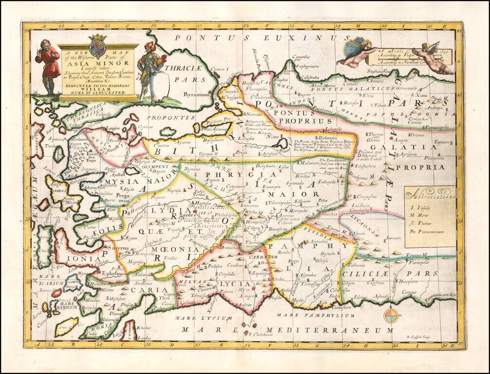
Striking map of Asia Minor and and neighboring Islands. This decorative map was part of a set of 22 maps dedicated to William, Duke of Glouchester, who was then an 11 year old student at Oxford.
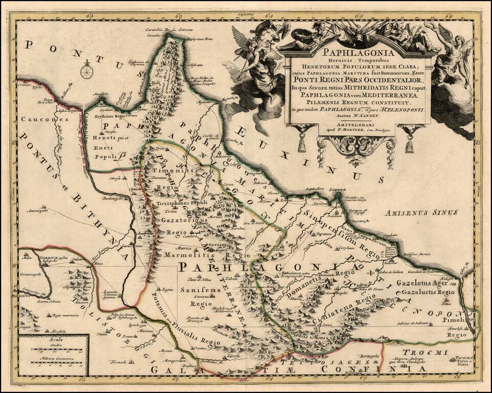
Scarce map of the Turkish Coastline of the Black Sea, centered on Sinope, based upon an earlier map by Nicholas Sanson. Remarkable decorative carouche. The map has not been recorded in a dealer catalog in the past 25 years.
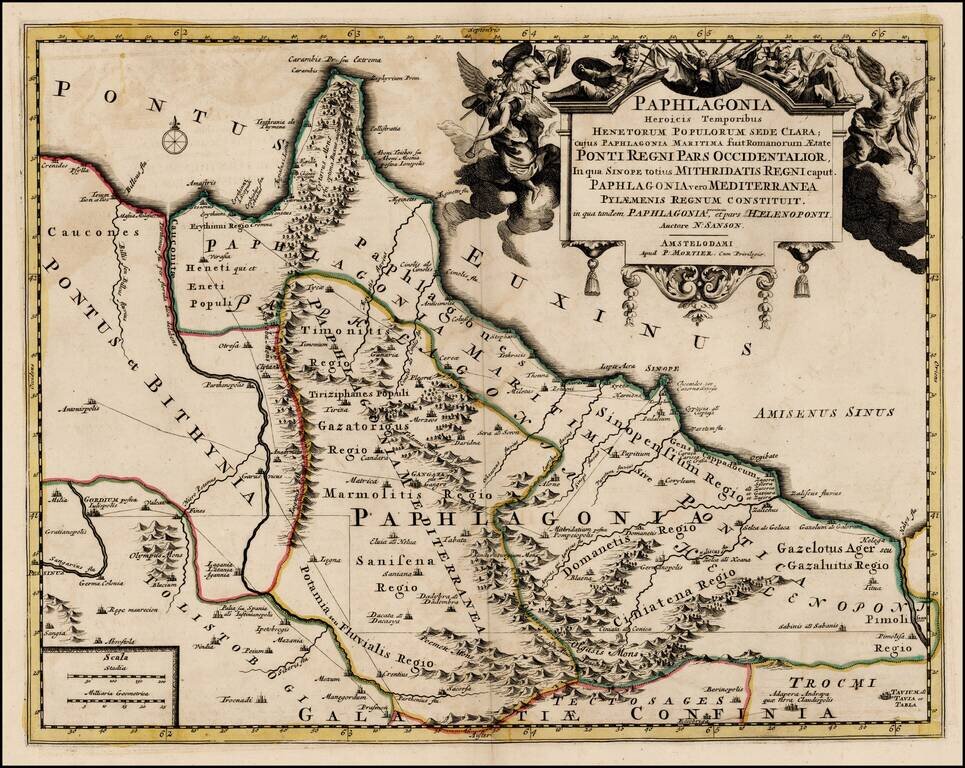
Scarce map of the Turkish Coastline of the Black Sea, centered on Sinope, based upon an earlier map by Nicholas Sanson. Remarkable decorative carouche.
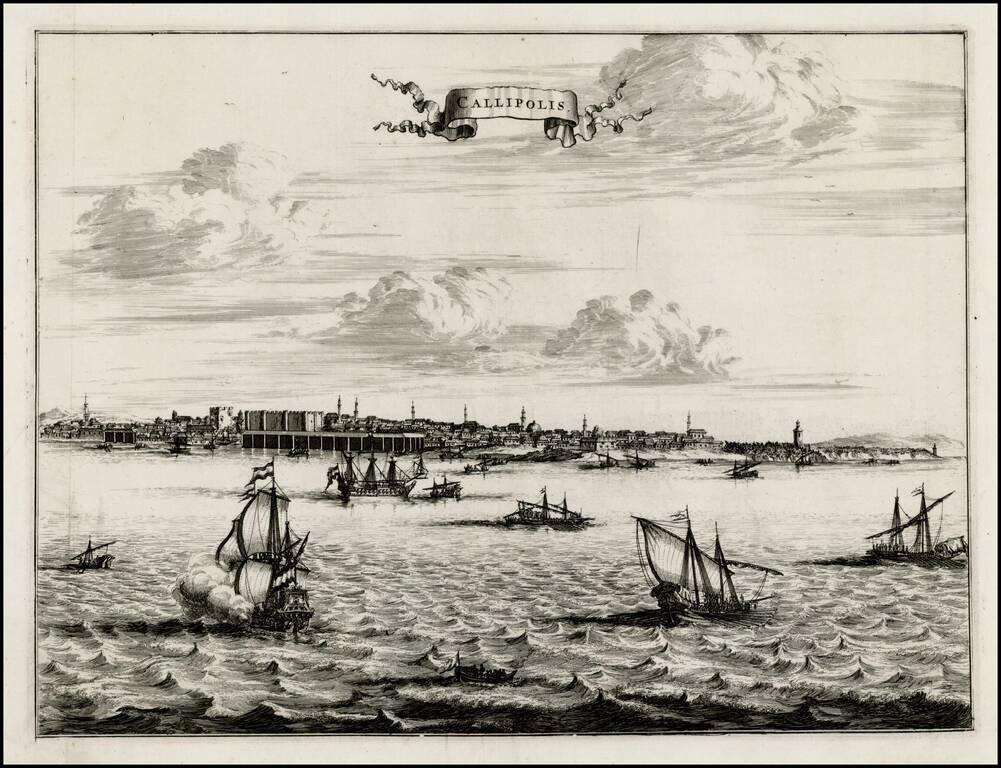
Fine early view of Gallipoli, from an unknown source. A fine view from the harbor, with sailing vessels in the foreground and a profile of buildings and Minarets on the horizon.
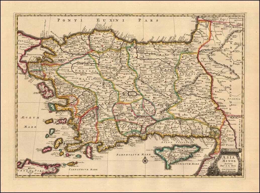
A finely detailed example Mortier's edition o of Philipe de la Rue's map of Asia Minor also known as the Anatolian peninsula, or the Anatolian plateau, which makes up the majority of modern-day Turkey. The map is centered on Ascanius Lacus (Lake...
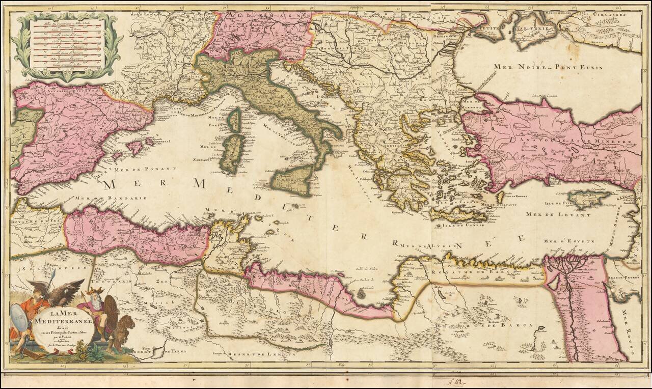
Scarce map of the Mediterranean, published by Gerard Valk circa 1700. The map extends from the Straits of Gibraltar to Cypress and Haifa. Includes an allegorical title cartouche. A fine old color example of a map that appears to be quite rare on the...
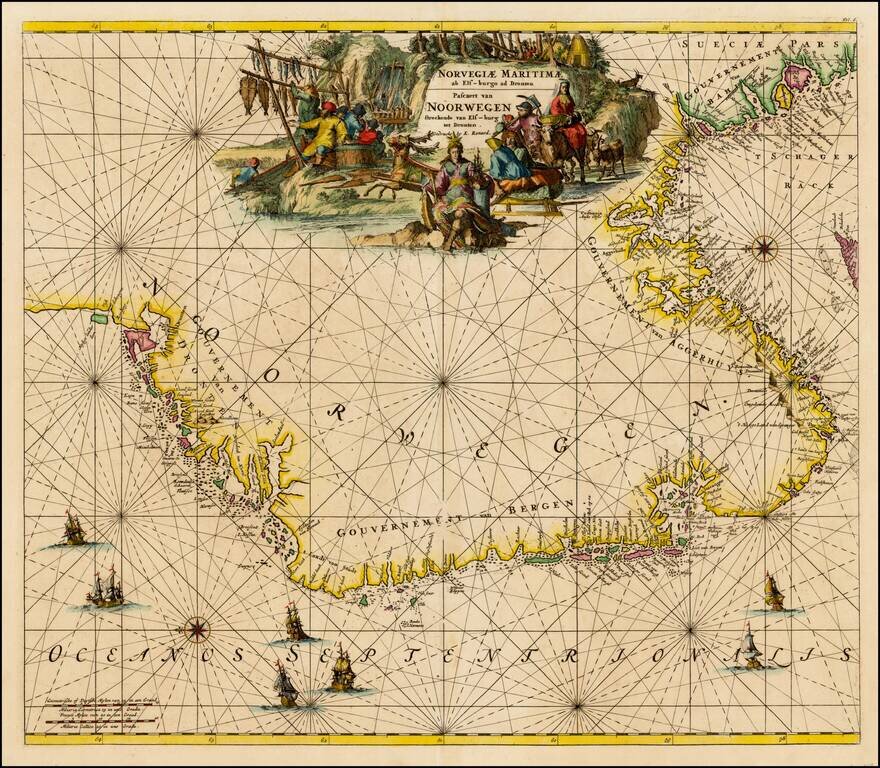
Finely colored map of Louis Renard's sea chart of Norway, with east oriented at the top. Striking sea chart, with detailed treatment of the coastal regions, rhumb lines, compass roses, elaborate cartouches and sailing ships.
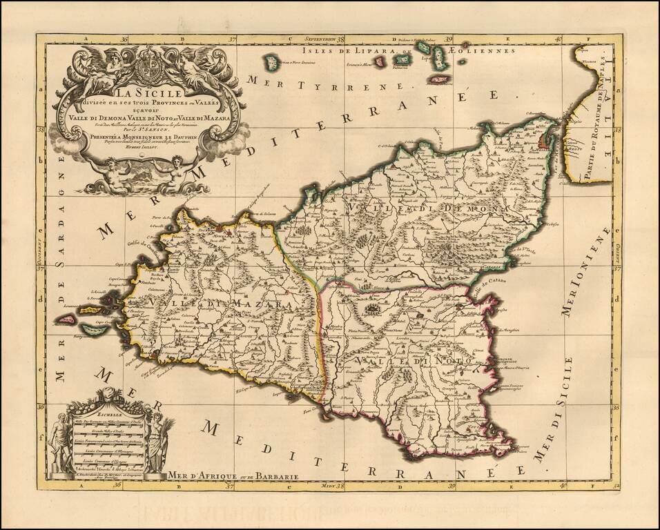
Fine Pierre Mortier edition of Jaillot's large decorative map of Sicily, showing the eruption of Mount Aetna both on the map and below the decorative title cartouche. The island is divided into 3 provinces including Valle Di Demona, Valle De Mazara...
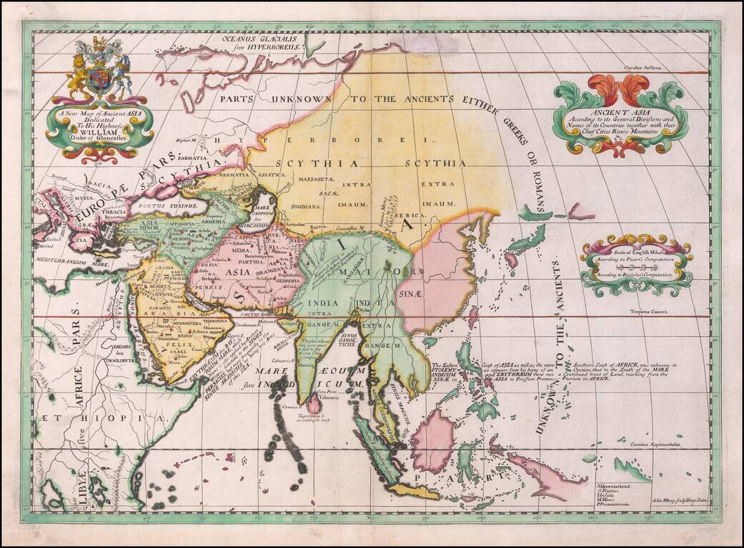
Decorative map of Asia, published in Oxford, circa 1700. The map extends from Saudi Arabia and the Black Sea to Japan, New Guinea and unknown parts which would appear to be the northern Australia coastline. This decorative map was part of a set of 22...
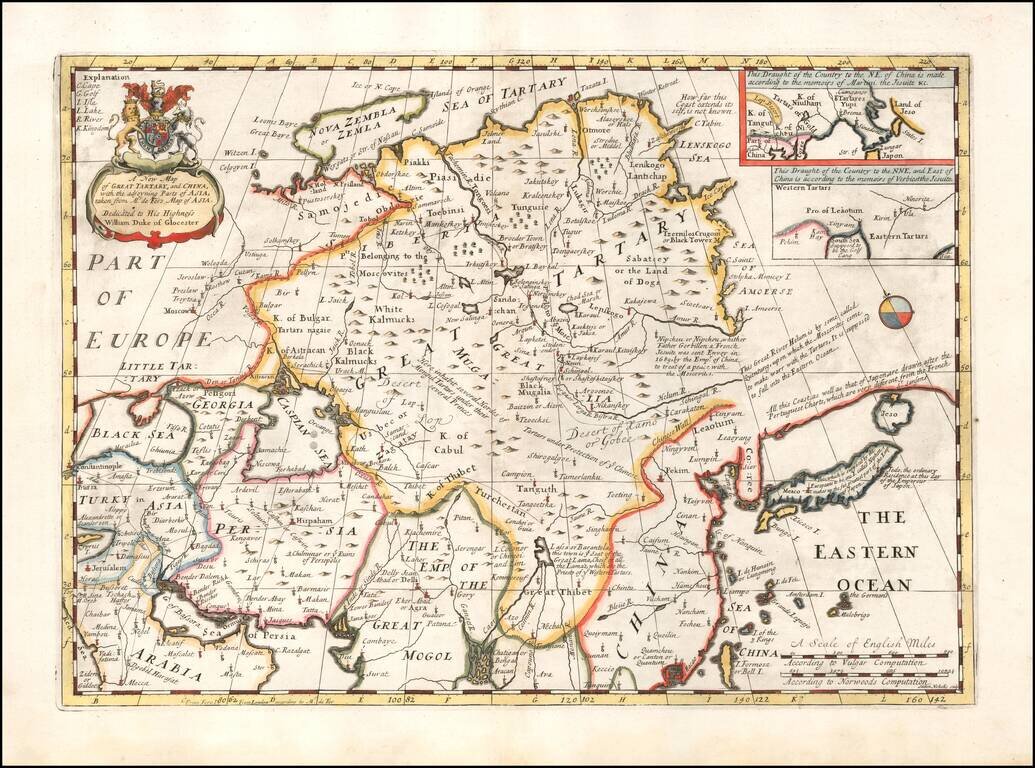
Decorative map of China, Tartary, Japan, Central Asia, etc. at the beginning of the 18th Century. Includes the mythical land bridge to America, the Island of Formosa or Bell Island, and other interesting details. This map was part of an atlas...
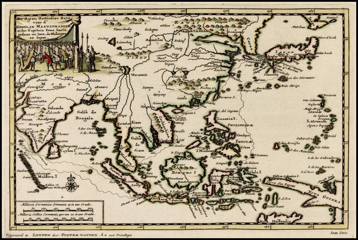
Decorative map of the region from India to Southeast Asia and north to Japan and Korea, including an illustration of the Great Wall of China, illustrating the Dutch translation of the account of the voyage of John Saris, Captain of the first English...