Map size in jpg-format: 35.1293MiB
Click to open in high resolution (open in new tab).
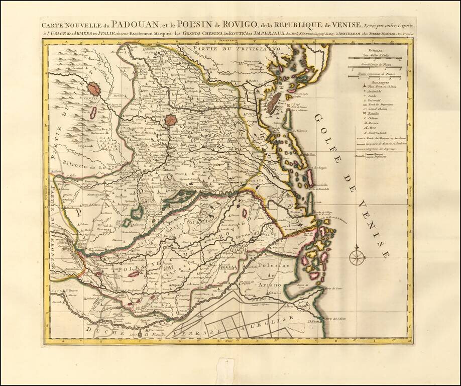
Detailed map of Padua, Italy. Includes the Province of Rovigo and the Gulf of Venice. The map illustrates the islands, roads, pathways, valleys, mountainous regions, forests and waterways the Italian and French armees used to navigate through the region. The map highlights the towns of Padua, Vincenza, and Venice.
The map features churches, chateaus, agricultural areas, lakes, universities, military ships, etc. Also includes a compass and scale of distance.
Published in Amsterdam, circa 1700.
Pierre, or Pieter, Mortier (1661-1711) was a Dutch engraver, son of a French refugee. He was born in Leiden. In 1690 he was granted a privilege to publish French maps in Dutch lands. In 1693 he released the first and accompanying volume of the Neptune Francois. The third followed in 1700. His son, Cornelis (1699-1783), would partner with Johannes Covens I, creating one of the most important map publishing companies of the eighteenth century.
If you are a student, write to us in telegram: @antiquemaps and indicate what material you need and for what work you need a map in high detail. We are ready to provide material on special terms. For students only!


