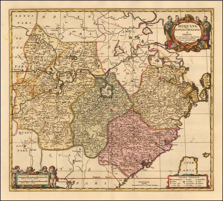
Fine example of the Valk & Schenk edition of Jansson's map of Hunan (Huquang), Jiangxi (Kiangsi), Zhejiang (Che Kiang), and Fujian (Fokien) in eastern China. The map is drawn largely from Blaeu's maps compiled by Jesuit Father Martino Martini who...
![[ Hong Kong / Macao / Canton ] Iunnan, Queicheu, Quangsi et Quantun, Provinciae Regni Sinensi Praefecturae dictae](/map/small/55800.jpg)
Fine example of the Valk and Schenk edition of Jansson's regional map of China, including the Hong Kong - Macao Region . A beautifully engraved map of Southern China covering Hainan and the Pearl River Delta with Macao and the islands around...
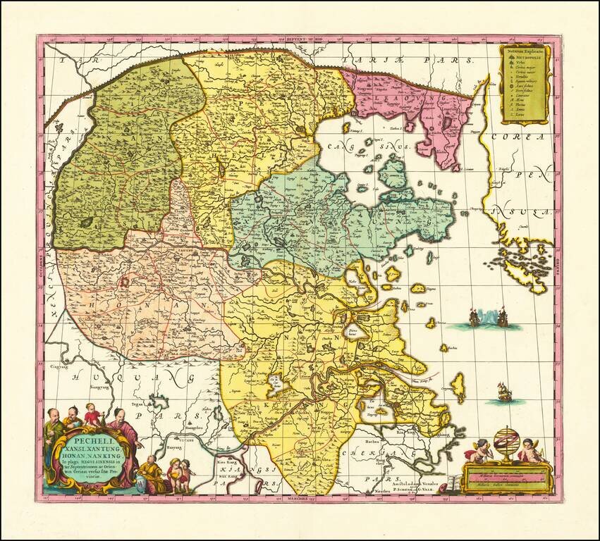
Scarce Valk & Schenk edition of Jan Jansson's highly decorative map of northeastern China and Korea. The present map is very geographically advanced for its time and depicts the provinces of Hebei (Pecheli), Shanxi (Xansi), Shandong (Xantung),...
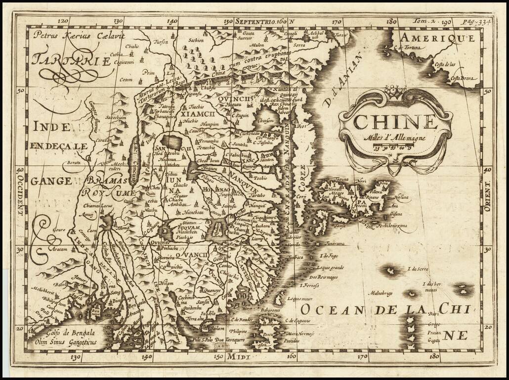
A Rare Variant! Rare early map of China, published by Martineau du Plessis in Paris. The map is printed from a copper plate originally engraved by Petrus Kaerius (Peter Vander Keere) Johannes Cloppenburg's Atlas Sive Cosmographie in 1730. This state...
An attractive map of the region bounded by northern India, Pakistan, Afghanistan and Bangladesh and extending inland up the Ganges and Indus Rivers to Tartary and the Himalayas, including Katmandu, Kabul and other legendary cities along the great...
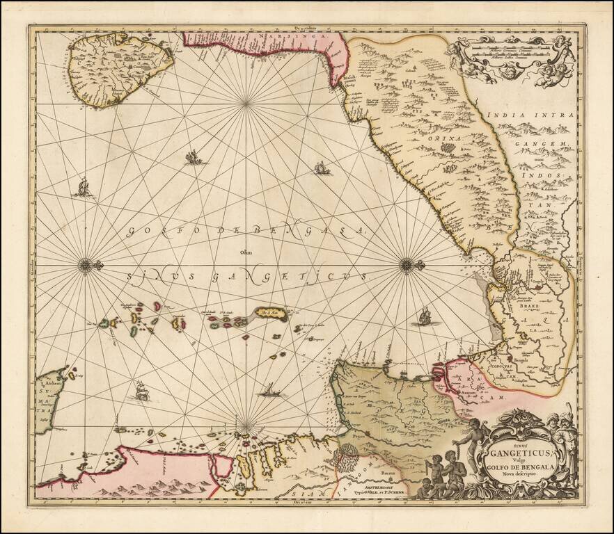
Valk and Schenk's edition of Jansson's engraved map of the Bay of Bengal from Ceylan (Sri Lanka) to Sumatra. This striking large format sea chart was originally published in a Jansson sea atlas. European and Oriental vessels are shown crossing the...
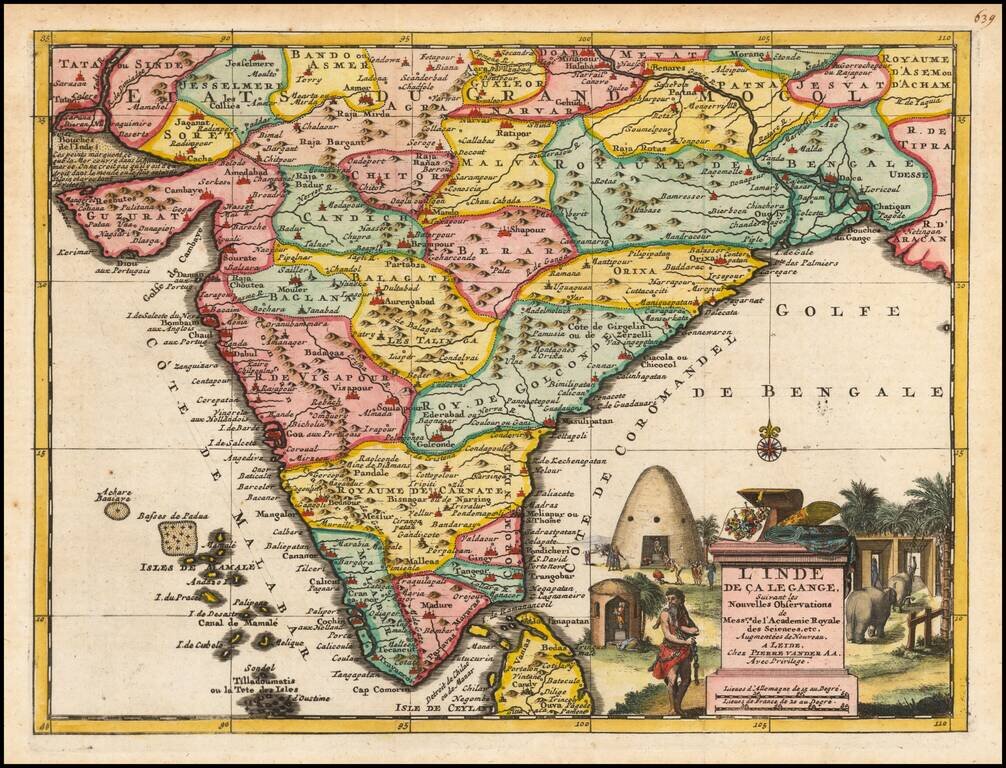
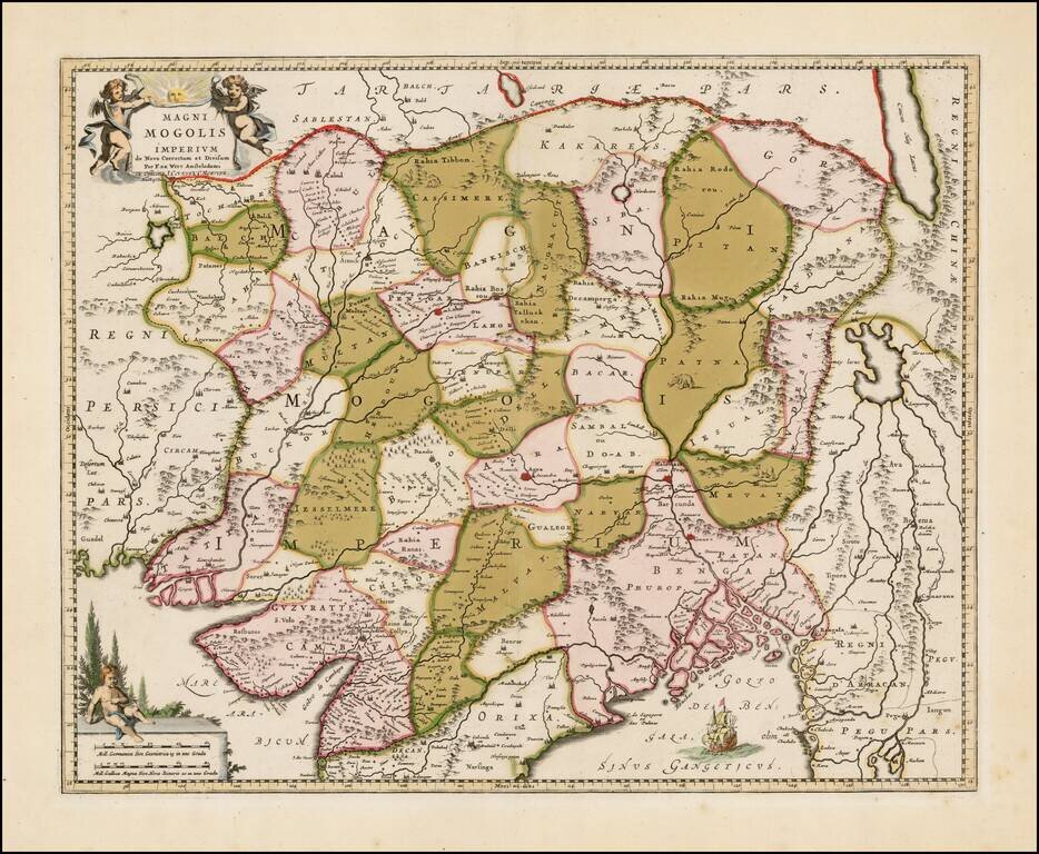
A highly attractive map embracing most of India, made during the height of the Mughal imperial expansion. The map encompasses most of India and Sri Lanka, showing cities, rivers, mountains, islands, political divisions, and more. An intriguing note...
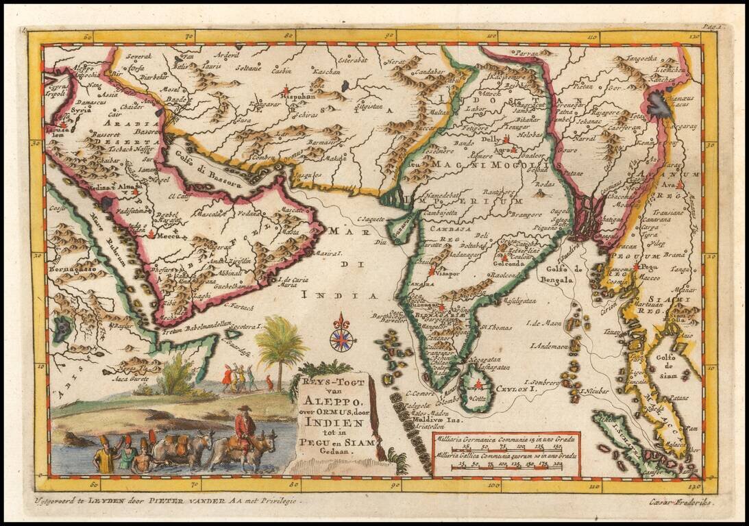
Detailed regional map of regions contiguous to the Indian Ocean, from the Red Sea, Persian Gulf and Saudi Arabia to the Gulf of Siam and Sumatra and extending North to Kandahar and the eastern Mediterranean. Caeser Frederiks traveled from Cyprus via...
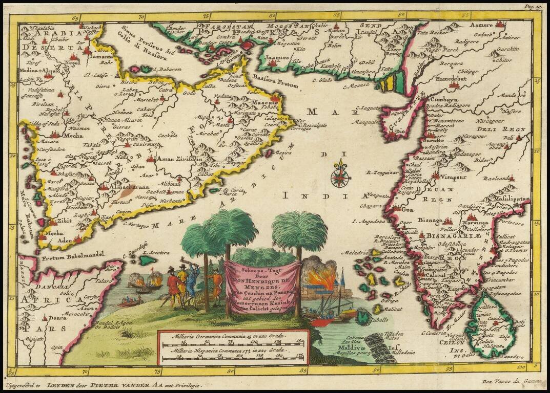
Fine image of the Arabian Peninsula and much of India, illustrating the third and final voyage of Vasco Da Gama, which result in his death and the ascendancy of Henrique de Menezes as Governor of India. Vasco da Gama was a Portuguese explorer and the...
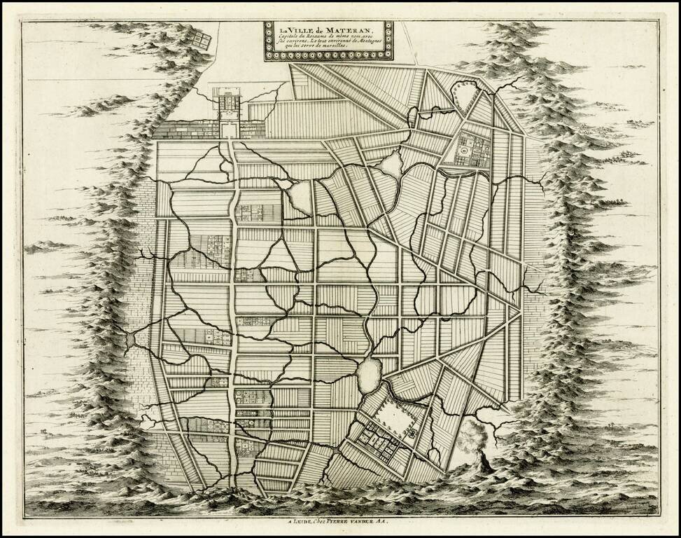
Rare plan of the city of Mataram on the Island of Lombok, immediately east of Bali in Indonesia. The Dutch had first visited Lombok in 1674 and the Dutch East India Company concluded its first treaty with the Sasak Princess of Lombok.
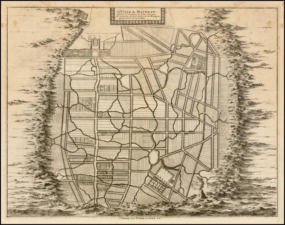
Rare plan of the city of Mataram on the Island of Lombok, immediately east of Bali in Indonesia. The Dutch had first visited Lombok in 1674 and the Dutch East India Company concluded its first treaty with the Sasak Princess of Lombok.
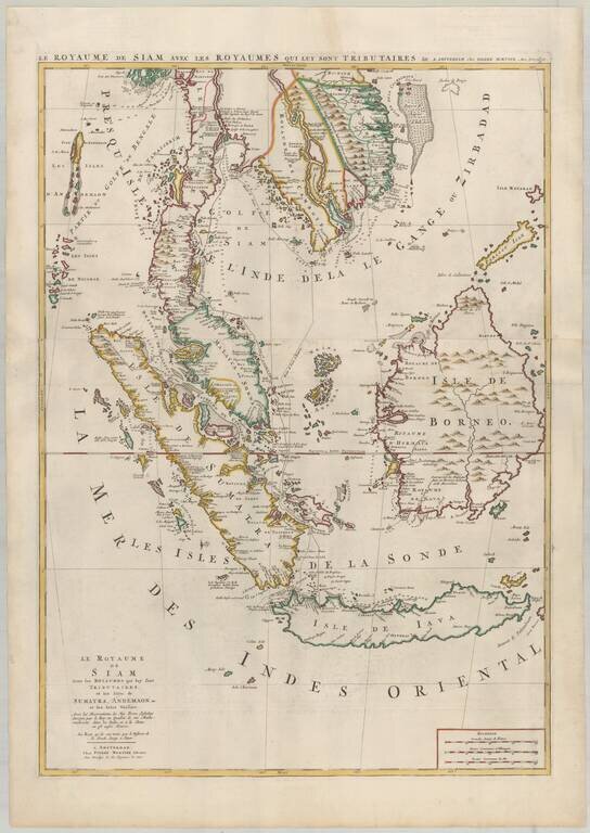
Mortier's Large Format Map of the Kingdome of Siam, Malaysian Peninsula, Singapore, Indonesia, etc. Finely colored example of Pierre Mortier's map of Southeast Asia, extending from Thailand, Cambodia, Viet Nam, and the Malay Peninsula and Gulf of...
![[Singapore, Sumatra, Borneo and Java] Le Royaume de Siam Avec les Royaumes qui luy sont Tributaires et les Isles de Sumatra, Andemaon, etc. et les Isles Voisine Avec les Observations des Six Peres Jesuits Envojez par le Roy en Qualite de Ses Mathematici](/map/small/64646.jpg)
Singapore, Sumatra, Borneo and Java Nice example of the lower sheet of Pierre Mortier's 2-sheet map, extending from Sinagpore to Java and Sumatra in the South. One of the more fascinating notes shows a discovery attributed to "Pierre Bertollo" in...
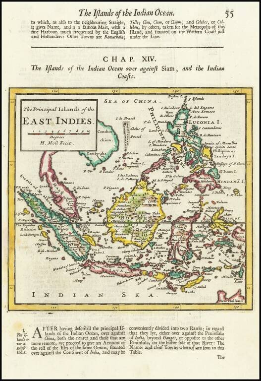
Detailed map of South East Asia and the Philippines, with explanatory text. First published in 1695, this map is from one of the subsequent editions of Abell Swall's and Tim Child's Thesaurus Geographicus issued in 1700, 1701 and 1709.
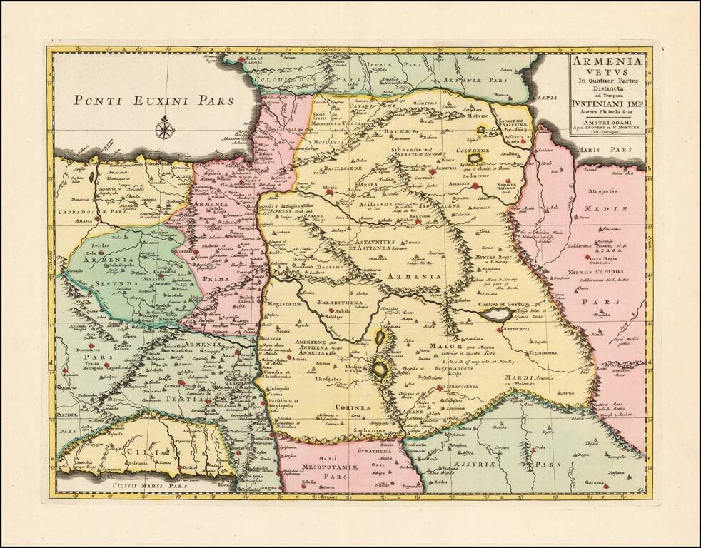
Scarce and highly detailed map of Ancient Armenia by Covens & Mortier, based upon an earlier map by Philippe De La Rue. One of the earliest printed maps to focus on Armenia.
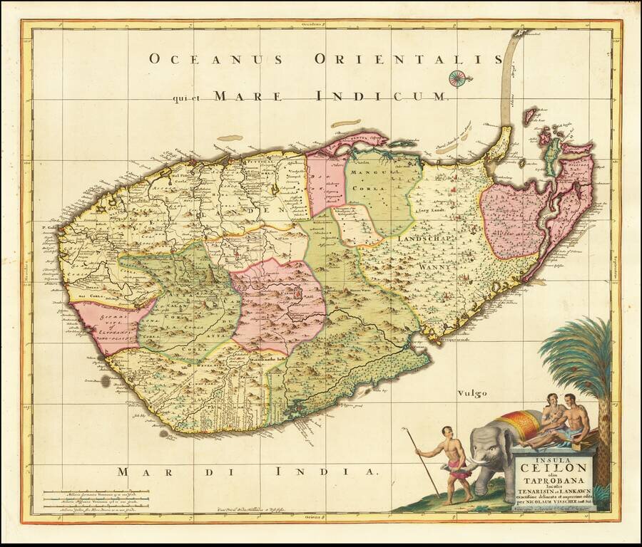
Fine large format map of Sri Lanka, first published in Amsterdam first published by Nicolas Visscher and later re-issued by Schenk. One of the largest atlas maps of Sri Lanka, with a striking cartouche, embellished with an elephant and local Sri...