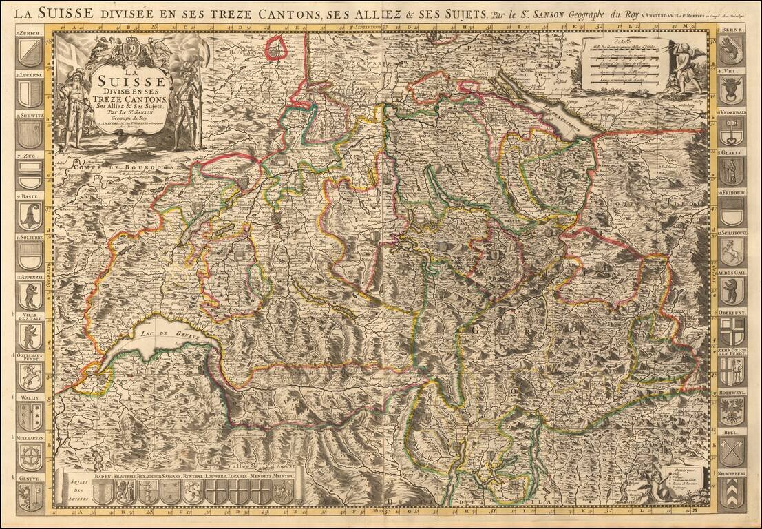
Map of Switzerland with decorative title cartouche at top left. The map is flanked at each side by a total of 24 coats of arms of the Swiss cantons, principal cities, and allies. A panel at the bottom left includes a further nine arms of "Sujets Des...
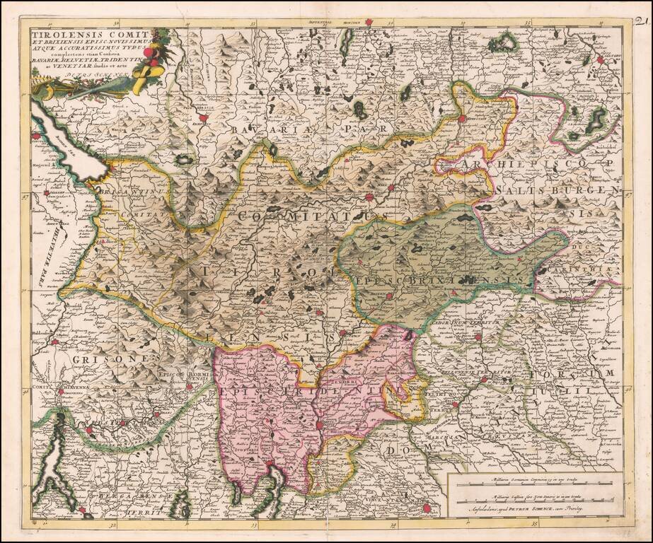
Fine old color example of the Tirolia region, published by Peter Schenk in Amsterdam.
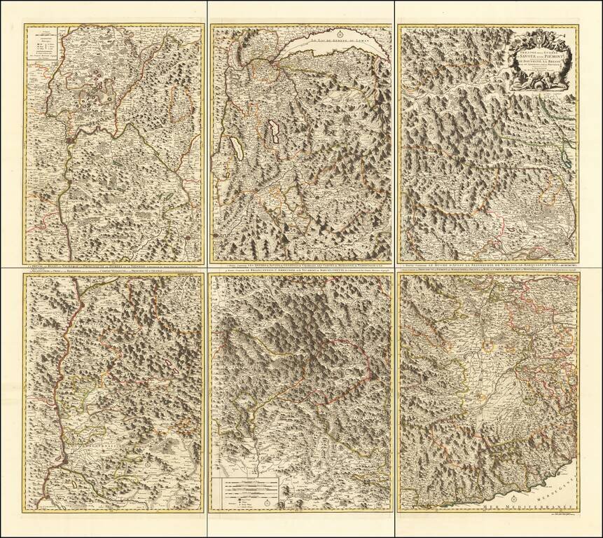
Rare 6-sheet map of the Savoy and Piemonte region, published by Pierre Mortier in Amsterdam. The map provide a highly detailed treatment of the topography of the region. Lake Geneva at the top center, with Monaco and the Italian Riviera at the bottom...
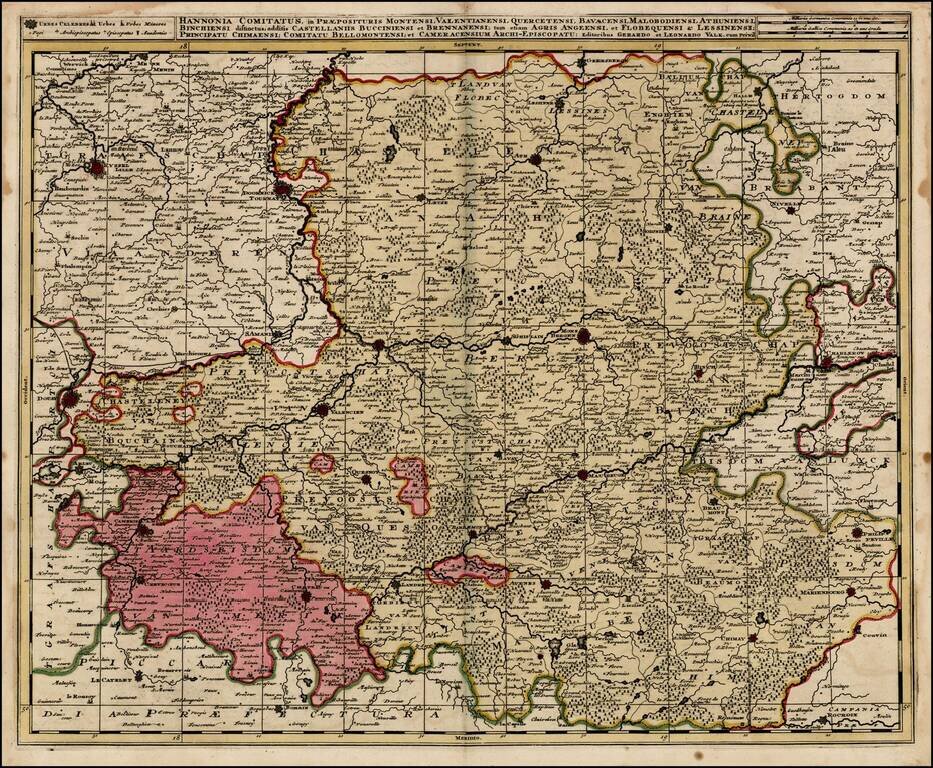
Detailed regional map, extending from Lille and Douay in the west and Charleroy and Phlippeville in the east, centered on Valencien, Conde, Mons, S. Amande, Cambray, Tournay, etc.
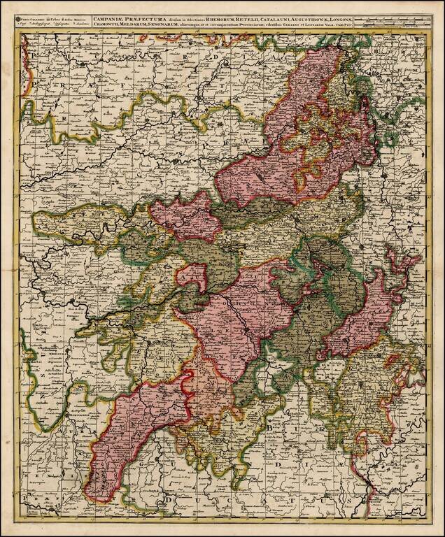
Detailed map of the Champagne region of France. Old Color. Double Thick Paper.
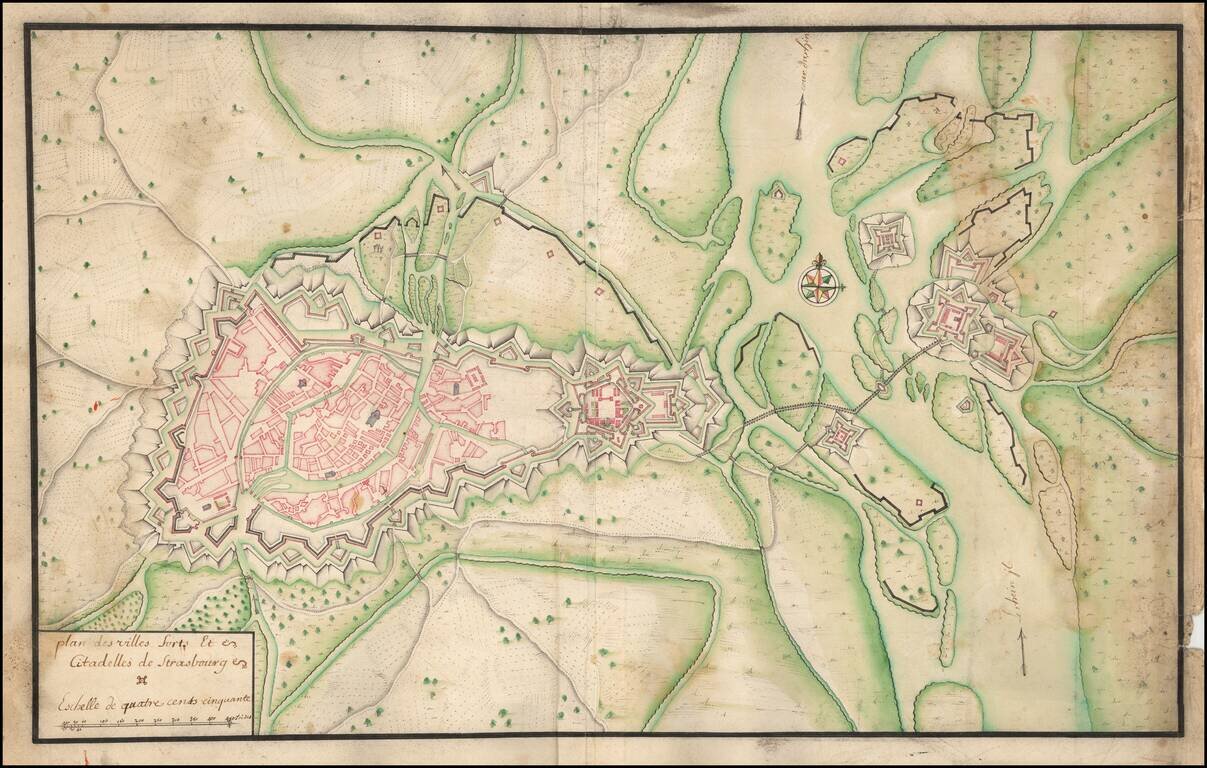
Manuscript Plan of Strasbourg and Environs, including the fortifications at Kehl. Detailed hand drawn plan of Strasbourg, focusing on its fortifications in the Vauban style.
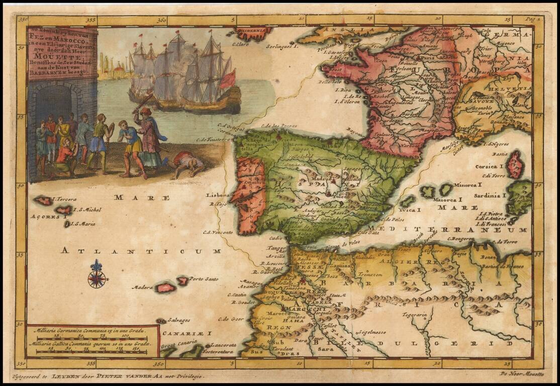
Fascinating map illustrating a voyage from Dieppe to Marseille, via the Straits of Gibralter. Decorative cartouche.
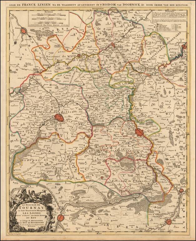
A fine example of Jaillot's map of the border area between France and Belgium with the towns of Tournai, Lille, Ipres, Douay, Condé and others. The map also locates smaller towns, churches, religious schools, residential areas, castles, cabarets,...
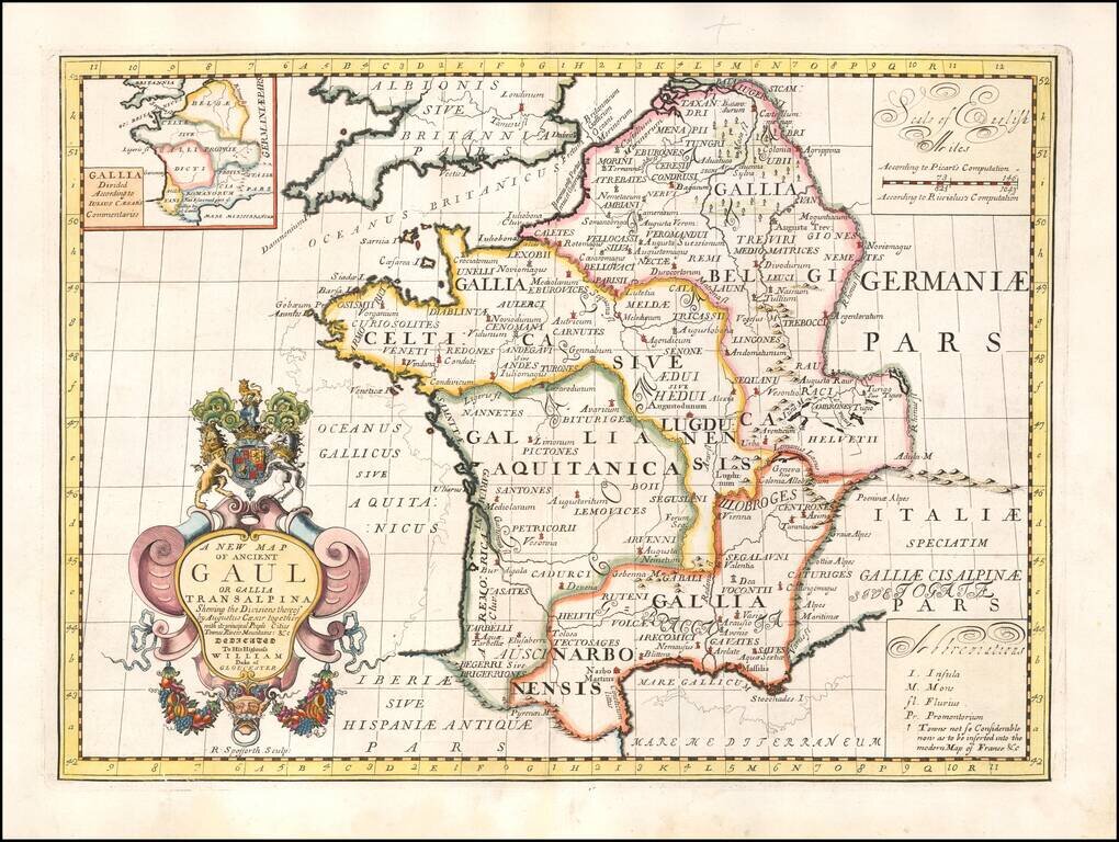
Decorative map of France, as divided by Augustus Ceasar. This decorative map was part of a set of 22 maps dedicated to William, Duke of Glouchester, who was then an 11 year old student at Oxford.
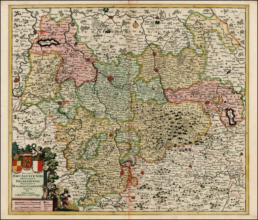
Detailed regional map of Germany, centered on Hanover, Holdesheim, Wolfenbuttel and Gottingen, and extending from Minden to Halberstadt. Includes a decorative cartouche with the coats of arms of Brunswick, Hildesheim, and Halberstadt.
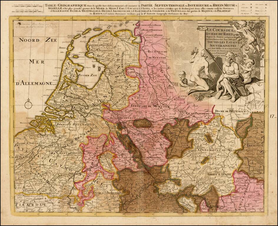
Detailed map the the Low Countries and Germany focusing on the course of the Rhine River.
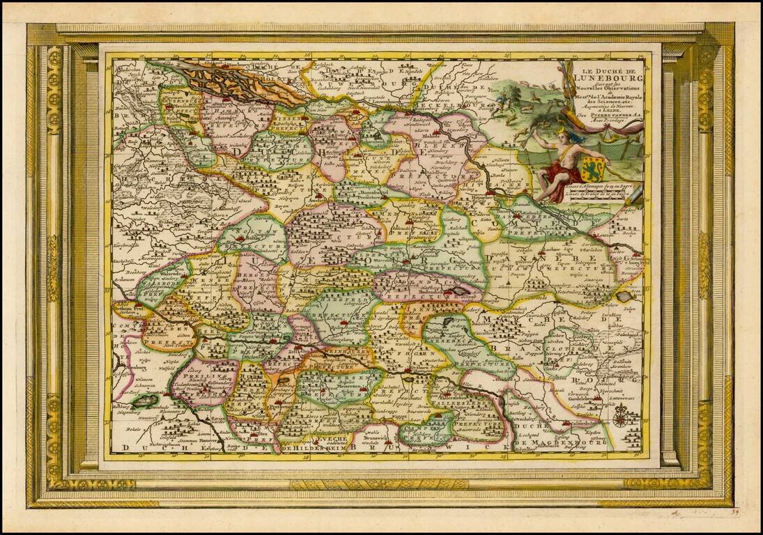
Decorative example of Vander Aa's map of the Duchy of Lunebourg. Nice example, with the picture frame border, which appeared in Vander Aa's Nouvelle Theatre Du Monde, published in 1713.
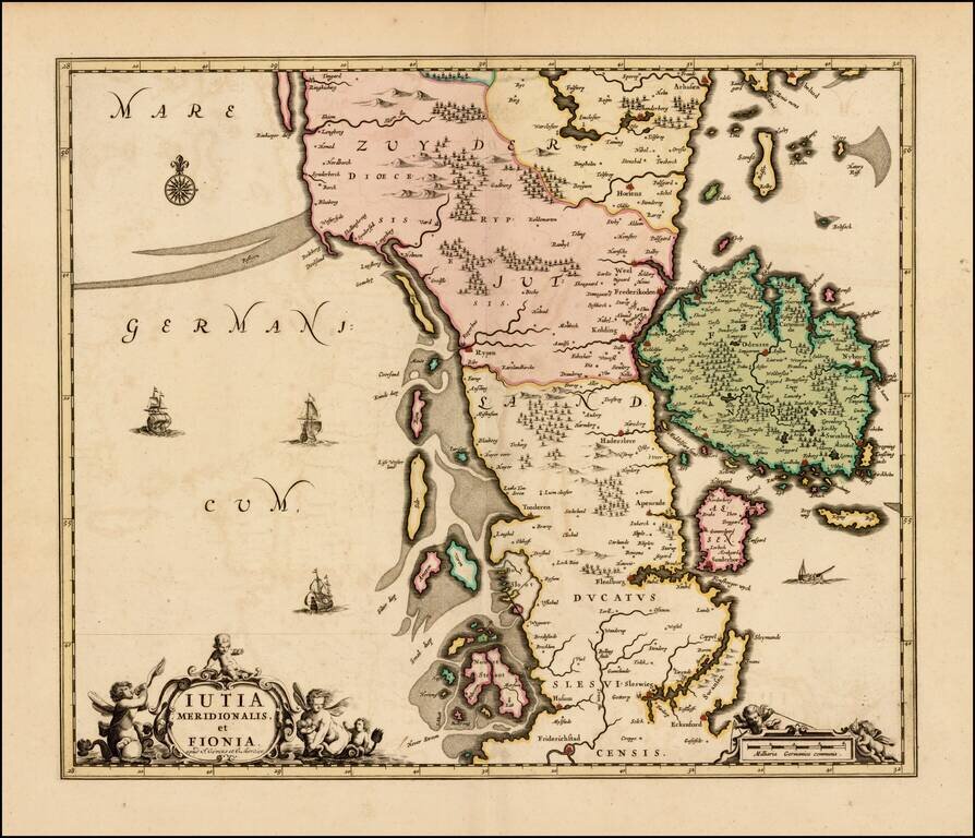
Rare map of the southern part of Jutland and the island of Fionia, published by Covens & Mortier. The map was originally issued by Hugo Allard, circa 1690. All editions are very rare on the market.
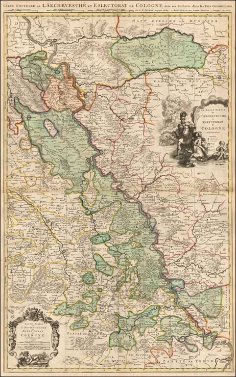
Detailed map the course of the Rhine River, from the Wesel area in the Duche of Cleves to Coblentz. Major towns in the region shown include Rheinberg, Duisberg, Dusseldorf, Leverkeusen, Cologne, and Bonn. Fine old color and 2 decorative cartouches.