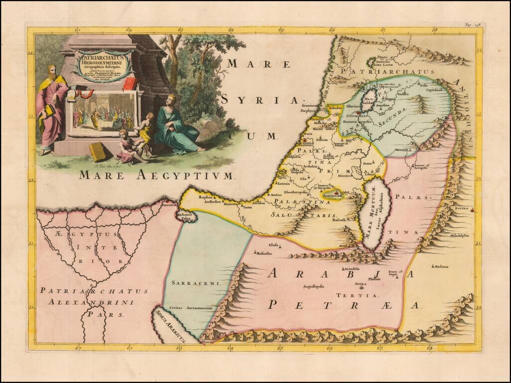
Fine example of Francois Halma's map of the Latin Patriarchate of Jerusalem. Latin Patriarchate of Jerusalem is the title of the see of Roman Catholic Archbishop of Jerusalem. It was originally established in 1099 with the Kingdom of Jerusalem...
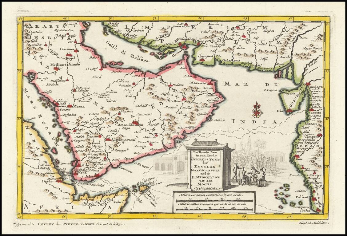
This is an interesting map centered on the Arabian peninsula. The title of the map refers to the (supposed) sixth voyage of Sir Henry Middleton on behalf of the East India Company. The map shows the Arabian peninsula in full, Abyssinia, the Horn of...
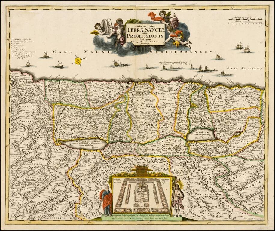
Rare example of David Funcke's richly detailed map of the Holy Land, published in Nuremberg. The map is oriented with west at the top, in the style of Van Adrichom. Shows the encampment of the Israelites, flanked by Moses & Jesus. One of the most...
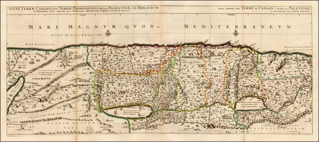
Fine 2 sheet map of the Holy Land, first issued by Pierre Mortier circa 1700. The map is based on the Holy Land on Christiaan van Adrichom's stunning map, Situs Terrae Promissionis, however with the Mediterannean oriented at the top of the map. The...
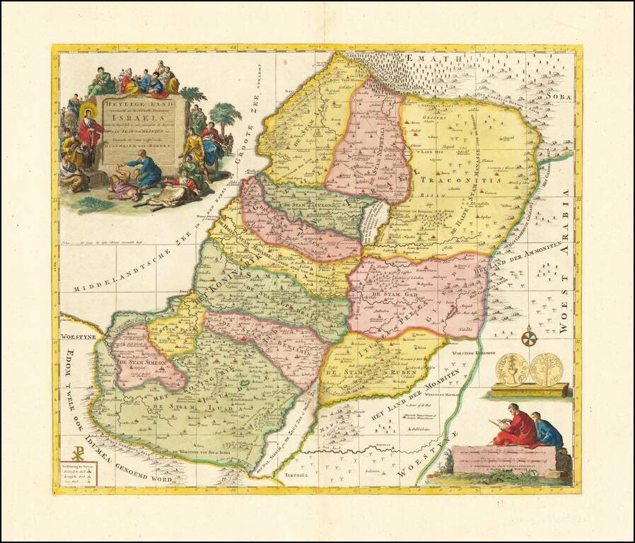
Finely engraved map illustrating the 12 Tribes of Israel, published in Amsterdam by Covens & Mortier.
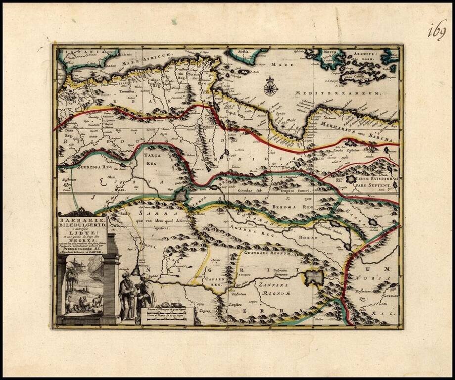
Decorative regional map of North Africa, with an elaborate title cartouche. The map illustrates North Africa and part of the region inhabited by the Negro Countries.
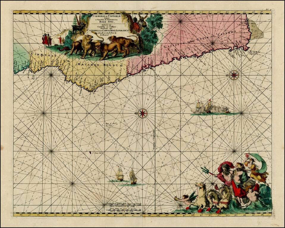
Nice old color example of Louis Renard's sea chart of the Southwestern Coast of Africa. Striking sea chart, with detailed treatment of the coastal regions, rhumb lines, compass roses, elaborate cartouches and sailing ships.
![[Title Page: Nova Totius Geographica Telluris Projectio. Edita Per Gerardum Valk]](/map/small/35730.jpg)
Fine full original color example of the title page from Valk's rare composite atlas. Valk's title page illustrates the mythical characters Atlas, Geography, Cybele, Neptune and History, surrounded by a putti. Above, the Angel of Fame with a trumpet in...
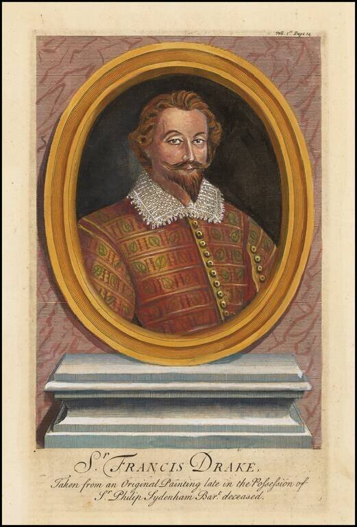
Finely engraved portrait of Sir Francis Drake.
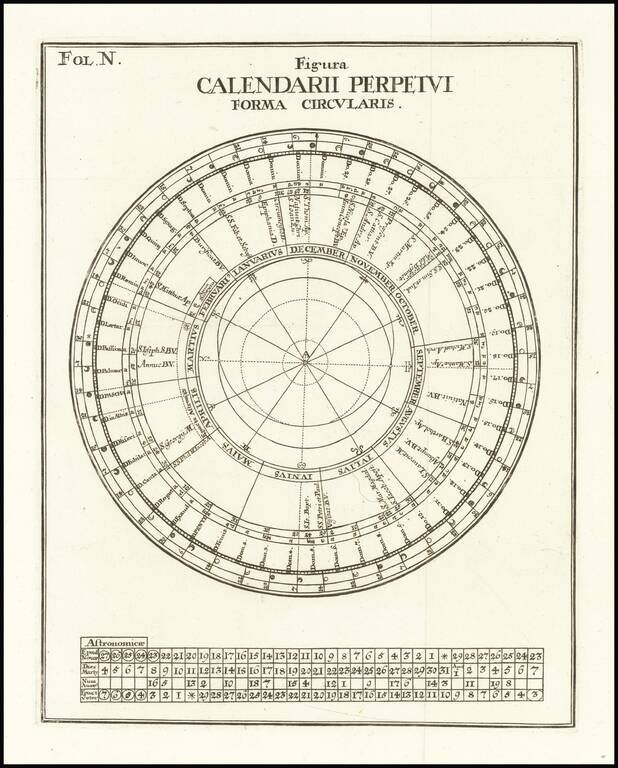
Fine Example of a Perpetual Calendar Circular figure showing a perpetual calendar, which was used to calculate future dates and events. The concentric circles of the diagram contain important information for figuring time, including zodiac signs,...