
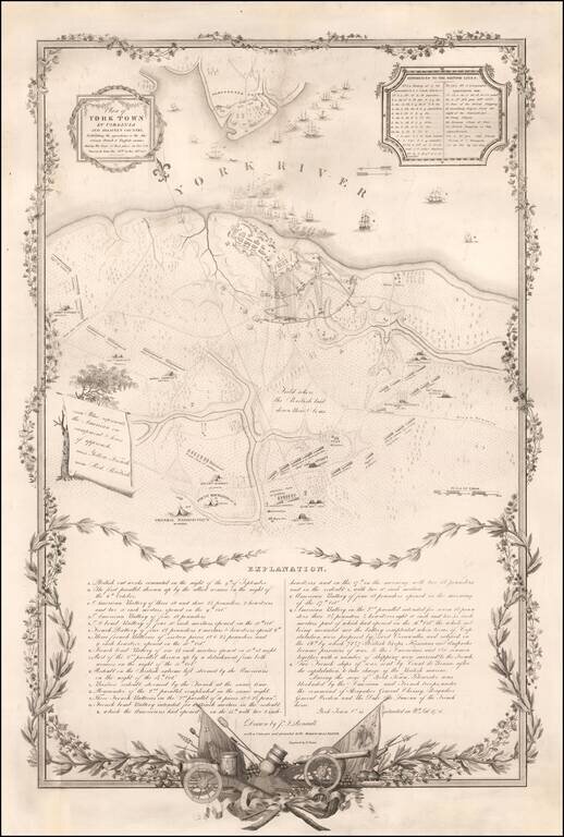
Revolutionary War Battle Plan Published to Commemorate the Marquis De Lafayette's Return To America in 1825 Rare plan of the siege of Yorktown, issued on the occasion of Lafayette's triumphal 1825 visit to America. Drawn by John Francis Renault, a...
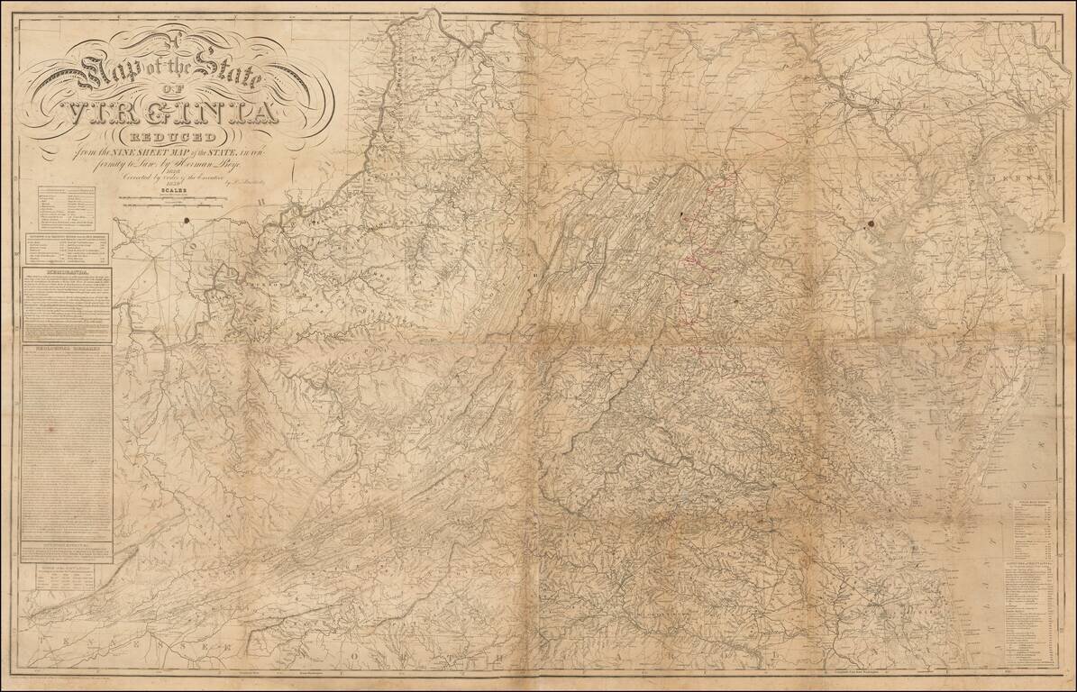
Annotated Example of the Most Important Virginia Map From Mid-19th Century, Showing The Confederate Army's Movements During the Gettysburg Campaign. Map Overview Herman Boye's map of Virginia is among the most important maps of Virginia published in...
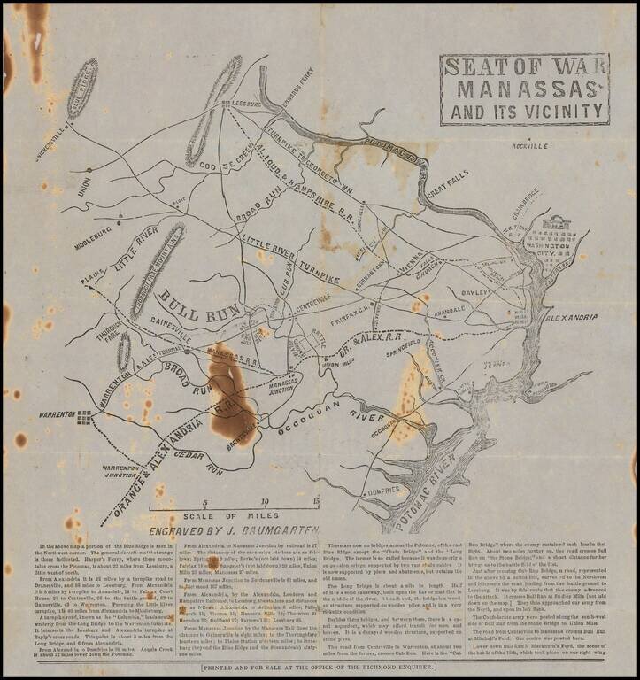
Rare Confederate broadside map related to the Battle of Bull Run, published for the Richmond Enquirer in the aftermath of the battle. Lithographed or wood-engraved map of northern Virginia, from Washington, D.C. to Warrenton. The map names Alexandria...
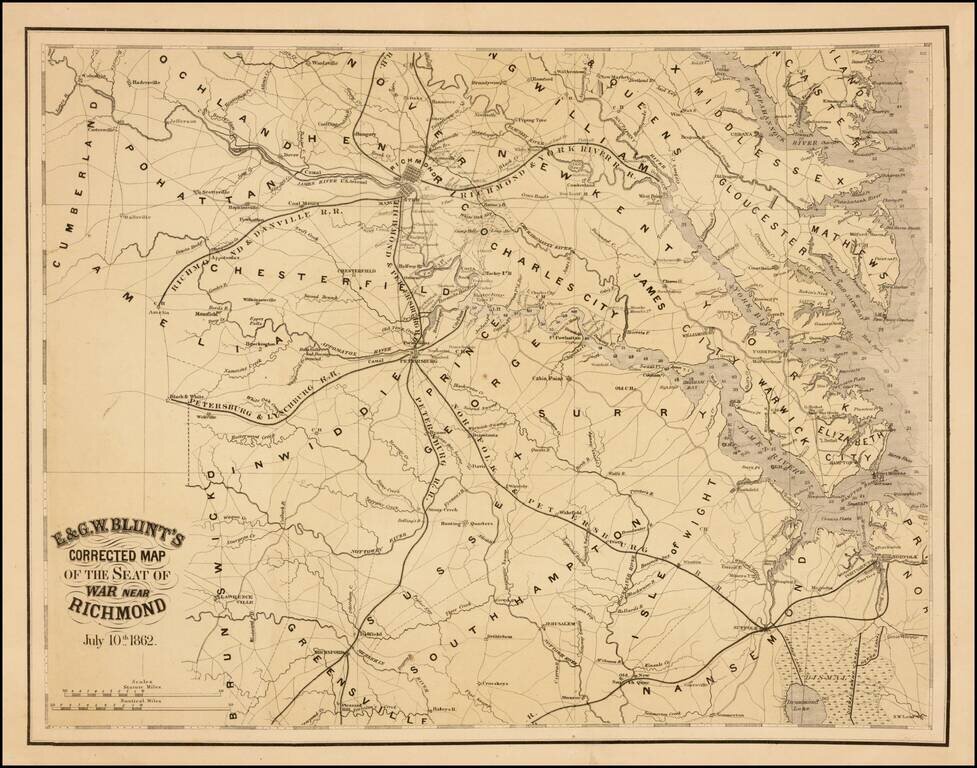
Rare separately issued map of the area around Richmond, Virginia, published by E & GW Blunt in July, 1862. The map shows Richmond and the railroad lines, canal, roads and rivers that feed into the City, including the Richmond & Danville...
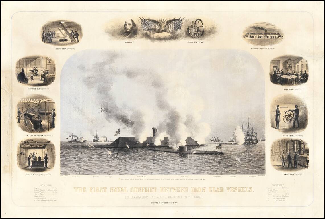
The First Battle of the Iron Clads. In a Contemporary Civil War-Era Lithograph. Three-stone color lithograph of the most famous naval battle of the Civil War; the engagement between the Iron Clads Virginia (of the CSA, a.k.a. "Merrimac") and Monitor...
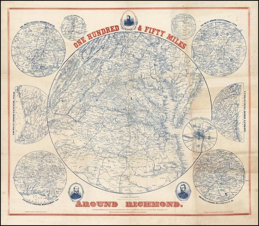
Scarce regional map of the area around Richmond, with 9 inset maps showing the 100 miles around Milledgeville, GA; 250 miles around Charleston, SC; 100 miles around Chattanooga, Tenn; Fortifications around Richmond; 200 miles around Montgomery, Ala,...
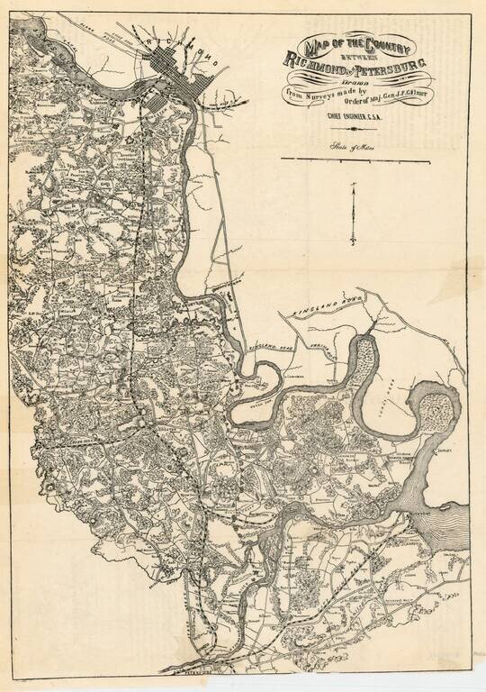
Rare Confederate States of America map of the region between Richmond and Petersburg, prepared by the Chief Engineer of the CSA, J.F. Gilmer. The map provides excellent detail, including town, roads, railroads, woods, rivers, forts, landowners and a...
Scarce map of the area around Richmond, showing towns, railroad lines, roads, rivers, bridges, court houses, and other details. Notes show the US Arsenal, Sherman's Crossing of the South Anna and subsequent capture on May 11, and other details....
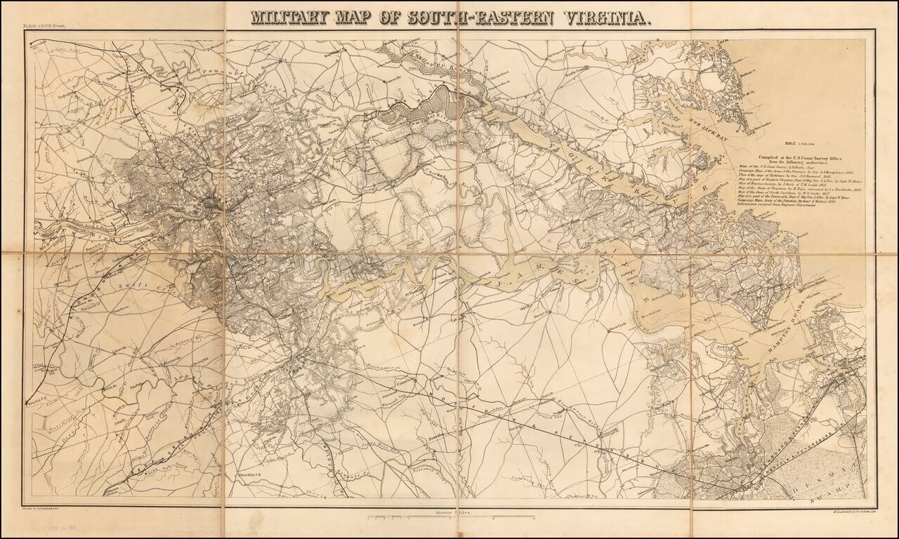
Rare separately issued map Southeastern Virginia, produced by Lindenkohl and lithographed by Krebs at the direction of the US War Department in 1864. The map depicts the towns, courthouses, lines of communication and other militarily significant...
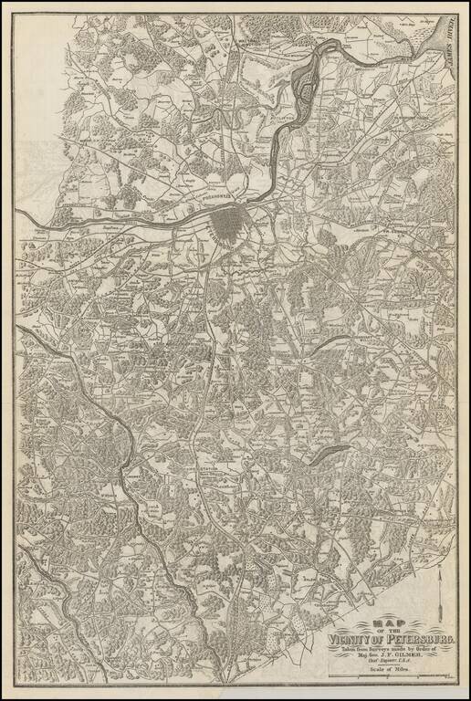
Scarce map of the vicinity of Petersburg, extending from the region just north of the James River to the state line with North Carolina. The map is exceptionally detailed and shows towns, court houses, roads, railroads, rives, woods and the names of...
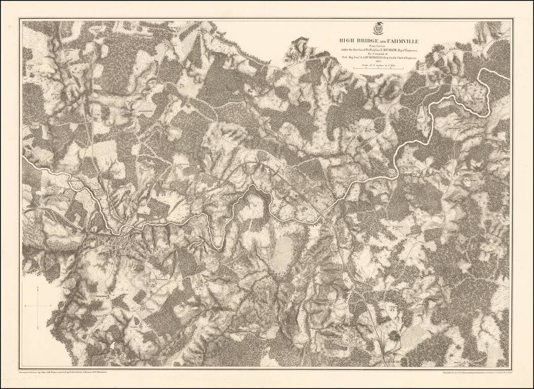
Highly detailed map of the area around Farmville, Virginia, depicting one of the final battle fields of the Civil War. Farmville Robert E. Lee retreated through Farmville as he escaped the Union Army in the Civil War. Farmville was the object of the...
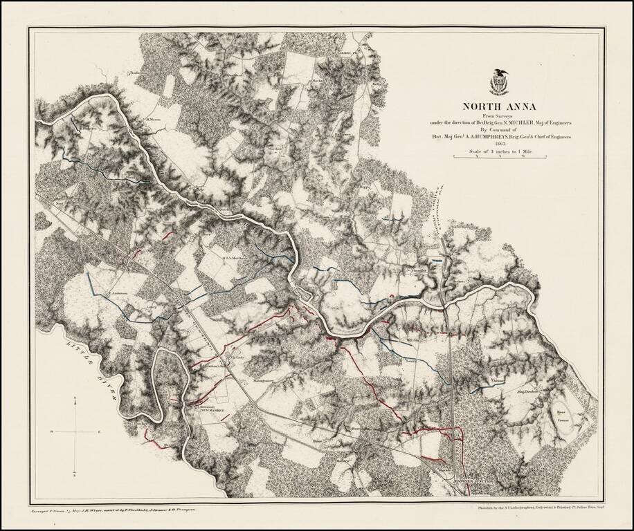
Fine example of this detailed map of area around North Anna. Rumsey describes the map as follows: Stephenson states these are a "detailed series of maps indicating fortifications, roads, railroads, houses, names of residents, fences, drainage,...
![[Atlanta Campaign] Map Illustrating the Military Operations in Front of Atlanta, Ga. From the Passage of Peach Tree Creek, July 19th 1864, to the Commencement of the Movement upon the Enemy's Lines of Communication, South of Atlanta, August 26th 1864 . .](/map/small/54700.jpg)
Remarkable map of the five miles around Atlanta, offered here in the so-called facsimile reproduction edition, published by the Graphic Company of New York. By far the most detailed map of the region around Atlanta to depict this fast growing southern...
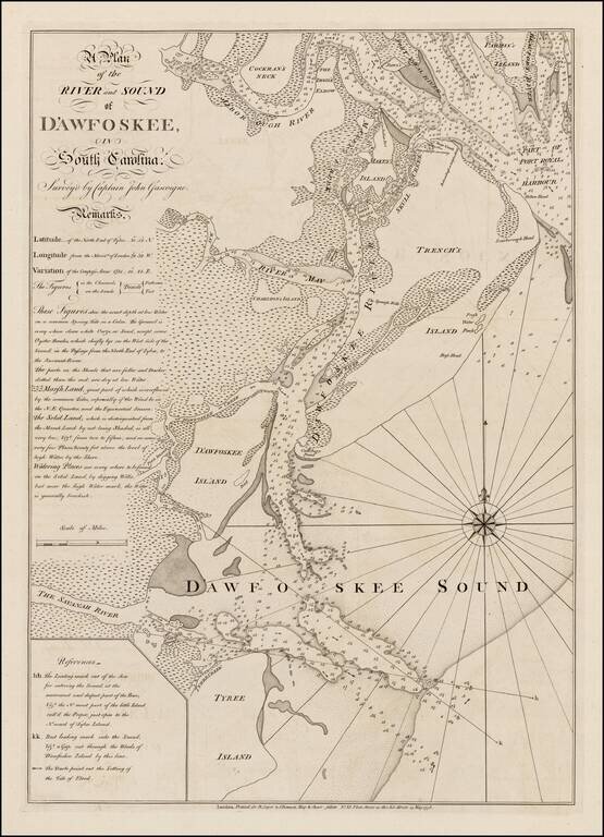
Highly detailed sea chart of the area around Hilton Head, South Carolina, based upon a survey by Captain John Gascoigne. Gascoigne's finely engraved chart was produced at the beginning of the American Revolution, at a time when the outcome among the...
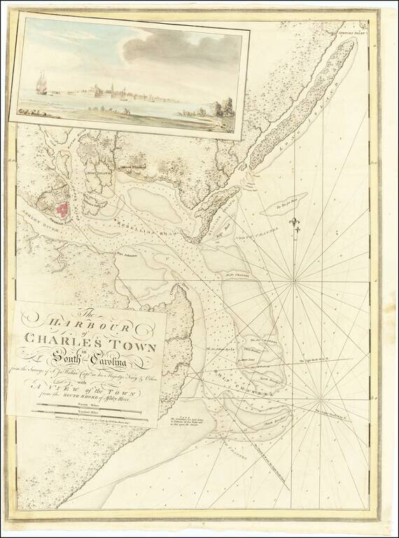
Magnificent Revolutionary War Reconnaissance Chart of Charleston, South Carolina from The Atlantic Neptune Spectacular Revolutionary-era chart of the harbor of Charleston, South Carolina, based on British surveys taken in the weeks prior to...
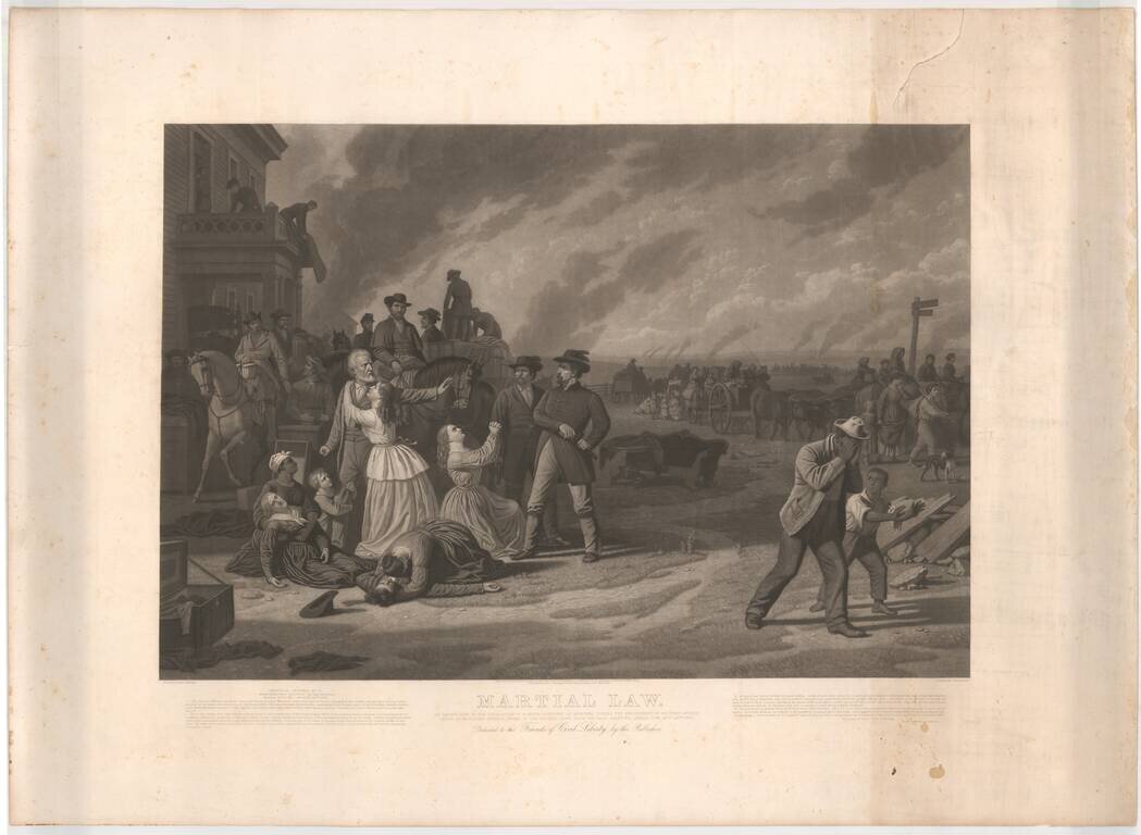
Proof state of this large mezzotint of George Caleb Bingham's painting "Martial Law," an artistic protest against the Federal Goverment's declaration of martial law on the Kansas-Missouri border. This iconic image shows the evacuation of civilians...