
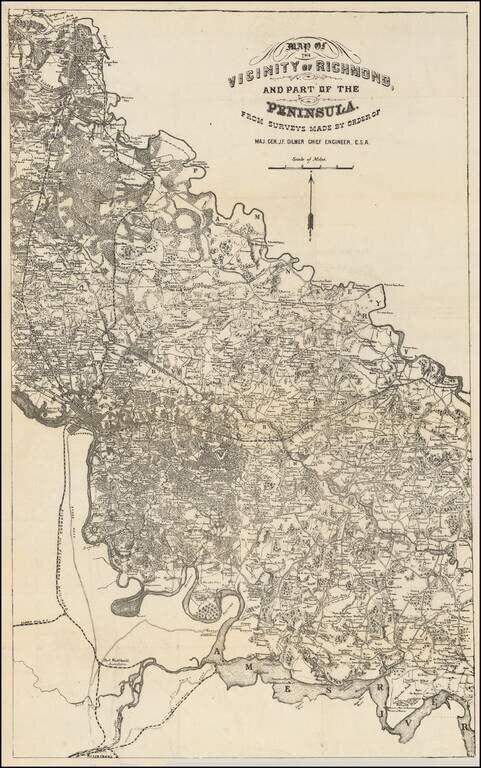
Rare map of the area between the Pamunkey and Ames Rivers, showing the Vicinity of Richmond, Virginia, as surveyed by Jeremy Francis Gilmer, surveyor for the Confederate States of America. The map bears some relationship to Albert H. Campbell's Map of...
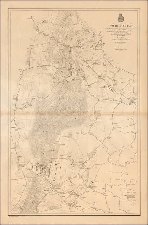
Large, detailed lithographed map of the Battle of South Mountain, a somewhat mixed Union Victory, which set the stage for the Battle of Antietam three days later. The Civil War Trust says of the Battle of South Mountain: After his success at Second...
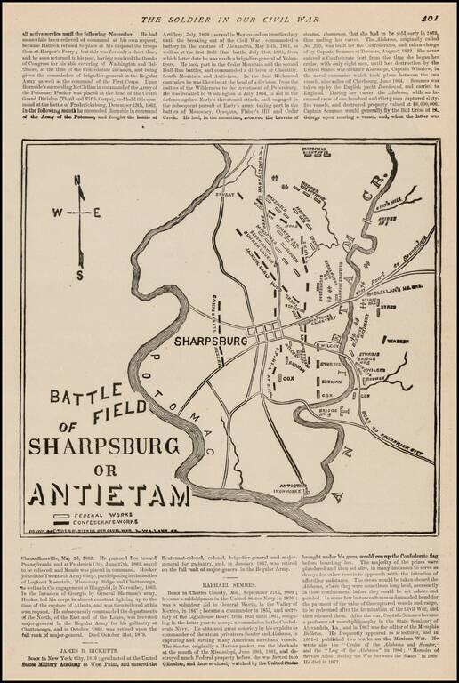
Fine sketch map of the Battlefield at Antietem, which appeared in The Soldier In Our Civil War, published by Frank Leslie. The map shows Confederate and Federal Works, various positions naming commanding officers, Roads and other important battle...
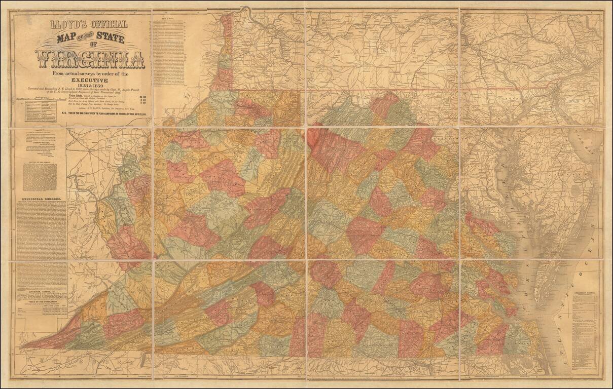
Important Large Map of Virginia With A Vitriolic Testimonial Added Nice example of the 1862 edition of JT Lloyd's large map of Virginia, the most widely distributed and influential map of Virginia during the Civil War period. Lloyd's map of Virginia...
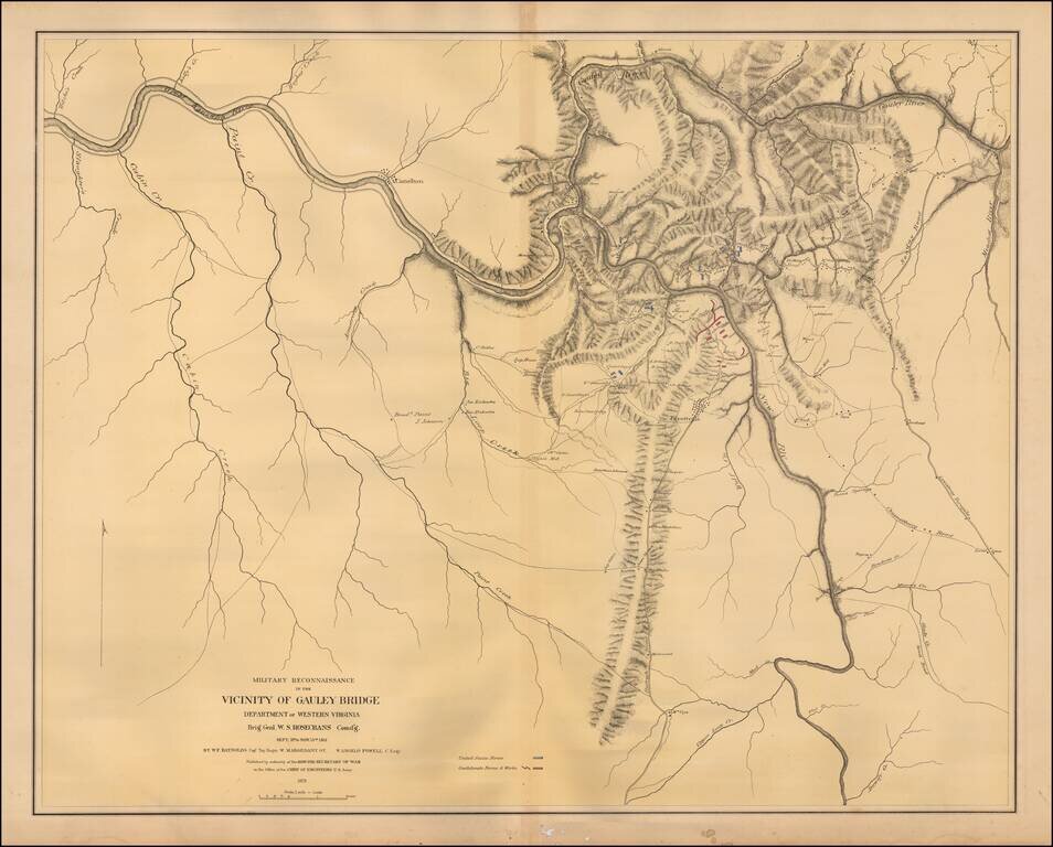
Color-lithographed map of the area near Gauley Bridge, (present-day) West Virginia. Gauley Bridge was the site of a minor battle during the Civil War, which resulted in a Union victory. "United States forces" are colored blue, and "Confederate forces...
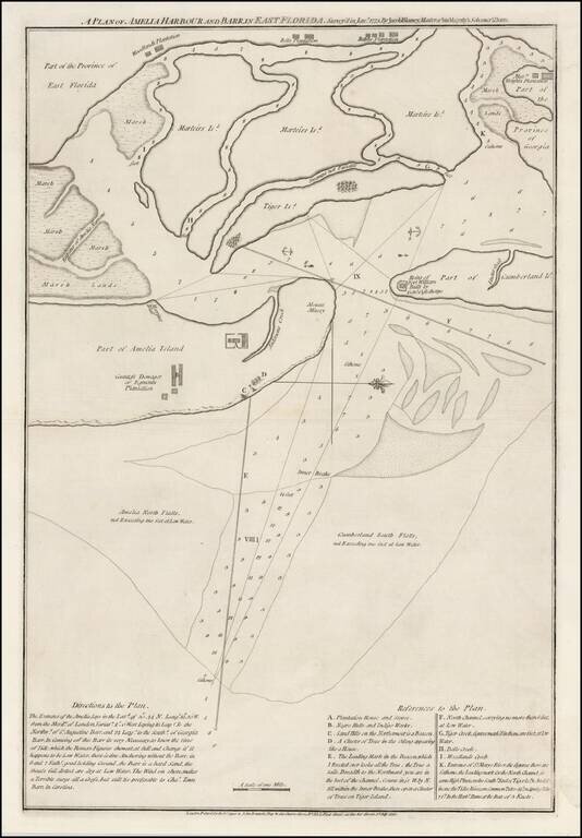
A Revolutionary War Florida Rarity. Fine wide margined example of Sayer & Bennett's chart of Amelia Harbor and Bar, based upon a survey conducted under the direction of Jacob Blamey in January 1775. The map is oriented with west at the top. On...
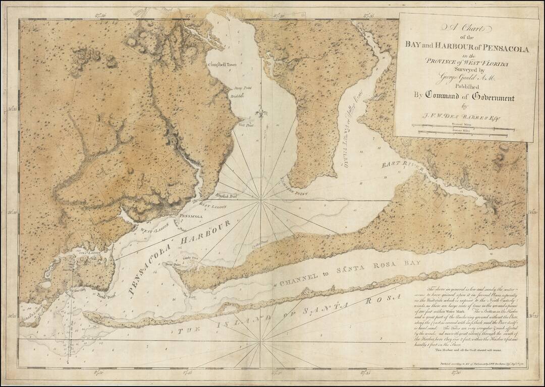
The Only George Gauld Chart Published During His Lifetime. Superb engraved chart of Pensacola Harbor in Florida, published during the American Revolution by J.F.W. Des Barres, from original surveys by George Gauld. The map extends from the eastern...
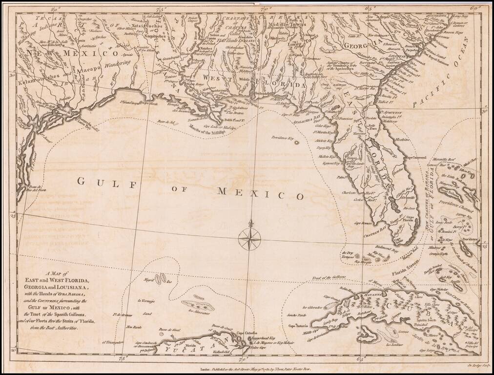
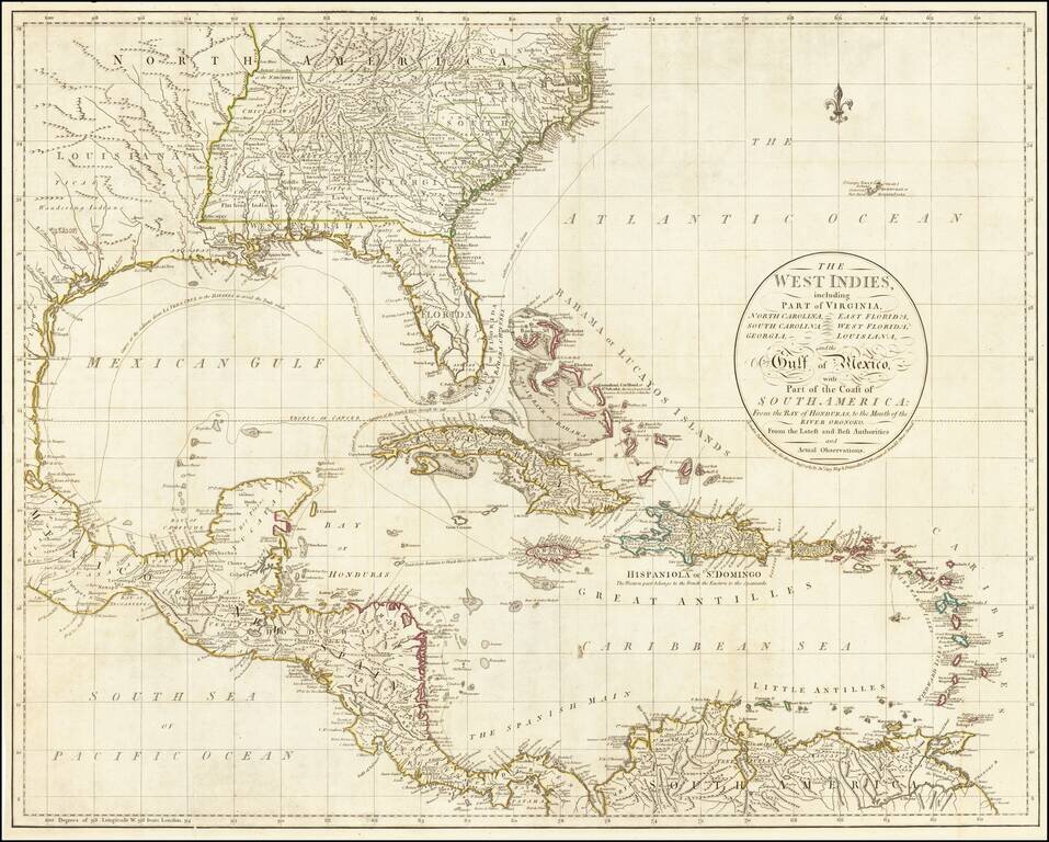
Antique Map of the Southeast United States During The American Revolution. Scarce Revolutionary War period map of the Southeastern part of the British Colonies in North America, Gulf Coast and Caribbean, illustrating the course of the Spanish Galleon...
John Cary's First Printed Map Nice example of John Cary's map of the Southeastern United States, Florida and the Caribbean, published on August 1, 1783. Published in August, 1783, the map was issued one month prior to the signing of the Treaty of...
![[South Florida] Miami. . . Sectional Aeronautical Chart](/map/small/69693.jpg)
Restricted World War II Aviation Map Detailed aeronautical map of the South Florida region. The chart is a font of information about civil and military aviation during WWII. It was intended for civil aviators flying by visual navigation and so...
Scarce Italian Map of the Southern Colonies in Colonial America at the Outset of the American Revolution A marvelous map the Southern part of Colonial America, published by Paolo Santini in Venice. The map covers most of Florida, then extending west...
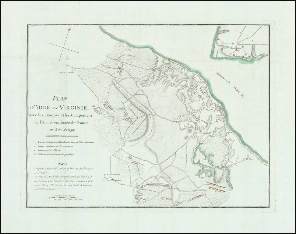
Detailed battle plan of the Battle of Yorktown, the final battle of the American Revolution. The map provides a detailed look at the battle of Yorktown, based upon French sources. The positions of the American, French and English forces and artillery...
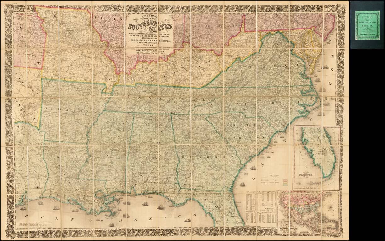
Second edition of Colton's detailed large format map of the Southern Plains and Midwestern States, at the outset of the American Civil War. Finely detailed map, one of the most commercially successful maps published by Colton during the 1860s.
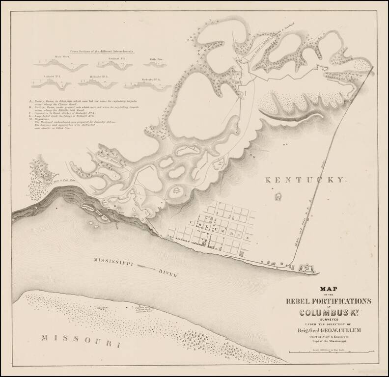
Rare plan showing the Rebel Fortifications at Columbus, Kentucky on the Mississippi River. Detail includes a town plan, tracks of the Mobile and Ohio R.R., Road to Elliott's Mill and Ft. Holt, Road to Blandville, Clinton Road to Milburn, Paducah &...
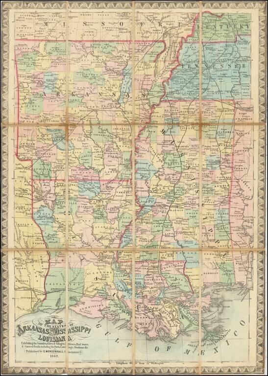
Extremely rare map of the states of the lower Mississippi, focusing on the states of Arkansas, Louisiana, and Mississippi, published by Edward Mendenhall, in Cinncinnati during the Civil War. The map labels the counties and parishes of the three...
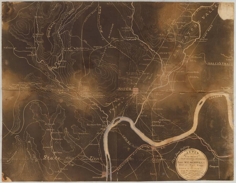
Early Photography & Battlefield Mapmaking Technology! Very rare and important Union Civil War "black map" or "sun map," printed in the field with a photographic process utilizing a mobile laboratory and darkroom. The map is centered on Jasper,...