Map size in jpg-format: 2877190B
Click to open in high resolution (open in new tab).
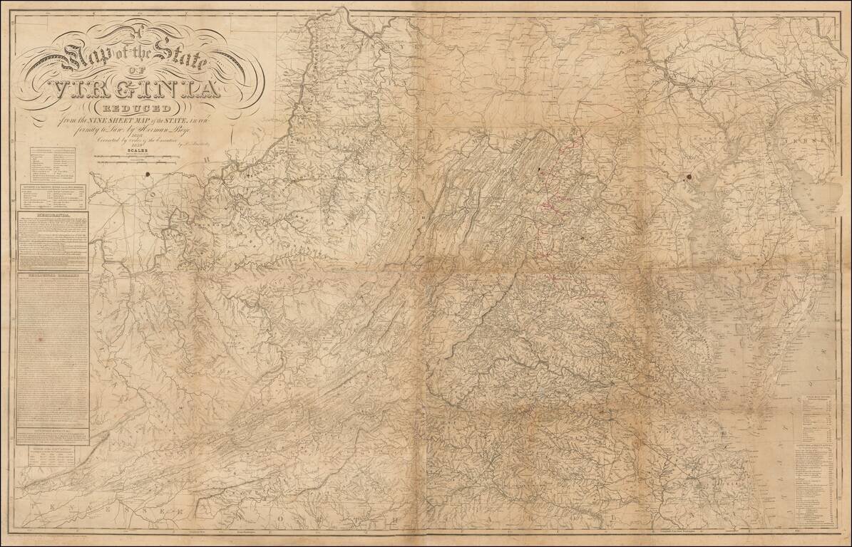
Annotated Example of the Most Important Virginia Map From Mid-19th Century, Showing The Confederate Army's Movements During the Gettysburg Campaign.
Map Overview
Herman Boye's map of Virginia is among the most important maps of Virginia published in the 19th Century. The map has its genesis in an Act of the Virginia Legislature passed in February 1816, which authorized the creating of an official map of the State. At the recommendation of Thomas Jefferson, John Wood was retained as the Chief Surveyor, with extensive correspondence between Wood and Jefferson regarding the project until Wood died in 1821 and was succeeded by Herman Boye. In 1817, the Legislature appropriated $50,000 for the project, not including the cost of engraving and publishing the map.
Under Wood and later Boye's supervision, a map of each county was created, based upon actual surveys, with the county maps compiled and assembled to create the map of the state. The final product was completed in 1827, with Henry Tanner of Philadelphia serving as the engraver. Governor William Branch Giles of Virginia noted that "Mr. Tanner, the artist, has done himself a great honor and the state ample justice in the execution of this work . . . " The map would thereafter become the prototype map for Virginia for at least 3 decades.
Originally issued in 9 sheets in 1827, the map was prepared by Herman Boye at the request of the Virginia legislature as a compilation of local surveys, which began with the creation of a series of 102 County maps by John Wood and Herman Boye from 1819 to1825, which were later used by Boye to create a comprehensive map of the state published 1827 and later updated and revised at the request of the Virginia legislature by Lewis von Bucholtz in 1859.
Boye's map is also the source map for the The Bucholtz-Ludwig Map of Virginia, first issued by Bucholz in Richmond in 1859 and thereafter updated by West & Johnson and others over the next 2 decades.
Gettysburg Campaign Manuscript Annotations
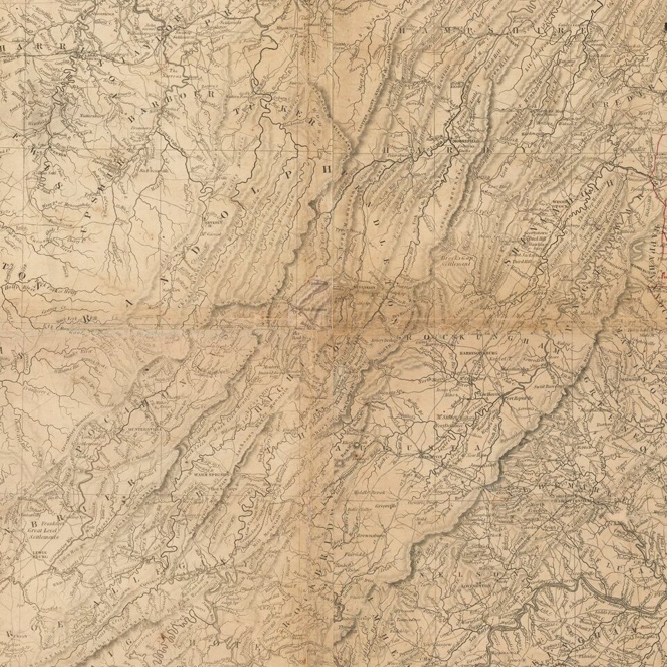
The annotations on the map would appear to follow the movements of the Army of the Confederate States of America during the Gettysburg Campaign in June and July of 1863. The dated annotations begin in Fredericksburg, Virginia on June 3, 1863 and continue west and then north to Gettysburg (July 1), before turning southwest through Fairfield, Waynseboro, Hagerstown and Williamsport, before finally reaching Reddington to the south of Falling Water on July 14 and ultimately ending in Fairfax (July 24).
In sum, these redline annotations provide a daily account of the primary CSA troop movements during the battle of Gettysburg, with the exception of the movements to Harrisburg, Carlisle and Wrightsville in the north, which may provide an important clue to the source of annotations and provenance of the map.
The annotations are similar to the style of those present on the Major General Jeremy Francis Gilmer copy of the Boye Map in the Collection of the University of North Carolina: http://dc.lib.unc.edu/cdm/ref/collection/gilmer/id/106 . Gilmer was the chief Engineer for the Confederate States of America during the war.
It is of note that all of the examples of the 1859 Boye map we were able to locate were uncolored and all include manuscript annotations of some sort. It would appear that the map was issued in very limited numbers and possibly only for official use.
Rarity
The 1859 4-sheet map is very rare on the market. We were unable to locate any examples of the map appearing at auction or in dealer catalogs.
If you are a student, write to us in telegram: @antiquemaps and indicate what material you need and for what work you need a map in high detail. We are ready to provide material on special terms. For students only!