
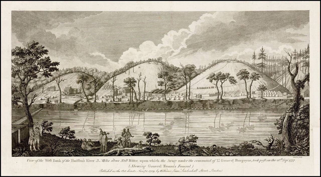
Fine view of Burgoyne's encampment along the Hudson River, published shortly after the end of the American Revolution. Burgoyne's campaign to defeat the revolutionary forces by advancing from Canada and meeting another British army from New York City...
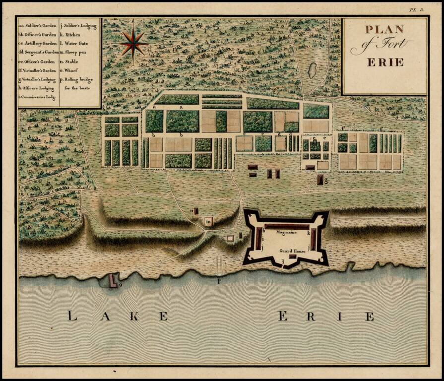
Important early plan of Fort Erie, from Collot's monumental Voyage dans l'Amerique Septentrionale ou Description des Pays Arroses par le Mississippi, l'Ohio, le Missouri, et Autres Riveres Affluentes, published posthumously in 1826, but based upon...
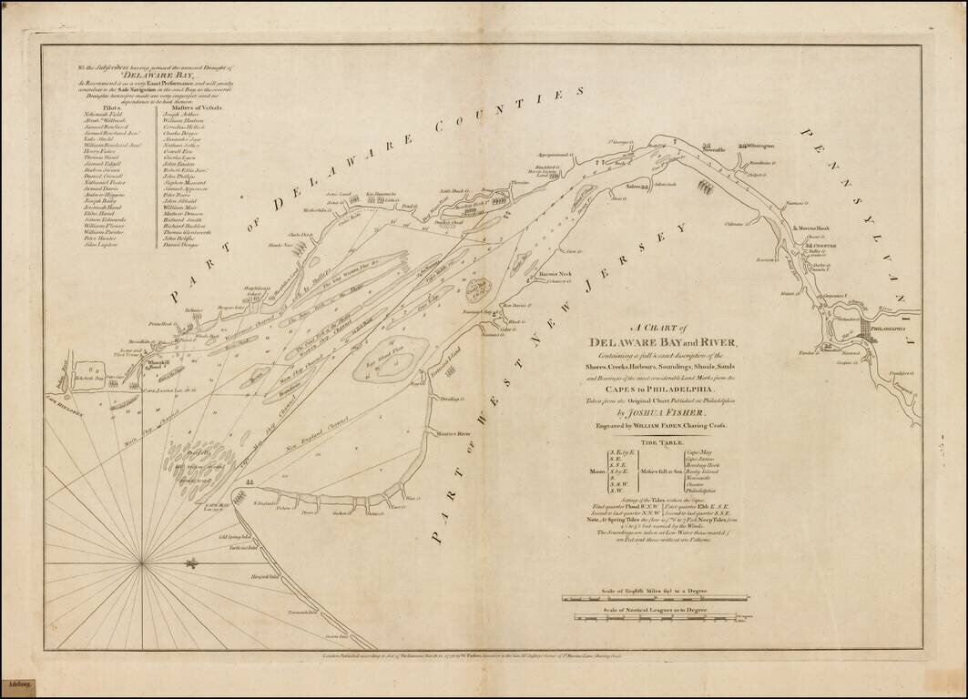
Fine example of William Faden's important early chart of the Delaware River, prepared on the eve of the American Revolutionary War. Fadens chart is the earliest obtainable derivative of Joshua Fisher's virtually unobtainable map, which has been...
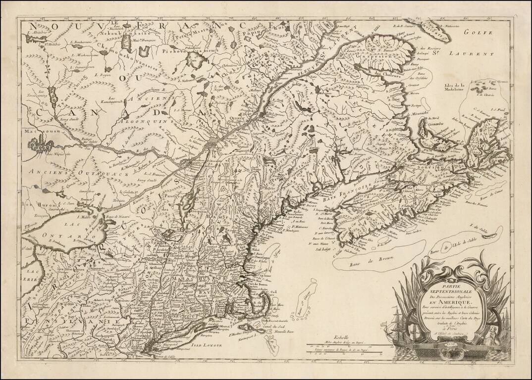
One of the Earliest Regional Maps of The Northern Theater of the Revolutionary War Published in Paris. Rare separately published map of the Northern British Colonies, shown at a time when the French were just beginning to actively join the American...
![[Revolutionary War Battle Plan] The Course of Delaware River from Philadelphia to Chester, Exhibiting the several Works erected by the Rebels to defend its Passage, with the Attacks made upon them by is Majesty's Land & Sea Forces . . . 1778](/map/small/62288.jpg)
Revolutionary War Battle Plan -- Fine Original Outline Color First state (of three) of Faden's battle map of the Delaware River, between Philadelphia and Chester. Faden's map depicts the Theater of War on the Delaware River, just below Philadelphia,...

A Legendary American Rarity: The First State of the Churchman Map of the Chesapeake, One of the Only Maps Published in America During the Revolution. Rare, separately-issued American map of the Delmarva Peninsula, Chesapeake Bay, and Delaware Bay,...
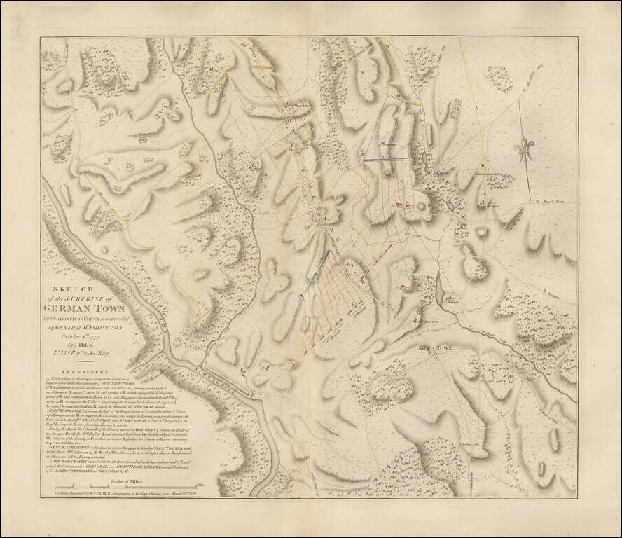
The Very Rare and Authoritative Revolutionary War Plan of the Battle of Germantown The present map showcases the Battle of Germantown, Pennsylvania, an especially dramatic action of the Revolutionary War that occurred on October 4th, 1777, during the...
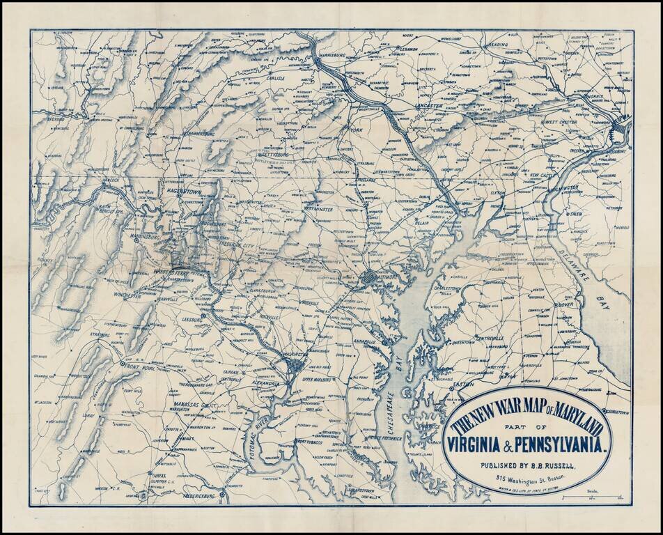
Rare separately issued map of the Mid-Atlantic theater of the American Civil War, published in Boston by Mayer & Co. The map extends south to Fredericksburg and Fairfax and north to Harrisburg and Reading and East to Philadelphia and Delaware Bay,...
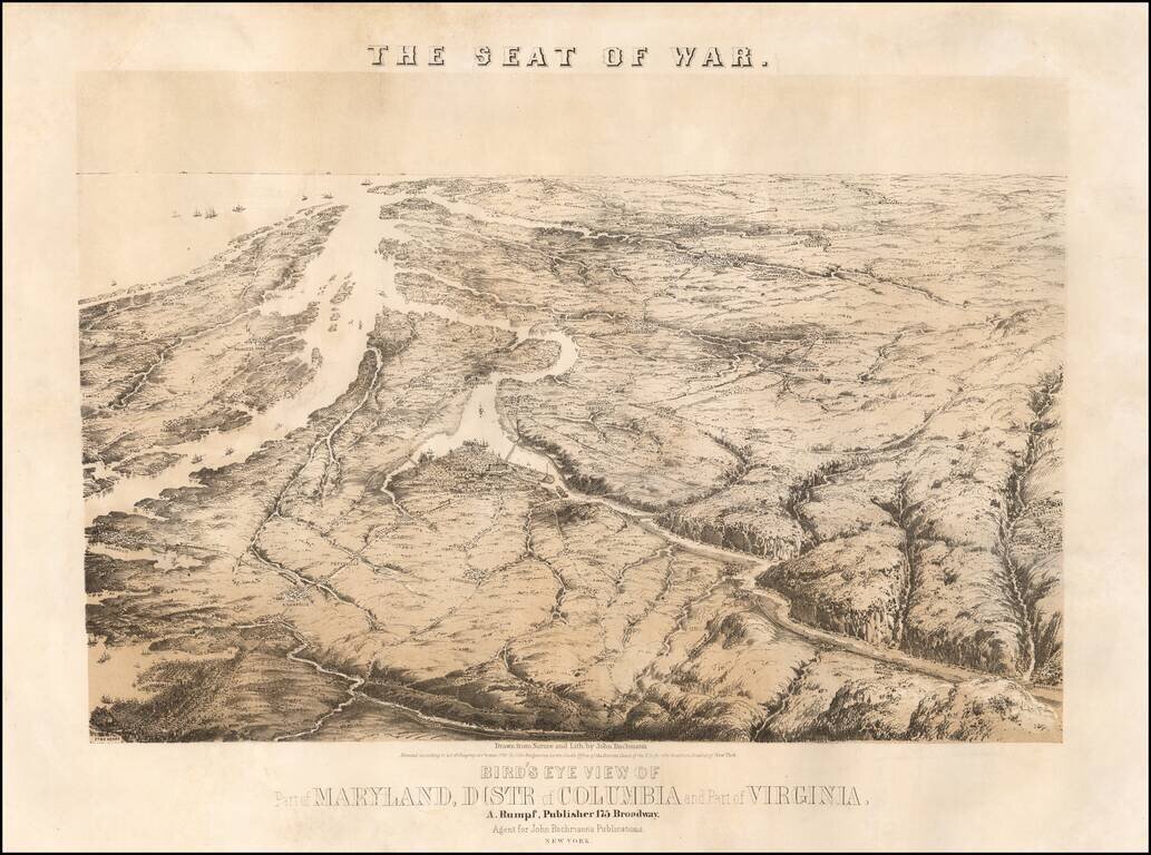
John Bachmann's celebrated series of bird-eye views of the U.S. Civil War, depicting the Virginia-Maryland theatre on the eve of conflict. This magnificent bird's eye view captures the Virginia-Maryland theater of the United States Civil War...

Fine example of Alexander Bache's map of the Eastern Virginia, published by Philip & Solomons of Washington, D.C. Detailed map of Eastern Virginia and Delaware, engraved by Charles Krebs and compiled by W.L. Nicholson, under the direction of A.D....
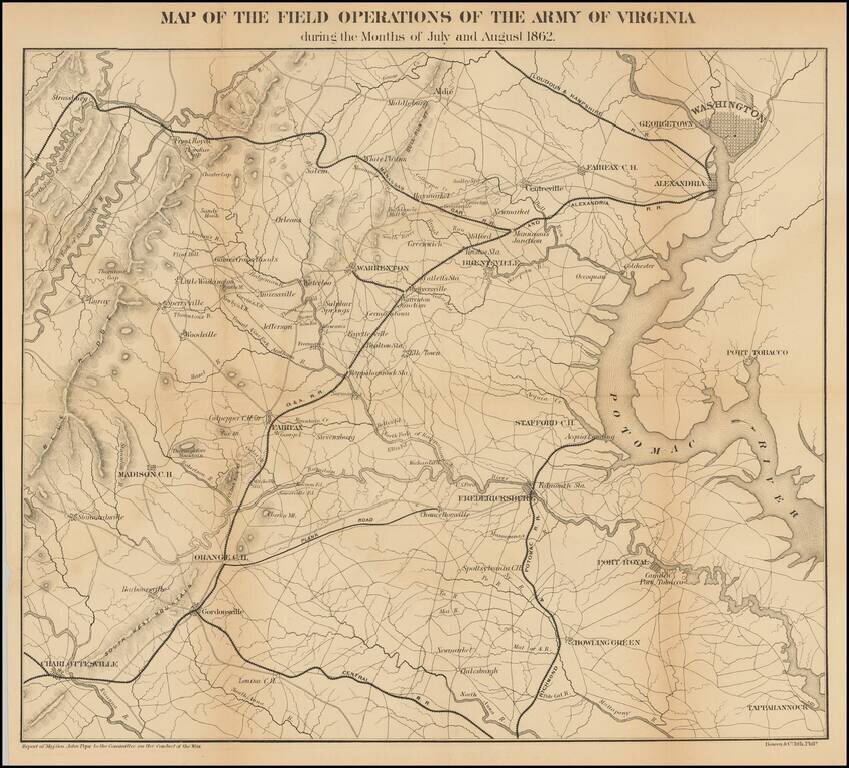
Detailed map of the Theater of War in Virginia. Washington D. C. is at the upper right. Charlottesville, Virginia is at the lower left. Shows roads, railroads, place names and terrain features. General Pope was the new commander of Federal forces in...
![Washington Warning Area Map I [and] Washington Warning Area Map II](/map/small/65353.jpg)
Nuclear War Evacuation Routes During The Cold War 1959 Office of Civil and Defense Mobilization map of Washington, D.C., published during the Cold War. The map extends from Falls Church and Springfield, Virginia to District Heights and Randolph...
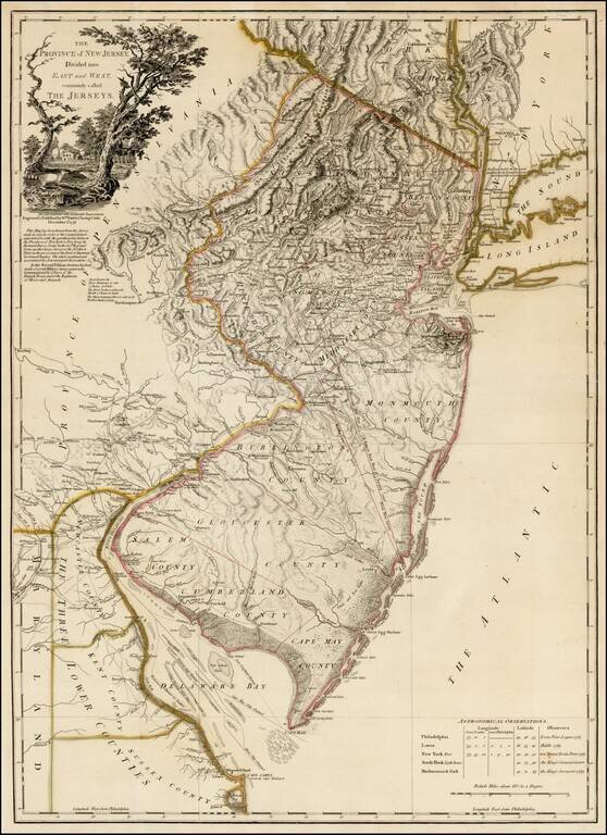
Rare second state of Faden's map of New Jersey, based upon Bernard Ratzer's surveys in 1769, as significantly revised and improved by Faden in December 1778. This rare second state of the map, issued 12 months after the first edition, is based upon...
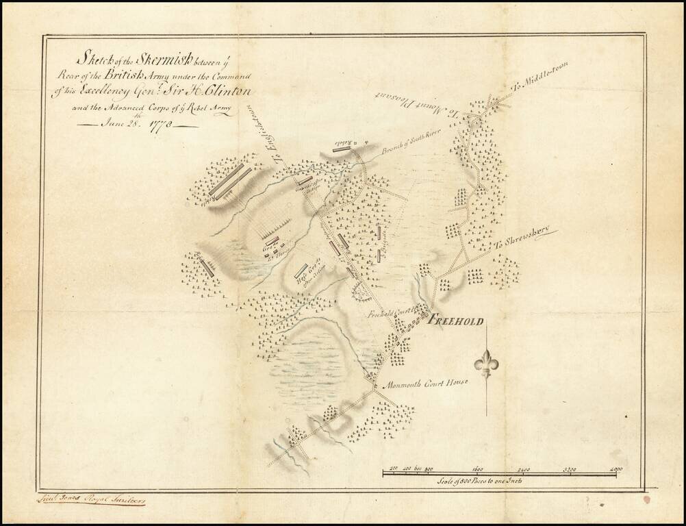
Unique Contemporary Manuscript Plan of Battle which Secured George Washington’s Role as “Father of the Nation” Finely-executed contemporary manuscript map of the Battle of Monmouth, the last major engagement of the Northern Theater of the...
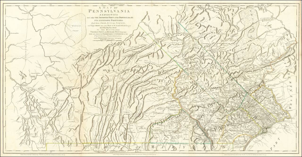
The Province of Pennsylvania on the Eve of the American Revolution Important Revolutionary War-era map of Pennsylvania, compiled by Sayer & Bennett, primarily from William Scull's landmark map. This large and impressive map of the colony of...
![A View and Plan of Mud Island on the Delaware [One of the First Depictions of an American Flag]](/map/small/65207.jpg)
Revolutionary War Manuscript Map of Fort Mifflin, with a very early Drawing of an American Flag Finely-executed Revolutionary War manuscript plan and view of Fort Mifflin on Mud Island on the Delaware River, just below Philadelphia, including a fine...