logo

1864. Grant's Campaign War Map. Supplement. 25 Miles Around Richmond.

  • Grant's Campaign War Map. Supplement.  25 Miles Around Richmond.

Grant's Campaign War Map. Supplement. 25 Miles Around Richmond. information:

Year of creation: 
Resolution size (pixels): 
 2952x3992 px
Disk Size: 
 2.47416MiB
Number of pages: 
 1
Place: 
 Boston
Author: 

Print information. Print size (Width x height in inches):
Printing at 72 dpi 
  41 х 55.44
Printing at 150 dpi 
 19.68 х 26.61
Printing at 300 dpi 
 9.84 х 13.31

An example of detailing the file of this map of in a printable high-resolution:

Click to open in high resolution (open in new tab).
Attention! this is just the central piece (central area 960x960 px) of the map file!
This is an example, so that you can see and study the level of detail of a given map. The entire Map will be fully available after payment!

Grant's Campaign War Map. Supplement.  25 Miles Around Richmond.

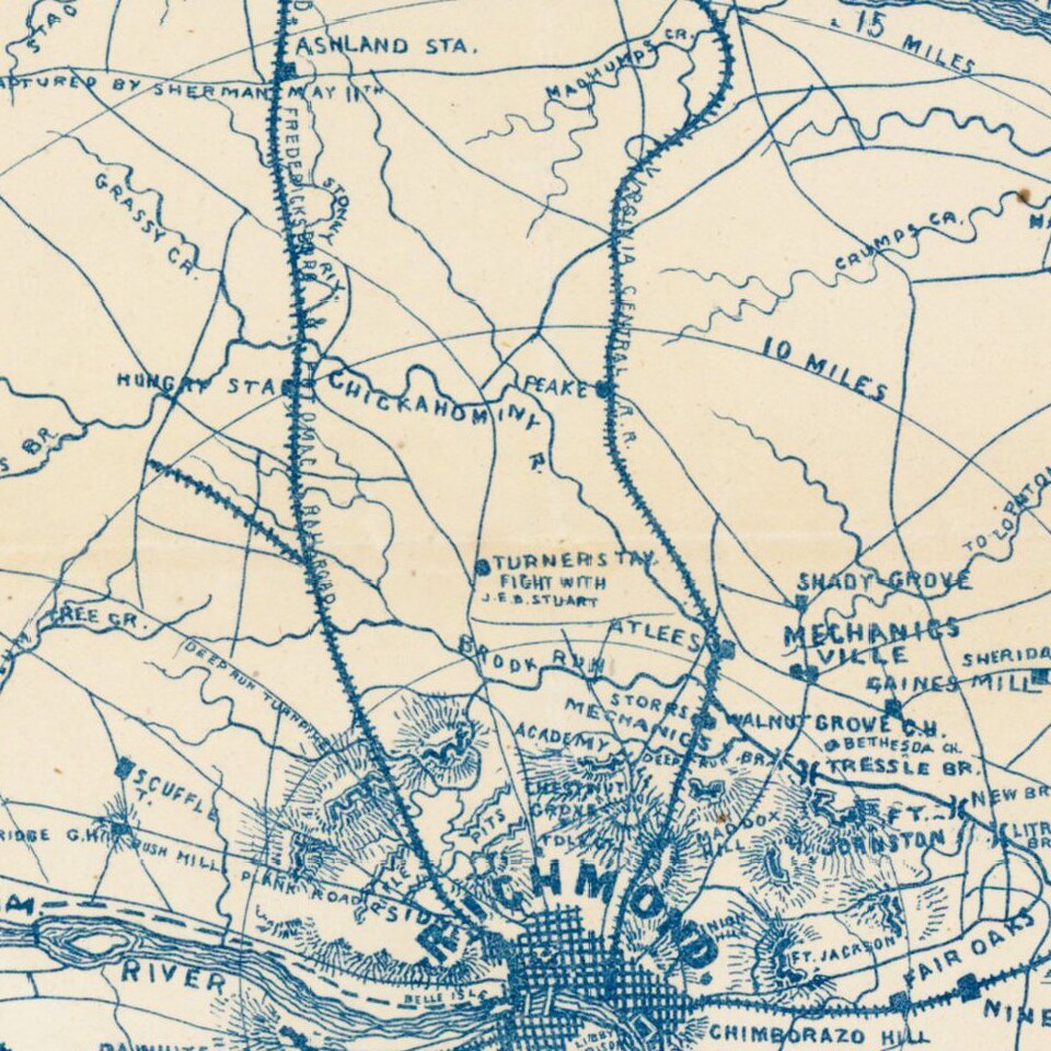
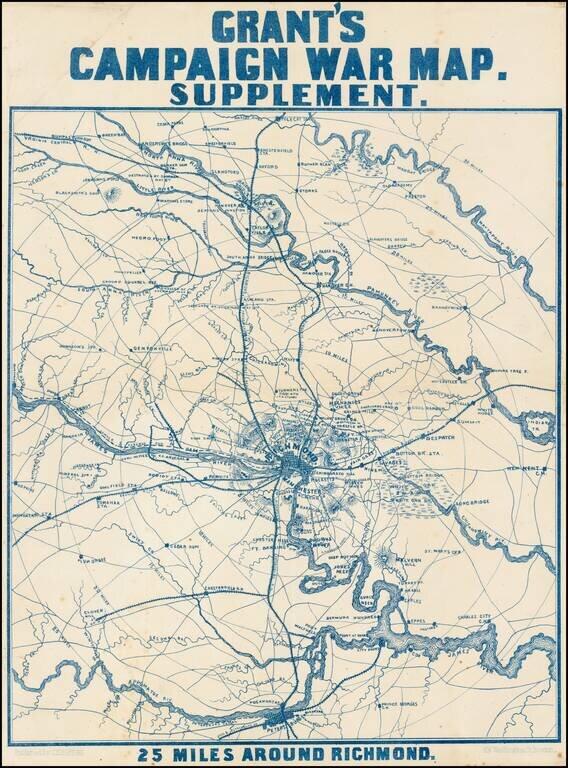
Scarce map of the area around Richmond, showing towns, railroad lines, roads, rivers, bridges, court houses, and other details.

Notes show the US Arsenal, Sherman's Crossing of the South Anna and subsequent capture on May 11, and other details.

Extends south to Petersburg and notes the Ptrs. & Lynchburg RR. Wonderful primitive style.

The map is quite rare. No appearances in dealer catalogues in the past 20 years and only our second ever example.


Special conditions for students!

If you are a student, write to us in telegram: @antiquemaps and indicate what material you need and for what work you need a map in high detail. We are ready to provide material on special terms. For students only!

Item information:

Year of creation:
Size:
2952x3992 px
Disk:
2.47416MiB
Number of pages:
1
Place:
Boston
Author:
J.H. Bufford.
$14.99

Related item