Map size in jpg-format: 696895B
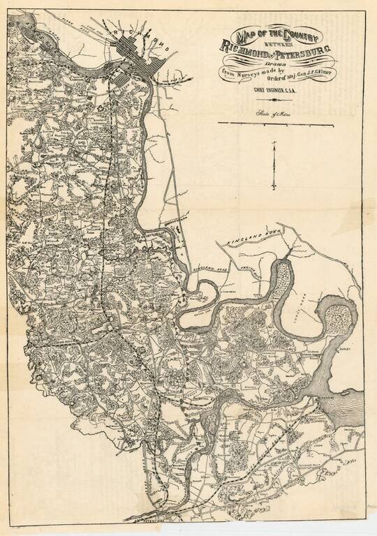
Rare Confederate States of America map of the region between Richmond and Petersburg, prepared by the Chief Engineer of the CSA, J.F. Gilmer.
The map provides excellent detail, including town, roads, railroads, woods, rivers, forts, landowners and a host of other details. The map was later reprinted by Penfield in New York in 1864.
If you are a student, write to us in telegram: @antiquemaps and indicate what material you need and for what work you need a map in high detail. We are ready to provide material on special terms. For students only!