Map size in jpg-format: 2.27977MiB
Click to open in high resolution (open in new tab).
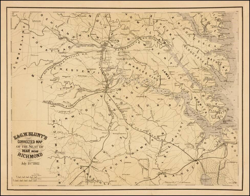
Rare separately issued map of the area around Richmond, Virginia, published by E & GW Blunt in July, 1862.
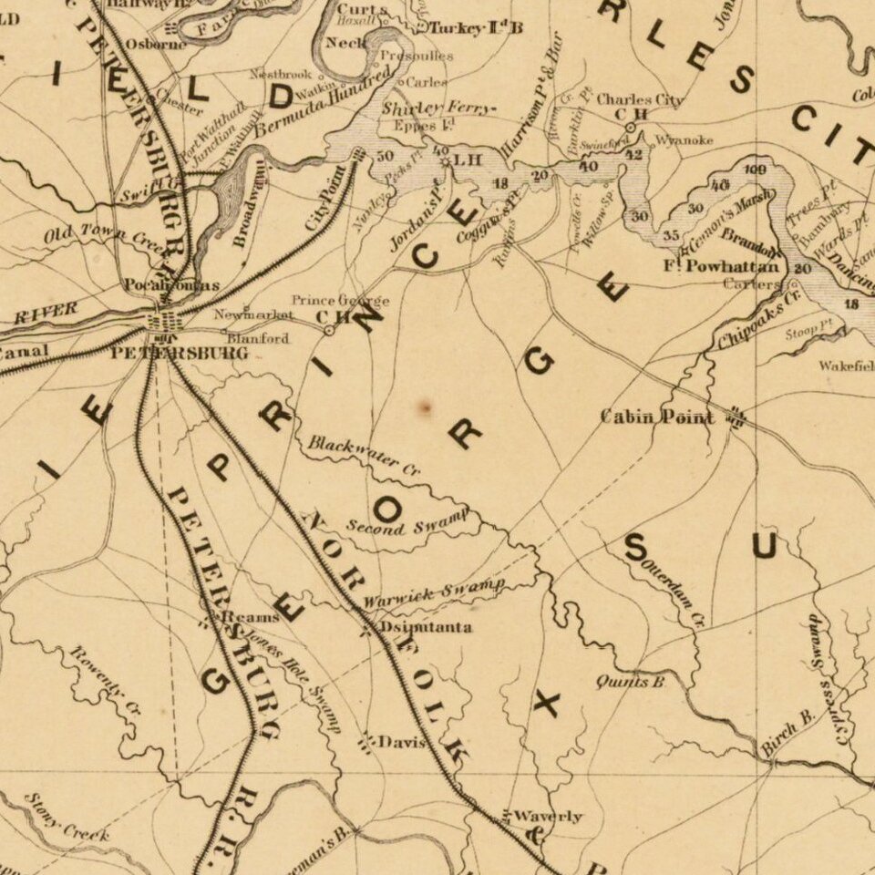
The map shows Richmond and the railroad lines, canal, roads and rivers that feed into the City, including the Richmond & Danville Railroad, the Richmond & Petersburg Railroad, the Richmond & York River Railroad and two other unnamed lines. The U.S Arsenal on the James River is also shown.
To the south, the map also highlights the railroads running to Petersburg, including the Petersburg and Lynchburg Railroad, the Norfolk & Petersburg Railroad and the Petersburg Railroad.
Many other roads are shown, along with towns, court houses, rivers, swamps, and other details. One unusual feature of the map is the inclusion of soundings for the rivers, bays and coastlines shown on the map, a feature which was consistent with the Blunt firm, which was best known for its fine sea charts. In fact, this is one of only a few examples of the Blunt firm publishing land maps, most of which were rare separately issued "Seat of War" maps, including
The present map would seem to employ a portion of the lithographic stone previously used for Blunt's extremely rare Map of Part of Virginia, Maryland and Delaware from the best Authorities 1861.: /gallery/detail/32253. However the present map includes significantly more place names and incorporates other details not shown on the earlier map.
The map is extremely rare, with only a single heavily damaged example offered at auction and no examples in dealers catalogs in the past 30 years.
If you are a student, write to us in telegram: @antiquemaps and indicate what material you need and for what work you need a map in high detail. We are ready to provide material on special terms. For students only!