Map size in jpg-format: 2.31153MiB
Click to open in high resolution (open in new tab).
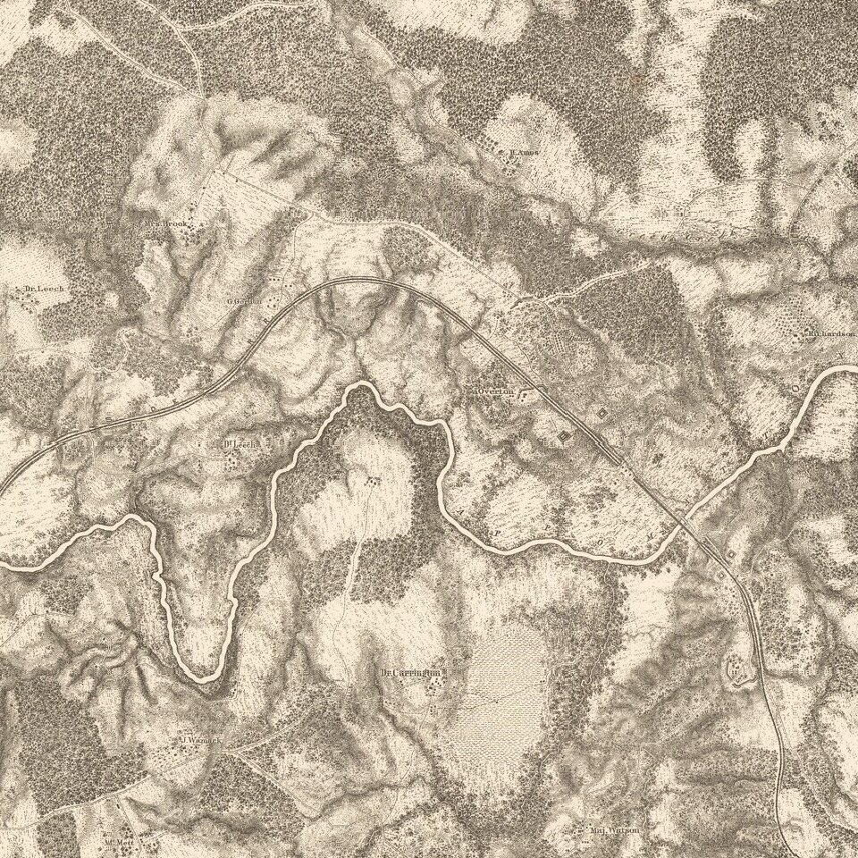
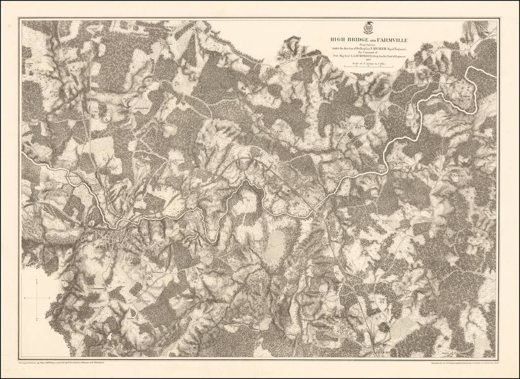
Highly detailed map of the area around Farmville, Virginia, depicting one of the final battle fields of the Civil War.
Farmville
Robert E. Lee retreated through Farmville as he escaped the Union Army in the Civil War. Farmville was the object of the Confederate Army's desperate push to get rations to feed its soldiers near the end of the American Civil War. The rations had originally been destined for Danville, but an alert quartermaster ordered the train back to Farmville. Despite an advance of the cavalry commanded by Fitzhugh Lee, the Confederate Army was checked by the arrival of Union cavalry commanded by Gen. Philip Sheridan and two divisions of infantry.
High Bridge
The High Bridge played a key role during Confederate General Robert E. Lee's final retreat from Petersburg in the last days of the War. The Battle of High Bridge took place there on April 6-7, 1865. Fleeing the Union troops, the Confederates set the bridge afire after crossing it, but failed to destroy it. Union troops were able to use it and continued the chase, which ended several days later at Appomattox Courthouse, where Lee's surrender to Union General Ulysses S. Grant took place on April 9, 1865.
The Map
As noted by Rumsey:
Stephenson states these are a "detailed series of maps indicating fortifications, roads, railroads, houses, names of residents, fences, drainage, vegetation, and relief by hachures." . . . See Stephenson 517-520 for the different editions.If you are a student, write to us in telegram: @antiquemaps and indicate what material you need and for what work you need a map in high detail. We are ready to provide material on special terms. For students only!