
![[Restricted Military Map of San Diego] The City of San Diego Including The Cities of Chula Vista Coronado El Cajon La Mesa National City . . .](/map/small/69860.jpg)
Restricted Military Map of San Diego Restricted Armed Forces edition of this World War II era map of San Diego, published by the Automobile Club of Southern California. As noted below the map, the map was "issued for the exclusive use of the Armed...
![[Confidential / Restricted Map -- Hawaiian Islands] Long Range Air Navigation Chart](/map/small/63172.jpg)
World War II Confidential / Restricted Aeronautical Map of Hawaiian Islands Detailed aeronautical map of the Hawaiian Islands, compiled by the U.S. Army Air Force Army Map Service. The front side map illustrates the Hawaiian Islands and Midway...
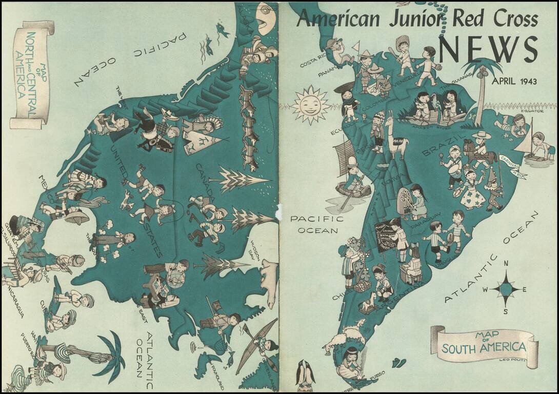
This is a map of the Americas, used as the cover for the 1943 edition of the American Junior Red Cross News. The map shows the activities of children all throughout the America, dressed in regional clothing and partaking at various games. While...
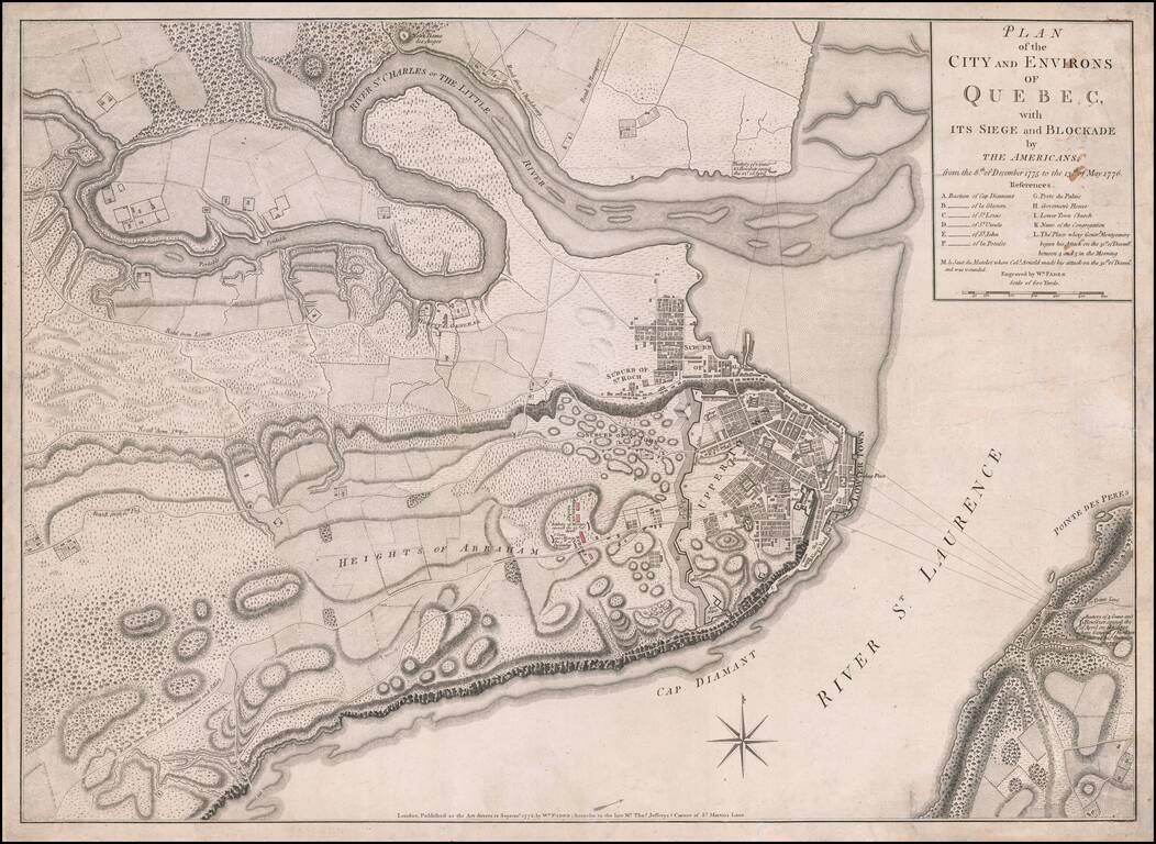
Fine, Detailed, Separately-Issued Plan of the Siege of Quebec (1775-6) Rare, separately-published plan of the Siege of Quebec, published by William Faden in London. The plan shows a pivotal early moment in the American Revolution and highlights the...
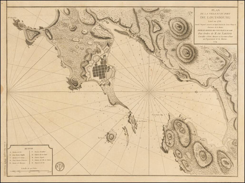
Plan of Louisbourg in 1779 Detailed plan of the town and port of Louisbourg, oriented with west at the top, made by order of the French Depot de la Marine, during the American Revolution. The plan was originally made 2 years prior to the Siege of...
![[East Coast of Prince Edward Island - Rollo Bay to Wood Islands]](/map/small/62849.jpg)
Rare chart of the East Coast of Prince Edward Island, centered on Cardigan Bay and Panmure Island. St. John's Island (Isle of St. John) was renamed Prince Edward Island in 1798, after Edward, Duke of Kent. This fine chart appeared in the Atlantic...
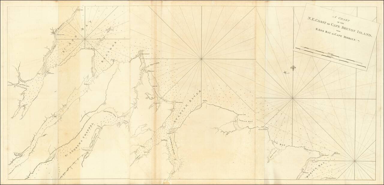
Rare chart of the North East Coast of Cape Breton, from Morien Bay to St Anne's Bay. This fine chart appeared in the Atlantic Neptune by Captain Joseph Frederick Wallet des Barres. The Atlantic Neptune was remarkable, multi-volume set of sea charts...
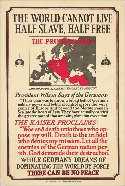
This is a great American propaganda poster encouraging US involvement in World War I. The work attempts to reshape the way that Americans viewed the war by rephrasing the conflict as a result of German imperial ambitions. The map is particularly...
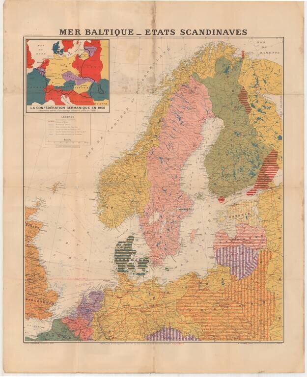
Large format map of the Theater of War in 1940, published in Paris. The inset map shows the German Confederation as it will appear in 1950, based upon a public German document from 1904. The areas identified in Striped regions have already been taken...
![(End of World War II) אירופה מפת ידיעות אחרונות [Europe | Map of Latest News]](/map/small/61074.jpg)
A Contemporary Israeli Map of the Last Stages of World War II. Color-printed newspaper map of Europe, entirely in Hebrew, published in the October 8, 1944 issue of Yedioth Ahronoth (ידיעות אחרונות). This issue of the paper focuses on...
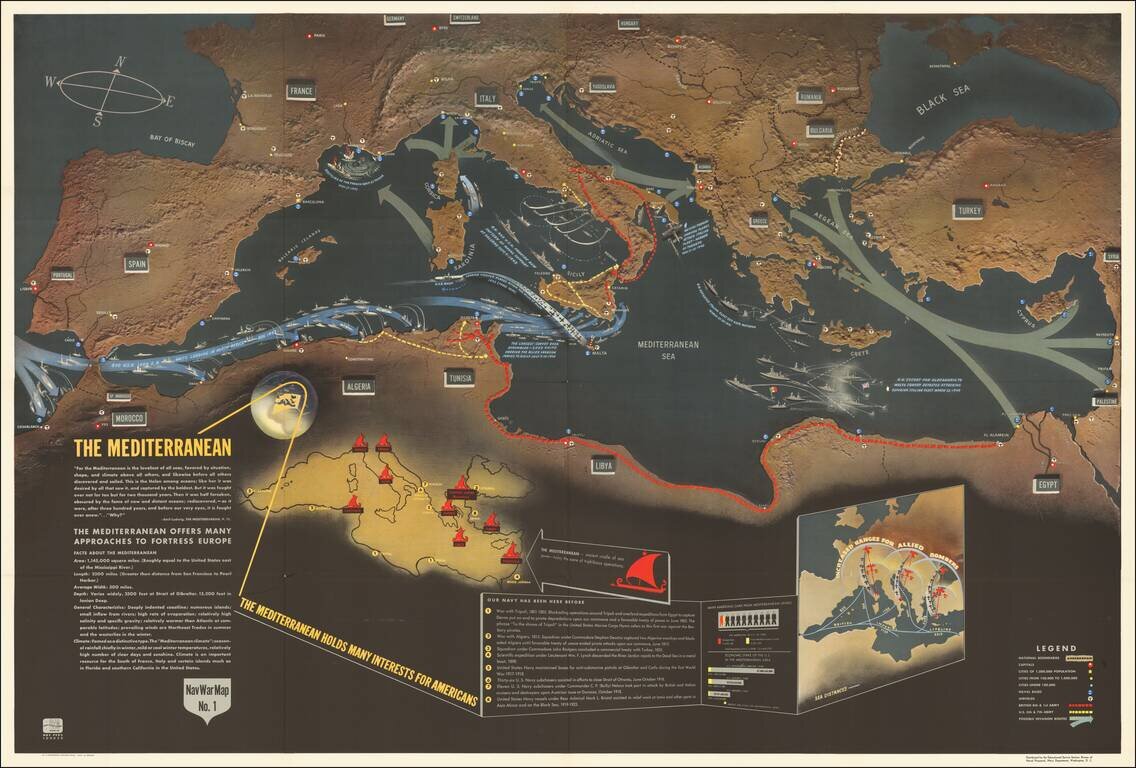
Excellent "NavWar" pictorial map of the Mediterranean Theater during the Second World War. The map highlights the progress of British and American forces in liberating North Africa and parts of southern Italy and the strategic advantages that these...
![(Second World War - Eastern Front) [Strikes by the Red Army on the Enemy in 1944] Удары Красной Армии По Противнику в 1944г.](/map/small/68414.jpg)
Extremely rare Red Army-published map of the progress of the Second World War on the Eastern Front during 1944. The map shows the extensive gains of the U.S.S.R. throughout late 1943 and 1944, from their nadir, with the Germans at the outskirts of...
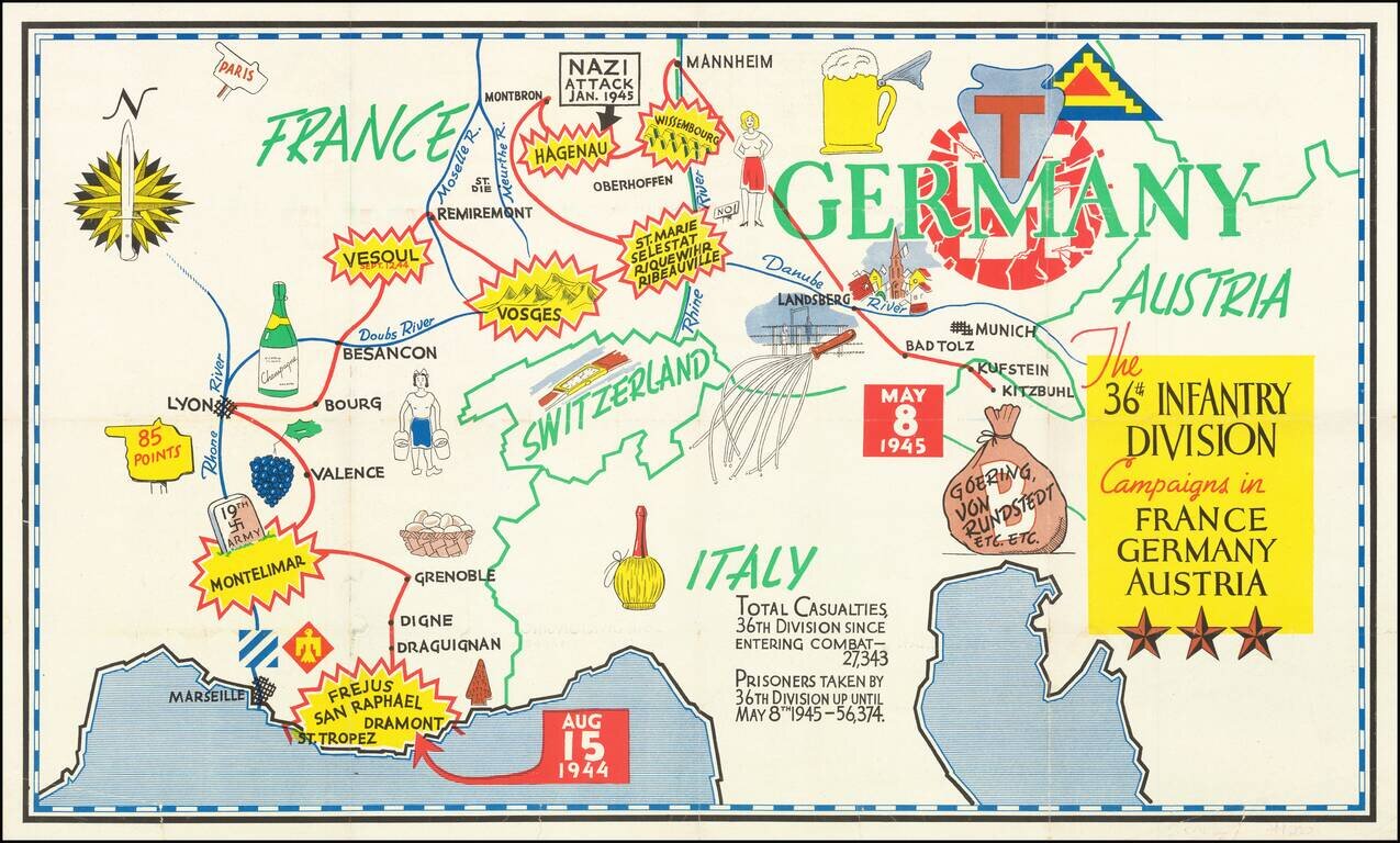
Triumphal Pictorial Map of the 36th Infantry Division's Campaign in Europe. The map shows the T-patchers landing in Saint-Raphaël-Fréjus in southern France on Aug. 15, 1944, during Operation Dragoon. The Division proceeds to Montelimar where it...
![Gibraltar to Berlin. [World War II Broadside Map.]](/map/small/63270.jpg)
Fascinating WWII broadside propaganda map, published in India, in order to keep the local populous informed about the War. The map shows the theater of war in parts of Western Europe and North Africa, with the course of railways, roads, and tracks....
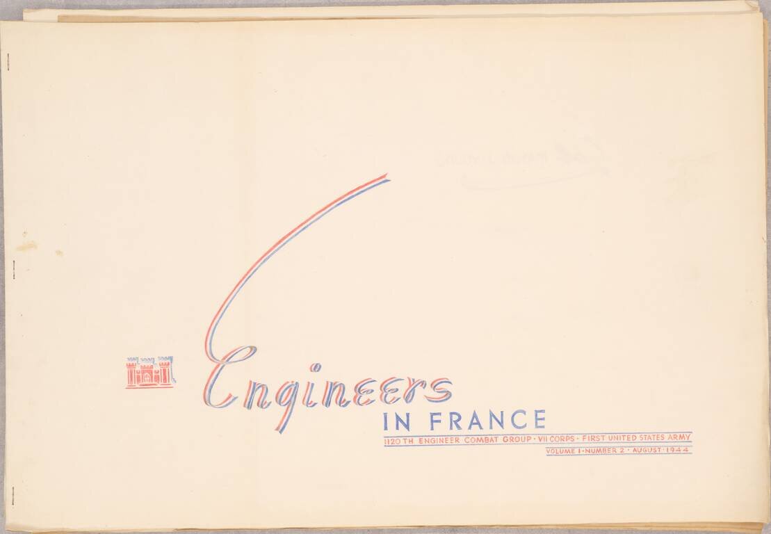
A Series of Albums Commemorating American Engineer's Roles in the Liberation of Europe, Made for a Decorated Colonel This is a truly outstanding work consisting of three booklets, each showcasing the role of the 1120th Engineer Combat Group, attached...
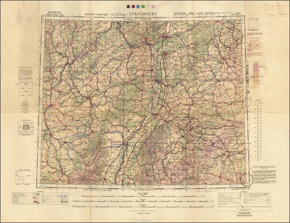
A Wall of Flak Batteries Leading into Germany. Detailed WWII air navigation map of the area around Strasbourg, published by the British War Office. The map is noteworthy for the manuscript circles highlighting the flak batteries stationed in major...