
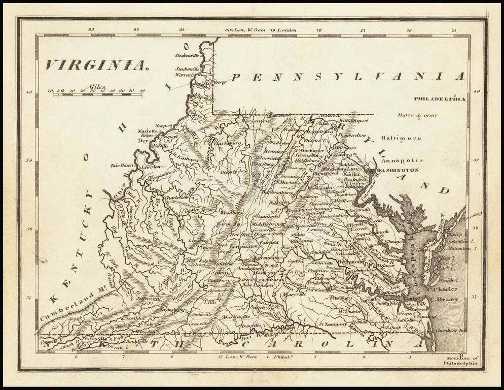
Nice example of Carey's map of Virginia. A highly detailed map, which includes towns, roads, rivers, mountains, and many other details.
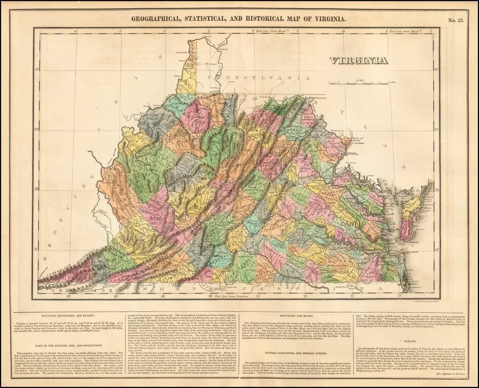
Striking example of this finely executed map of Virginia, from the first edition of Carey & Lea's Atlas. The map includes contemporary details concerning the topography, indigenous lands, rivers, climate, towns, manufacturing, commerce, and other...
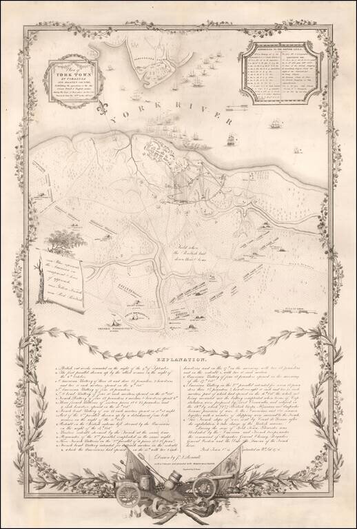
Revolutionary War Battle Plan Published to Commemorate the Marquis De Lafayette's Return To America in 1825 Rare plan of the siege of Yorktown, issued on the occasion of Lafayette's triumphal 1825 visit to America. Drawn by John Francis Renault, a...
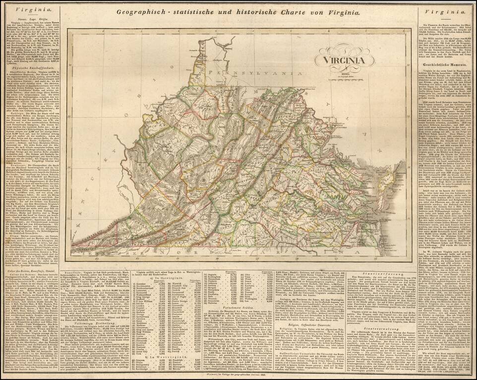
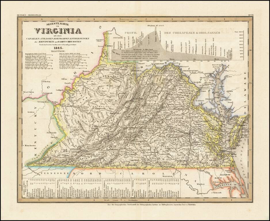
Rare German map of Virginia, mimicking the style popularized by Carey & Lea. The map shows early towns, roads, rivers, lakes, and other geographical features. The early road detail is noteworthy. Many court houses and post offices also shown....
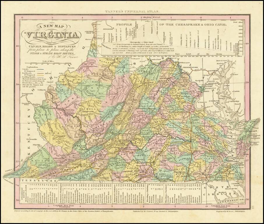
Detailed map of Virginia, from Tanner's Universal Atlas. Detailed and interesting map, hand colored by county and showing towns, rivers, bays, lakes, railroads, roads, distances, etc. Tables of Steam Boat routes and distances. Population Table by...
Elegantly engraved & detailed map of Virginia, taken based upon Tanner's work in the early 1840s. Shows counties, towns, roads, railroads, mountain ranges, etc.
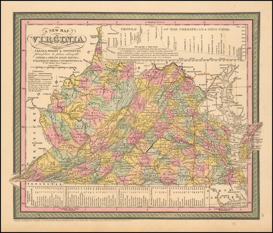
Nice example of Cowperthwait's early map of the State of Virgina, showing counties, towns, rivers, roads, mountains, lakes, Canals, etc. Profile of the Chesapeake and Ohio Canal at the top of the map and a schedule of steamboat routes and distances at...
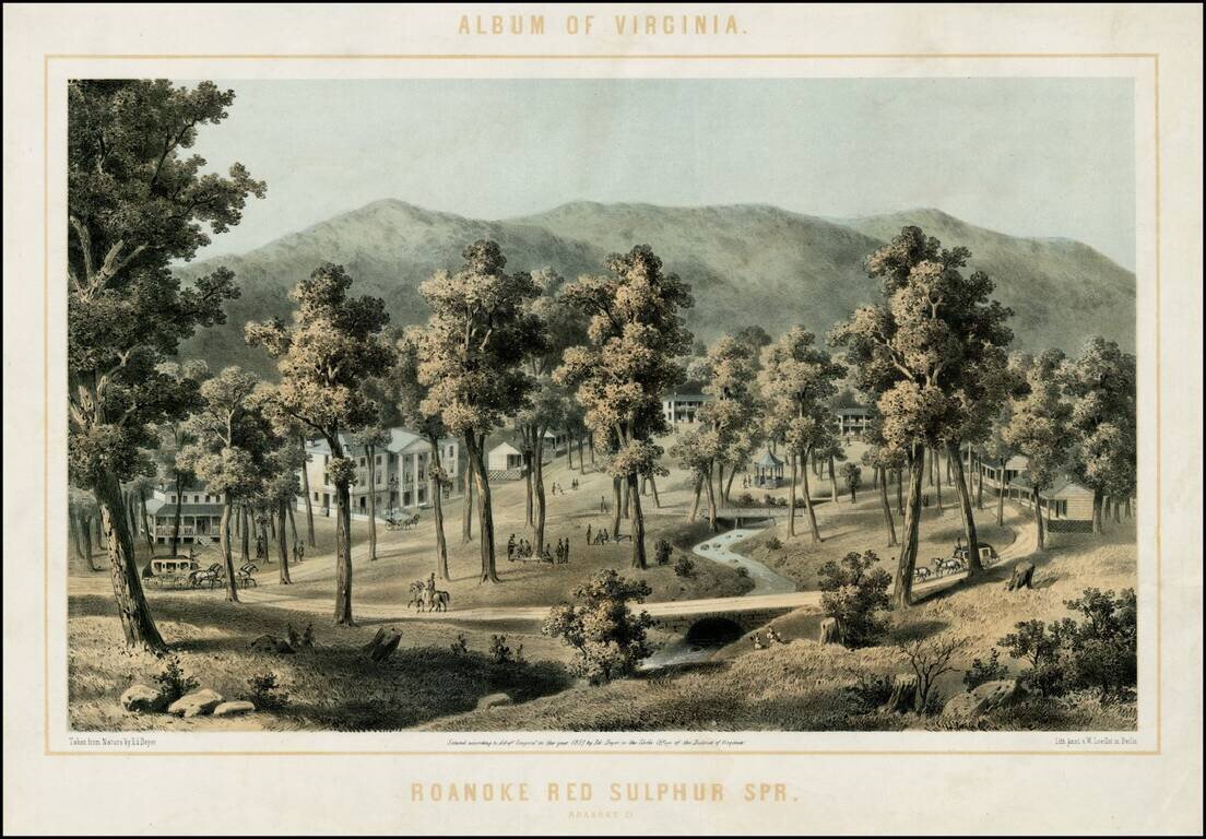
Fine engraving of the newly opened Roanoke Red Sulphur Springs in Roanoke, Virginia. Roanoke Red Sulphur Springs was a 1200 acre resort, which opened in early 1858 and operated as a spa in the first half of the 19th Century and was later the site of...
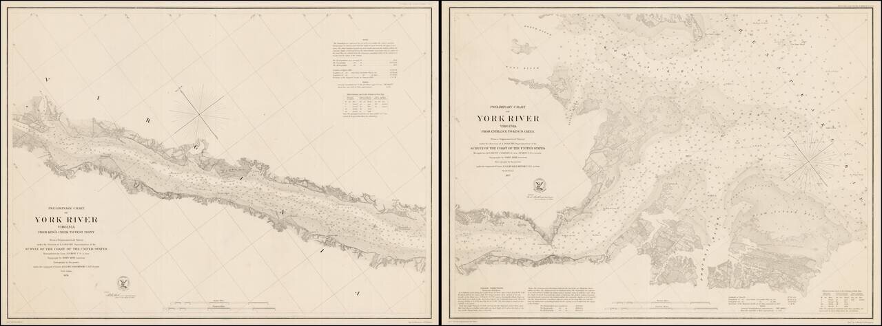
Rare pair of separately issued Coast Survey Charts, showing a section of the James River, from its entrance to West Point. The maps are exceptionally detailed, including sailing directions, soundings and other fine details. The first of the charts...
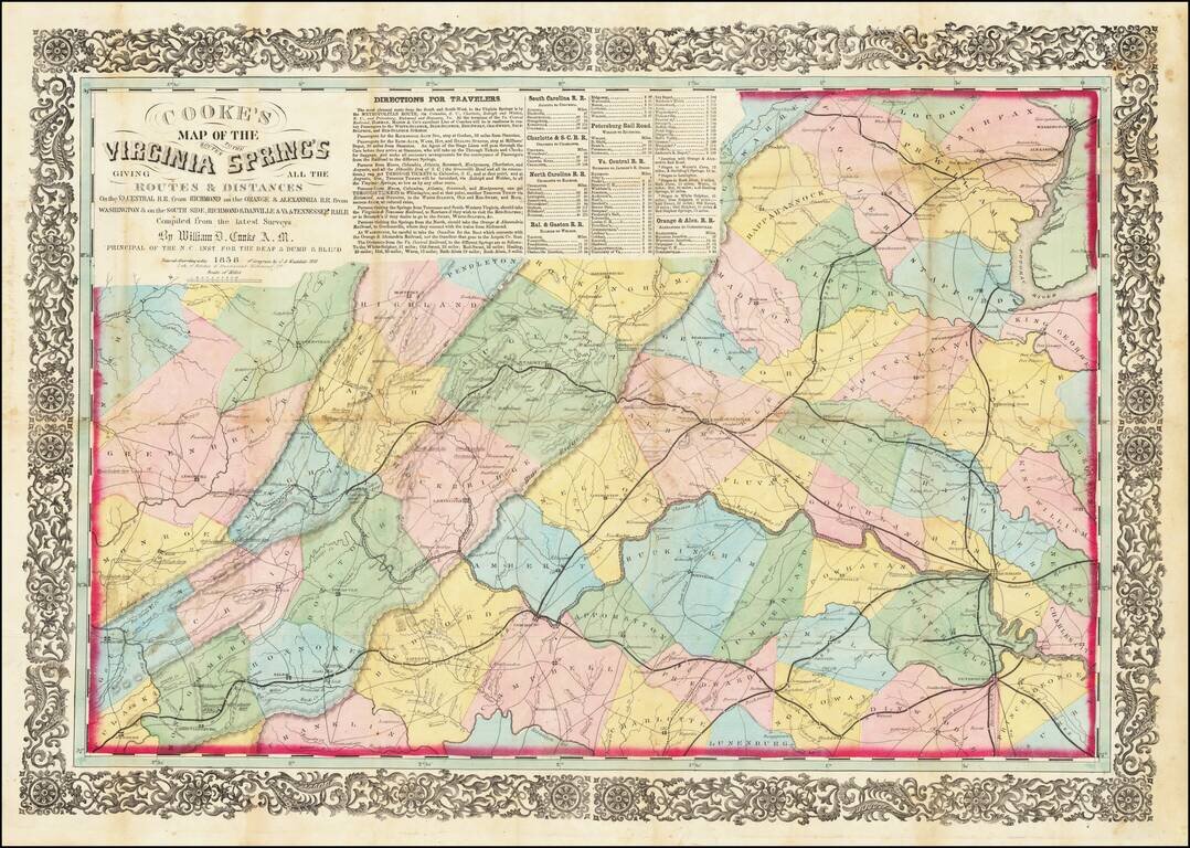
Rare Richmond Imprint Centered on Charlottesville Nice example of this rare regional map of Virginia, centered on Charlottesville and emphasizing the early railroads within the state. The map was intended to illustrate the available railroad routes...
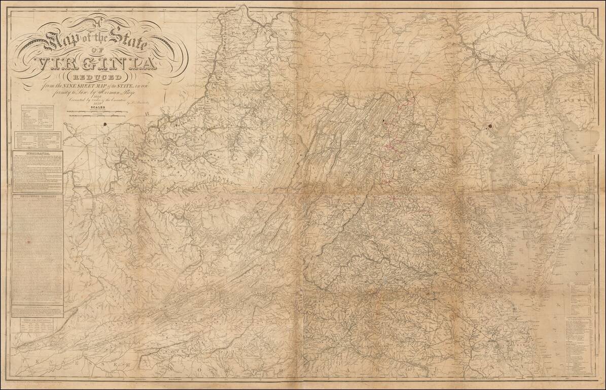
Annotated Example of the Most Important Virginia Map From Mid-19th Century, Showing The Confederate Army's Movements During the Gettysburg Campaign. Map Overview Herman Boye's map of Virginia is among the most important maps of Virginia published in...
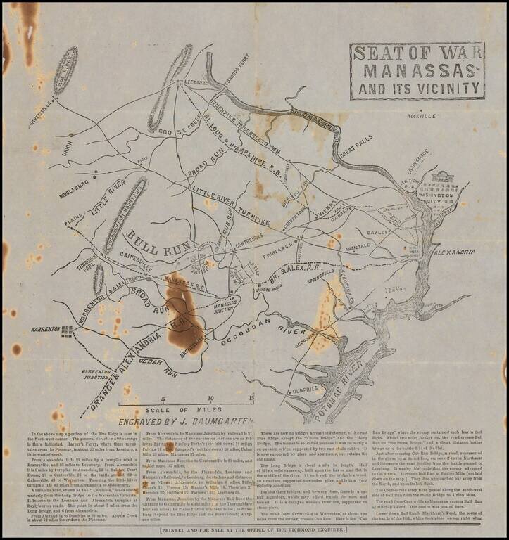
Rare Confederate broadside map related to the Battle of Bull Run, published for the Richmond Enquirer in the aftermath of the battle. Lithographed or wood-engraved map of northern Virginia, from Washington, D.C. to Warrenton. The map names Alexandria...
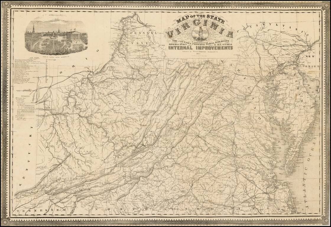
Rare confederate map of Virginia, which derives directly from Ludwig von Bucholtz seminal map of Virginia, published in 1858. Von Bucholtz was commissioned to prepare the revisions to the 1826, Hermann Boye 9 sheet map, and 4 sheet maps of Virginia,...
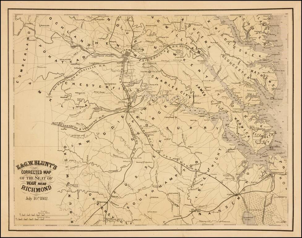
Rare separately issued map of the area around Richmond, Virginia, published by E & GW Blunt in July, 1862. The map shows Richmond and the railroad lines, canal, roads and rivers that feed into the City, including the Richmond & Danville...
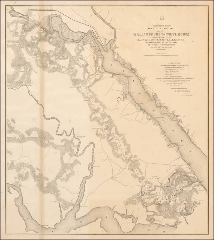
Large lithographed map of the area from Williamsburg, Virginia to "White House" on the Pamunkey River, prepared for McClellan and published in 1862. The map was one of a series of maps showing the theater of operations of the Army of the Potomac. The...
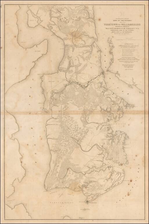
Large lithographed map of the area from Yorktown, Virginia to Williamsburg, prepared for McClellan and published in 1862. The map was one of a series of maps showing the theater of operations of the Army of the Potomac. The map shows Fortress Monroe,...