Map size in jpg-format: 49.7257MiB
Click to open in high resolution (open in new tab).
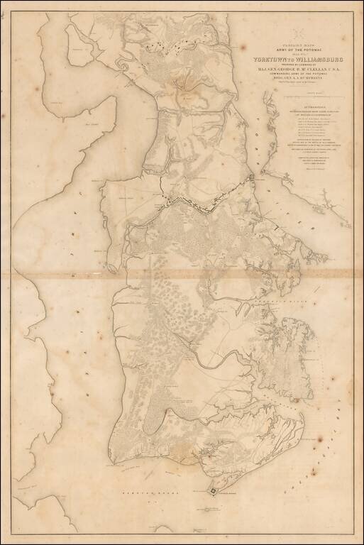
Large lithographed map of the area from Yorktown, Virginia to Williamsburg, prepared for McClellan and published in 1862.
The map was one of a series of maps showing the theater of operations of the Army of the Potomac. The map shows Fortress Monroe, Fort Wool, and major fortifications along the Warwick River outside Yorktown.
The maps in the series are:
If you are a student, write to us in telegram: @antiquemaps and indicate what material you need and for what work you need a map in high detail. We are ready to provide material on special terms. For students only!