
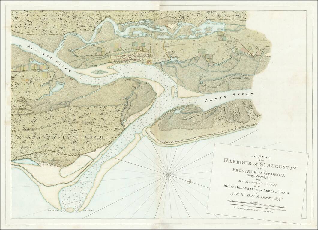
Striking, Intricate Map of St. Augustine, From the Atlantic Neptune Fine example of Des Barres’ massive two-sheet plan of St. Augustine, which featured in his famed and rare sea atlas, the Atlantic Neptune. The town is the oldest...
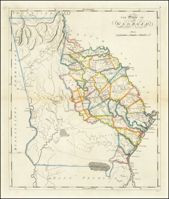
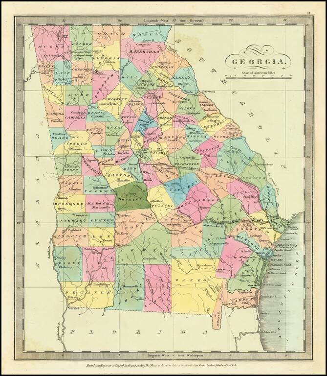
One of the Earliest Obtainable Maps of Georgia in its Modern Configuration. Rare full wash color example of Matthew Carey's second map of Georgia, first issued in 1814. Following the creation of Mississippi Territory in 1798, the borders between...
![[Georgia] Carte Geographique, Statistique Et Historique De La Georgie](/map/small/57769.jpg)
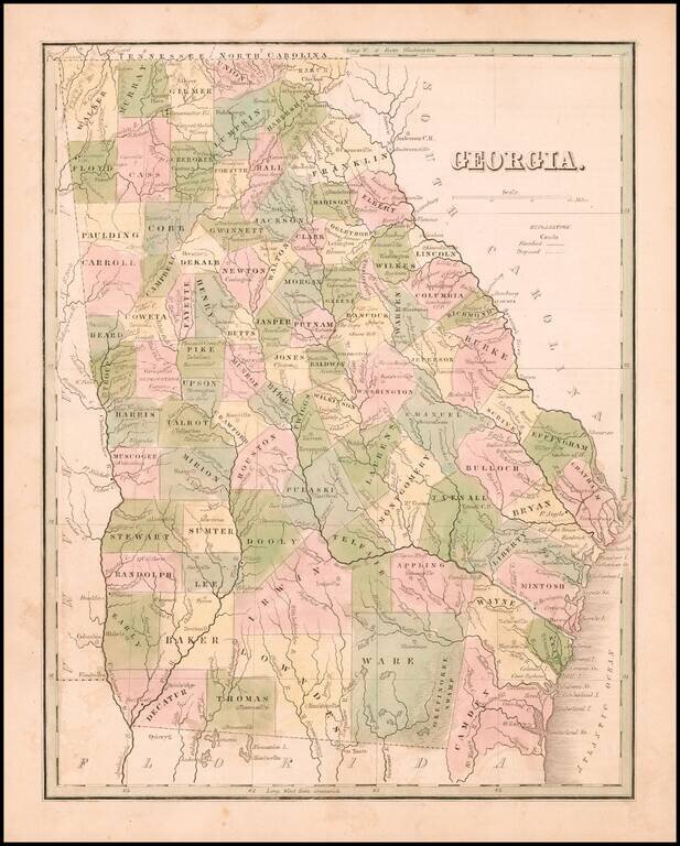
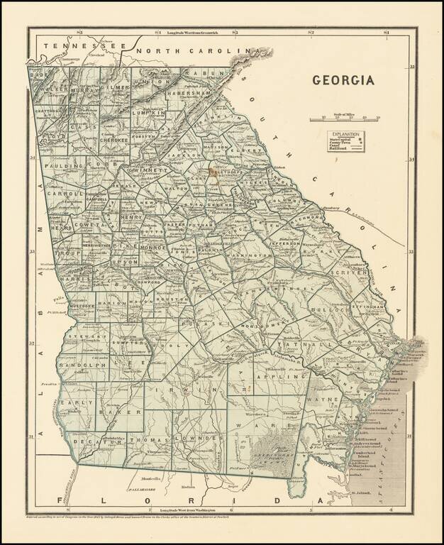
Detailed map of Georgia, based upon the 1822 map by Carey & Lea. The western counties are still unformed and classified as Indian lands, including the Cherokis and Lower Creek. Massive Appeling, Irwin and Early Counties dominate the south and are...
Rare full original color map of Georgia, from Bradford's Comprehensive Atlas. The map is colored by counties and shows towns, rivers, lakes, swamps, and other early points of interest. The Southern counties are still not complete. Bradford's...
Scarce full original color map of Georgia and the Carolinas, from Bradford's Comprehensive Atlas. Shows counties, towns, rivers, and other details. Bradford's Comprehensive Atlas was one of the most successful commercial atlases of the 1830s, at a...
Striking full color example of David Burr's map of Georgia, which first appeared in David Burr's Universal Atlas, in 1836. Burr's Atlas was perhaps the most elegant American commercially published atlas of its time, utilizing wonderful wash colors and...
Detailed map of Georgia, divided by counties and townships. Shows towns, roads, mountains, rivers, railroads, lakes, etc. Morse & Breese's North American Atlas was a landmark in American Cartography, being the first atlas to employ the cerographic...
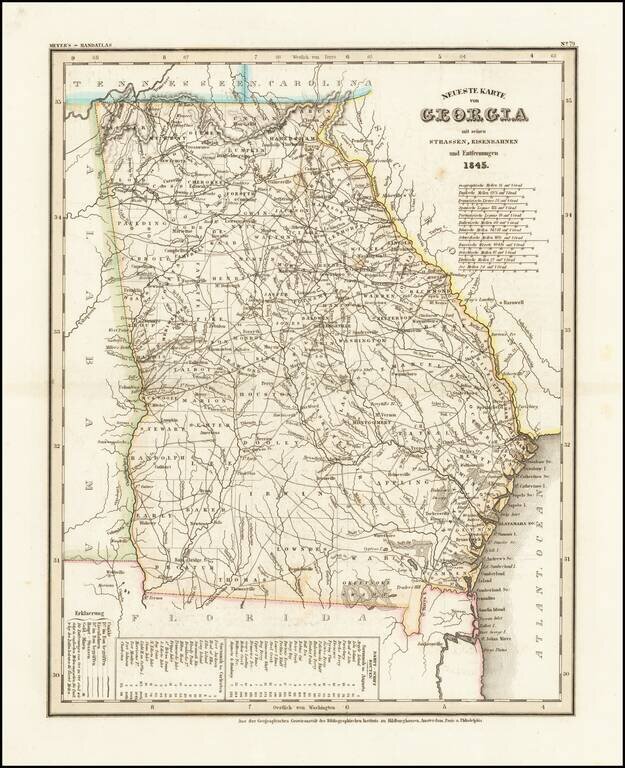
Elegantly antique engraved map of Georgia, produced by Joseph Meyer in Hildburghausen in 1845. The map shows counties, towns, roads, canals, lakes, etc. There are several editions of the map, this being the first.
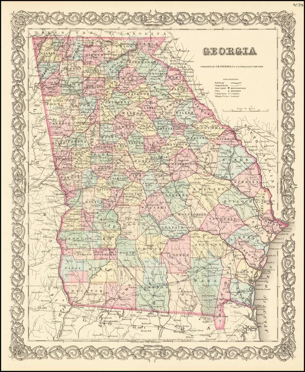
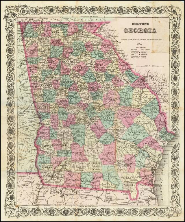
Detailed map of Georgia, colored by counties. Shows roads, railroads, towns, villages, post offices, rivers, lakes, stations and a host of other details. Decorative border. A terrific map, from John Hutchins Colton, one of the most prolific American...
![[Defending The Southern Coast During the Spanish American War] Map of Sea Islands. Coast of Georgia. from St. Mary's River to Savannah River compiled from the best Authorities 1864 / Map of Sea Islands. Coast of Georgia. from St. Mary's River to Sav](/map/small/59563.jpg)
Defending the Southern Coastline Against Spanish Attacks From Cuba Finely executed manuscript map of the Sea Islands of Georgia and Sea Islands of South Carolina, created by Robert Deas Gignilliat during the Spanish-American war, 1898. The map is...
Separately Published Map of Georgia Scarce separately published pocket map edition of GW & CB Colton's map of Georgia. Shows roads, railroads, towns, villages, post offices, rivers, lakes, stations and a host of other details. Decorative border....
![[Atlanta Campaign] Map Illustrating the Military Operations in Front of Atlanta, Ga. From the Passage of Peach Tree Creek, July 19th 1864, to the Commencement of the Movement upon the Enemy's Lines of Communication, South of Atlanta, August 26th 1864 . .](/map/small/54700.jpg)
Remarkable map of the five miles around Atlanta, offered here in the so-called facsimile reproduction edition, published by the Graphic Company of New York. By far the most detailed map of the region around Atlanta to depict this fast growing southern...
![Gray's New Map of Georgia [Savannah Inset]](/map/small/71184.jpg)
Detailed map of Georgia, published by OW Gray. The map is colored by counties and showing townships, towns, villages, post offices, lakes, forts, roads, railroads (projected and completed), Light Houses, Light Ships, etc. Large insets of the town of...
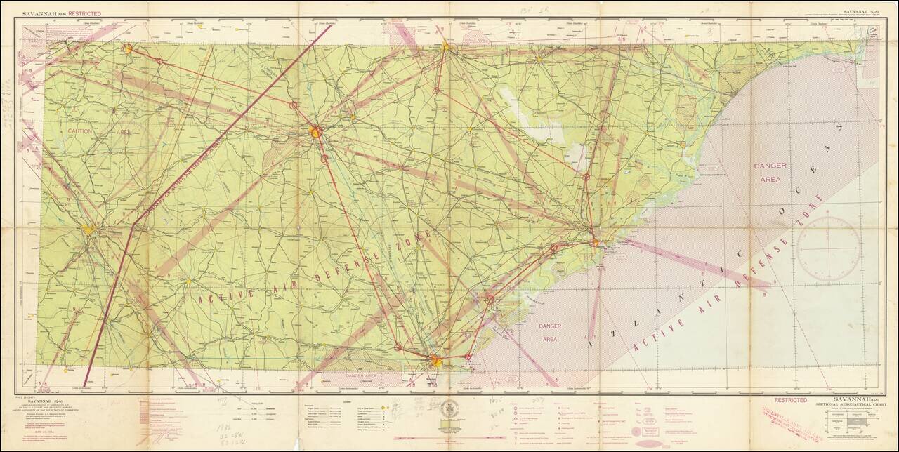
Restricted World War II Aviation Map -- Greenville, Army Air Base Artifact. Detailed aeronautical map of the Savannah area. The present example bears the stamp of the Greenville Army Air Base, Office of Base Operations Officer, Greenville, SC. (Later...
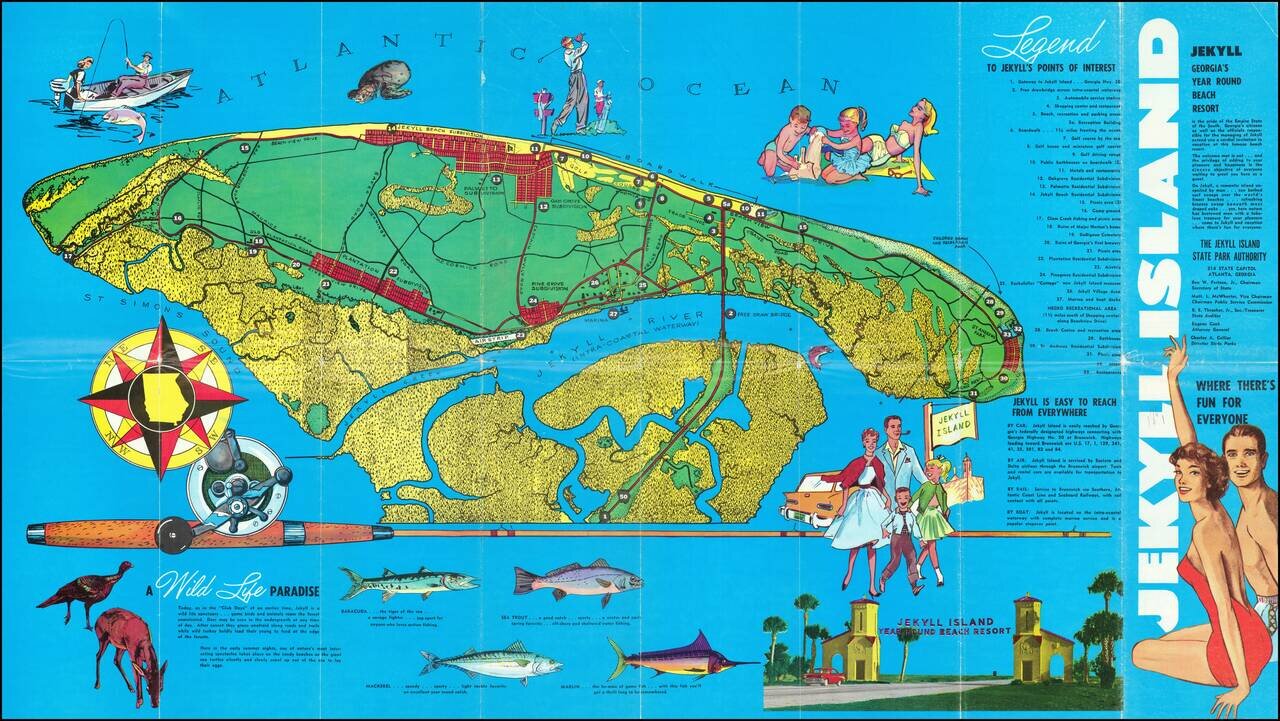
Pictorial map of Jekyll Island, Georgia, illustrating the island and its recreational activities. The map highlights the island's fishing, wildlife and golf activities, with photos on the verso.
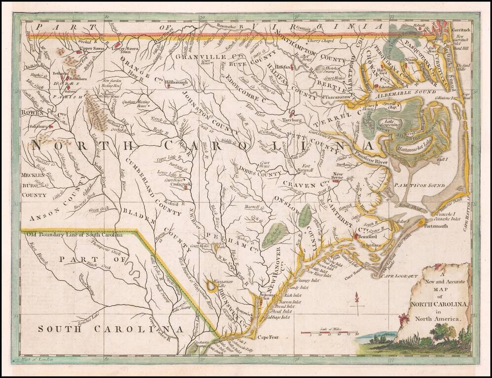
Scarce colonial map of North Carolina, based upon John Collet map, which appeared in the Universal Magazine. Shows towns, counties, rivers, lakes, mountains, inlets, islands, etc. The map covers all of North Carolina westward to Table [Rock] Mountain...