
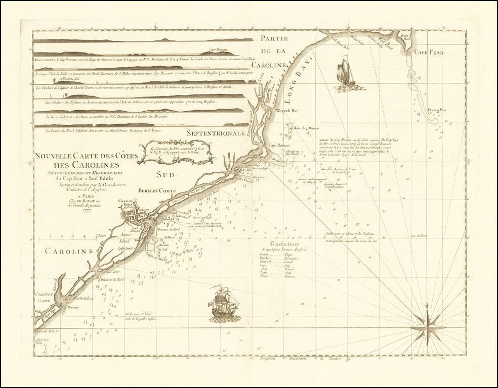
Rare chart of the Carolina coast, prepared by Le Rouge in connection with France's participation in the American Revolutionary War. This rare chart is one of a group of charts prepared by Georges Louis Le Rouge for use by the French Navy, which...
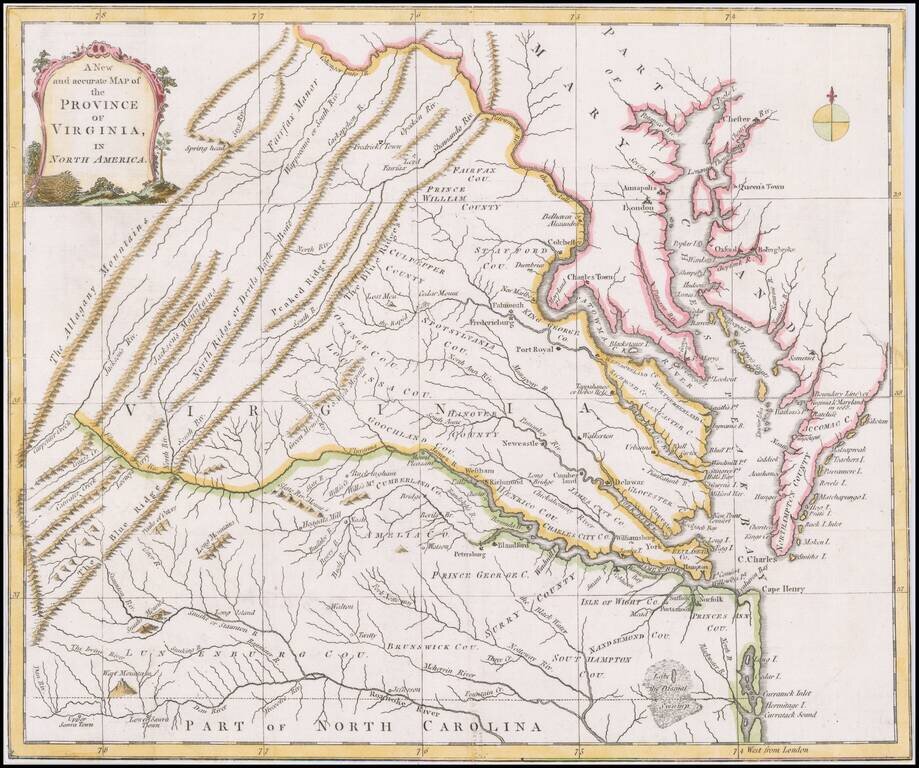
Scarce map of Virginia based largely on the Fry Jefferson map, as revised in 1775. The map is one of the first large format maps of Virginia to have appeared in a British serial publication ( Universal Magazine). It provides an excellent depiction of...
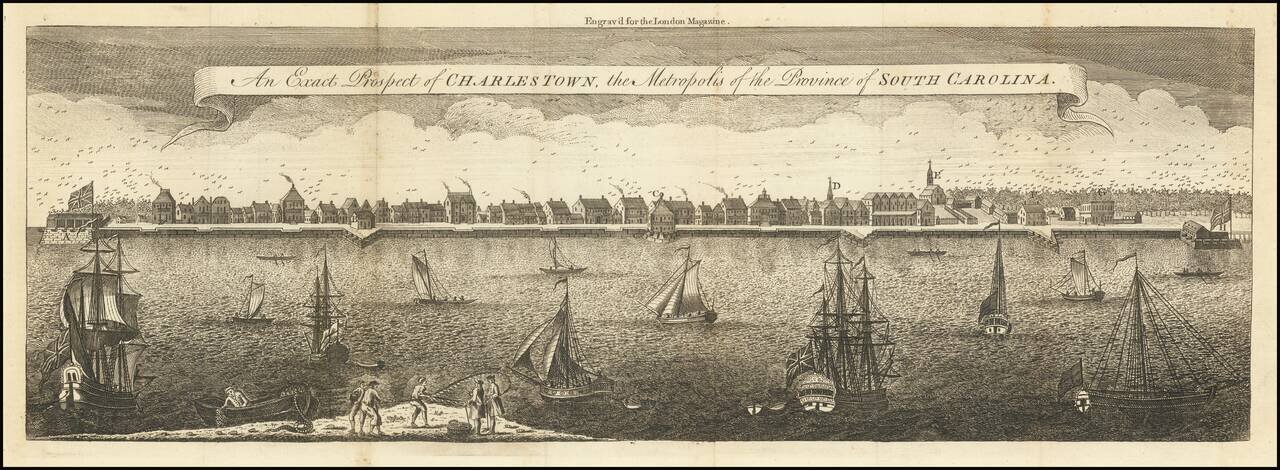
The Earliest Reasonably Obtainable View of Charleston Second edition of this large format view of Charleston is based upon a painting by Bishop Roberts in 1739, which was engraved by William Henry Toms for the London Magazine. There are two examples...
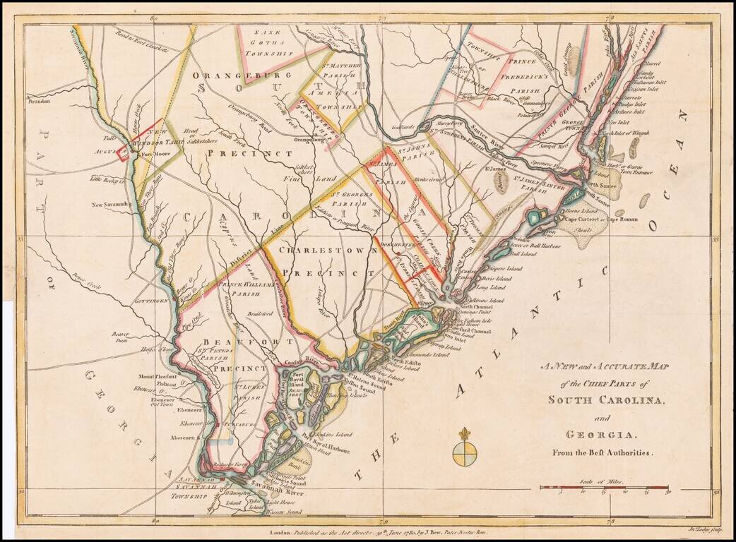
Fine early Revolutionary War map of South Carolina and part of Georgia, engraved by Jonathan Lodge for the Political Magazine of June 1780. The map shows early southern forts, counties, townships, parishes, precincts, towns, roads, rivers, and many...
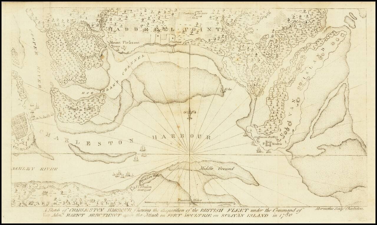
The Second Map Printed South of the Mason Dixon Line. Scarce and important Charleston and Fort Sullivan Battle Plan, issued in David Ramsay's History of the Revolution of South Carolina... . Thomas Abernethie was an early engraver in Charleston,...
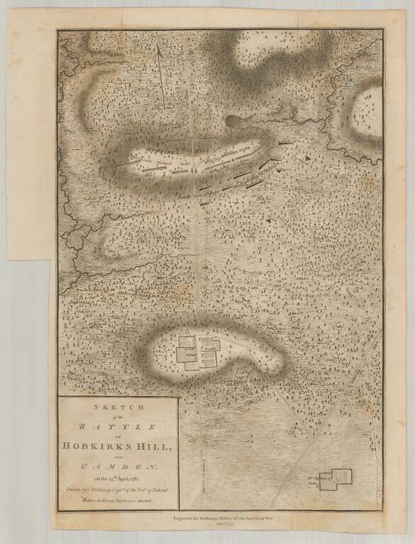
Scarce example of Faden's Revolutionary War battle map drawn by Vallancey, a British Captain. The map shows the position of the troops of the Lord Rawdon versus Nathanial Greene. Noted on the map are Log Town (destroy'd) and Mr. Charleston's burnt...
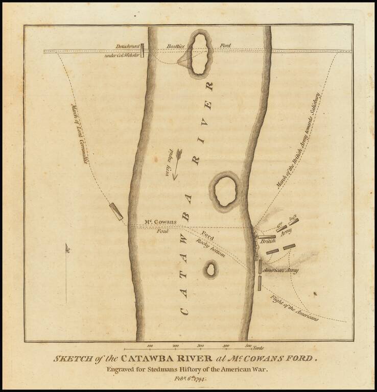
Detailed Revolutionary War battle plan, showing Lord Cornwallis' march crossing the Catawba River at McCown's Ford (now Cowan's Ford) and on towards Salisbury, along with the position of the Americans and their subsequent flight. Above the main...
Scarce map of the Southeast from Mentelle & Chanlaire's Atlas Universel… engraved by Tardieu and Valet. The map has interesting details throughout the region, including counties, roads, towns, counties, rivers, lakes, bays, forts, islands, etc....
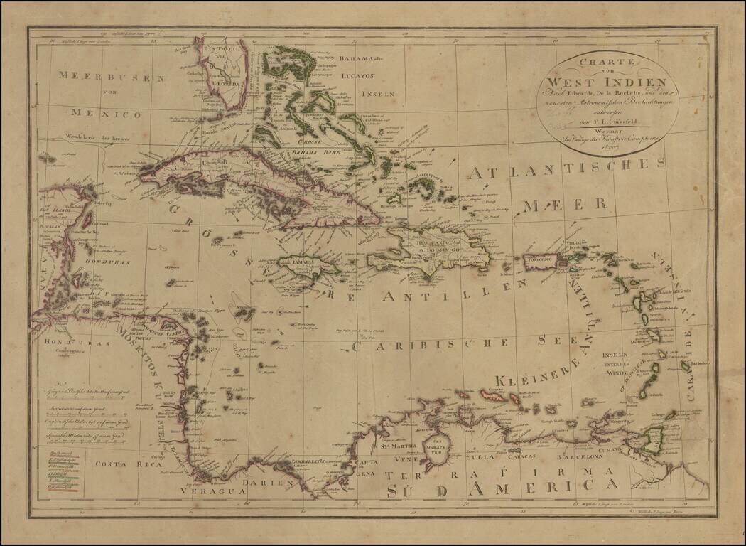
Rare edition of Gussefeld's map of South Florida, the Caribbean and coastlines of Central America. The map would be updated and re-issued for at least the next 20 years, with corrections. A comparison of this edition to the 1816 edition which we...
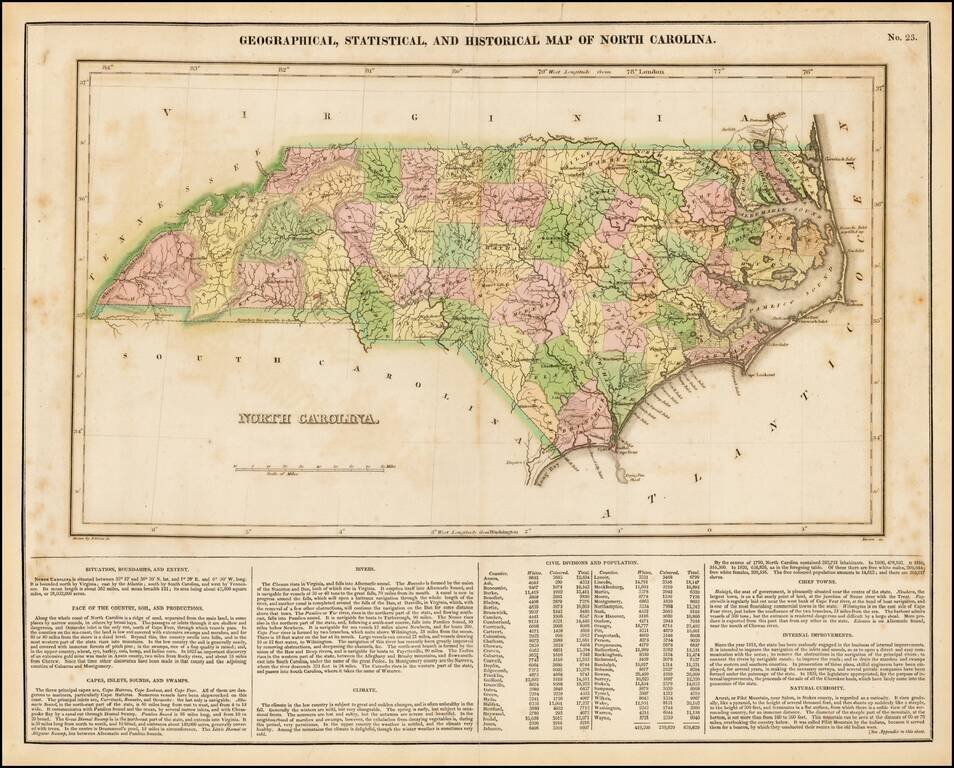
Detailed map of North Carolina, from the first edition of Carey & Lea's Atlas. Many counties still not formed. Size includes text below map, which includes wonderful contemporary details concerning the topography, indigenous lands, rivers,...
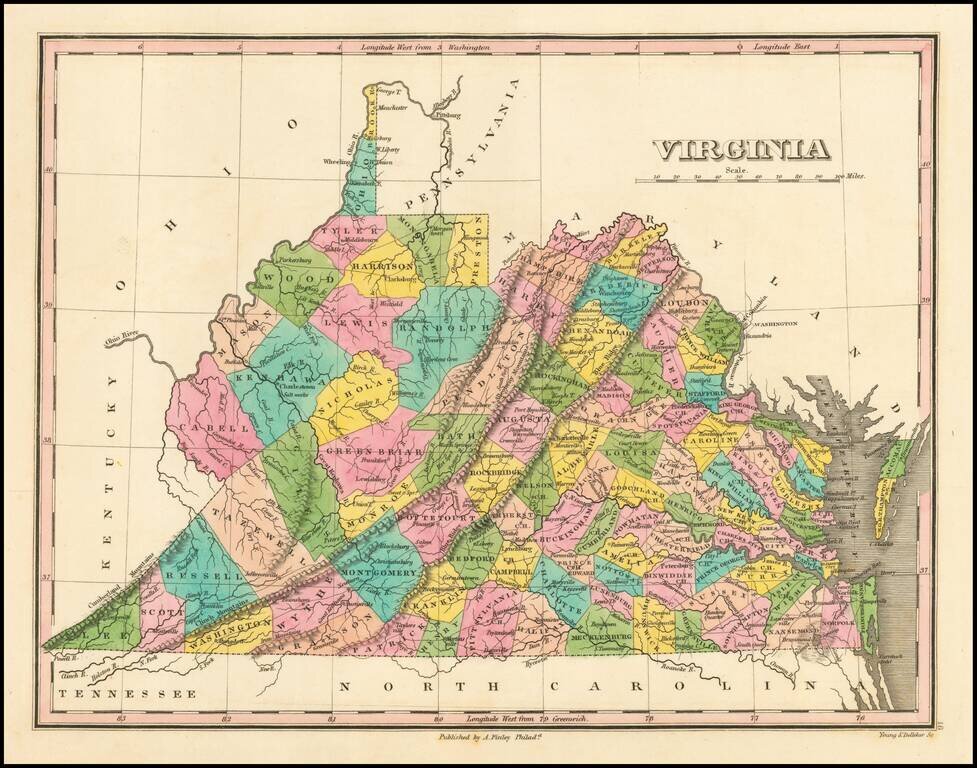
First edition of this early map of the state of Virginia from Finley's atlas. The map is hand colored by counties and shows towns, roads, rivers, mountains and other geographical features. The western portion of the state lacks a number of Counties,...
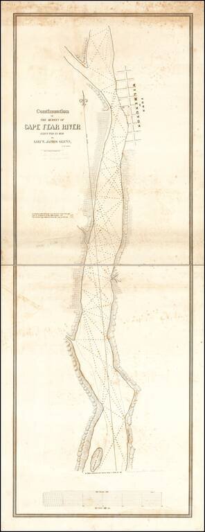
Rare 2-sheet map of a section of the Cape Fear River, prepared under the direction of James Glynn in 1839, as part of the US Navy's search for a suitable port for the establishment of a Southern Navy Yard and printed by P. Haas, Lithy., Washington...
![[Untitled Coast chart of North Carolina, South Carolina, Georgia, and Florida, with insets of the harbor of Charleston, S.C. and the entrance of the Saint Johns River]](/map/small/50156.jpg)
Scarce single sheet map of the the region from Cape Fear, North Carolina to St. Augustine Florida, one of a series of maps covering the east coast of North America, engraved by William Hooker and published by E & G.W. Blunt of New York. Blunt's...
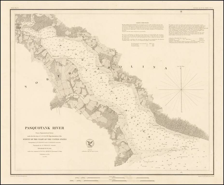
Rare separately issued sea chart of the Pasquotank River, published by the United States Coast Survey. Includes fine details throughout, including soundings and sailing directions. The Pasquotank River is one of the major rivers flowing into...
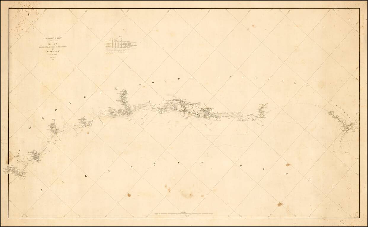
Unusual thick paper copy of the US Coast Survey progress chart from North Carolina to South Carolina, tracking the progress of the survey from 1847 to 1857 on along the Southeast Coastline. The accompanying notes identify the location of Astronomical...
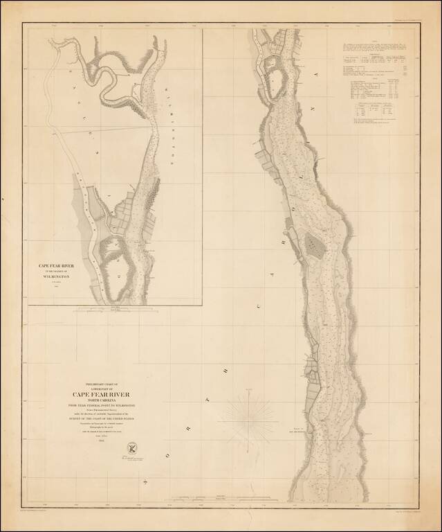
Rare separately issued example of the first edition of this detailed chart of the Lower Part of the Cape Fear River, from the Wilmington area to just south of the Ruins of Old Brunswick, first issued in 1856. Includes a large inset of the area around...