Map size in jpg-format: 34.6366MiB
Click to open in high resolution (open in new tab).
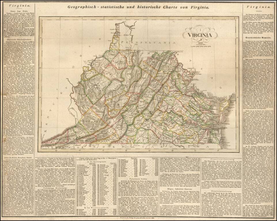
Rare German map of Virginia, mimicking the style popularized by Carey & Lea.
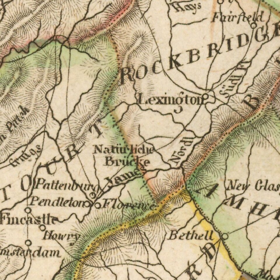
The map shows early towns, roads, rivers, lakes, and other geographical features. The early road detail is noteworthy. Many court houses and post offices also shown.
While the map is similar to the Carey & Lea, the text is significantly expanded.
Carey & Lea published the Atlas of North America in 1822. The atlas was a commercial success and was re-issued in 1823 and 1827. It adopted the style of the Lavoisne Atlas, which had been published in London and later in Philadelphia by Carey & Lea, with descriptive text on two or three sides of the maps, rather than on the verso or other pages.
A French edition of the Atlas was published by Buchon in Paris in 1825. This German edition by Weiland is by far the rarest. All of the maps have been re-engraved by the Weimar Geographischen Insitut, a well regarded cartographic publisher. The engraving quality of the maps far surpasses the American edition. Weiland actually added several maps which did not appear in the Carey & Lea or Buchon additions.
One of the earliest and rarest maps of the state printed outside the United States.
If you are a student, write to us in telegram: @antiquemaps and indicate what material you need and for what work you need a map in high detail. We are ready to provide material on special terms. For students only!