
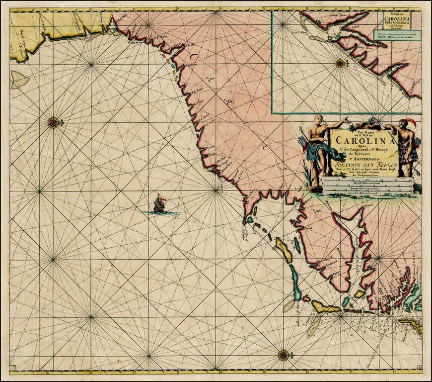
Striking full color example of Van Keulen's map of the coastline from Cape Charles and the mouth of the Rappahanock River to Cape Canaveral, with a large inset of the region around Charleston Harbor, extending to C. de S. Romano. Nice early...
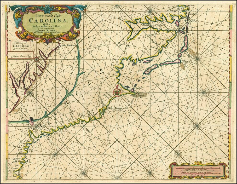
Jacob Robijn edition of this early chart of the Carolina, Georgia & North Florida Coastline, first published by Arent Roggeveen, from his Het Brandende Veen, oriented with south at the top of the map. Roggeveen's chart of the Carolinas, etc. is...
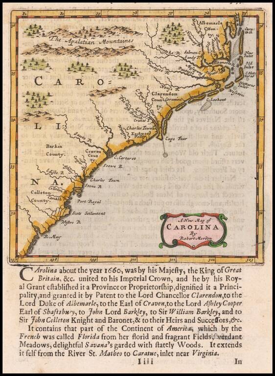
Nice example of Morden's map of the Carolinas, one of the earliest obtainable English maps of the Carolinas. Beginning in the 1670s, the English fortunes in North America took a dramatic turn upward, resulting in a booming interest in the British...
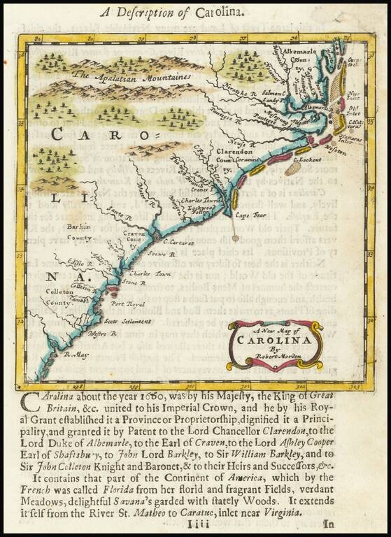
Nice example of Morden's map of the Carolinas, one of the earliest obtainable English maps of the Carolinas. Beginning in the 1670s, the English fortunes in North America took a dramatic turn upward, resulting in a booming interest in the British...

Nice example of this scarce late 17th Century map of the Southeast. Valk & Schenk's map is a rare re-issue and reworking of Jan Jansson's map of the region. Jansson's map of the Carolinas and Blaeu's map of the Carolinas are virtually...
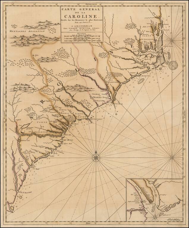
French Edition of An Important Early Map of the Carolinas First state of Mortier's map of the Carolinas, one of the most detailed and up to date maps of the period. Mortier's map is based upon Thornton, Morden & Lea's virtually unobtainable map...
![Carte Particuliere De La Caroline Dresse sur les Memoires le plus Nouveaux Par Le Sieur S[anson] . . .](/map/small/58997.jpg)
A good example of Mortier's highly detailed map of the area around Charleston, South Carolina (founded 1669), the earliest obtainable map of South Carolina printed outside of England. Covens & Mortier's map is based upon surveys and manuscript...
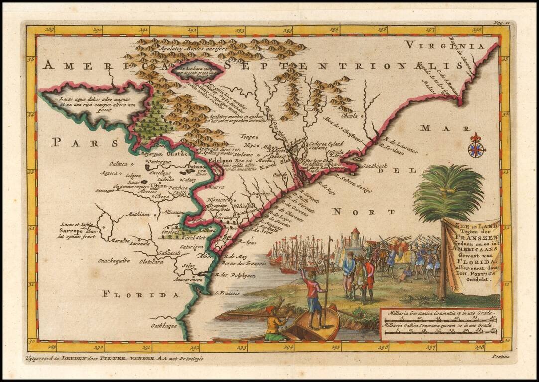
Nice example of Vander Aa's decorative map of the Carolinas, illustrating the travel and discoveries of Ponce De Leon. The map is based upon the earlier Hondius-Mercator map of the same region, with a few later influences. There is no waterfall into...
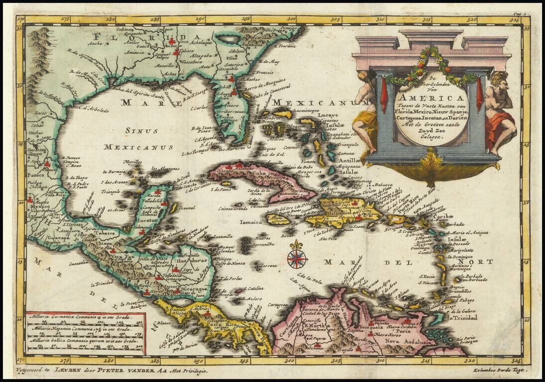
Detailed regional map of Florida and the Caribbean, used by Vander Aa to illustrate a Dutch translation of the narrative of one of Columbus' Voyages to the New World. Shows Central America and the Caribbean in full, with small parts of South America...
![[Indian Wars in Carolina] De gruwlyke aanvalle der Indiaanen op de Engelse in Carolina . . .](/map/small/69953.jpg)
A series of nine current event broadsides, most notably the image showing the English battling Indians in the Carolinas at the top left. The Carolina image shows a Dutch view of the Yamasee War. The full title, translated from the Dutch, reads "The...
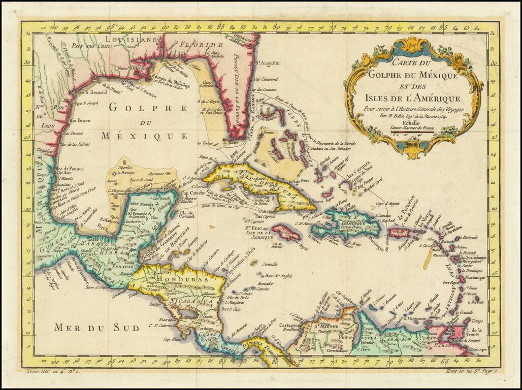
Interesting and detailed map of Florida, the Gulf Coast, Central America, and the Caribbean. The map shows the route of Ponce de Leon when he discovered Florida, Cortez's route in 1519, and that of De Cordova in 1517. The map features a decorative...
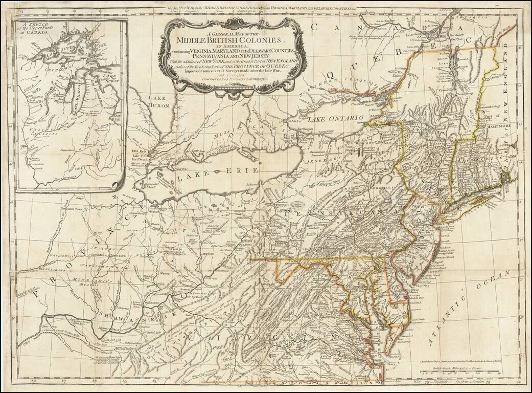
The scarce "Holster Atlas" edition of Lewis Evans' highly important map of the Middle British Colonies, at the start of the American Revolution. This edition of the map was prepared specifically for the American Military Pocket Atlas, an atlas...
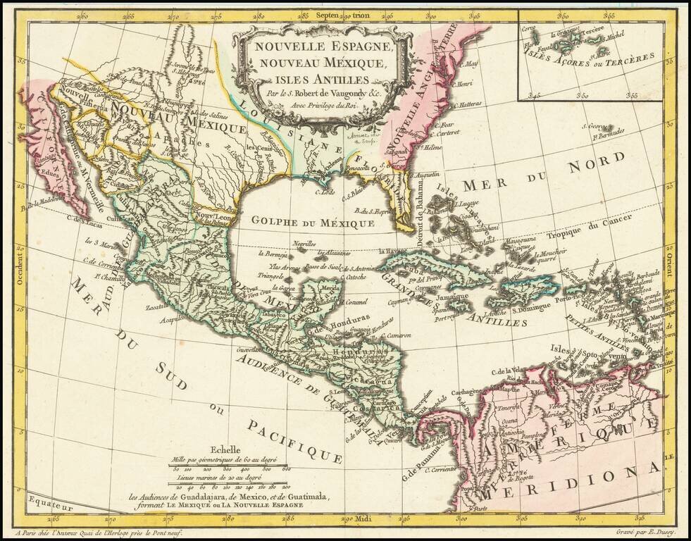
Antique Map of Texas, Mexico and the American Southwest, Florida and the Caribbean Scarce map of the Southwest, Caribbean and Gulf Coast, from De Vaugondy's Nouvel Atlas Portatif. Includes a marvelous contemporary cartographic representation of the...
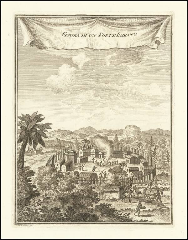
A Pomeiooc Village in Virginia Interesting view of a native American settlement, based upon De Bry. Includes dwellings, domestic animals such as oxen and donkeys [?], palisades, guns or muskets, and council fire. This image is derived from Theodor...
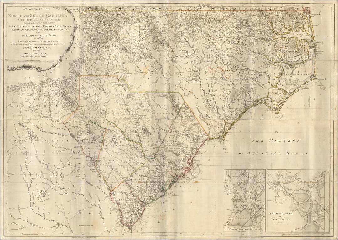
Second state of Henry Mouzon's landmark 4-sheet map of the Carolinas, the primary source for the geographical details of the Carolinas for the American, English and French armies during the American Revolution. Mouzon's map was unquestionably the most...
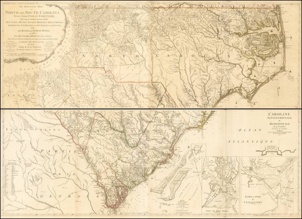
Second edition (first French Edition) of Henry Mouzon's landmark 4-sheet map of the Carolinas, the primary source for the geographical details of the Carolinas for the American, English and French armies during the American Revolution. Le Rouge...