
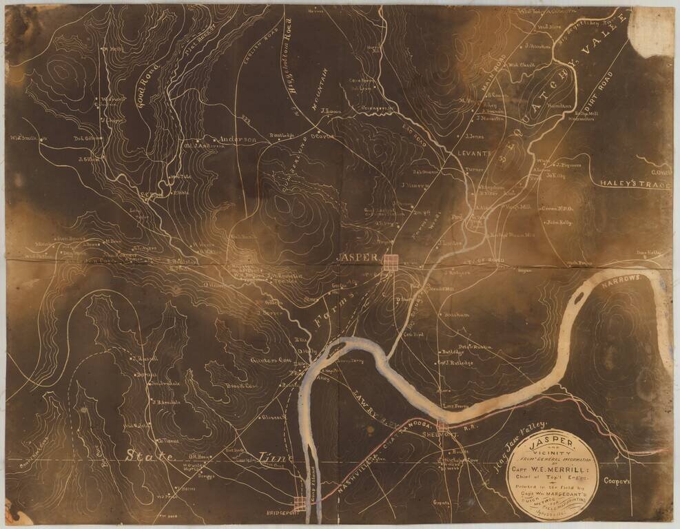
Early Photography & Battlefield Mapmaking Technology! Very rare and important Union Civil War "black map" or "sun map," printed in the field with a photographic process utilizing a mobile laboratory and darkroom. The map is centered on Jasper,...
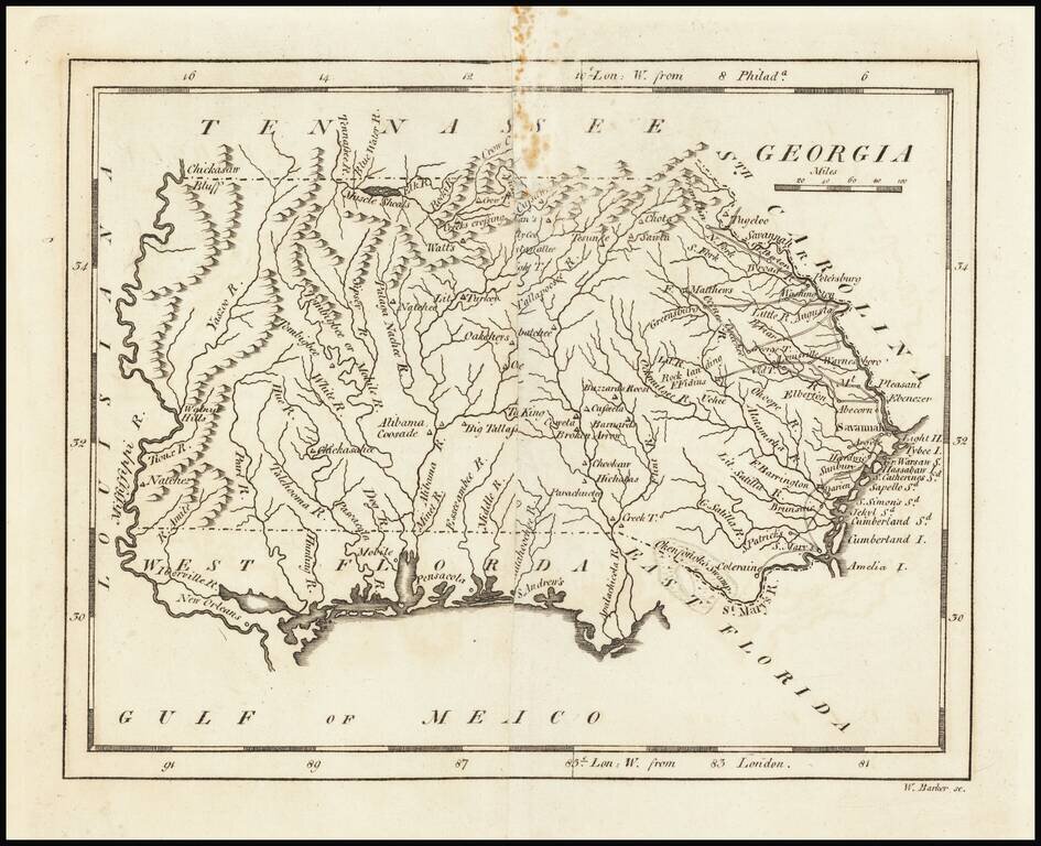
Nice example of Carey's map of Georgia, prior to the creation of Mississippi Territory. A highly detailed map, which includes towns, roads, rivers, mountains, and many other details.
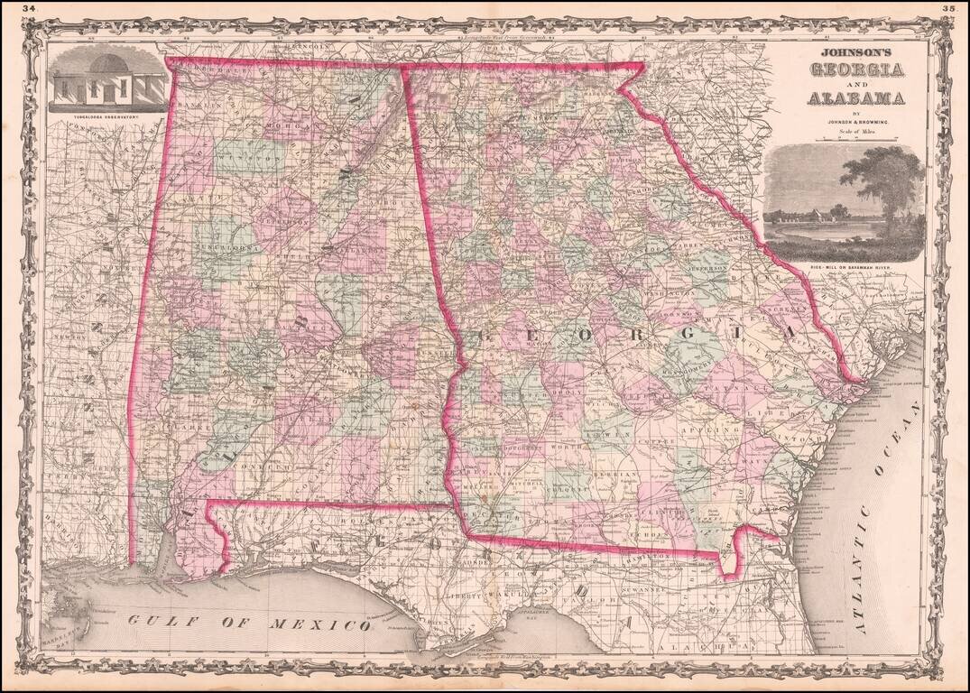
Detailed map of Georgia and Alabama, hand colored by counties, from one of the leading American map makers of the Civil War Period.
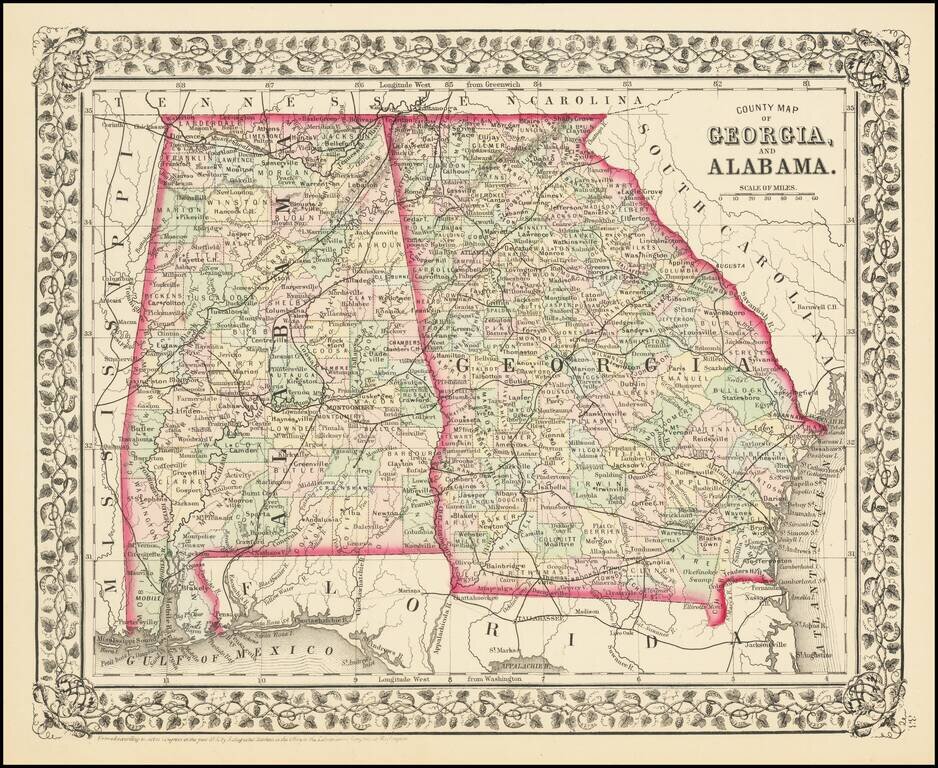
Detailed map of Georgia and Alabama, published by SA Mitchell Jr. The map is colored by counties and shows towns, roads, railroads, forts, proposed railroads, etc. Includes a decorative grapevine border.
![County Map of the States of Georgia and Alabama [Insets of Atlanta and Savannah]](/map/small/69561.jpg)
With Early Map of Atlanta! Nice full color map of Alabama and Georgia, published by SA Mitchell Jr. This is the first atlas map to include a plan of Atlanta. The map is hand colored by counties, and shows towns, roads, railroads, stations,...
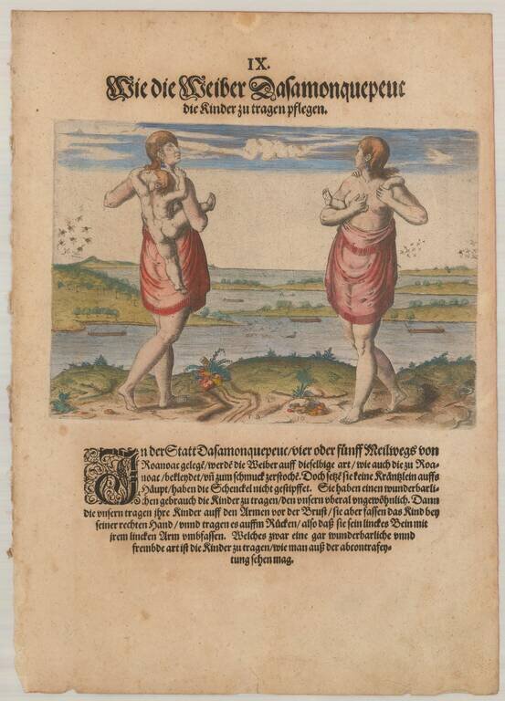
Virginia Indians: Woman with Child Fine copper plate engraving showing Theodore De Bry's version of John White's painting. Theodor de Bry's engraving shows a native American woman of Dasamonguepeuc carrying a child. In 1585, Governor John White,...
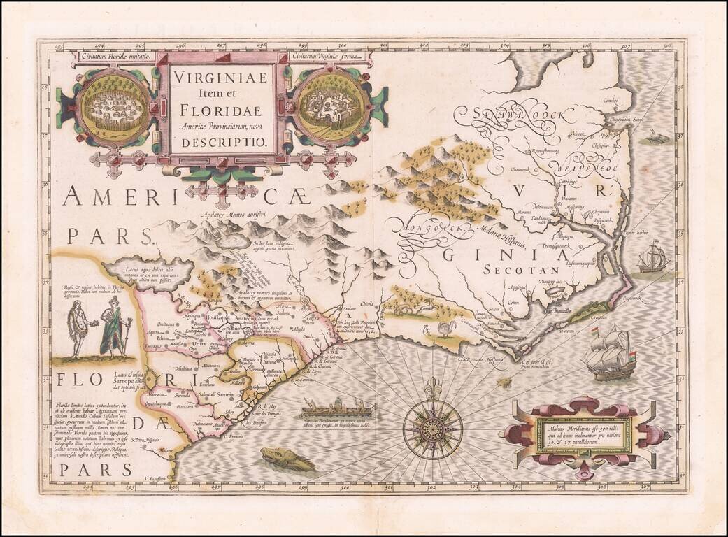
Early Seventeenth Century Map of Carolina and Virginia Fine old color example of Jodocus Hondius's important map of Virginia and the Carolinas, from the Mercator-Hondius A tlas Sive Cosmographie . . . Hondius utilized John White's map of Virginia and...
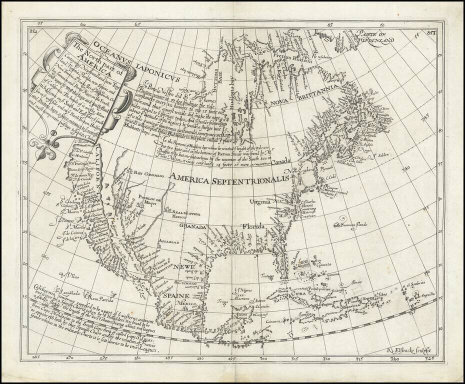
The Most Important Map of North America Published in England in the Seventeenth Century Fine example of Henry Briggs’ famous map of North America, one of the most important and influential printed maps of the seventeenth century. It was included in...
Rare second state of Cloppenberg's map of the Carolinas and parts of Virginia and Georgia, first issued in the Cloppenburg edition of Jansson's Atlas sive Cosmographie in 1630. The map extends from St. Augustine in the south to just north of...
Nice example of Jansson's map of the Southeast. Jansson's map of the Carolinas and Blaeu's map of the Carolinas are virtually indistinguishable cartographically, although there are a number of minor differences in the embellishments. Both maps are on...
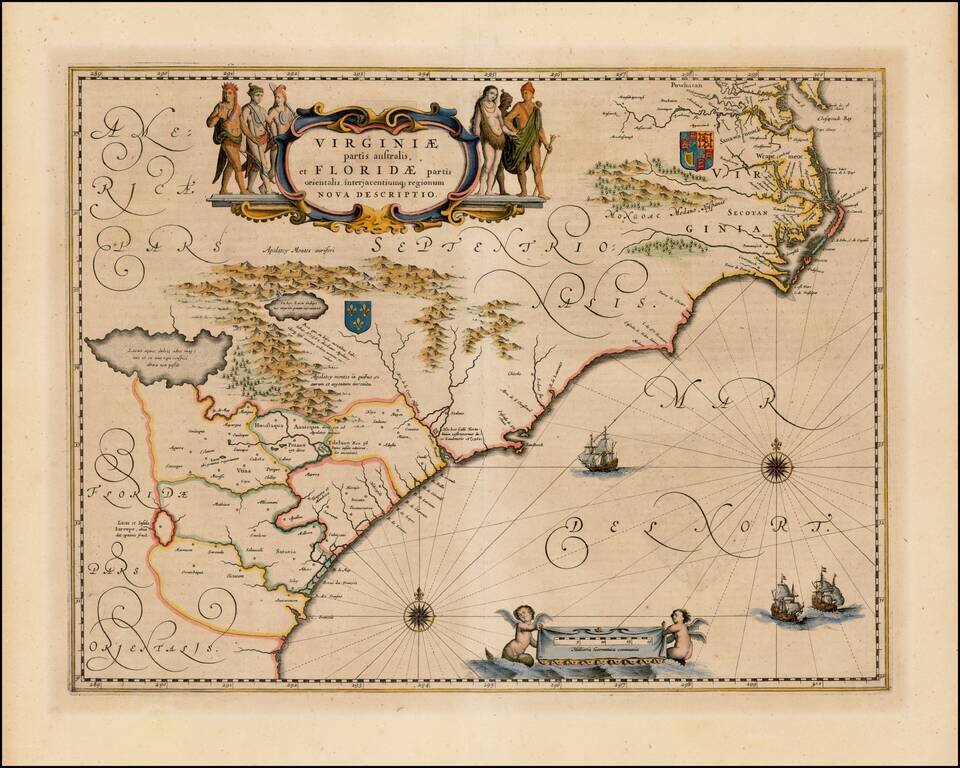
![[Carolinas, Georgia, etc] Virginiae Partis australis, et Floridae partis orientalis, interjacentiumqus regionum Nova Descriptio](/map/small/51779.jpg)
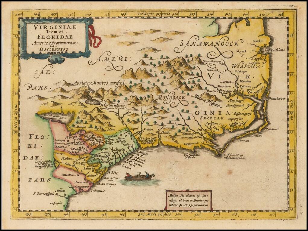
The Second Earliest Dutch Map of the Carolinas, Southern Virginia & Georgia. Fine old color example of Blaeu's map of the Southeast. This map is based on the 1606 Mercator-Hondius map, but with significant improvements. The map covers an area...
![[Port Royal, South Carolina]](/map/small/65162.jpg)
Finely engraved view, based upon original watercolor painting by Jacques Le Moynes de Morgues, an official French artist, who accompanied two important French Expeditions to North America in the 1560s. The image shows the French landing at Port Royal,...
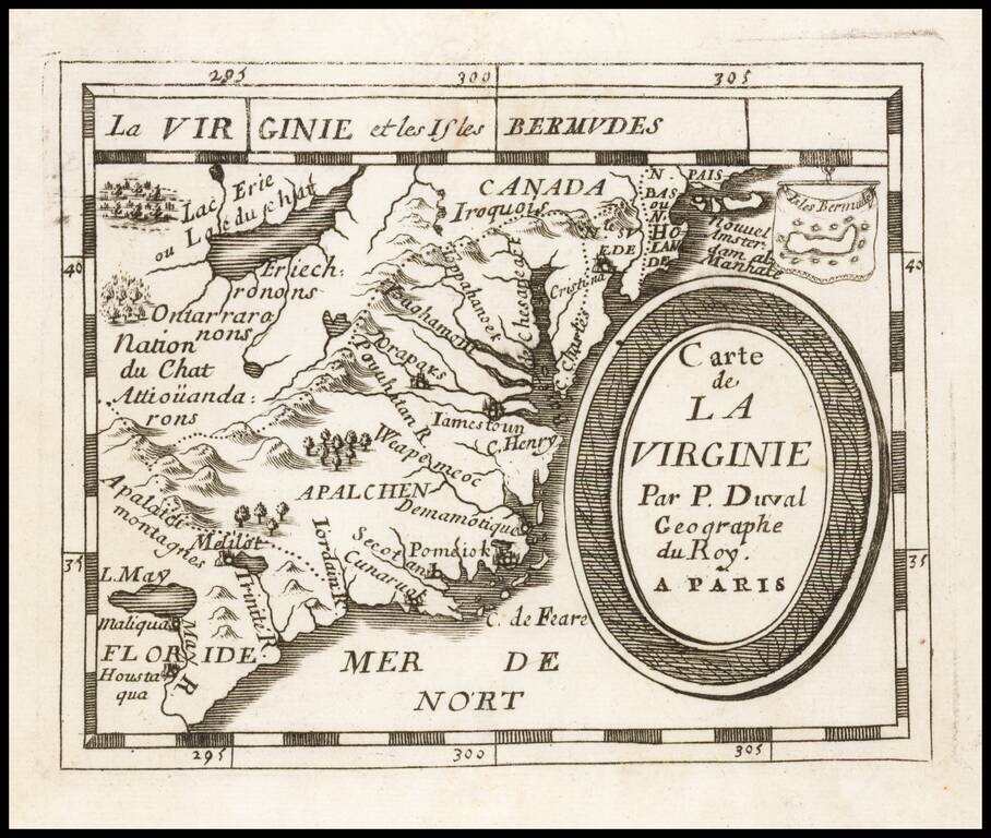
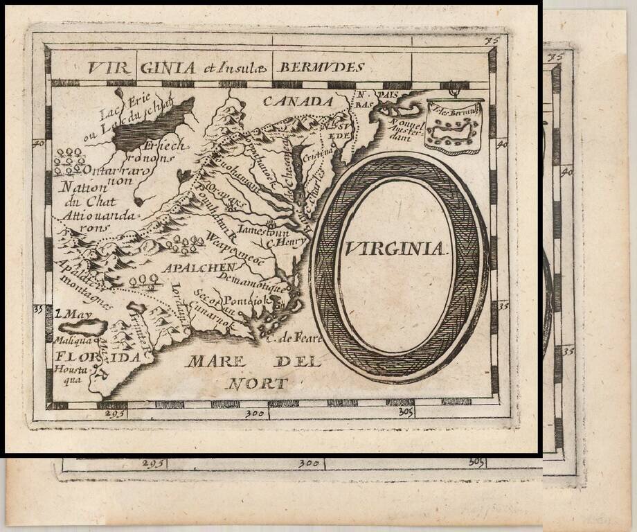
Early regional map from Duval's Le Monde Terrestre, first published in 1659, although no copy located pre-dates 1660. Includes an early depiction of the Chesapeake region, the mythical Lake May above Floride, Jamestown, Cape Henry, Secot, Pomeiok, an...
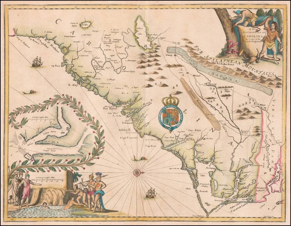
Rare and important early promotional map of the Carolinas, from the coast of the Appalachians, prepared by James Moxon to promote the newly established Carolina Colony. This map is the first large format map of the newly settled Carolina Colony,...
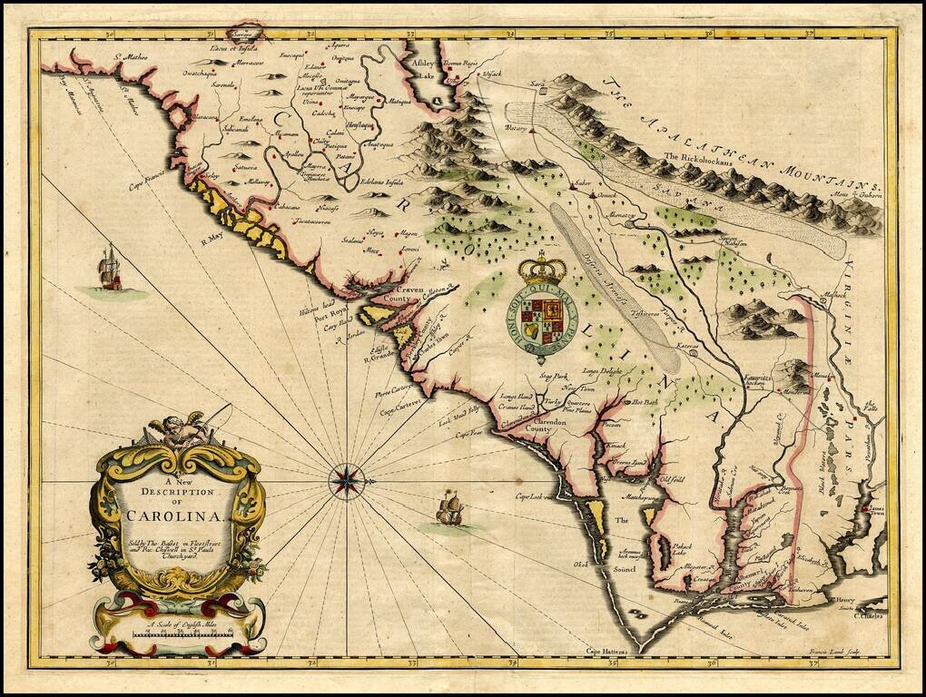
Important early map of the Carolinas, engraved by Francis Lamb for the 1676 edition of Speeds A Prospect . . . of the World. The map is Speed's edition of the famous Lords Proprietors' Map of Carolina, based upon Charles II's grant to 8 of his...
Early German Map of Virginia. Rare German edition of Pierre Duval's map of the region centered on Virginia, the Chesapeake and the Carolinas, published by Johann Hoffman in his Geographiae Universalis, first issued in 1678. The map is a close...