
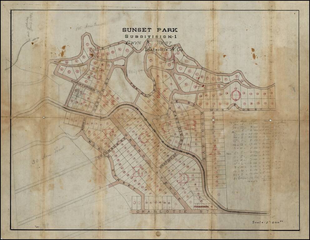
Detailed manuscript map of the Sunset Park Subdivision - 1, by Gwyn & West, in Asheville, North Carolina, one of the earliest subdivisions in Asheville's "modern" history. The map is oriented with East at the top extends from Sunset Drive to...
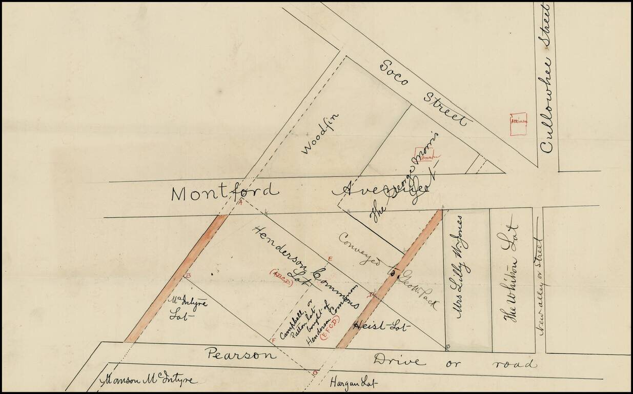
Early cadastral map of part Asheville, North Carolina, just south of the University of North Carolina, Asheville, identifying the land owners in a section of town including Pearson Drive, Montford Avenue, Soco Street and Cullowhee Street, just...
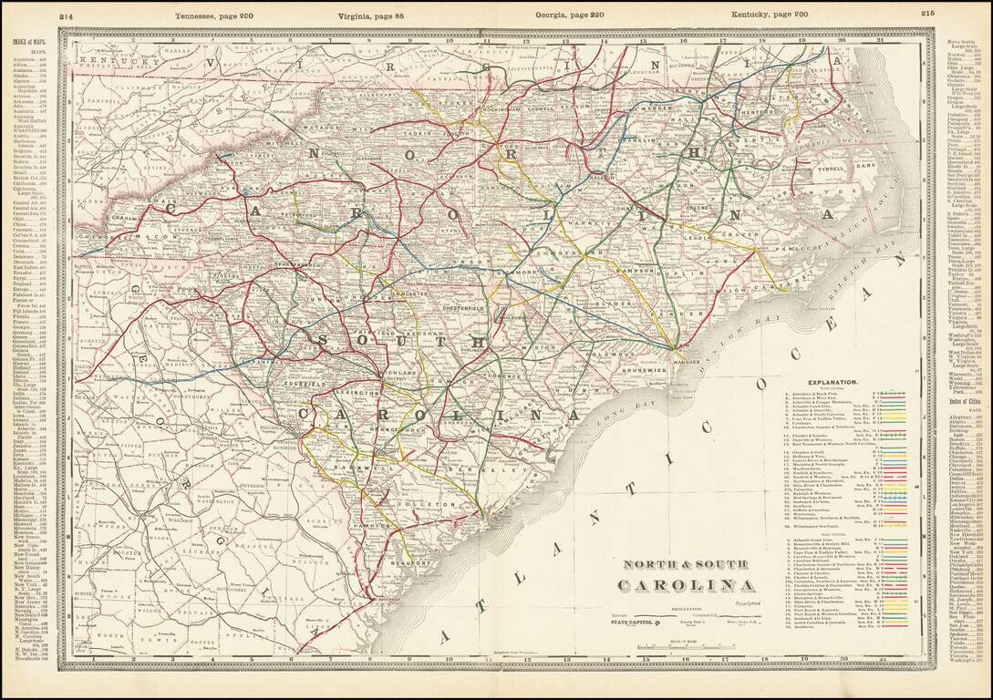
A fabulously detailed railroad map of the Carolinas, from Cram's scarce Standard American Railway Atlas. Shows over 60 different railroads, stations, and numerous other details. The best atlas railroad map of the time period.
![Western Part of North and South Carolina [and] Eastern Part of North and South Carolina](/map/small/69547.jpg)
A fabulously detailed railroad map of the Carolinas, from Cram's scarce Standard American Railway Atlas. Shows over 60 different railroads, stations, and numerous other details. The best atlas railroad map of the time period.
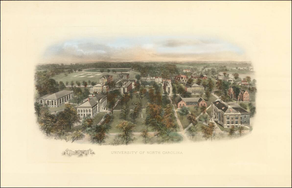
Fine example of this marvelous early birdseye view of the University of North Carolina, Chapel Hill. At the turn of the century, Littig & Company commissioned a number of artists, including the accomplished artist Richard Rummell (1848-1924), to...
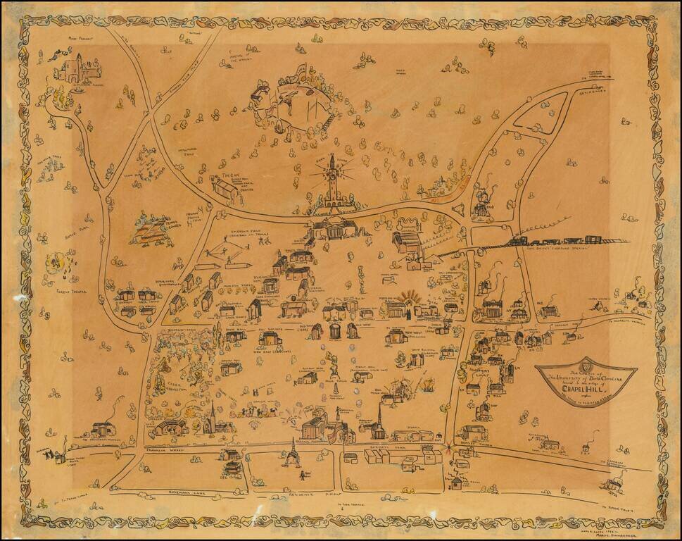
Impressive manuscript pictorial map of the University of North Carolina at Chapel Hill, drawn by Mary C. Dirnberger in 1933. The view is oriented with south at the top, at the bottom of the map it is bounded by Rosemary Street, at the top (south) of...
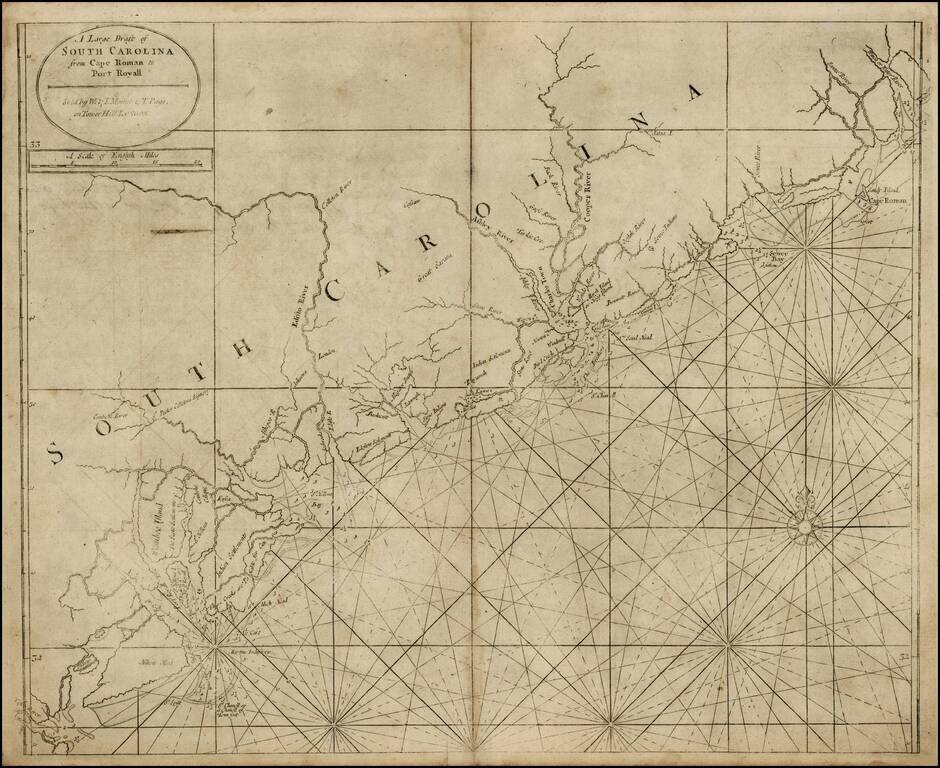
Fine example of this scarce map of the coast of South Carolina from the English Pilot, Fourth Book, including fascinating 18th Century provenance. Nice example of the third state of this fine chart of South Carolina, updated by Mount & Page just...
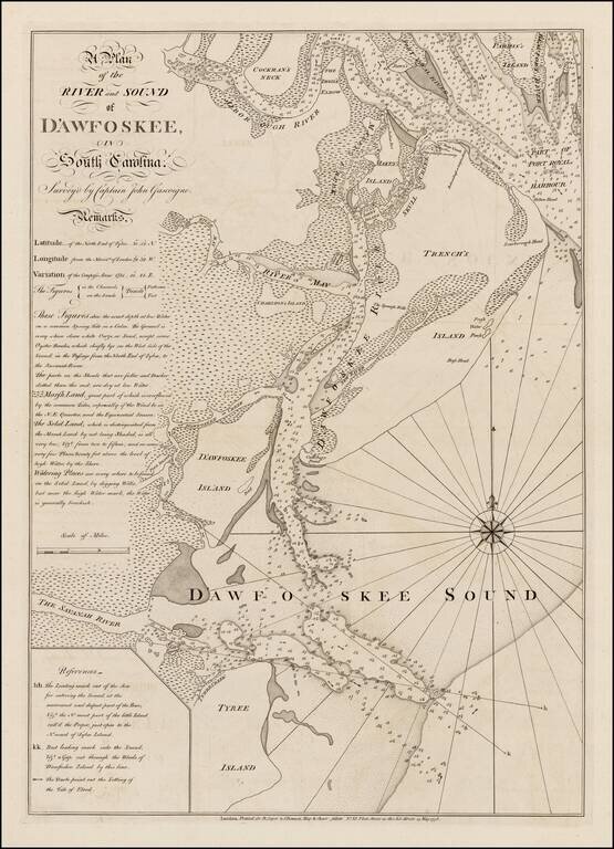
Highly detailed sea chart of the area around Hilton Head, South Carolina, based upon a survey by Captain John Gascoigne. Gascoigne's finely engraved chart was produced at the beginning of the American Revolution, at a time when the outcome among the...
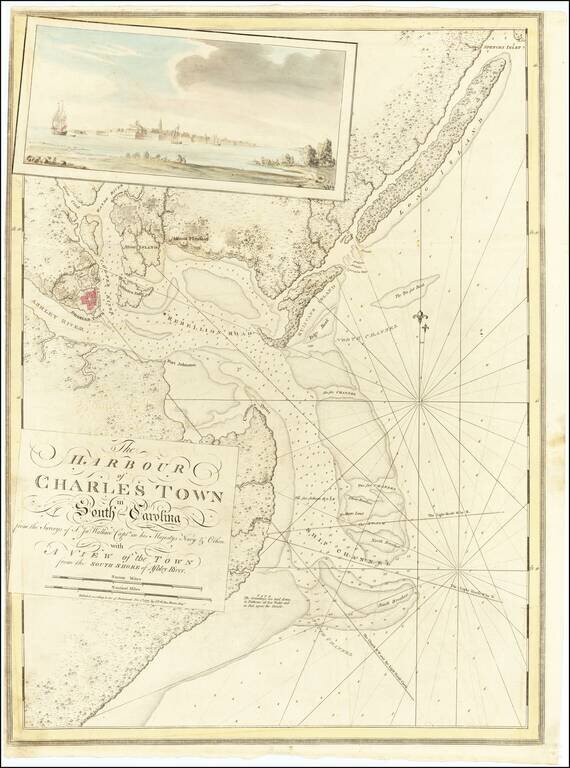
Magnificent Revolutionary War Reconnaissance Chart of Charleston, South Carolina from The Atlantic Neptune Spectacular Revolutionary-era chart of the harbor of Charleston, South Carolina, based on British surveys taken in the weeks prior to...
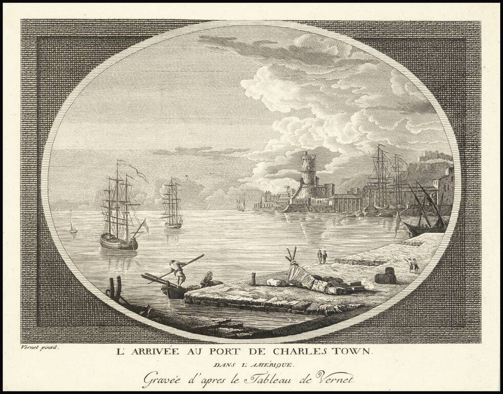
Rare view of the entrance to the port of Charleston, South Carolina, engraved by Claude Joseph Vernet in London. Vernet's separately published views were offered for sale individually and in albums. His American views are largely fanciful in nature,...
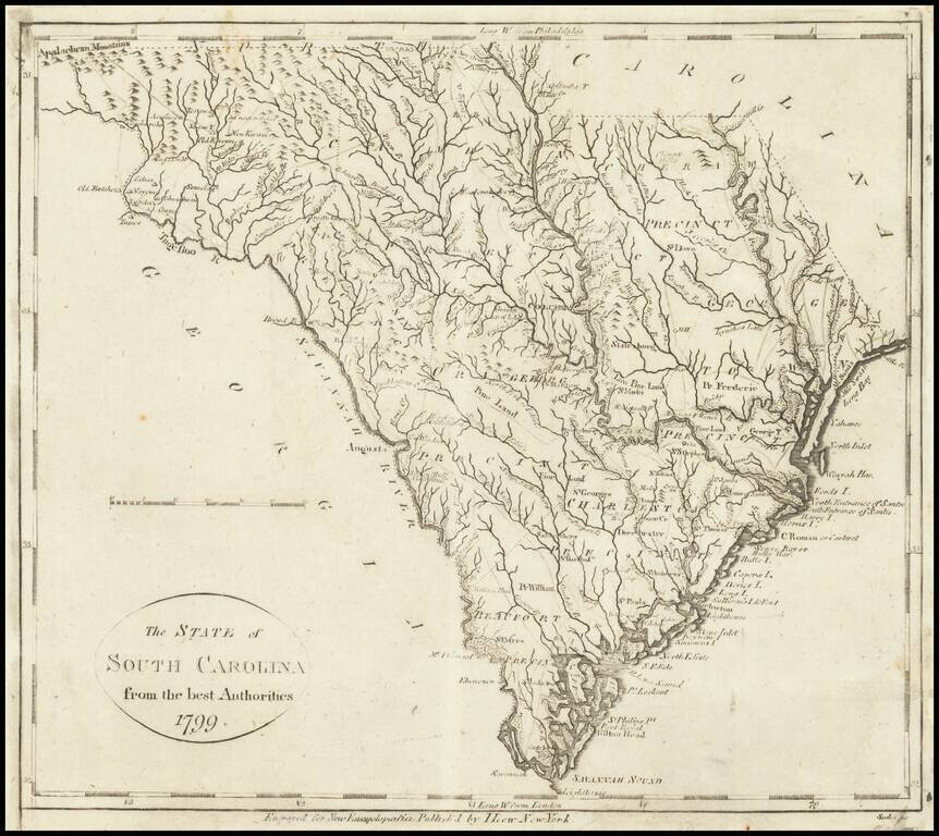
Excellent example of John Reid's map of South Carolina, the second folio map of the state to appear in a commercial atlas. The map was engraved by Benjamin Tanner and is drawn largely from Carey's map by Samuel Lewis, issued the prior year. An...
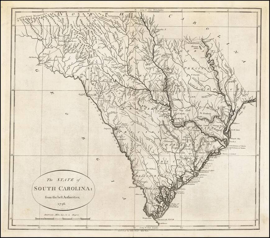
One of the earliest obtainable maps of the State of South Carolina. The map shows counties, towns, roads, rivers, lakes, islands, swamps, courthouses, along with topographical details. The map is based upon earlier maps that appeared in atlases...
Finely colored example of Carey's map of South Carolina, hand colored by counties, from the rare 1816 edition of Mathew Carey's General Atlas. The map provided a large format and highly detailed map of the state, showing towns, roads, rivers,...
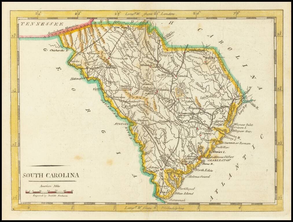
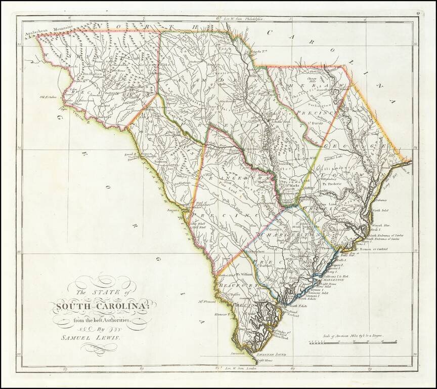
Nice early map of South Carolina from Carey's American Pocket Atlas. The map shows towns, roads, rivers, mountains and other topographical features. Following the publication of Carey's American Atlas in 1795, there were a small group of 18th Century...
![South Carolina [Pocket Map!]](/map/small/24952.jpg)
Extremely rare Carey & Lea Pocket Map of South Carolina in original covers. The map is hand colored by counties and shows towns, rivers, roads, court houses, meeting houses, post offices and other details. This is the earliest pocket maps of...
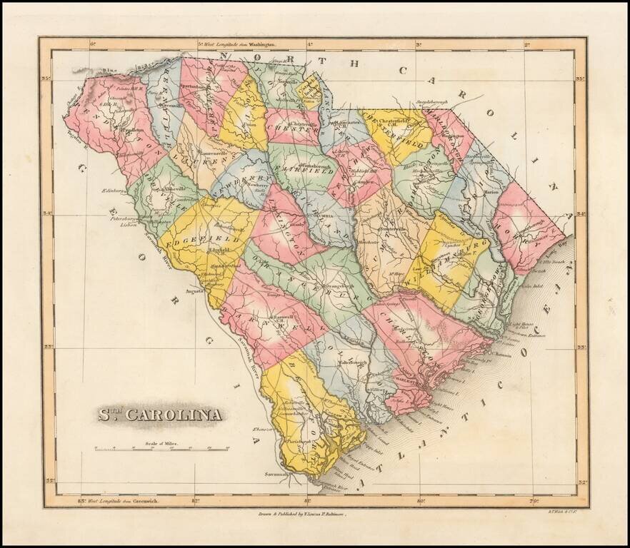
Striking example of Fielding Lucas' finely executed map of South Carolina. Lucas's maps were typcally printed on a higher quality paper than contemporary maps by Carey & Lea and demonstrate a superior engraving quality and more attractive coloring...