Map size in jpg-format: 9158780B
Click to open in high resolution (open in new tab).

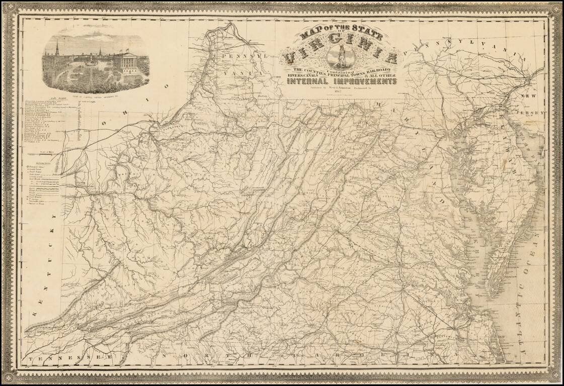
Rare confederate map of Virginia, which derives directly from Ludwig von Bucholtz seminal map of Virginia, published in 1858.
Von Bucholtz was commissioned to prepare the revisions to the 1826, Hermann Boye 9 sheet map, and 4 sheet maps of Virginia, which was at the time the most detailed and important map of Virginia. While Von Bucholtz work was exhaustive, the requirement that he was to essentially revise was the existing copperplates, which resulted in a less than accurate product. With the information he obtained in revising the Boye map, Bucholtz prepared several much more accurate maps of Virginia in the late 1850s, including the present map, which was issued by Ritchie & Dunnivant in 1858.
The lithographic plate engraved by Charles Ludwig for the Ritchie & Dunnivant map was utilized again by West & Johnston in 1862, for the present map. A new decorative border was added for the present map, along with an updated table of railroads and some minor geographical changes, which are outlined by William Wooldridge in his comprehensive study of the Bucholtz map and its 3 derivates, published in the Spring 2007 edition of The Portolan. As noted by Wooldridge, the map was also used by Matthew Fontaine Maury, with additions, in connection with his work on the state of Virginia published in 1868, and also by a map commonly referred to as the Virginia Military Institute (VMI) map.
If you are a student, write to us in telegram: @antiquemaps and indicate what material you need and for what work you need a map in high detail. We are ready to provide material on special terms. For students only!