
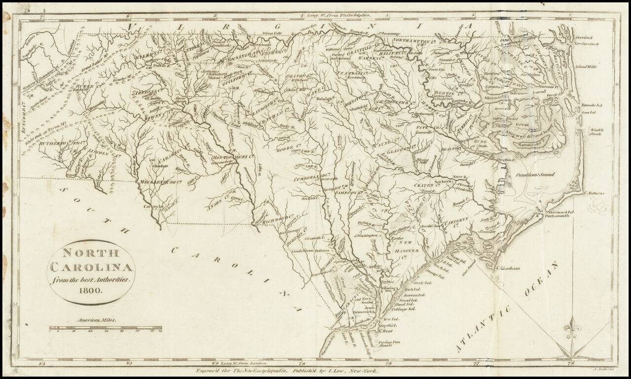
One of the earliest obtainable maps of the state of North Carolina. Shows counties, towns, roads, rivers, lakes, islands, swamps, court houses, and other early details. This map appeared in Volume IV of John Payne's New and Complete Universal...
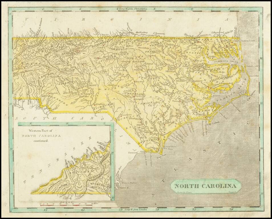
Early map of North Carolina. Early county names and configurations are shown. "Western Part of North Carolina continued." is shown in an inset map in the lower-left corner.
Striking example of Mathew Carey's map of North Carolina, one of the earliest large format maps of the State after independence. Includes the topography of North Carolina, as well as roads, towns, rivers, lakes, and a host of other details. The map...
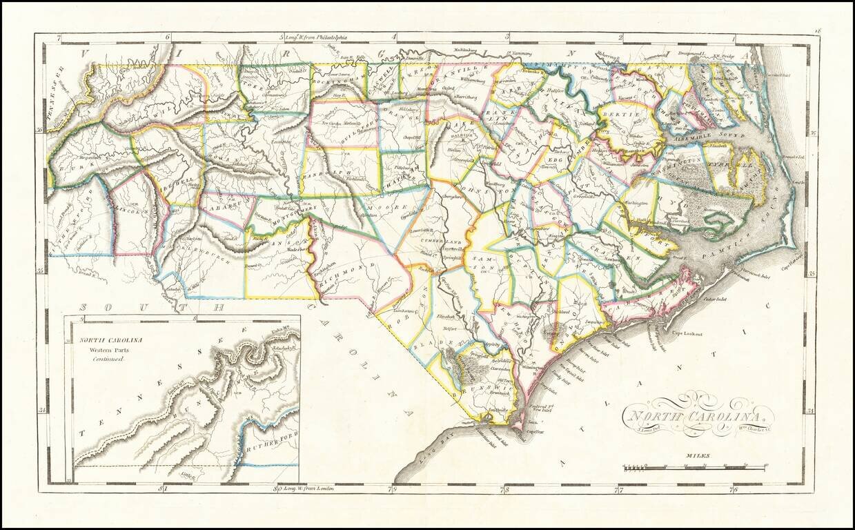
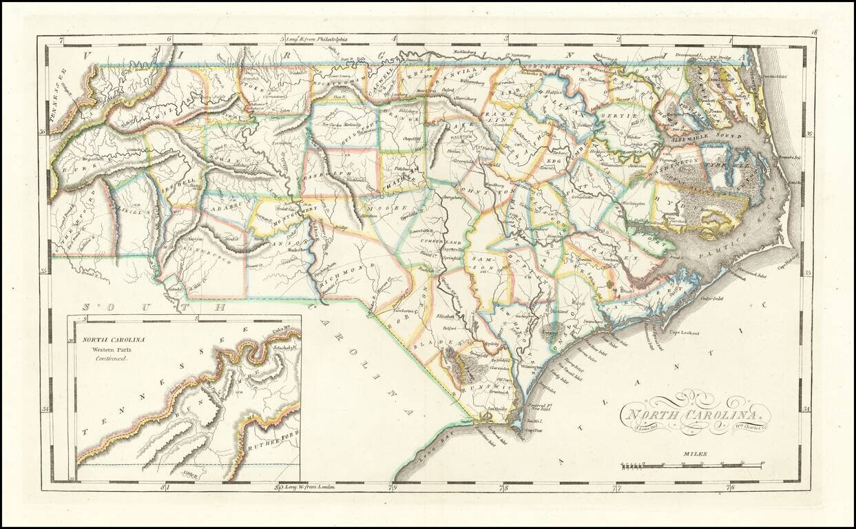
Scarce early map of the North Carolina, published by Mathew Carey. As noted on the North Carolina Map Blog: Although slightly smaller than the 1796-1810 map, it is most easily distinguished from the earlier plate by the presence of an inset of...
Rare Final State From 1818 Striking example of the edition of Mathew Carey's map of North Carolina, one of the earliest large format maps of the State after independence. Includes the topography of North Carolina, as well as roads, towns, rivers,...
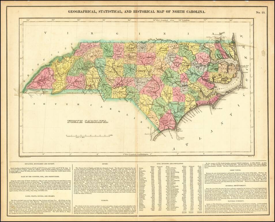
Detailed map of North Carolina, from the first edition of Carey & Lea's Atlas. Many counties still not formed. Size includes text below map, which includes wonderful contemporary details concerning the topography, indigenous lands, rivers,...
![Amer. Sep. No. 57(bis) Partie De Etats Unis [North Carolina & Bermuda]](/map/small/21805.jpg)
Scarce map of a part of North Carolina, showing Albermarle Sound, Pamlico Sound, Tyrrel County, Hyde County, Martin Coutny, Caretare County and areas just to the West, including towns such as Columbia, Tarborao, Greenville, Newberne, Washington,...
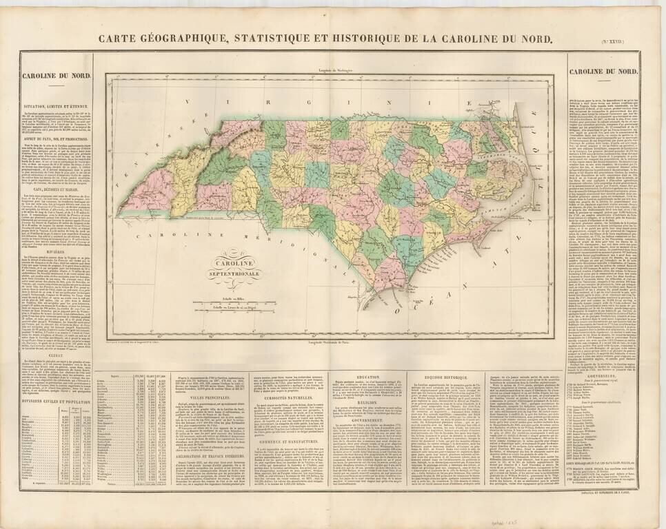
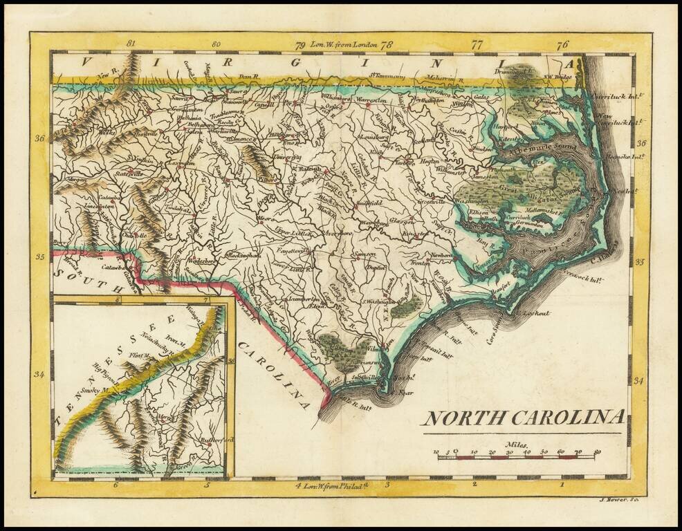
The First Map of North Carolina published in France Attractive map, colored by county and showing the various towns, roads, rivers, bridges, and a host of other details. Overall plate size is 24x17 inches, surrounded by text describing the state, its...
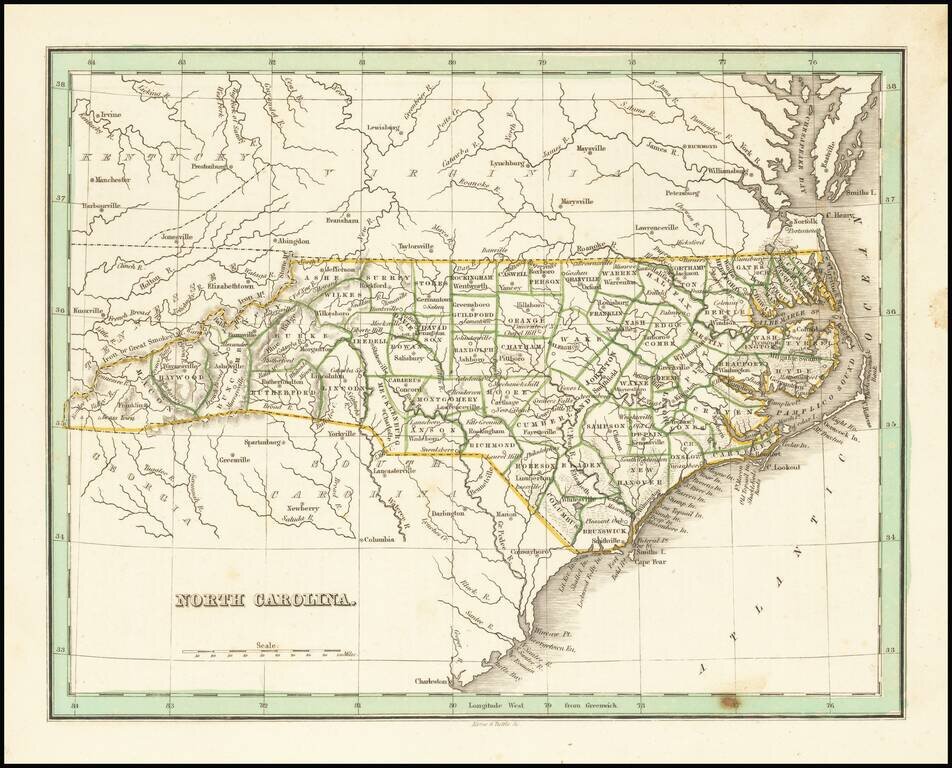
Nice example of this early map of the state of North Carolina from Bradford's Comprehensive Atlas. Shows counties, towns, rivers, etc.
Nice example of the first edition of David Burr's map of the Carolinas, which appeared in his Universal Atlas, first issued in 1836. Shows counties, towns, rivers, roads, courthouses and other details. Burr's Atlas was perhaps the most elegant...
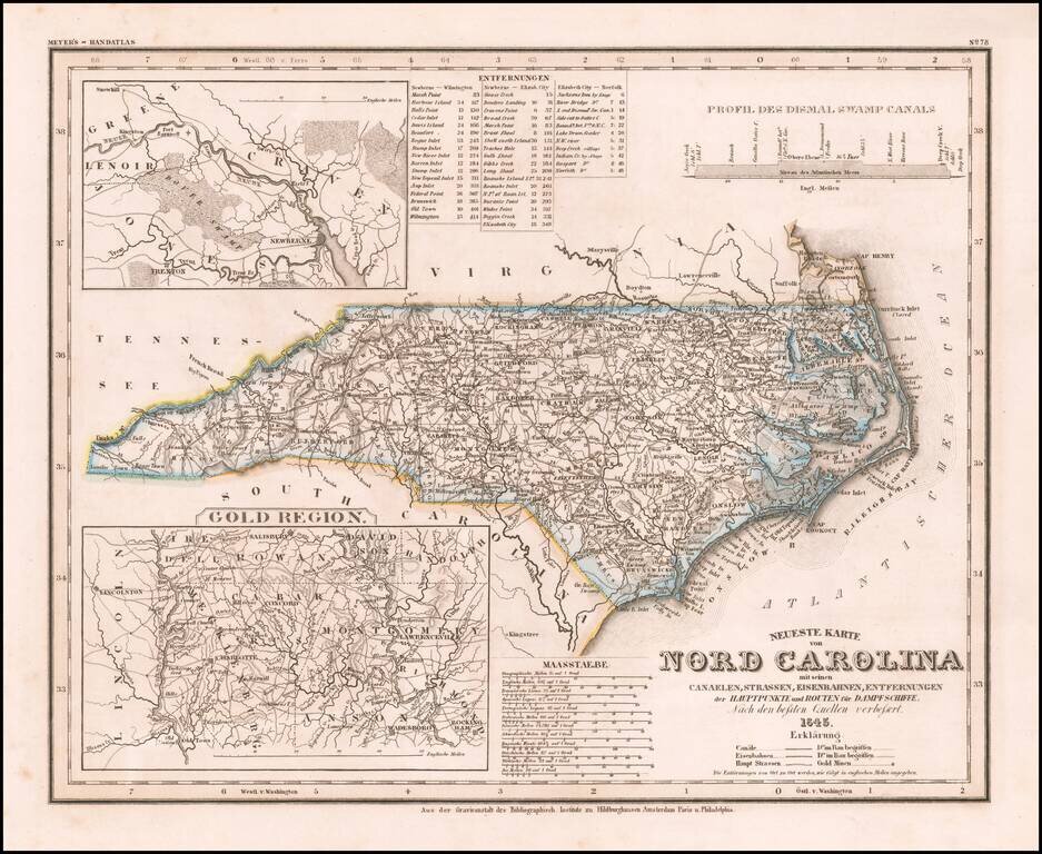
Elegantly engraved & detailed map of North Carolina, based upon Tanner's work in the early 1840s. Shows counties, towns, roads, canals, lakes, etc. Detailed insets of the Gold Region. While often referred to as the "German Mitchell," this is an...
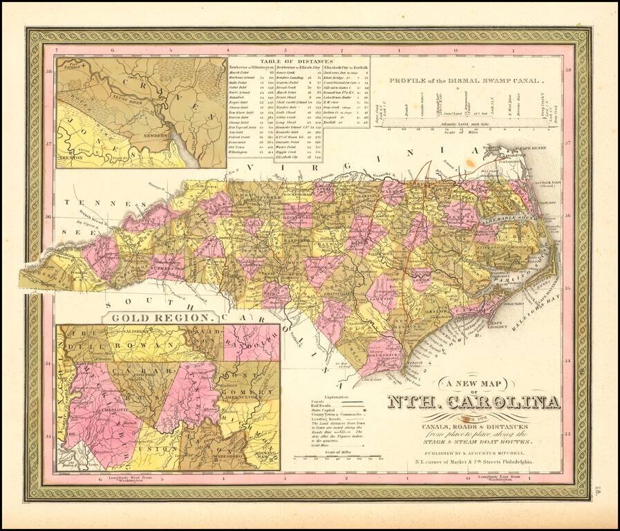
Nice example of S.A. Mitchell's map of North Carolina, with insets of the Gold Region (centered on Cabarus and Montgomery Co) and the Neuse River and New Berne. Shows towns, roads, railroads, rivers, mountains, lakes, creeks, canals, etc. Canals are...
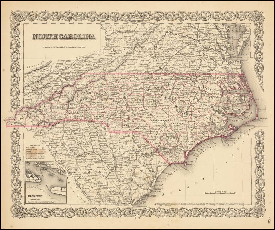
Colton's detailed map of North Carolina, hand colored by counties. Shows roads, railroads, towns, villages, post offices, rivers, lakes, stations and a host of other details. Inset map of Beaufort. Decorative border. A terrific map, from JH Colton,...
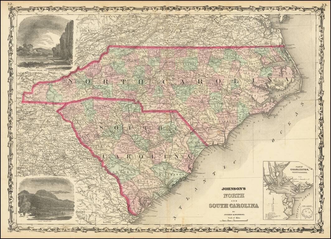
Attractive map of the Carolinas, published by Johnson & Browning. The map is colored by counties and showing towns, railroads, lakes, rivers, forts, swamps, islands, etc. Large inset plan of Charleston and Fort Sumter and large vignettes of Table...
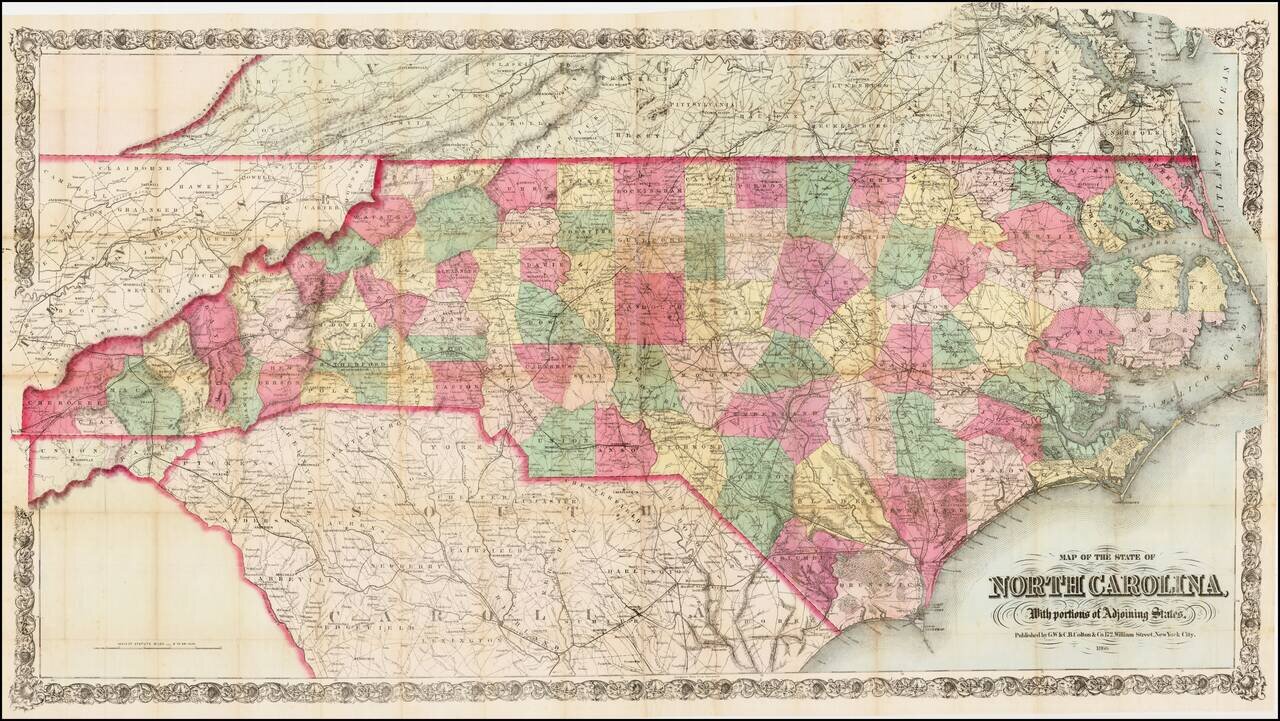
First edition of this scarce large format map of North Carolina, colored by counties, published by GW & CB Colton in New York, on a scale of 6 inches = 50 miles. Colton's map of North Carolina is one of the most detailed and largest commercial...
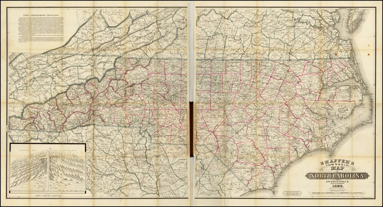
Fine example of this rare and highly detailed large format map of North Carolina, published in Raleigh, North Carolina by A. Webster Shaffer. Shaffer's map of North Carolina is perhaps the best and largest format of the State published in this time...