
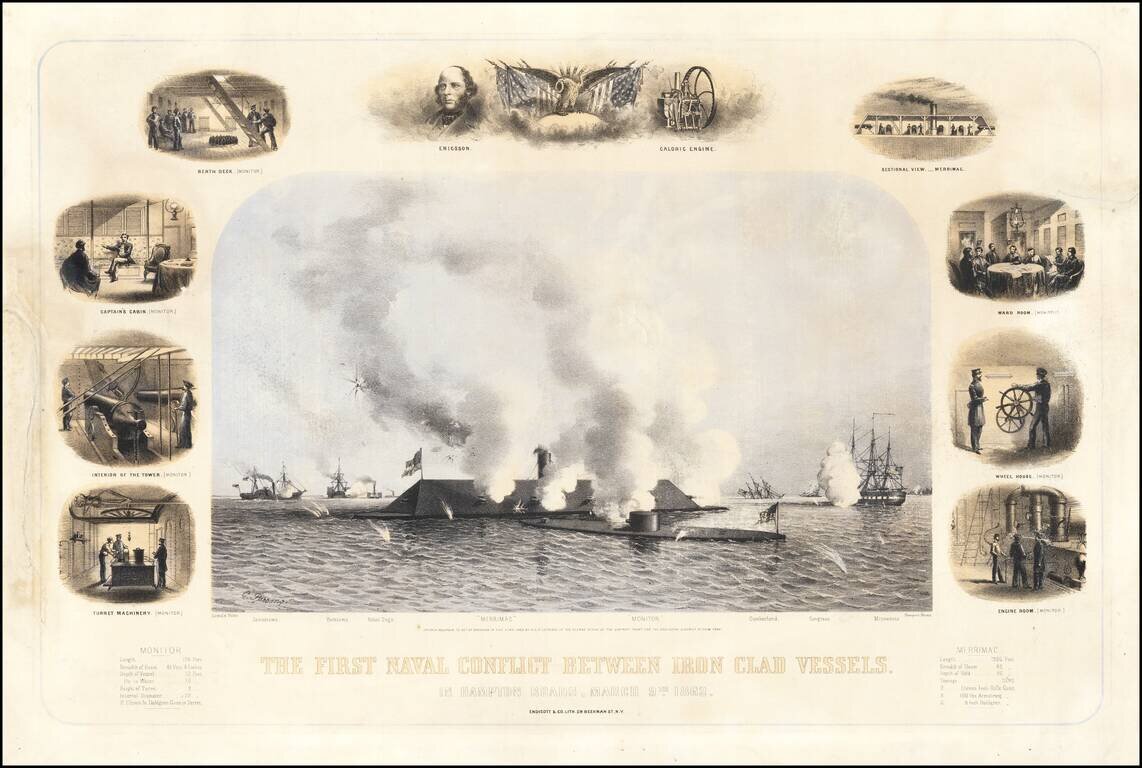
The First Battle of the Iron Clads. In a Contemporary Civil War-Era Lithograph. Three-stone color lithograph of the most famous naval battle of the Civil War; the engagement between the Iron Clads Virginia (of the CSA, a.k.a. "Merrimac") and Monitor...
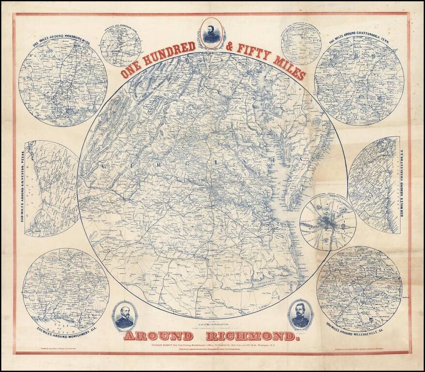
Scarce regional map of the area around Richmond, with 9 inset maps showing the 100 miles around Milledgeville, GA; 250 miles around Charleston, SC; 100 miles around Chattanooga, Tenn; Fortifications around Richmond; 200 miles around Montgomery, Ala,...
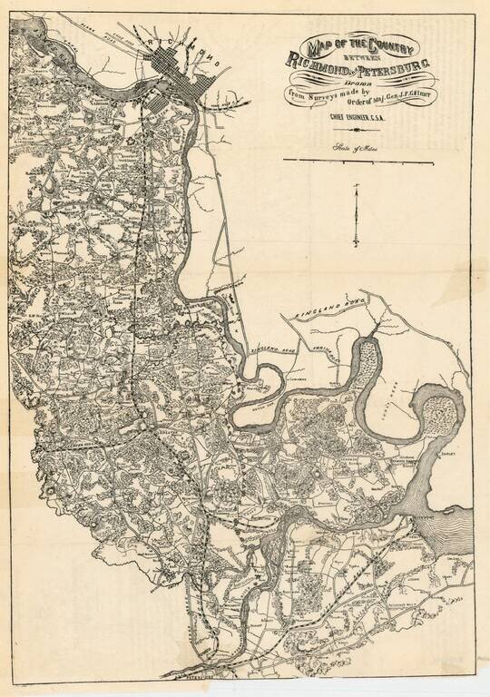
Rare Confederate States of America map of the region between Richmond and Petersburg, prepared by the Chief Engineer of the CSA, J.F. Gilmer. The map provides excellent detail, including town, roads, railroads, woods, rivers, forts, landowners and a...
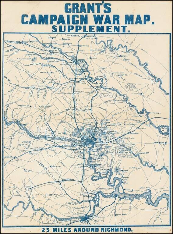
Scarce map of the area around Richmond, showing towns, railroad lines, roads, rivers, bridges, court houses, and other details. Notes show the US Arsenal, Sherman's Crossing of the South Anna and subsequent capture on May 11, and other details....
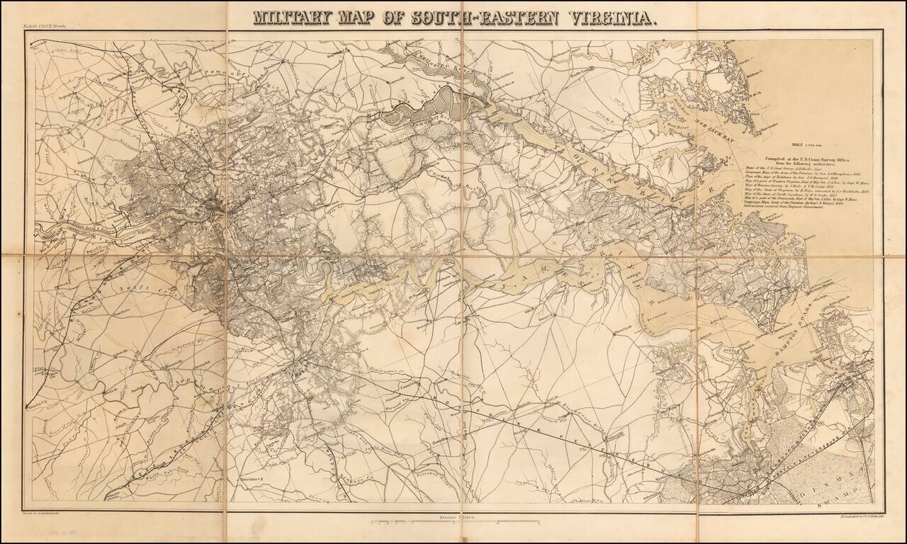
Rare separately issued map Southeastern Virginia, produced by Lindenkohl and lithographed by Krebs at the direction of the US War Department in 1864. The map depicts the towns, courthouses, lines of communication and other militarily significant...
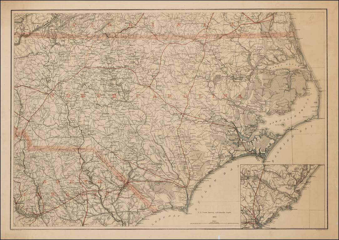
Rare printed color example of this extremely rare map of North Carolina, with the adjoining parts of Virginia and South Carolina, produced by Lindenkohl and lithographed by Krebs at the direction of the US War Department in 1865. During the Civil War,...
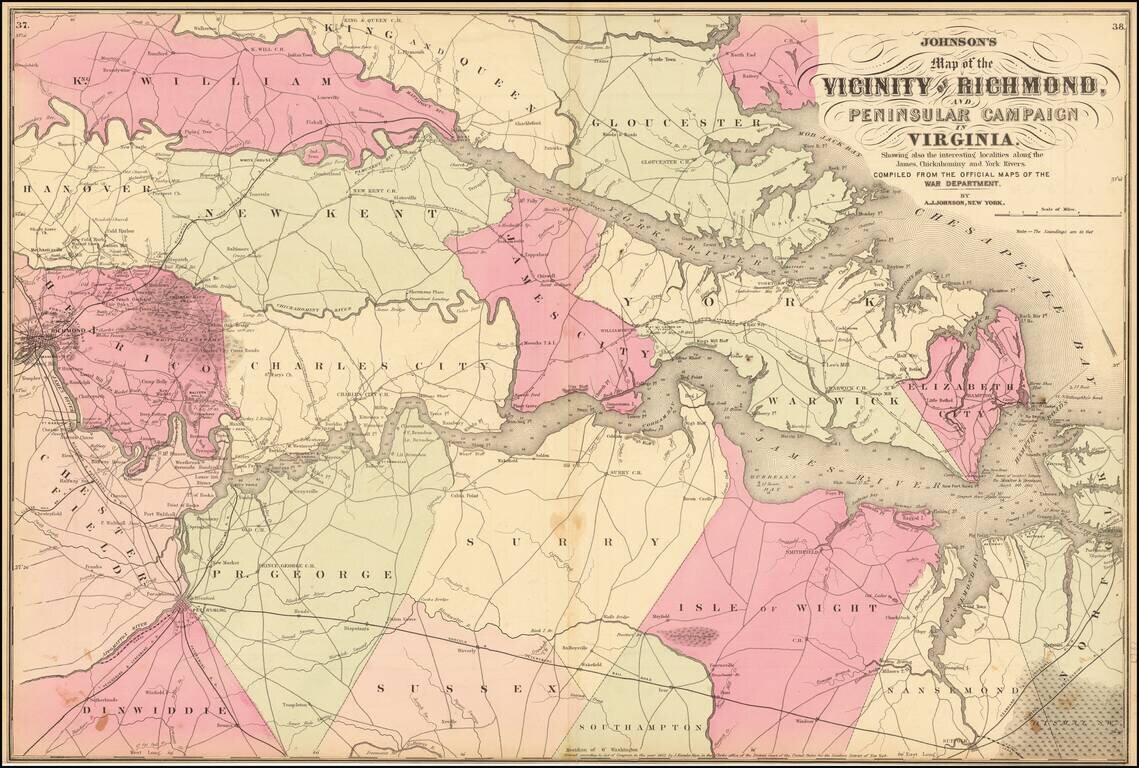
Johnson's map of the Vicinity of Richmond, colored by counties. Includes the line of advance and retreat of the Union Army, several battles and other details. Shows towns, roads, rivers, lakes, bays, islands, soundings, railroads, court houses and...
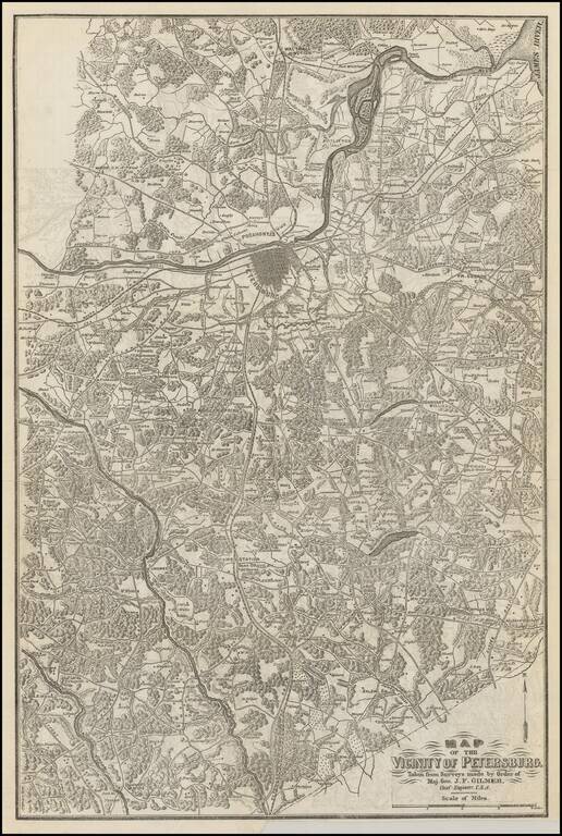
Scarce map of the vicinity of Petersburg, extending from the region just north of the James River to the state line with North Carolina. The map is exceptionally detailed and shows towns, court houses, roads, railroads, rives, woods and the names of...
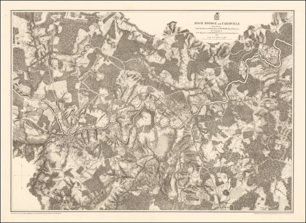
Highly detailed map of the area around Farmville, Virginia, depicting one of the final battle fields of the Civil War. Farmville Robert E. Lee retreated through Farmville as he escaped the Union Army in the Civil War. Farmville was the object of the...
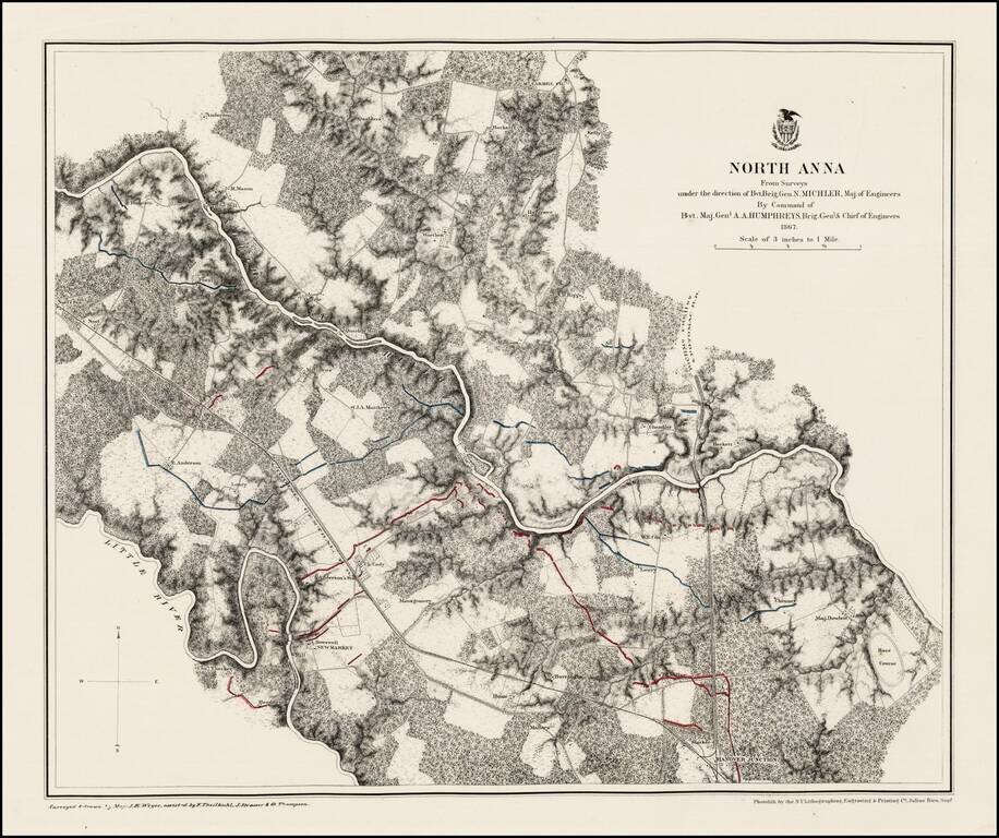
Fine example of this detailed map of area around North Anna. Rumsey describes the map as follows: Stephenson states these are a "detailed series of maps indicating fortifications, roads, railroads, houses, names of residents, fences, drainage,...
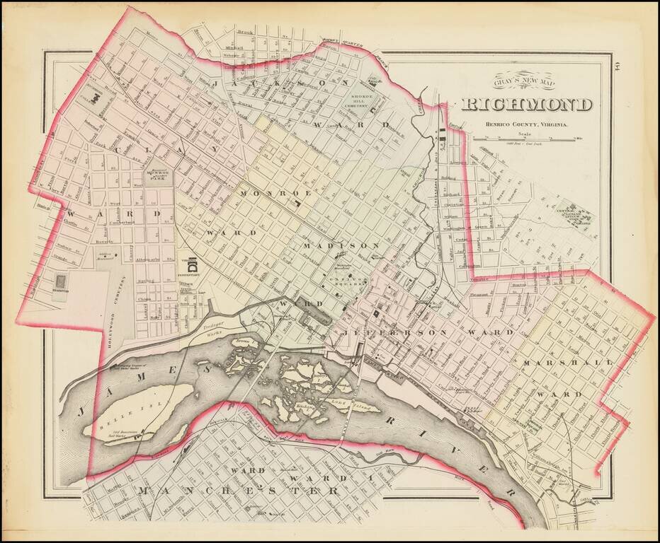
The First Map of Richmond Published in a Commercial Atlas Nice example of Gray's scarce map of Richmond Virginia, colored by wards and showing streets, rail lines, parks, buildings, stations and a host of other details. The map was published by OW...
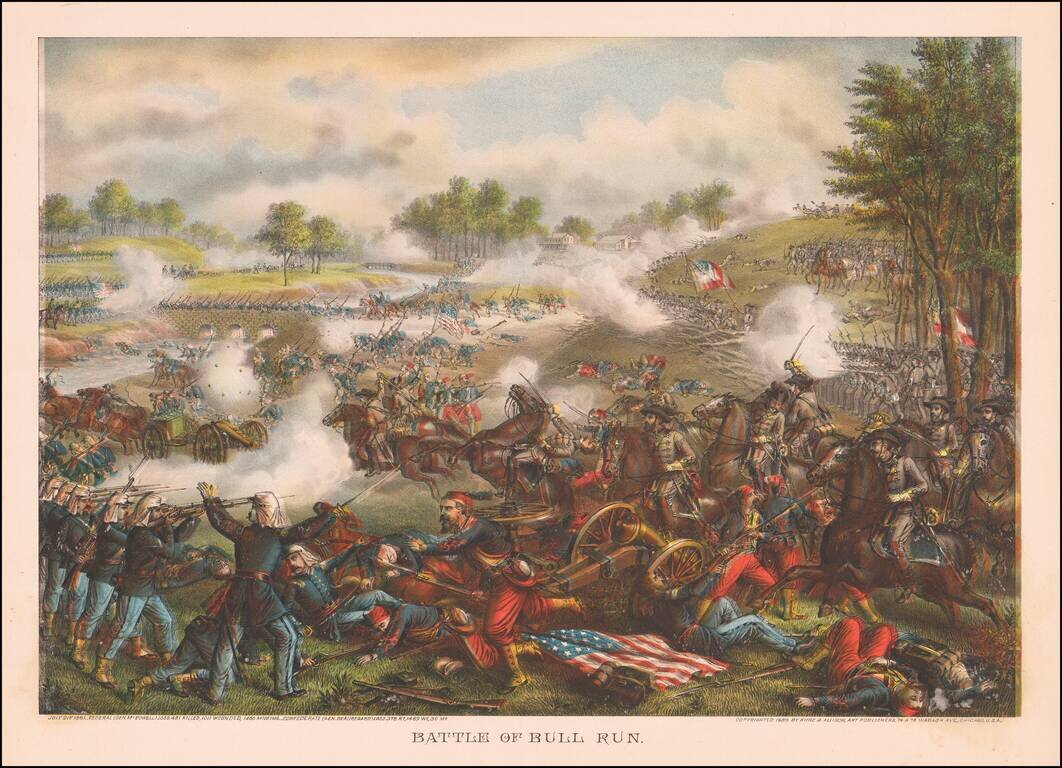
Elaborate battle scene at Bull Run, illustrating the action on July 21, 1861. The chromolithographic plates are a bit mis-aligned, creating a shadow image effect.
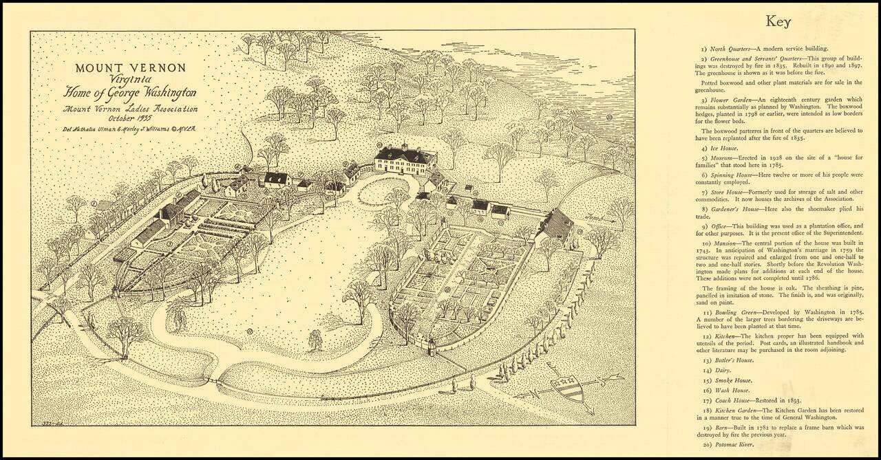
Rare Vintage View of George Washington's Mount Vernon, Virginia. Separate 1938 bird's eye view of George Washington's estate of Mount Vernon, issued by the Mount Vernon Ladies Association. The map includes a 20-point descriptive key enumerating...
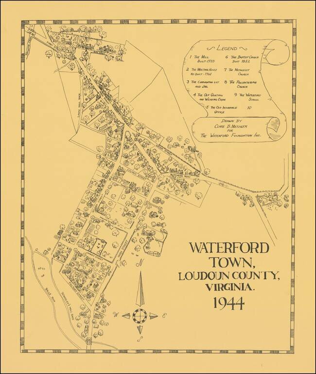
Interesting pictorial map of Waterford Town, Virginia, drawn by Clare B. Metzger for The Waterford Foundation. The present map is based the official map of the town, commissioned in 1875. The Acts of 1875 provided that the Waterford council should...

Lively pictorial map of Williamsburg, illustrating the town following its restoration "through the generosity of . . . John D. Rockefeller, Jr. and members of his family." The main map provides a fine overview of the town, with buildings named.
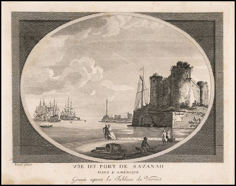
Rare view of the Port of Savannah, engraved by Claude Joseph Vernet in London. Vernet's separately published views were offered for sale individually and in albums. His American views are largely fanciful in nature, but very rare. One of the earliest...