
![[Siege of Vicksburg -- Manuscript Battle Map / Field Sketch]](/map/small/62795.jpg)
Hand Drawn During The Siege of Vicksburg Detailed hand drawn map / field sketch showing troop positions during the siege of Vicksburg, during the American Civil War. The map locates troop positions, Rebel Works, topographical features, bridges and...

Decorative and unusual trading card map from this famous series. Map is surrounded by decorative vignette, showing Paddlewheeler, sweet potatoes and cotton. Includes population statistics.
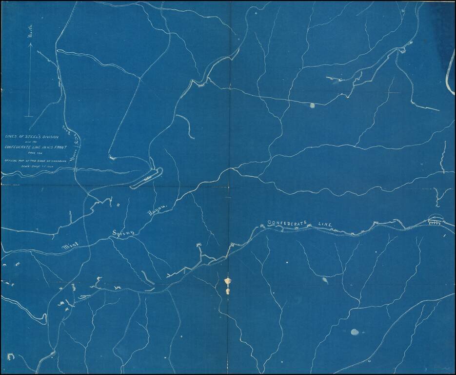
Detailed blueprint map illustrating the location of "Steel's Division" during the Siege of Vicksburg. "Steel" is Frederick Steele (1819 – 1868), a career military officer in the United States Army, who served as a major general in the Union Army...
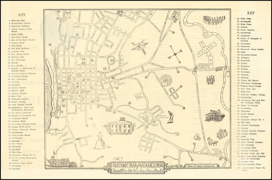
Scarce Pictorial map of the Natchez, Mississippi area, illustrating historical sites, extending frrom the Mississippi River to Sharpe Airport. On the verso, a key with points illustrating on the map is given.
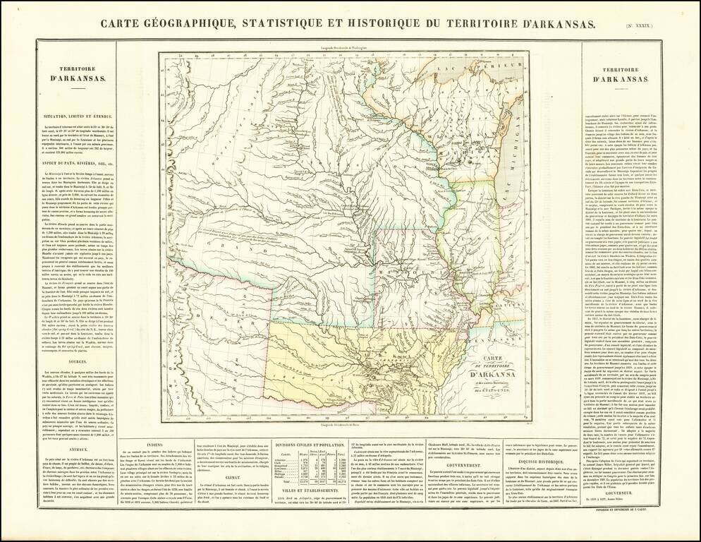
French edition of Stephen Long's seminal map of the region drained by the Arkansas, Kansas, Missouri and Mississippi Rivers, one of the most important maps of the American West. Stephen H. Long led a government expedition to the Rocky Mountains in...
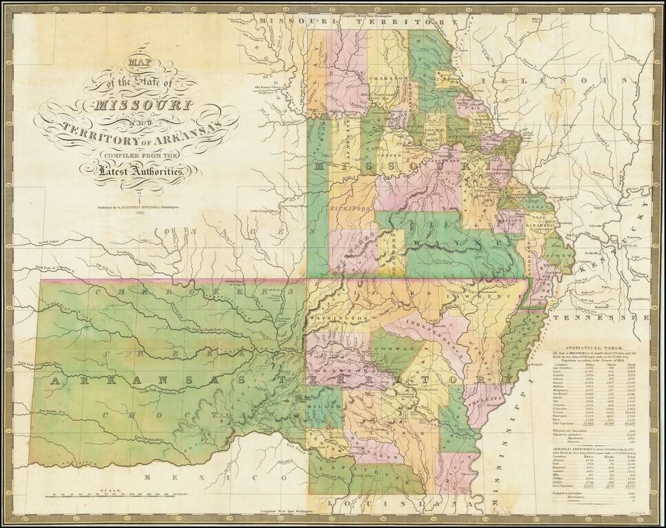
Nice example of the 1831 Mitchell edition of Finley's map of Arkansas and Missouri, being one of the earliest separately issued regional maps to show Arkansas in its double-width configuration (including most of Oklahoma). A number of counties in the...
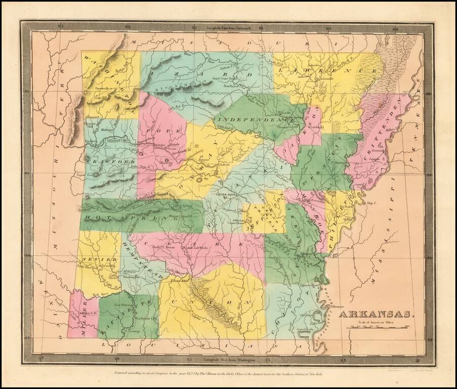
The First Map of Arkansas Territory in its "Statehood" Configuration. Burr's map of Arkansas Territory is the earliest printed map of Arkansas in its final statehood configuration to appear in a commercial atlas. All earlier maps show Arkansas...
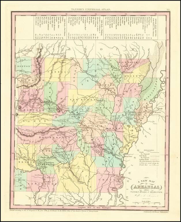
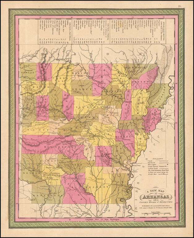
Scarce early map of Arkansas from Tanner's Universal Atlas. Shows canals, proposed canals, railroads, proposed railroads, major roads, distances, towns, rivers, etc. A key at the top of the map shows the steamboat routes and distances. Well less than...
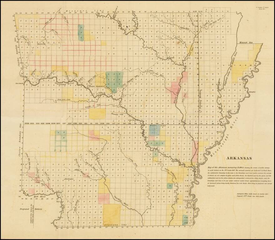
Early General Land Office Survey map of Arkansas, published in 1837. The map shows the extent of the public surveys in Arkansas with the following symbols. The various symbols and surveys reflect completed surveys, surveys contracted but not yet...
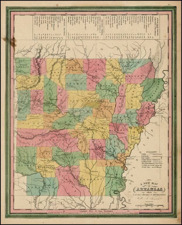
Scarce early map of Arkansas from Tanner's Universal Atlas. Shows canals, proposed canals, railroads, proposed railroads, major roads, distances, towns, rivers, etc. A key at the top of the map shows the steamboat routes and distances. Well less than...
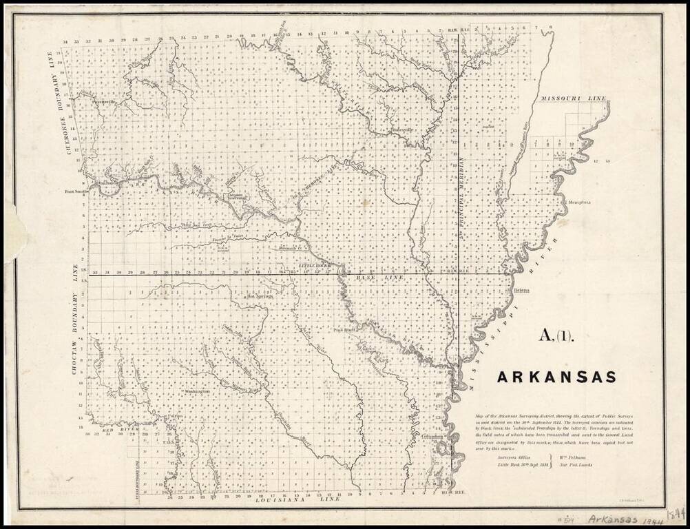
Map of the Arkansas Surveying district, shewing the extent of Public surveys in said district on the 30th September 1844. Shows the progress of the public land surveys. Indicates townships to be resurveyed, incomplete, those under contract but...
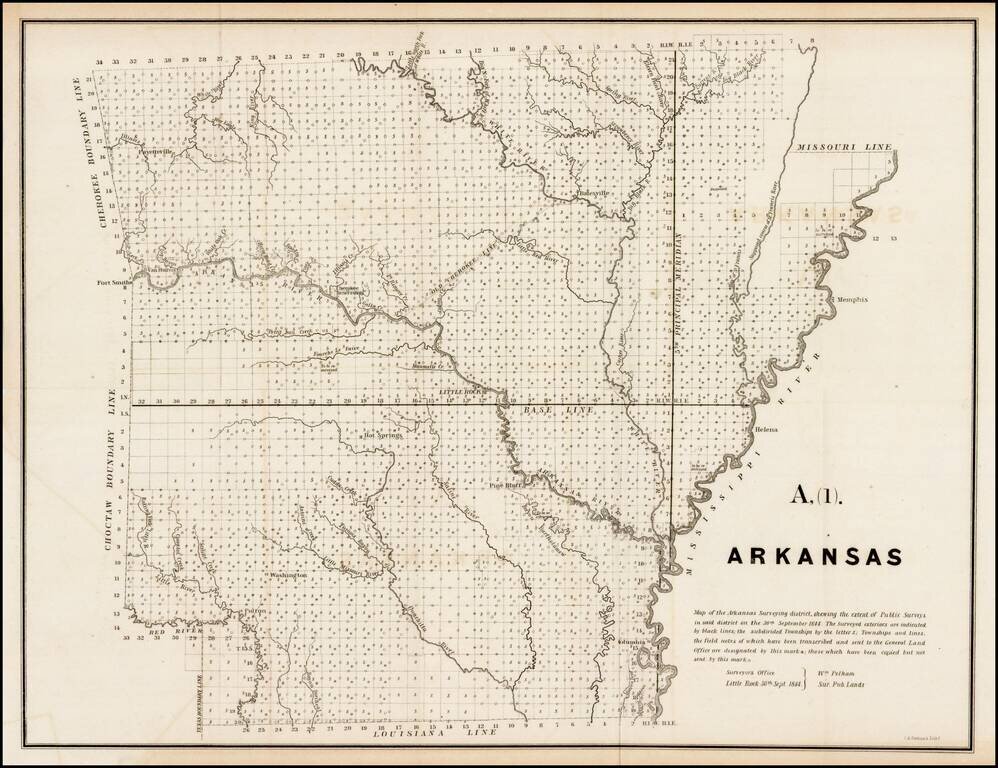
Interesting early survey map of Arkansas, showing the progress of the township survey work through 1844, along with a detailed explanation of the progress of the surveys through September 30, 1844, by William Pelham, the Surveyor General of Arkansas.
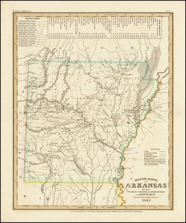
An elegantly engraved and highly detailed map or Arkansas, based upon Tanner's work in the early 1840's. Shows counties, towns, roads, canals, lakes, etc. While often referred to as the German Mitchell, this characterization is unfair, as the work...
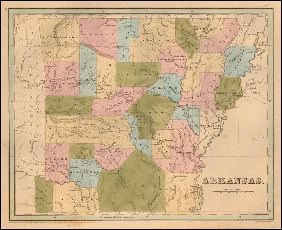
Rare late edition of Bradford's map of Arkansas. The map is hand colored by counties and shows very early railroads, towns, rivers, forts, post offices and other details. Bradford's atlas was a departure from other atlases of the period. Along with...
Detailed early map of Arkansas, hand colored by counties, with a chart showing the steam boat routes and illustrating canals, railroads, and other details.

Cowperthwait's map of Arkansas, hand colored by counties, with a chart showing the Steamboat routes and illustrating canals, railroads, and other details.