
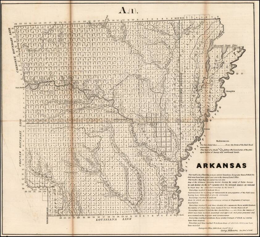
Interesting map of Arkansas, showing the progress of the township survey work through 1854, along with a detailed explanation of the progress of the surveys through October 1854, by George Milbourne, the Surveyor General of Arkansas.
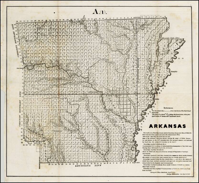
Interesting map of Arkansas, showing the progress of the township survey work through 1854, along with a detailed explanation of the progress of the surveys through October 1854, by George Milbourne, the Surveyor General of Arkansas.
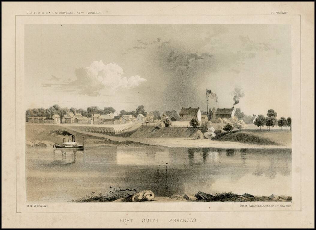
Fine early view of Fort Smith, Arkansas, prepared as part of the United States survey for the most practicable route for a railroad line to the West Coast of America, conducted just prior to the Civil War.
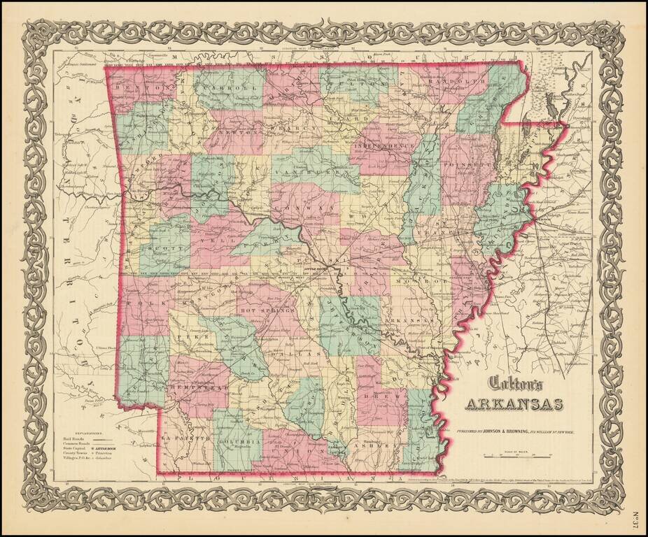
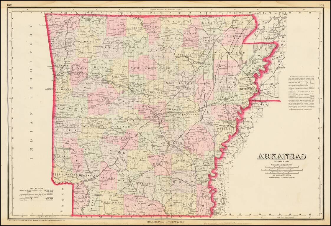
Detailed map of Arkansas, colored by counties. Shows roads, railroads, towns, villages, post offices, canals, rivers, lakes, stations and a host of other details.
Detailed map of Arkansas, published by OW Gray. The map shows towns, townships, roads, railroads, rivers, train stations, lakes, etc. Gray was one of the most successful atlas publishers of the 1870s and one of the last to employ hand coloring.

Decorative and unusual trading card map from this famous series. Map is surrounded by decorative vignette, showing Lumber Sawmill and Cotton Gin. Includes population statistics.
![[Polish Emigration to Arkansas] Map of the Marche & Cold Springs Ry.](/map/small/65283.jpg)
A Railroad LIne Built By Polish Emigrants in Arkansas Drawn by Helen Choinski Manuscript map of the Marche and Cold Springs Railway, hand drawn by "Helen Ch" circa 1890. The map is executed by a skilled hand, showing the line of the Railway (red),...
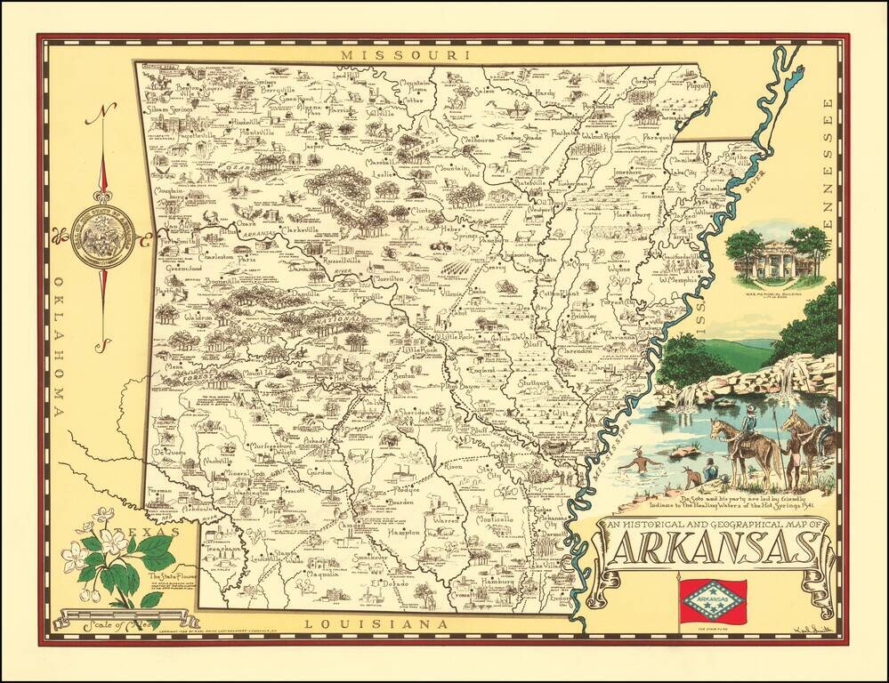
Rare pictorial map of Arkansas, drawn by Karl Smith. The map shows historic sites, locations of significant events, cities and towns, Indian settlements, agricultural products, industry, parks, historical trails, rivers, and recreational activities....
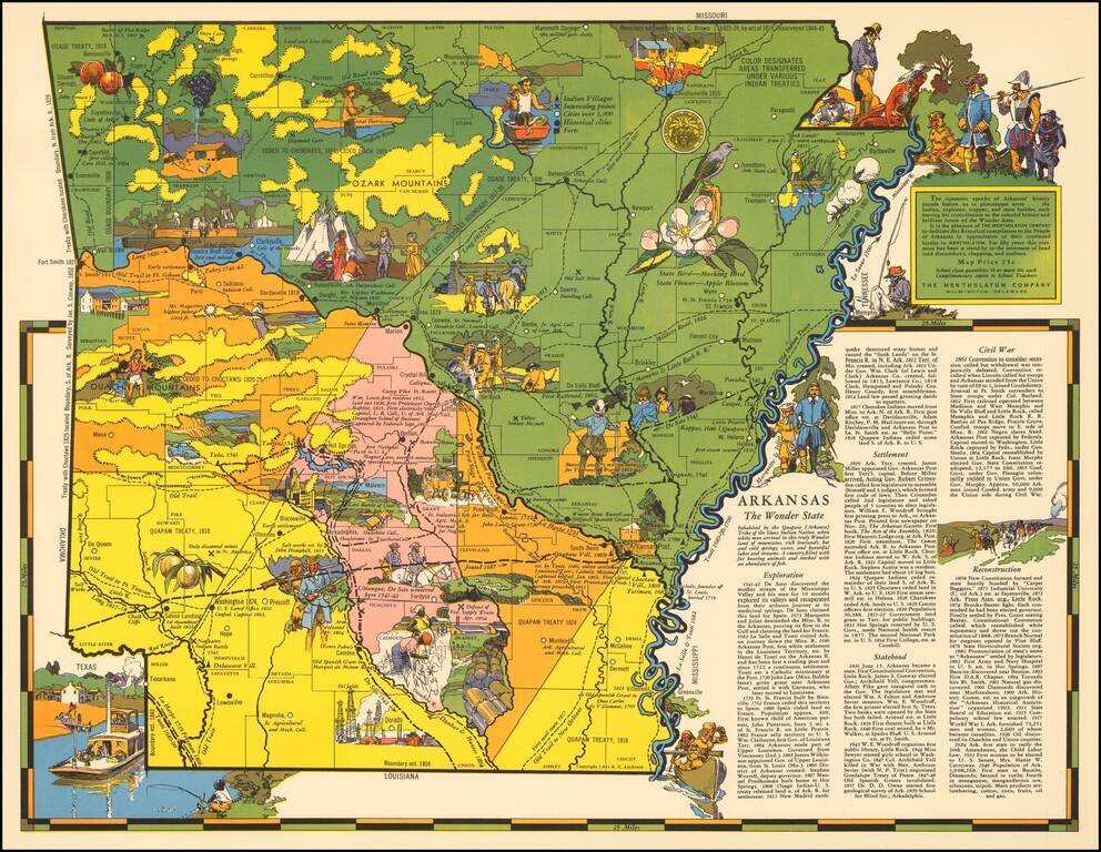
Rare pictorial map of Arkansas by R.T. Aitchison, published by The Mentholatum Company. The map includes decorative vignettes illustrating the history and resources of Arkansas with a detailed text history of the state. R.T. Aitchison was a Witchita,...
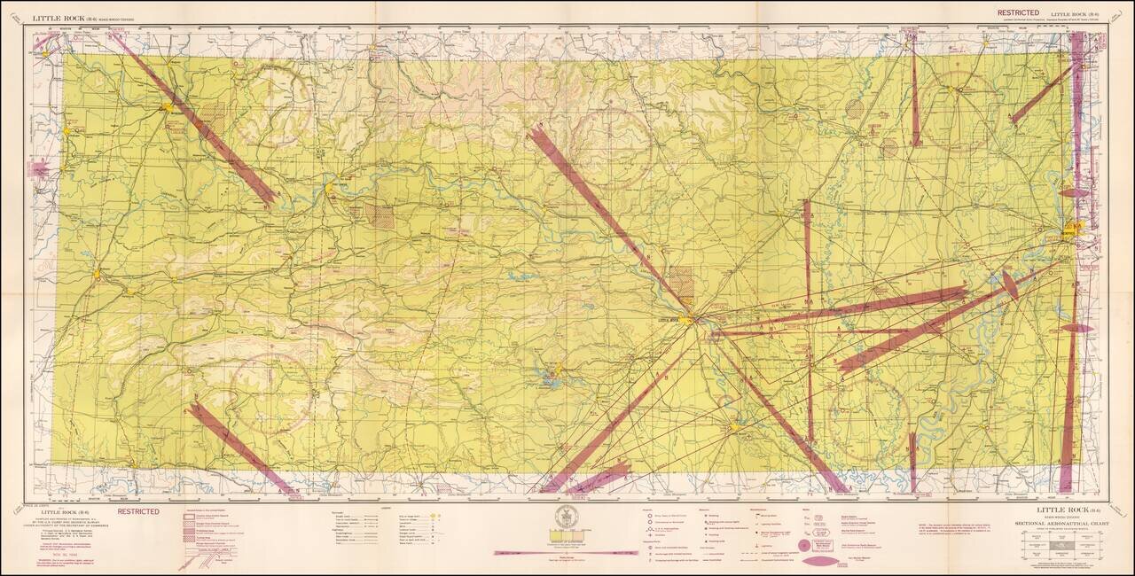
Restricted World War II Aviation Map Detailed aeronautical map of the Little Rock, Arkansas region. The chart is a font of information about civil and military aviation during WWII. It was intended for civil aviators flying by visual navigation and...
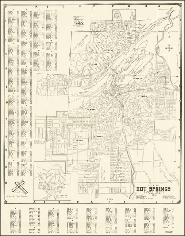
Detailed map of Hot Springs Arkansas, drawn by Robert S. Lowrey from data furnished by the City Engineer.
![[Early Ohio River Promotional Map] Plan Des Achats Des Compagnies de L'Ohio et du Scioto](/map/small/58635.jpg)
Rare Early Real Estate Speculation in the Ohio Valley (Manuscript Additions!) Rare first state of this important map for the early development of the Ohio Valley, promoting the lands of the Scioto Company. The present example is a rare early state,...
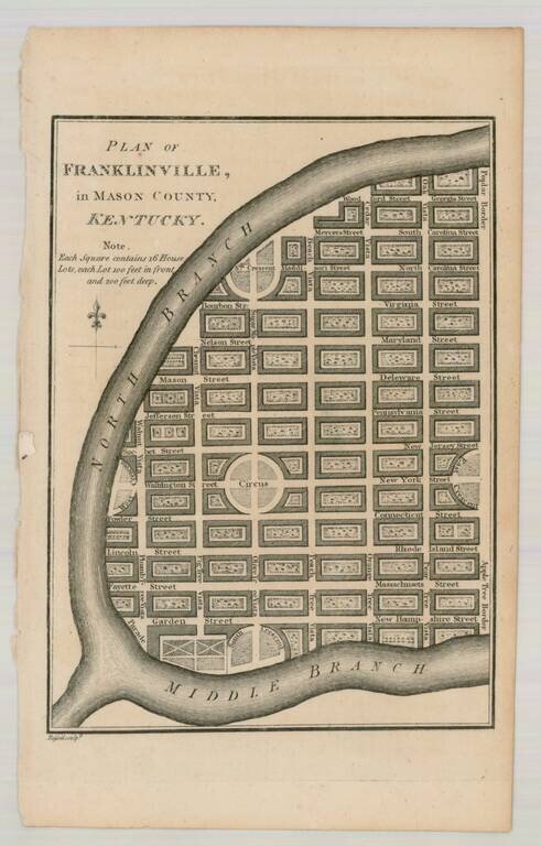
Interesting pair of maps showing towns that were never built in the present-day state of Kentucky. Franklinville located in Mason County, was formed on paper in 1794 by a group of London speculators. The town was to be built beside the North Fork of...
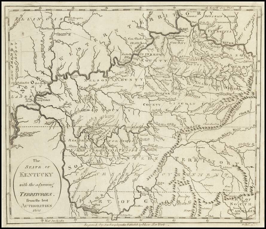
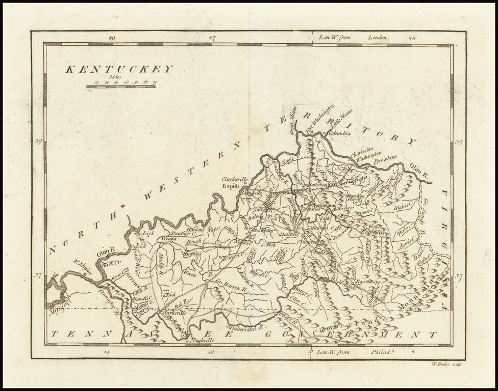
Early Map of Kentucky, Tennessee and Southern Ohio Important early map of Kentucky, Tennessee (then still Southwestern Territory) and the Ohio Valley, with marvelous early information. Kentucky includes about a dozen early counties, plus towns,...
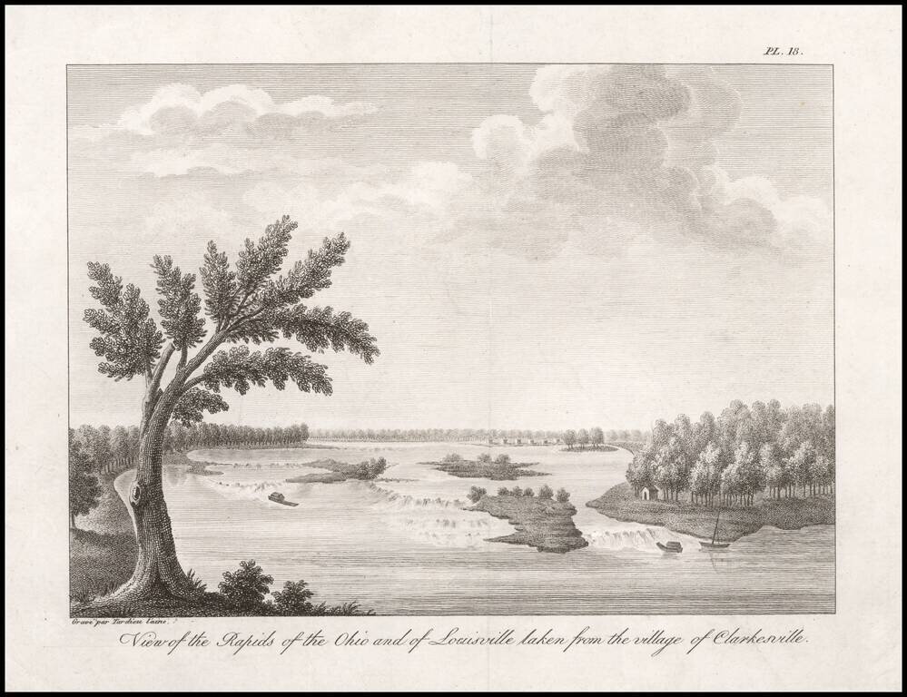
One of the Earliest Views of Louisville, Made Shortly After It Was Founded by Col. George Rogers Clark. An 18th century French Spy's View of the Rapids of the Ohio. Fine engraved view of the Rapids of the Ohio River, taken from "Clarkesville" (now...
One of the earliest printed maps of the State of Kentucky. The map provides a fine and extensive treatment of Kentucky's early roads. Numerous towns and courthouses are also shown, along with the Rapids below Louisville on the Ohio River. Includes...