
![County Map of the States of Georgia and Alabama [Insets of Atlanta and Savannah]](/map/small/69561.jpg)
With Early Map of Atlanta! Nice full color map of Alabama and Georgia, published by SA Mitchell Jr. This is the first atlas map to include a plan of Atlanta. The map is hand colored by counties, and shows towns, roads, railroads, stations,...
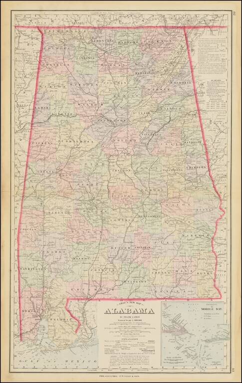
Detailed map of Alabama, colored by counties. Shows towns, township surveys, forts, swamps, lakes, rivers, railroads, roads, post offices, stations, etc. Large inset of the Entrance to Mobile Bay. Includes a table of census populations from 1810 to...
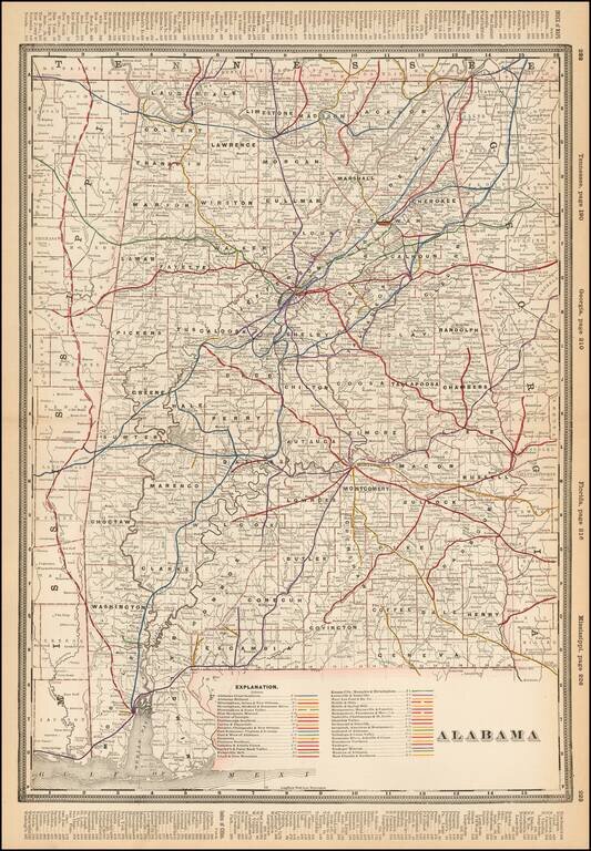
Detailed railroad map of Alabama, showing counties, railroad lines, towns, rivers, township surveys, lakes, mountains, creeks, and a host of other information. The Explanation Key locates approximatley 40 Railroad Lines.
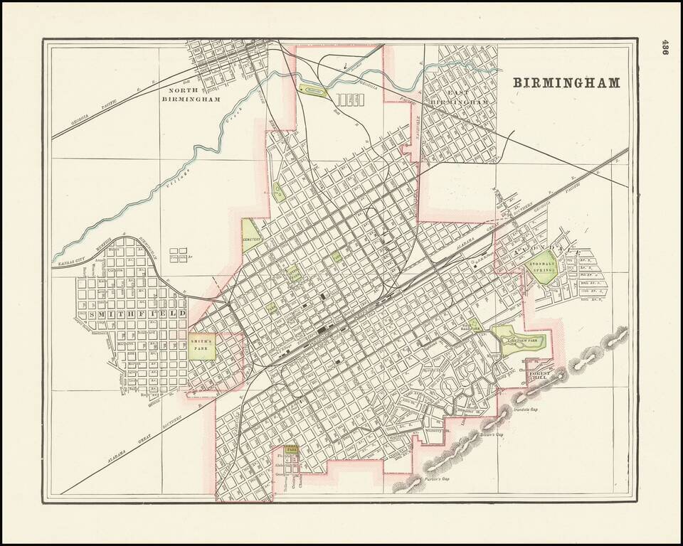
Detailed city plan of Birmingham, Alabama showing streets, buildings, train lines, public places, rivers etc. Cram was one of the pre-eminent American mapmakers of the late 19th century, relying upon a cerographic printing process first applied to...
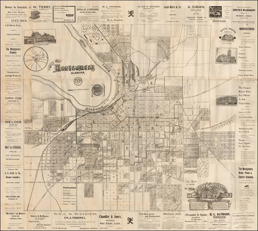
Rare separately issued promotional map of Montgomery Alabama, published by the State Abstract Company. Includes decorative vignettes of the Union Passenger Station, Court House, State Capital Building, and illustrating the town in exceptional detail,...

Restricted World War II Aviation Map Detailed aeronautical map of the Mobile, Alabama area. The chart is a font of information about civil and military aviation during WWII. It was intended for civil aviators flying by visual navigation and so...
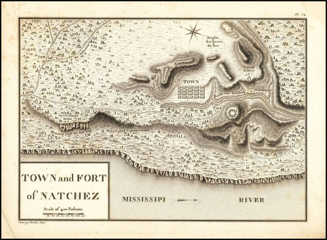
The First European Settlement on the Mississippi River Rare engraved town plan of Natchez (then a part of French Louisiana), by famed French cartographer and spy Victor George Henri Collot. who visited Natchez in October 1796, during his...
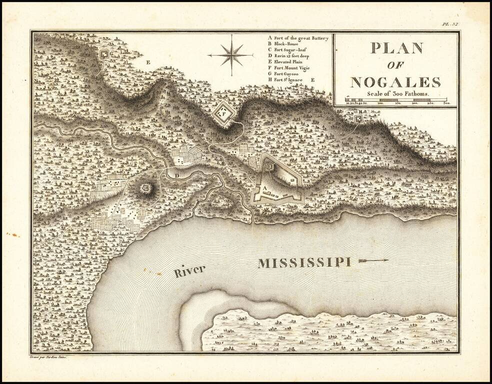
Rare engraved town plan of the site that would become Vicksburg, Mississippi, by famed French cartographer and spy Victor George Henri Collot. In 1790, the Spanish founded a military outpost on the site of present-day Vicksburg, which they called Fort...
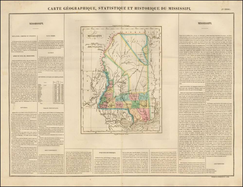
The first French Map of the State of Mississippi. Detailed map of Mississippi, published by Buchon in Paris in 1825, the earliest map of the newly formed state published outside the United States. Very few counties are shown in the north part of the...
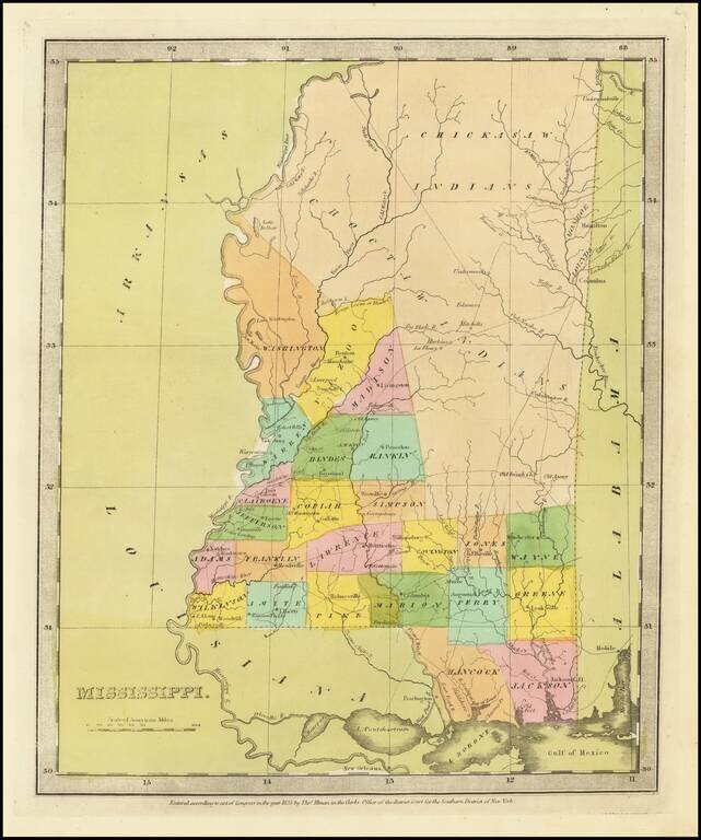
Fine example of David Burr's map of Mississippi, which appeared in his Universal Atlas. The map includes massive Chickasaw and Choctaw Indian regions in the North and Central part of the State, although Monroe and Lound County are now carved out of...
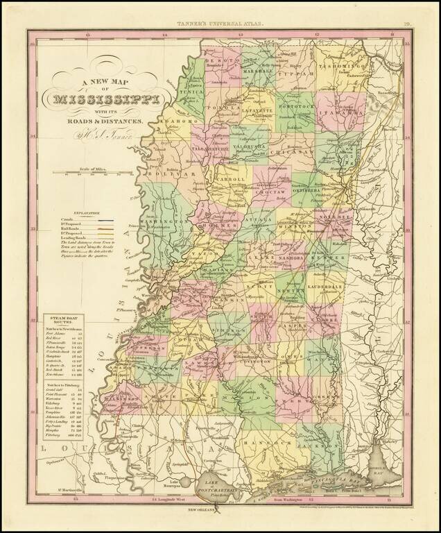
Fine example of Tanner's map of Mississippi, from the first edition of Tanner's Universal Atlas. This example of the map was first issued in 1836. It is hand colored by counties, and shows towns, roads with distances, railroads, steamship routes, and...
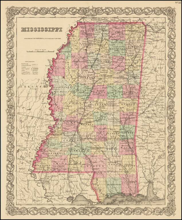
Detailed map of Mississippi, colored by counties and showing roads, railroads, towns, villages, post offices, canals, rivers, lakes, railroad stations and a host of other details. The map appeared in the first edition of JH Colton's Atlas. JH Colton...
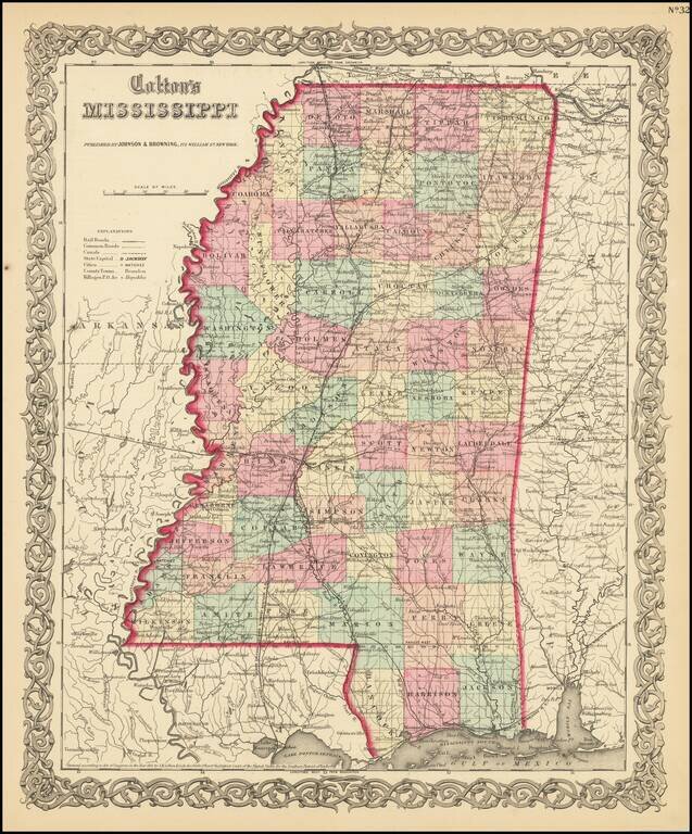
Detailed map of Mississippi, colored by counties and showing roads, railroads, towns, villages, post offices, canals, rivers, lakes, railroad stations and a host of other details. The map appeared in an early edition of JH Colton's Atlas. JH Colton...
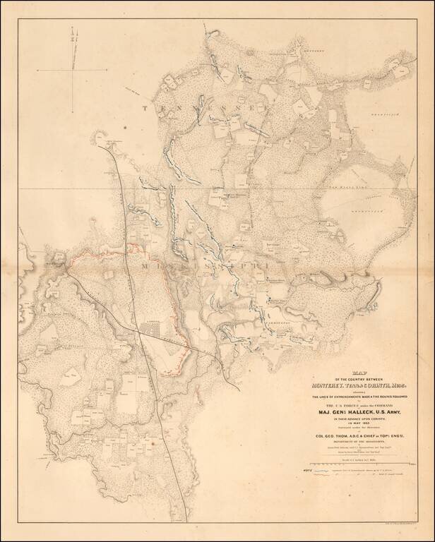
Highly detailed map showing the battlefield positions, roads, rivers, towns, etc., between Corinth and Monterrey. Full of Battlefield information, fortification information, and a host of other information utilized by the War Department during the...
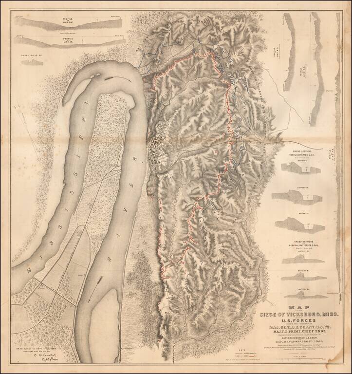
Detailed map of the Siege of Vicksburg, drawn by Charles Spangenberg. The present map is the printed version of a manuscript field map drawn by Spangenberg and dated August 20, 1863, the original of which is held by the Library of Congress....
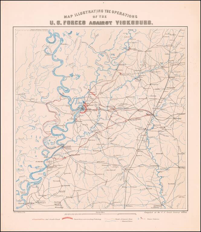
The Vicksburg Campaign Rare separately published map of the area around Vicksburg, Mississippi, showing the military operations of the Union and Confederate Armies. The map was compiled by in the offices of the United States Coast Survey, which at...