logo

1950. Historic Map of Natchez, Miss. Showing 101 Sites of Ante-Bellum Homes, Historical Places, Etc.

  • Historic Map of Natchez, Miss. Showing 101 Sites of Ante-Bellum Homes, Historical Places, Etc.
  • Historic Map of Natchez, Miss. Showing 101 Sites of Ante-Bellum Homes, Historical Places, Etc.

Historic Map of Natchez, Miss. Showing 101 Sites of Ante-Bellum Homes, Historical Places, Etc. information:

Year of creation: 
Resolution size (pixels): 
 9969x6609 px
Disk Size: 
 10.7891MiB
Number of pages: 
 2
Place: 
 Natchez, MS
Author: 

Print information. Print size (Width x height in inches):
Printing at 72 dpi 
  138.46 х 91.79
Printing at 150 dpi 
 66.46 х 44.06
Printing at 300 dpi 
 33.23 х 22.03

An example of detailing the file of this map of in a printable high-resolution:

Click to open in high resolution (open in new tab).
Attention! this is just the central piece (central area 960x960 px) of the map file!
This is an example, so that you can see and study the level of detail of a given map. The entire Map will be fully available after payment!

Historic Map of Natchez, Miss. Showing 101 Sites of Ante-Bellum Homes, Historical Places, Etc.

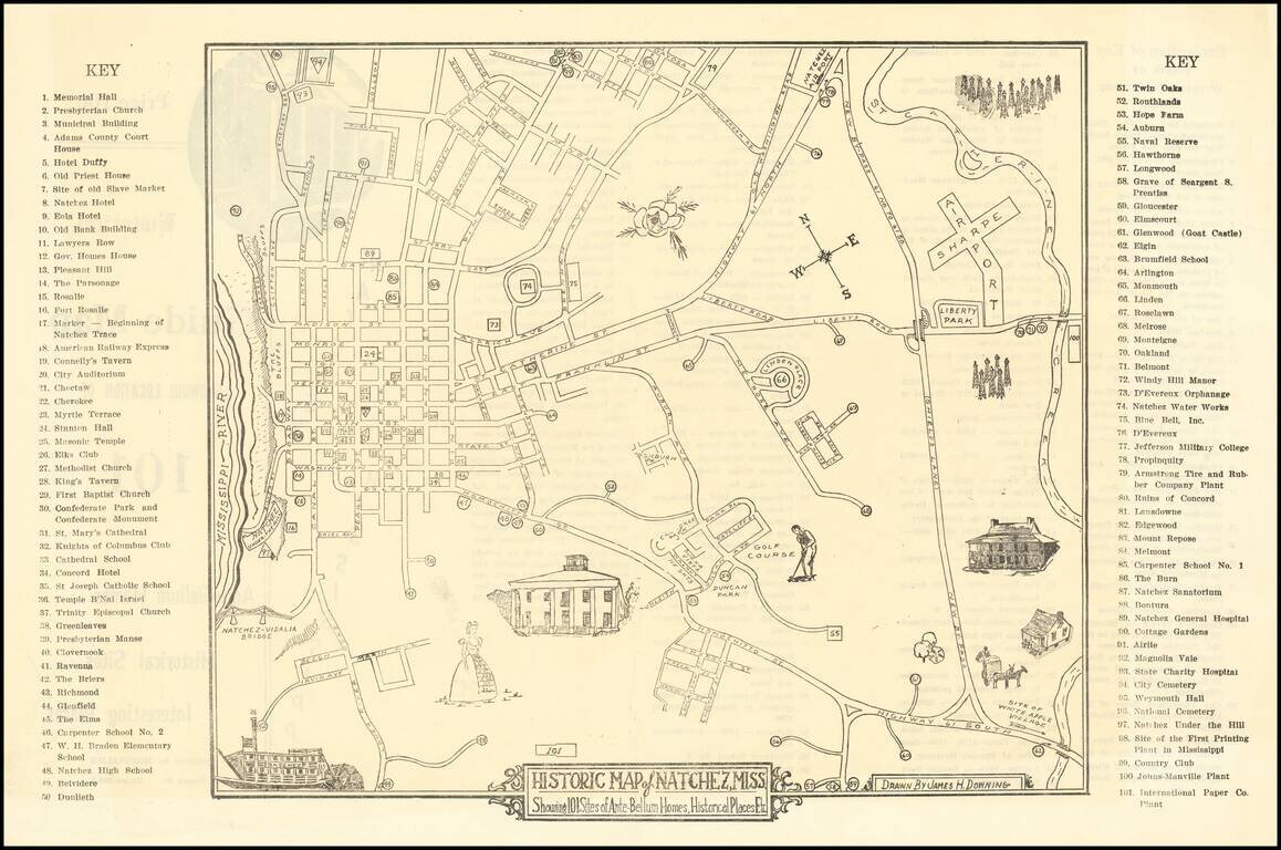
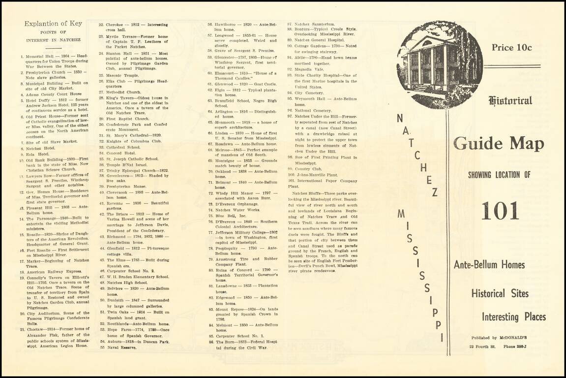
Scarce Pictorial map of the Natchez, Mississippi area, illustrating historical sites, extending frrom the Mississippi River to Sharpe Airport.

On the verso, a key with points illustrating on the map is given.


Special conditions for students!

If you are a student, write to us in telegram: @antiquemaps and indicate what material you need and for what work you need a map in high detail. We are ready to provide material on special terms. For students only!

Item information:

Year of creation:
Size:
9969x6609 px
Disk:
10.7891MiB
Number of pages:
2
Place:
Natchez, MS
Author:
James H. Downing.
$14.99

Related item