logo

1844. A.(1). ARKANSAS. Map Of The Arkansas Surveying District, Shewing The Extent Of Public Surveys In Said District On The 30th September 1844 . . .

  • A.(1). ARKANSAS. Map Of The Arkansas Surveying District, Shewing The Extent Of Public Surveys In Said District On The 30th September 1844 . . .

A.(1). ARKANSAS. Map Of The Arkansas Surveying District, Shewing The Extent Of Public Surveys In Said District On The 30th September 1844 . . . information:

Year of creation: 
Resolution size (pixels): 
 1208x926 px
Disk Size: 
 303869B
Number of pages: 
 1
Place: 
 
Author: 

Print information. Print size (Width x height in inches):
Printing at 72 dpi 
  16.78 х 12.86
Printing at 150 dpi 
 8.05 х 6.17
Printing at 300 dpi 
 4.03 х 3.09

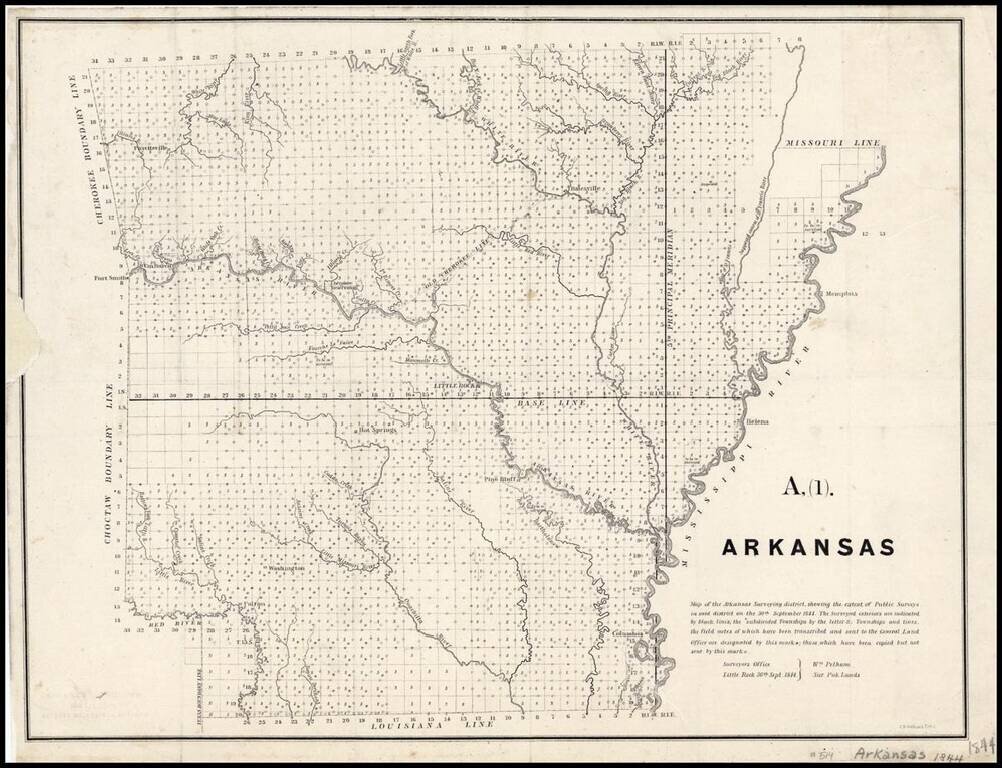
Map of the Arkansas Surveying district, shewing the extent of Public surveys in said district on the 30th September 1844.

Shows the progress of the public land surveys. Indicates townships to be resurveyed, incomplete, those under contract but unfinished, those completed, and those under contract of which no returns have been received. Identifies a base line and the location of the Old Cherokee line and the Cherokee Reservation.


Special conditions for students!

If you are a student, write to us in telegram: @antiquemaps and indicate what material you need and for what work you need a map in high detail. We are ready to provide material on special terms. For students only!

Item information:

Year of creation:
Size:
1208x926 px
Disk:
303869B
Number of pages:
1
Place:

Author:
C.B. Graham.
$9.99

Related item