
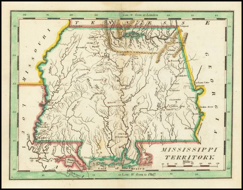
Nice example of Carey's small map of Mississippi Territory, illustrating the region prior to the creation of Alabama Territory. A highly detailed map, which includes towns, roads, rivers, mountains, and many other details.
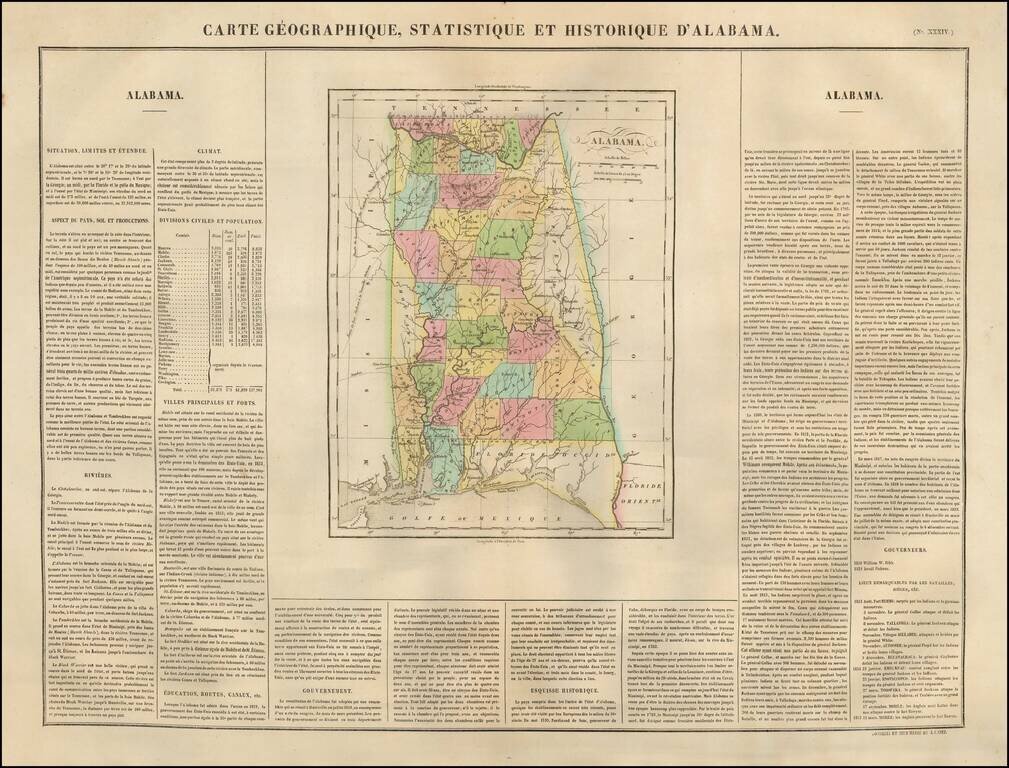
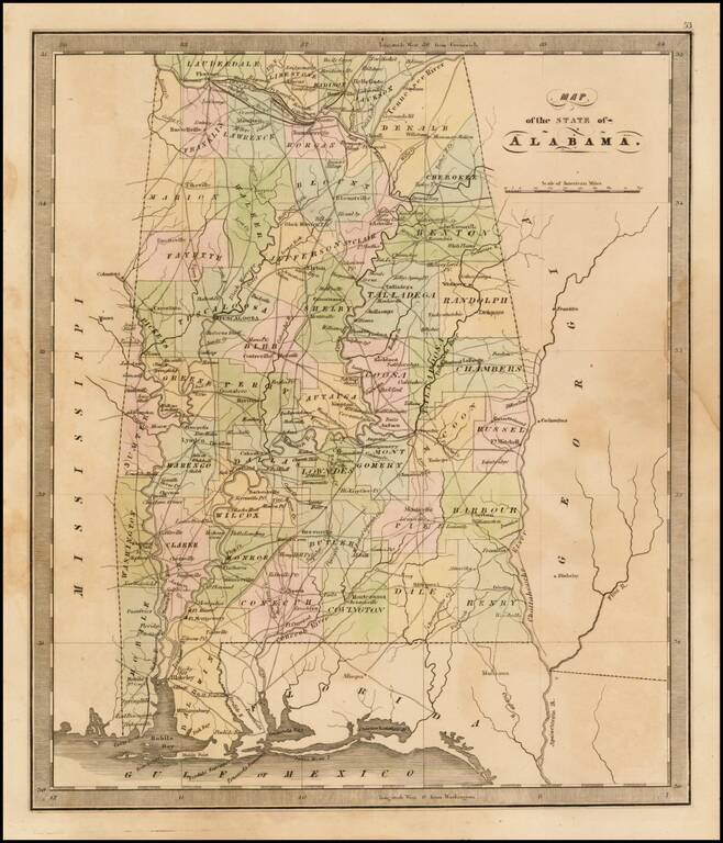
Nice example of the French edition of Carey & Lea's sought after map of Alabama. Hand colored by counties. Shows early roads, rivers, towns, bays, court houses, and other early details. General Jackson's route to New Orleans and the Government...
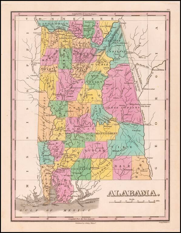
Nice example of Anthony Finley's early map of Alabama from an early edition of Finley's General Atlas, one of the earliest obtainable separate maps of Alabama. The map is hand colored by counties and showing towns, roads, rivers, mountains and other...
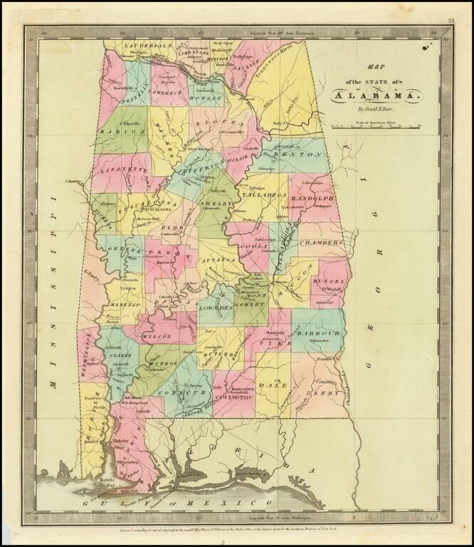
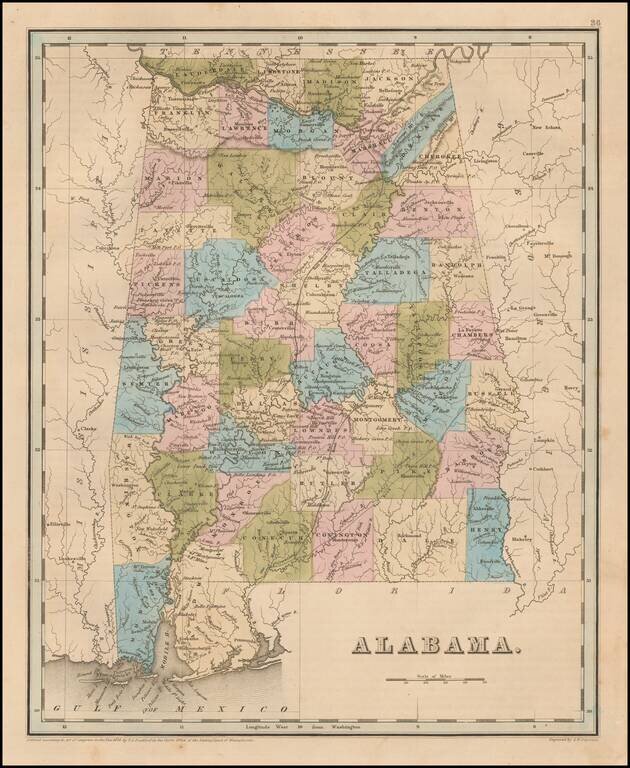
Fine example of David Burr's map Alabama, published just 15 years after Alabama became a state. The map is hand colored by counties and showing roads, towns, rivers, forts, and other details. A number of counties not yet shown and several shown as...
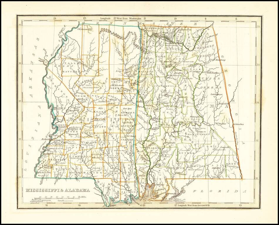
Early map of Mississippi and Alabama, which until about 15 years earlier had comprised a single territory. The eastern part of Alabama is still the lands of the Creek and Cherokee Indians and a number of counties are still not present. The Northern...
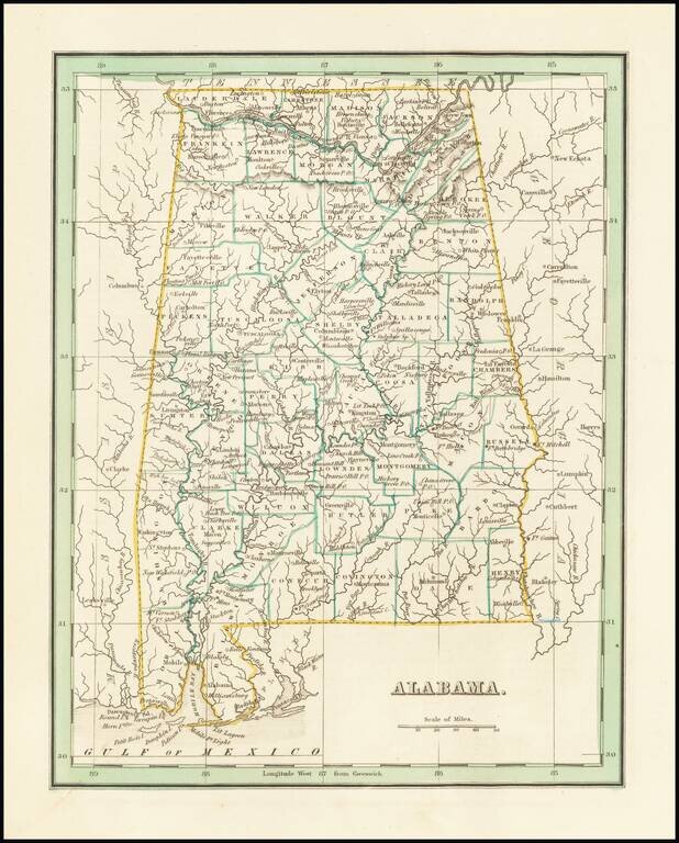
Fine example of this early map of the state of Alabama from Bradford's Comprehensive Atlas. Shows, counties, towns, rivers, etc.
From the 1849 edition of Greenleaf's map of Alabama, which first appeared in David Burr's Universal Atlas, in 1836. Burr's Atlas was perhaps the most elegant American commercially published atlas of its time, utilizing wonderful wash colors and...
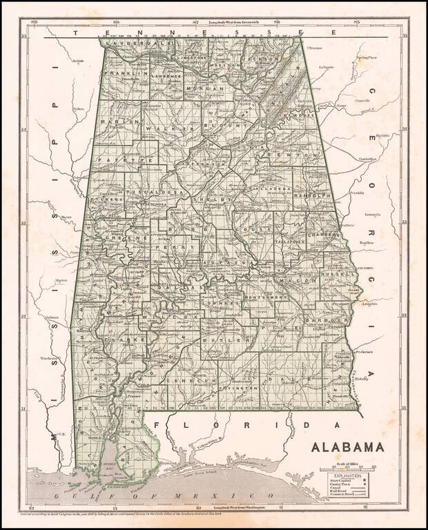
Early map of Alabama, showing counties, townships, towns, roads, railroads, etc. Morse & Breese's North American Atlas was a landmark in American Cartography, being the first atlas to employ the cerographic printing process, which would...
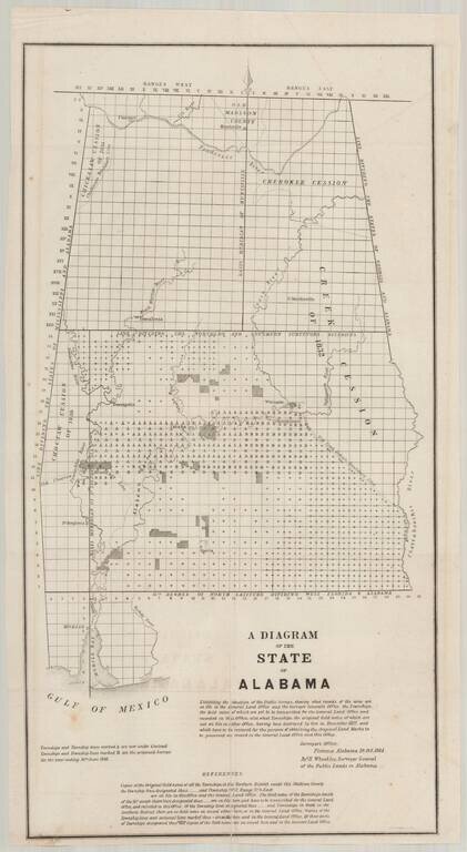
Detailed map of Alabama, illustrating the progress of the General Land Office Surveys as of October 10, 1844. Based upon a report signed in Florence, Alabama, on October 10, 1844, this map details both the progress on the surveys to date and those...
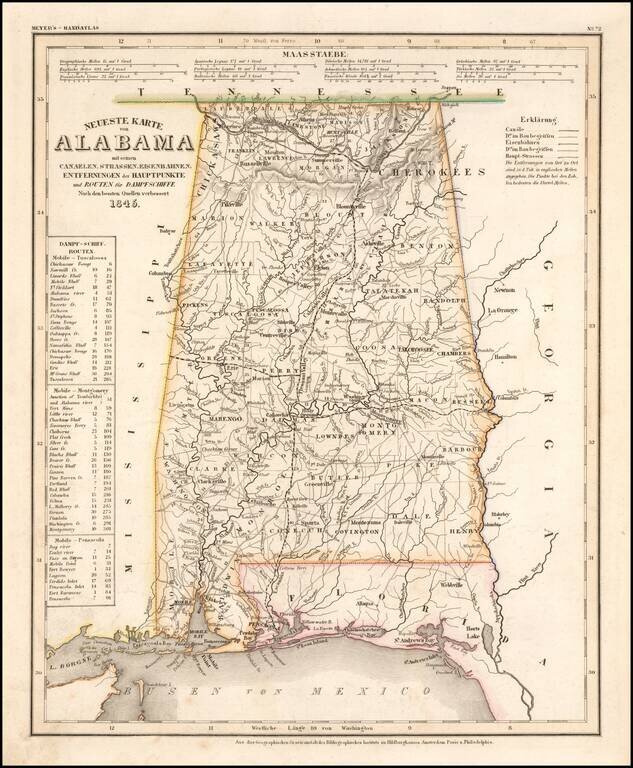
An elegantly engraved and highly detailed map of Alabama, based upon Tanner's work in the early 1840s. Shows counties, towns, roads, canals, lakes, etc. Detail includes western Florida. While often referred to as the German Mitchell, this...
Nice example of Bradford's early map of Alabama. The map is hand colored by counties and shows very early railroads, towns, rivers, forts, post offices and other details. The second edition can be distiguished easily from the first edition by the use...
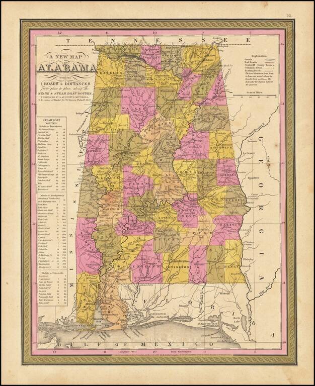
Detailed and interesting map of Alabama, hand colored by county and showing towns, rivers, bays, lakes, railroads, roads, distances, forts, etc. Includes tables of Steam Boat routes and distances.
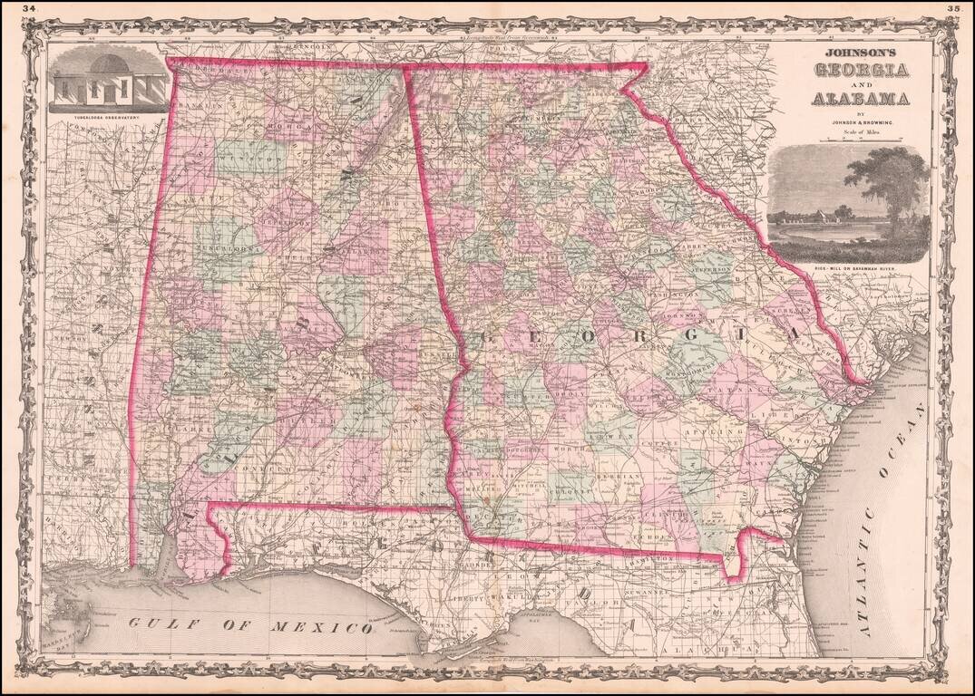
Detailed map of Georgia and Alabama, hand colored by counties, from one of the leading American map makers of the Civil War Period.
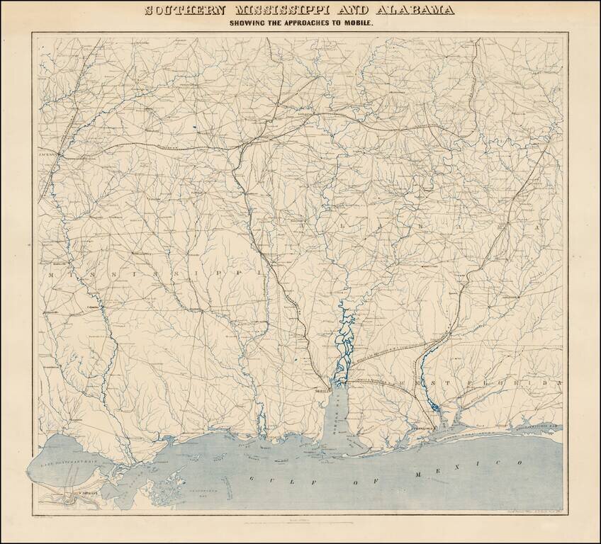
Fine uncut, unfolded example of the second edition of this rare Civil War map was created by the United States Coast Survey in 1863, under the direction of A.D. Bache. This exceptionally detailed map was prepared specifically by the US Coast Survey...
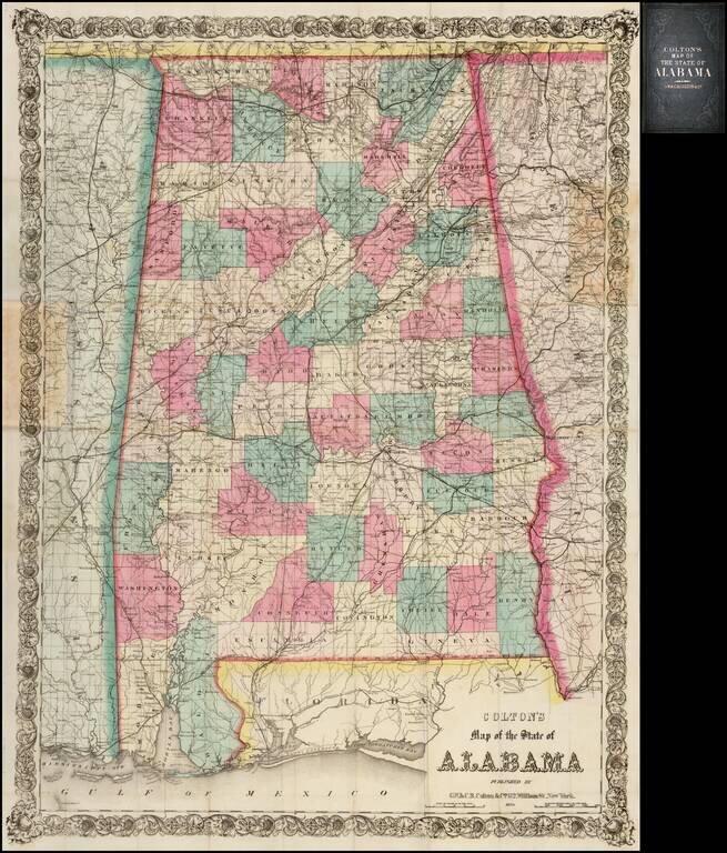
Fine example of this early edition of Colton's large format pocket map of Alabama. A large scale and highly detailed map, drawn on a scale of two miles to the inch. Shows roads, railroad lines, cities and towns, rivers, lakes, and mountain ranges....
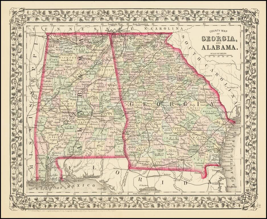
Detailed map of Georgia and Alabama, published by SA Mitchell Jr. The map is colored by counties and shows towns, roads, railroads, forts, proposed railroads, etc. Includes a decorative grapevine border.