Map size in jpg-format: 14.0564MiB
Click to open in high resolution (open in new tab).
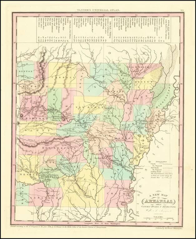
Scarce early map of Arkansas from Tanner's Universal Atlas.
Shows canals, proposed canals, railroads, proposed railroads, major roads, distances, towns, rivers, etc. A key at the top of the map shows the steamboat routes and distances. Well less than half of Arkansas' counties have been established. Hot Springs County extends from Saline Creek to the western border with Texas.
If you are a student, write to us in telegram: @antiquemaps and indicate what material you need and for what work you need a map in high detail. We are ready to provide material on special terms. For students only!