Map size in jpg-format: 51.5578MiB
Click to open in high resolution (open in new tab).

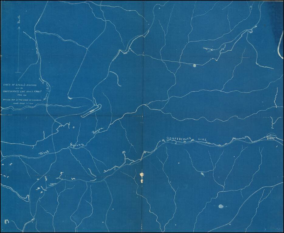
Detailed blueprint map illustrating the location of "Steel's Division" during the Siege of Vicksburg.
"Steel" is Frederick Steele (1819 – 1868), a career military officer in the United States Army, who served as a major general in the Union Army during the American Civil War.
If you are a student, write to us in telegram: @antiquemaps and indicate what material you need and for what work you need a map in high detail. We are ready to provide material on special terms. For students only!
![The Coast of West Florida and Louisiana . . . [with] The Peninsula and Gulf of Florida or Channel of Bahama with the Bahama Islands . . .](/map/small/38977.jpg)
![The Coast of West Florida and Louisiana . . . [with] The Peninsula and Gulf of Florida or Channel of Bahama with the Bahama Islands . . .](/map/small/66344.jpg)
