
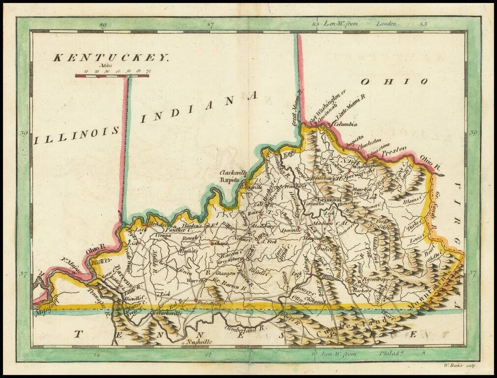
Scarce early map of Kentucky, published by Mathew Carey. This later 1814 edition references Ohio, Illinois and Indiana above. The prior state showed only the "Northwestern Territory.
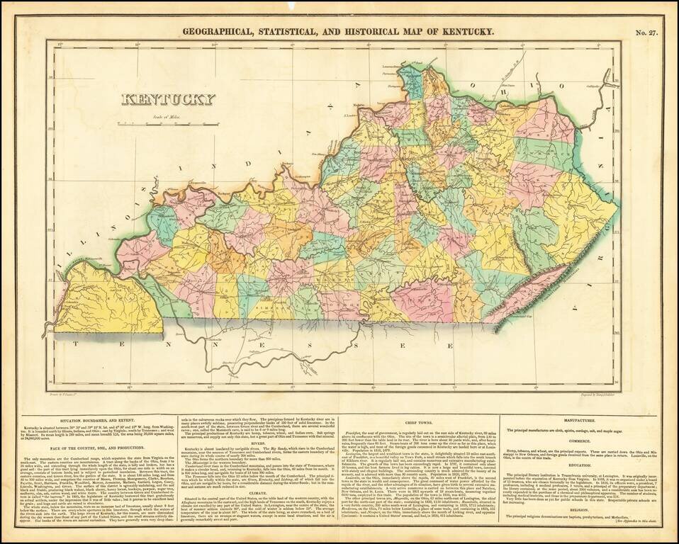
One of the best early maps of Kentucky, from the first edition of Carey & Lea's Atlas. Many counties still not formed. Size includes text below map, which includes wonderful contemporary details concerning the topography, indigenous lands, rivers,...
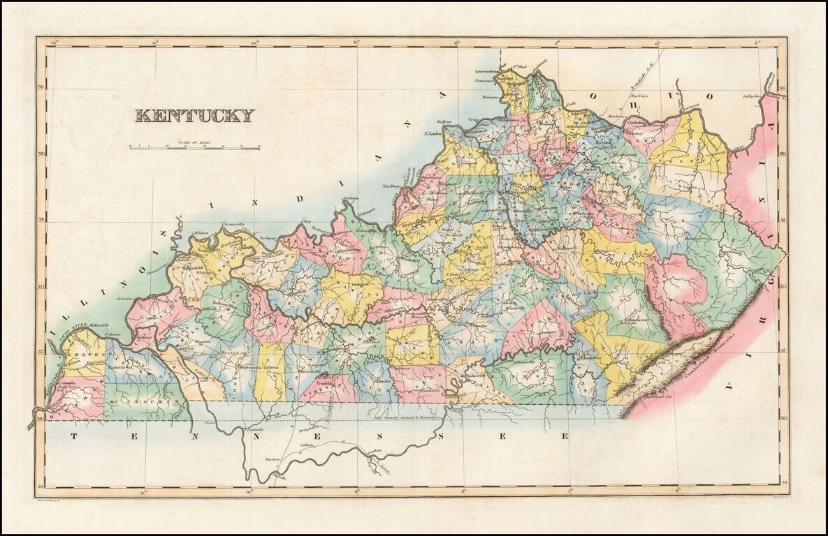
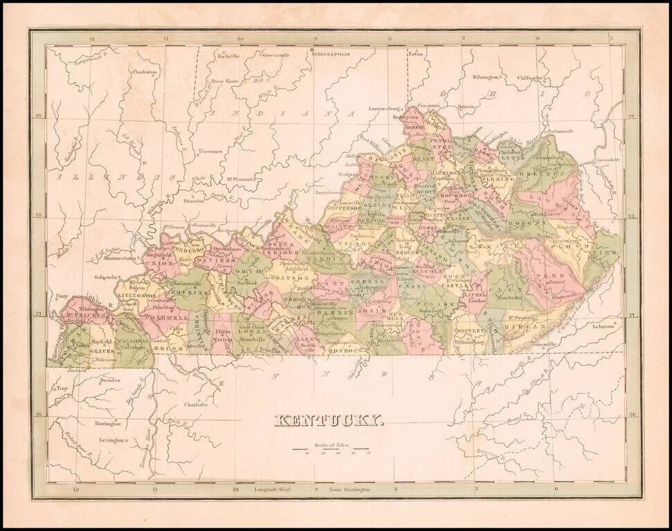
Striking map of Kentucky, colored by counties from Fielding Lucas' New Elegant General Atlas. A number of counties are still not shown, especially in the east. Undoubtedly one of the most attractive and sought after early 19th Century atlas maps of...
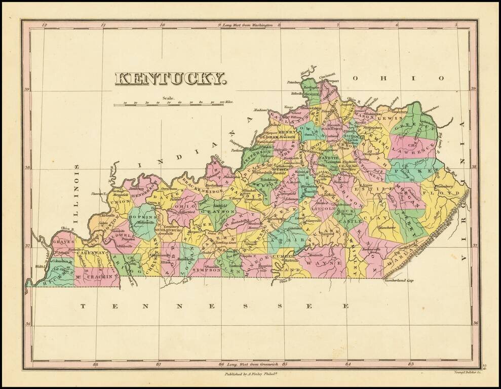
Striking map of Kentucky from Finley's General Atlas. The map is colored by counties and showing towns, roads, rivers, mountains and other geographical features.
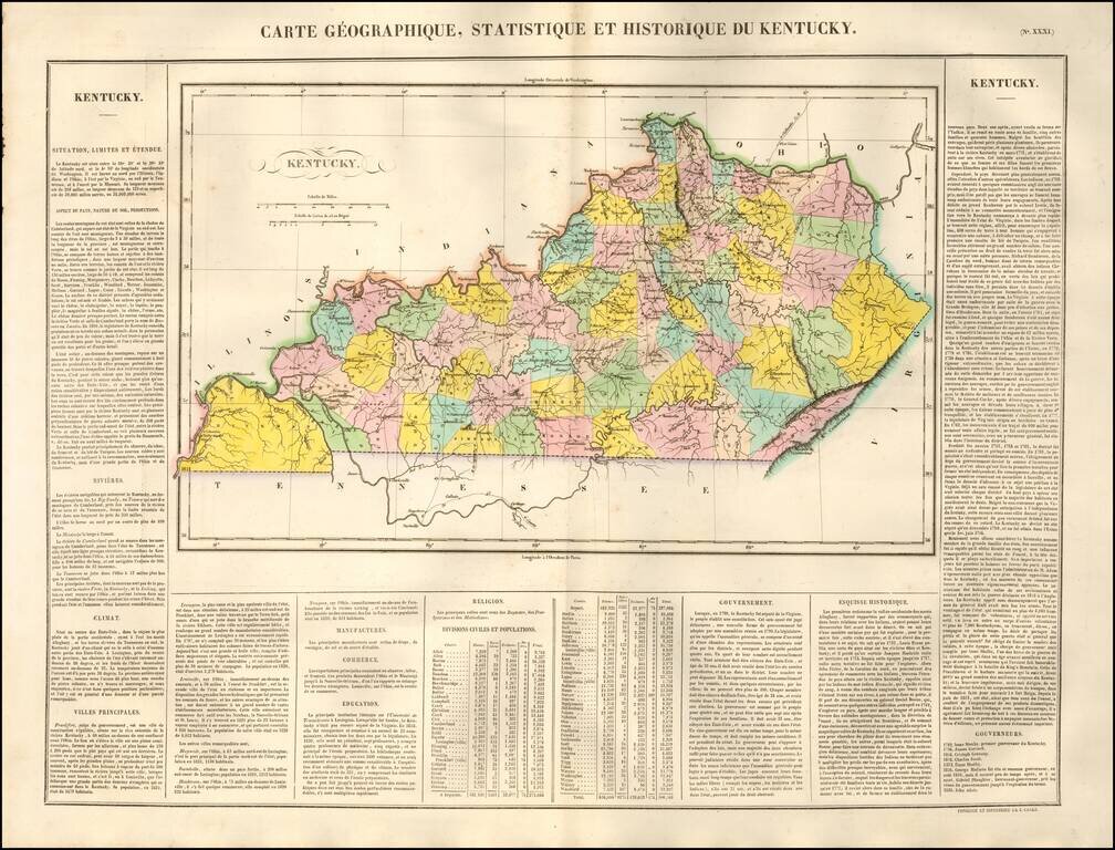
One of the Earliest Maps of the State of Kentucky Published in France Finely engraved map of Kentucky, hand colored by counties, published by Jean Alexandre Buchon, in Paris, in 1825. Buchon's work is colored by county and shows the various towns,...
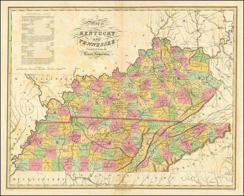
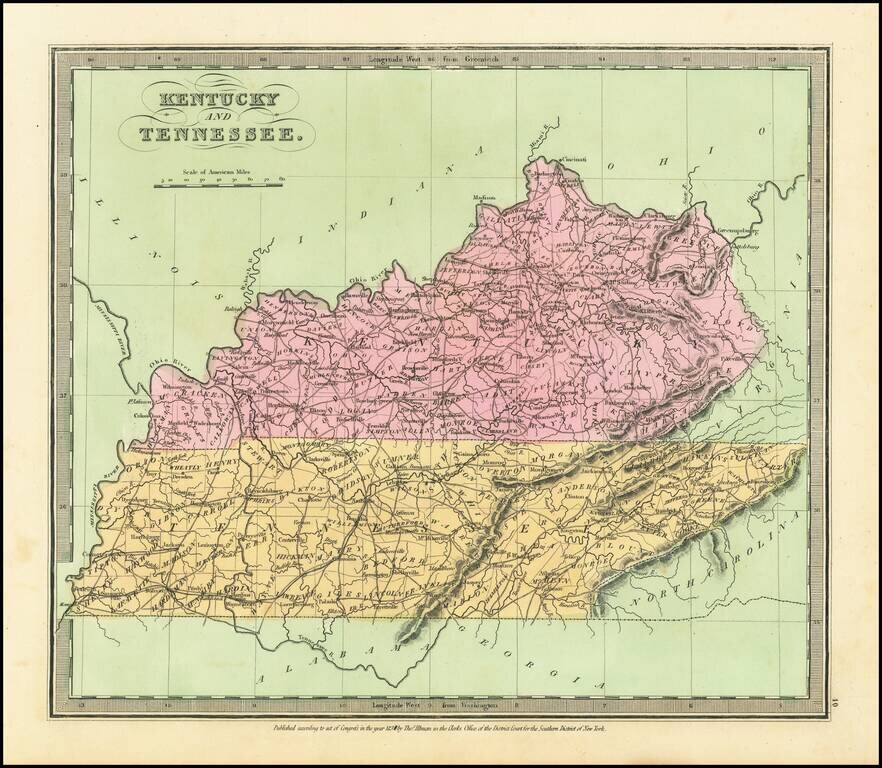
Fine early map of Kentucky and Tennessee, from Finley's New American Atlas. Includes a statistical table, roads and other early details. While the map occasionally appears on the market in pocket map form, it is especially desirable in this atlas...
Rare full original color example of the first edition of Bradford's map of Kentucky.
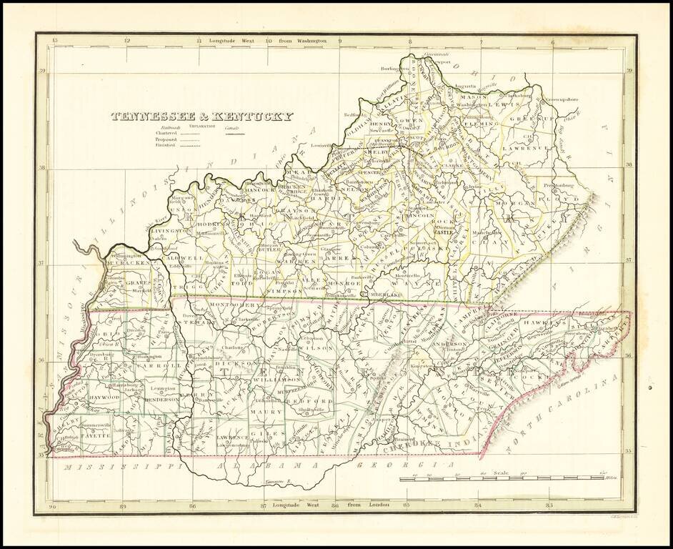
Early map of Kentucky & Tennessee, published by Bradford. Map shows counties in outline color.
Attractive example of David Burr's scarce map of Kentucky & Tennessee, from his rare Universal Atlas. The map shows counties, towns, roads, rivers, mountains, lakes, forts and other important details. Nice wide margined example of this hard to...
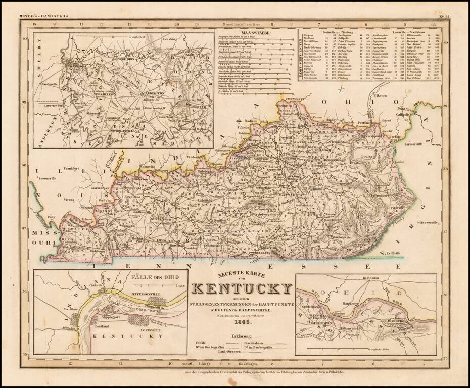
Elegantly engraved and detailed map of Kentucky, taken based upon Tanner's work in the early 1840s. Shows counties, towns, roads, rivers, etc. Inset maps of areas around Lexington, Nashville/Clarkesburg and the Falls of the Ohio.
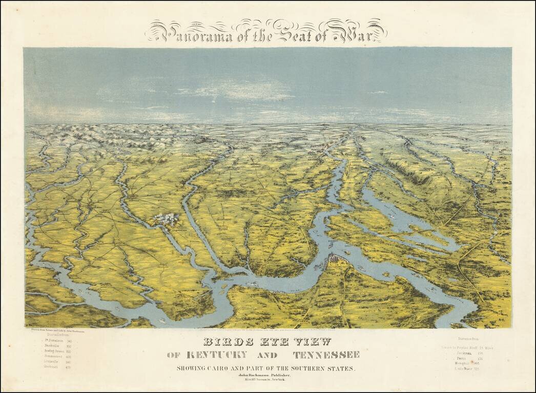
A Southern Rarity Rare regional birds eye view of Kentucky, Tennessee and parts of contiguous states, published by John Bachmann. The area shown is bounded by Cape Girardeau and the Mississippi River in the Southwest, Evansville and the Ohio River in...
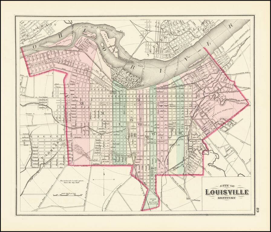
First Printed Atlas Map of Louisville Gorgeous map of Louisville, Kentucky, hand colored by wards, published by OW Gray. This is the earliest map of Louisville to appear in a commercial atlas.
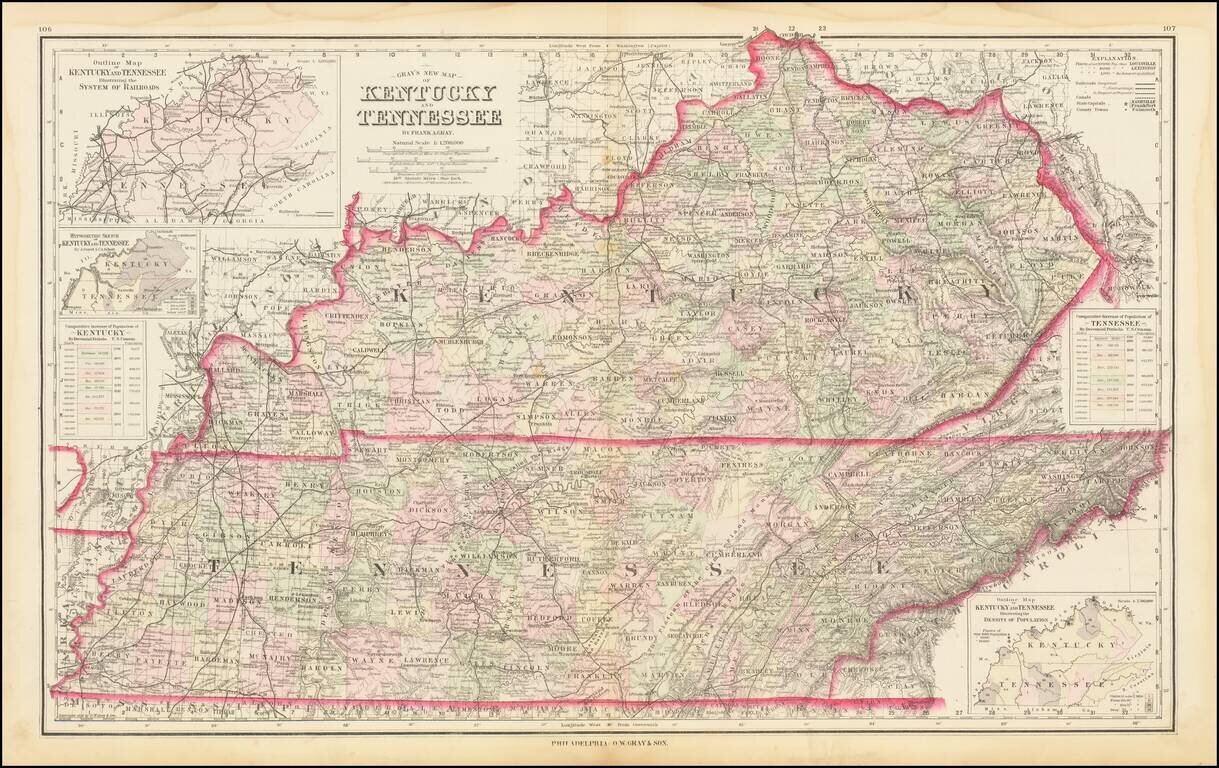
Detailed large format map of Kentucky and Tennessee, published by OW Gray in Philadelphia. The map is colored by counties and showing remarkable details for the period. Inset maps including a rail system and population density chart.
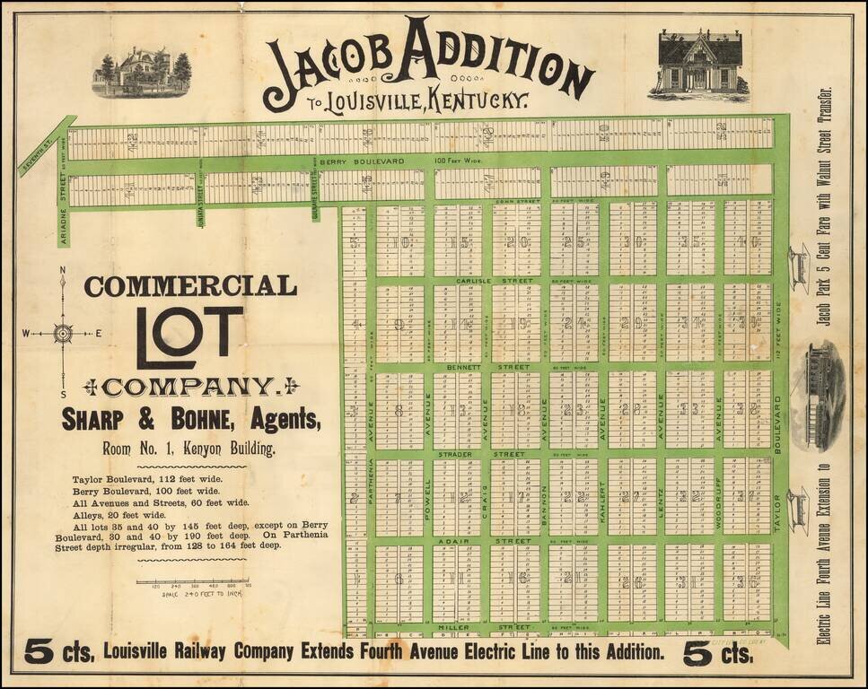
Rare promotional map, showing the Jacob subdivision of Louisville, Kentucky. The map was published by the Louisville land agents Sharpe & Bohne, who were promoting 52 blocks of approximately 1,000 tracts on the south side of the city available...
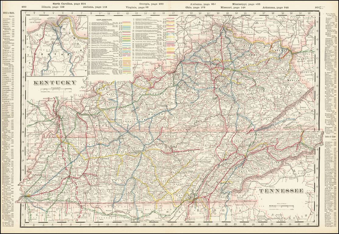
Highly detailed railroad map of Kentucky and Tennessee. Shows counties, railroads, railway stations, township surveys, mountains, rivers, lakes, and a host of other early details. Large inset of Covington, Newport and Vicinity.
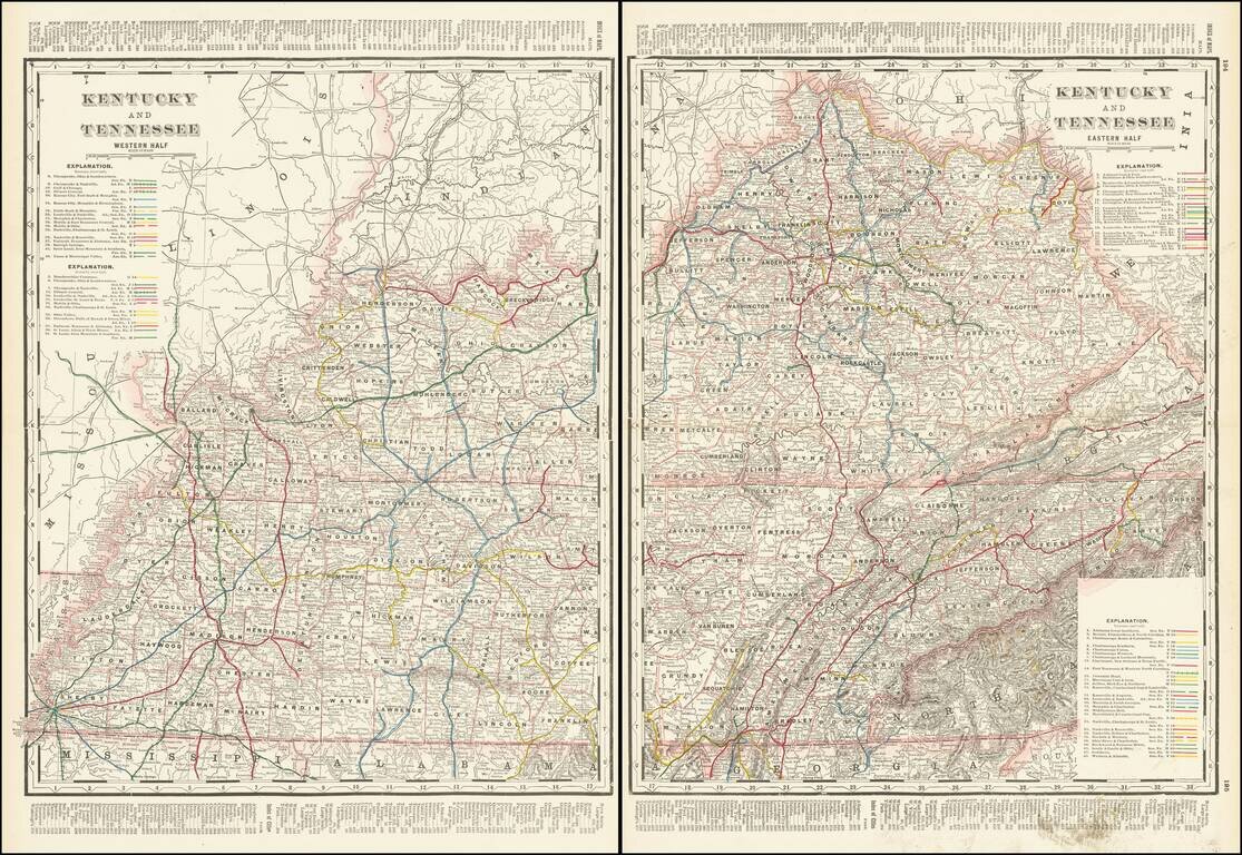
Highly detailed 2-sheet railroad map of Kentucky and Tennessee. Shows counties, railroads, railway stations, township surveys, mountains, rivers, lakes, and a host of other early details.