
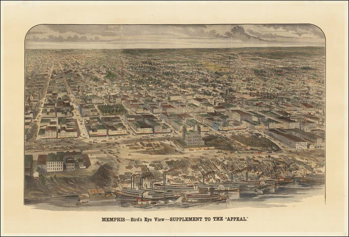
An Early Memphis Birdseye View Published in Memphis Rare view of Memphis, Tennessee, published as a supplement to the Memphis Appeal, October 15, 1887. The map shows an up-close view of the paddlewheeler's on the river, with a bustling waterfront...
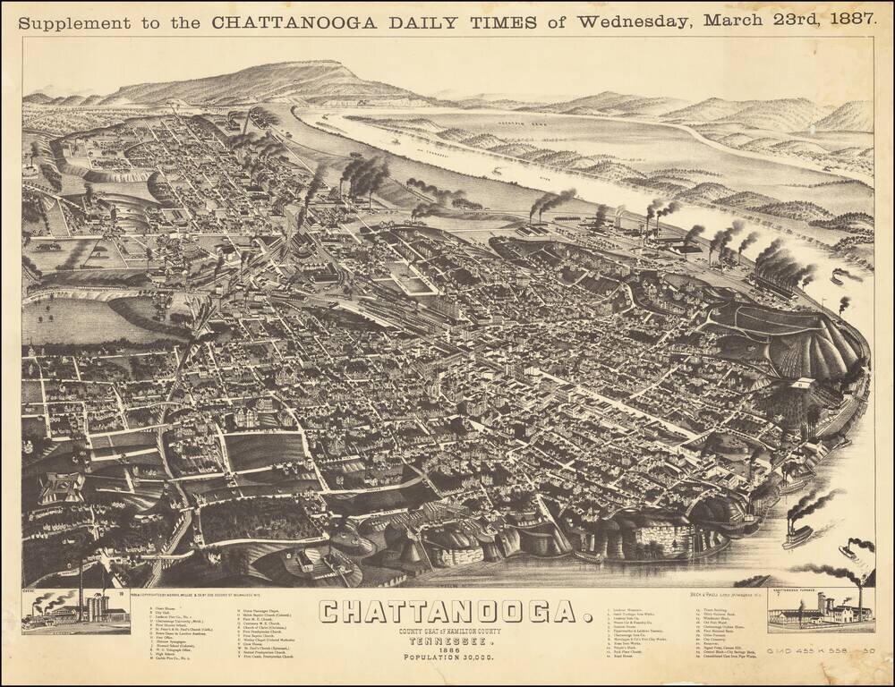
Wellge's bird's-eye-view provides a fine large view of City of Chattanooga, with significant buildings, streets, rivers, rail roads, and other geographical points of interest labeled. States of the View This is a later state of the view, which was...

Decorative and unusual trading card map from this famous series. Map is surrounded by decorative vignettes.
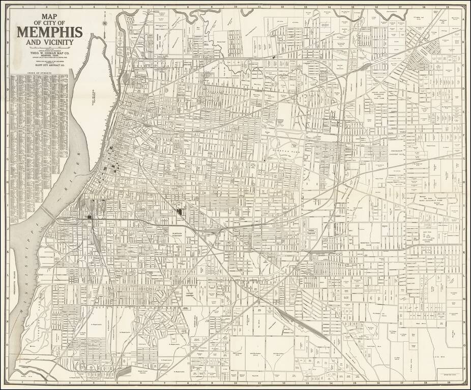
Marvelous separately published map of the City of Memphis, published by the Theo W. Ohman Map Company of Memphis, Tennessee. The map lays out the city proper, with a detailed street index. Downtown, near the water, a number of public and private...
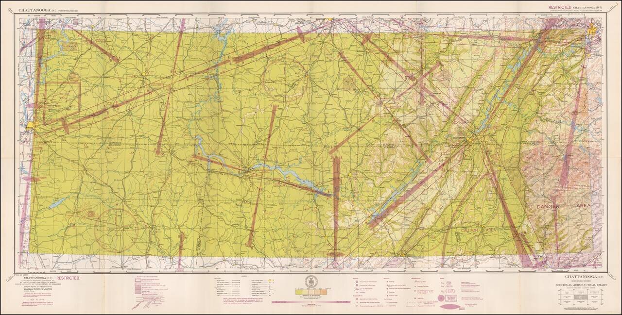
Restricted World War II Aviation Map Detailed aeronautical map of the Chattanooga, Tennessee area. The chart is a font of information about civil and military aviation during WWII. It was intended for civil aviators flying by visual navigation and...
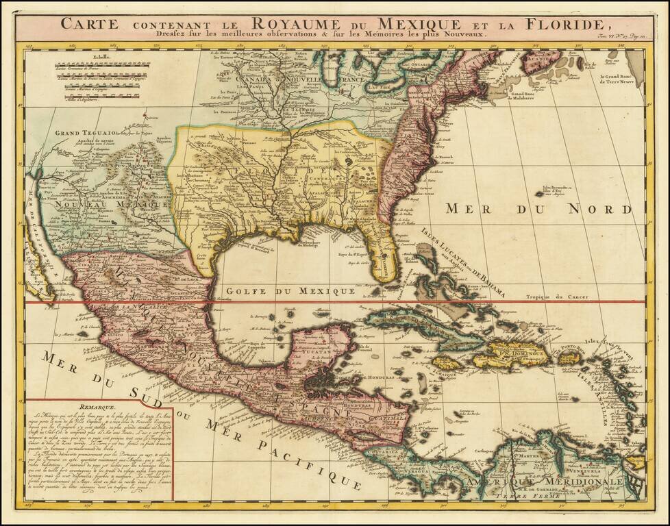
An Early Re-Issue of a Cartographic Landmark Map This is a finely executed map of the southern part of North America by the French mapmaker Henri Chatelain. The map draws its inspiration from the royal mapmaker Guillaume de L'Isle's landmark map of...