
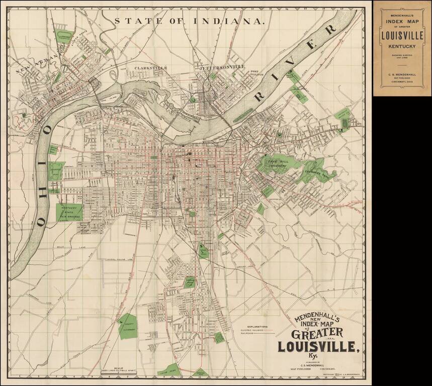
Scarce early map of the city of Louisville, published by C.S. Mendenhall. The map extends north to include Clarkesville, Jeffersonville and New Albany. The map identifies streets, major buildings, wharfs, and a number of land owners on the outskirts...
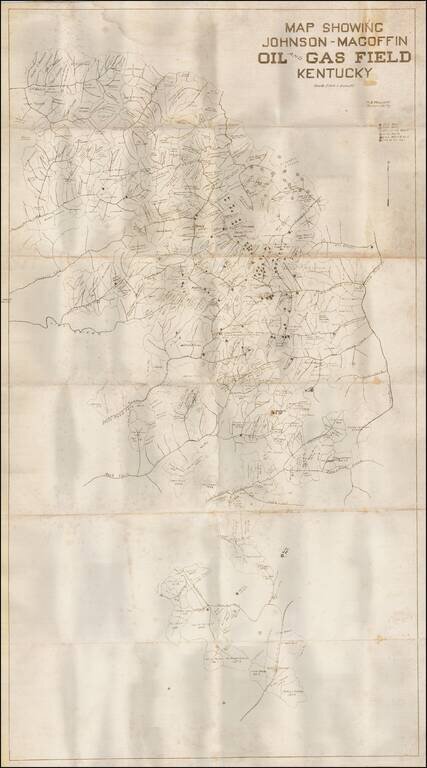
Detailed map showing the Johnson-Magoffin Oil and Gas Field in Kentucky. The map identifies property owners, oil wells, gas wells, drilling wells, dry holes, gas & oil wells and "Show of Oil." The creeks and rivers in the area are also located.

Scarce vintage pictorial map of Kentucky, celebrating the state's agricultural industries, produced by Karl Smith, one of the 1930s' prominent makers of state pictorial maps. The map features an exhaustive list of Kentucky's 120 counties at the time,...
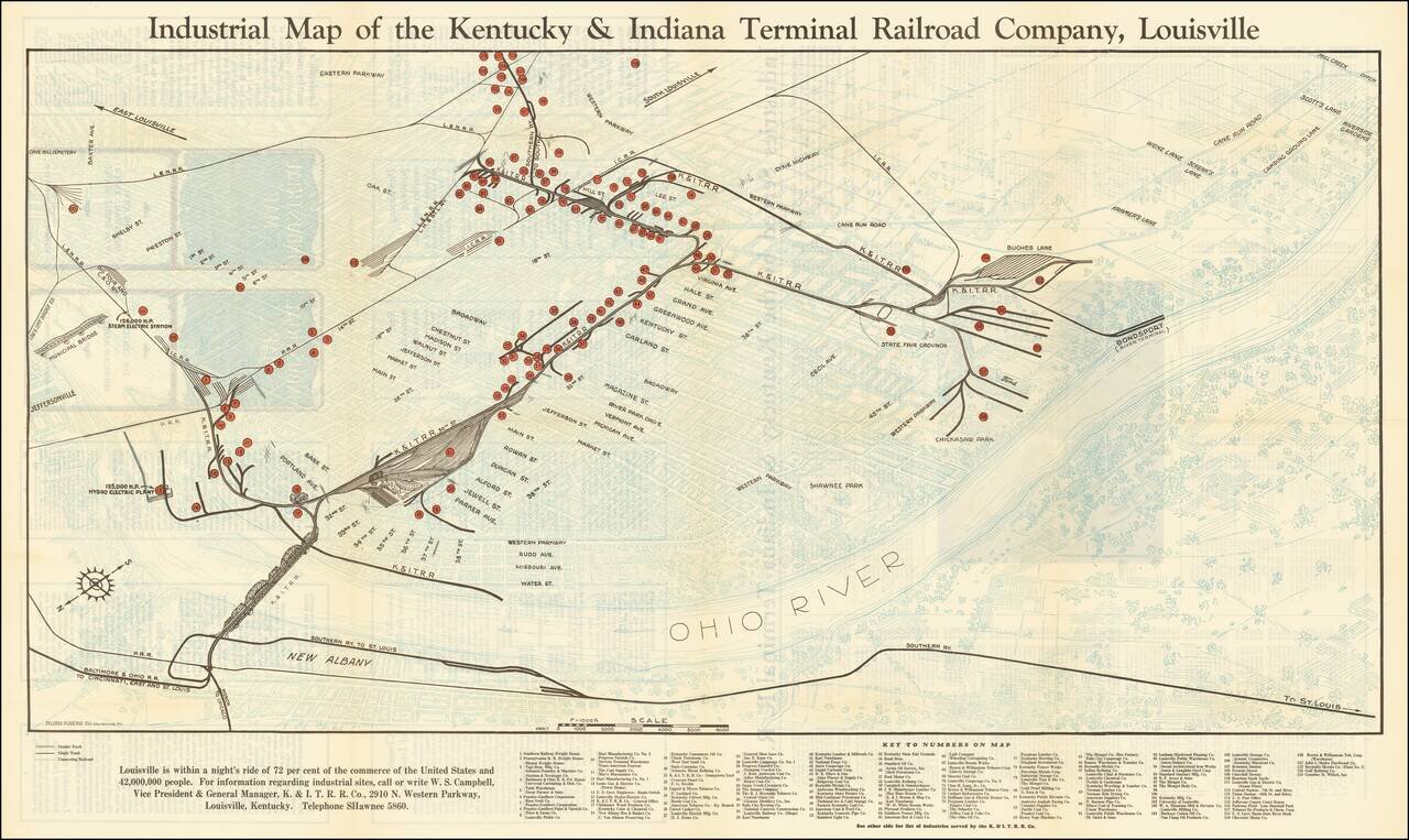
Louisville is within a night's ride of 72 per cent of the commerce of the United States and 42,000,000 People Interesting map of Louisville, Kentucky, highlighting the location of the railroad lines, major manufacturers, and freight houses in...
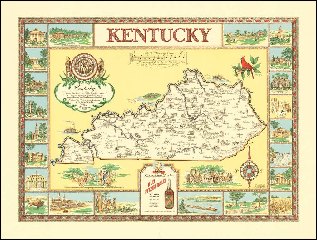
"The Dark and Bloody Ground" Rare pictorial map of the Kentucky, one of a number of different pictorial maps of Kentucky by the prolific illustrator Karl Smith. The map illustraes landmarks and historical events in the decorative panels which make up...
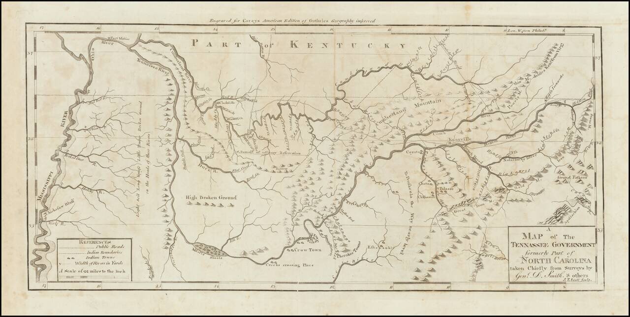
Nice example of the first state of Mathew Carey's map of Tennessee, published in Carey's American Atlas. This is the first state of the map, issued in 1795 and distinguishable from the second state by the words "Tennassee Government" in the title,...
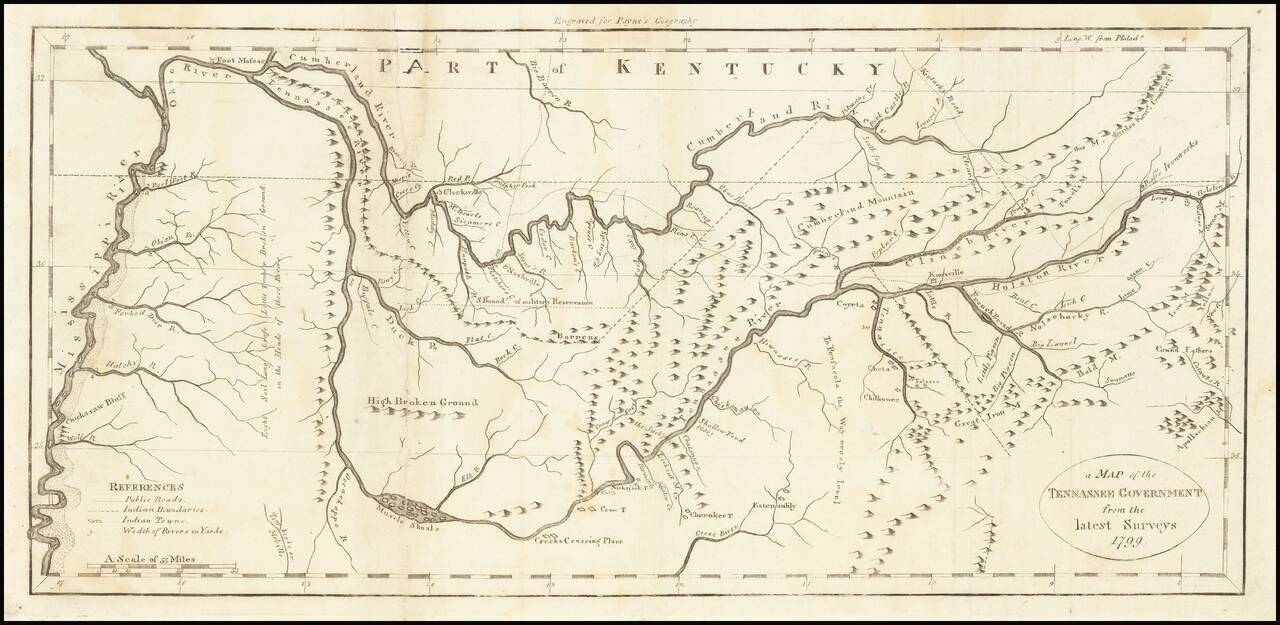
One of the earliest obtainable maps of Tennessee. Shows early counties, Rivers, Mountains, Indian Villages, military reservations and many topographical details. Nashville appears, as does Clerksville, although the primary detail in the map is along...
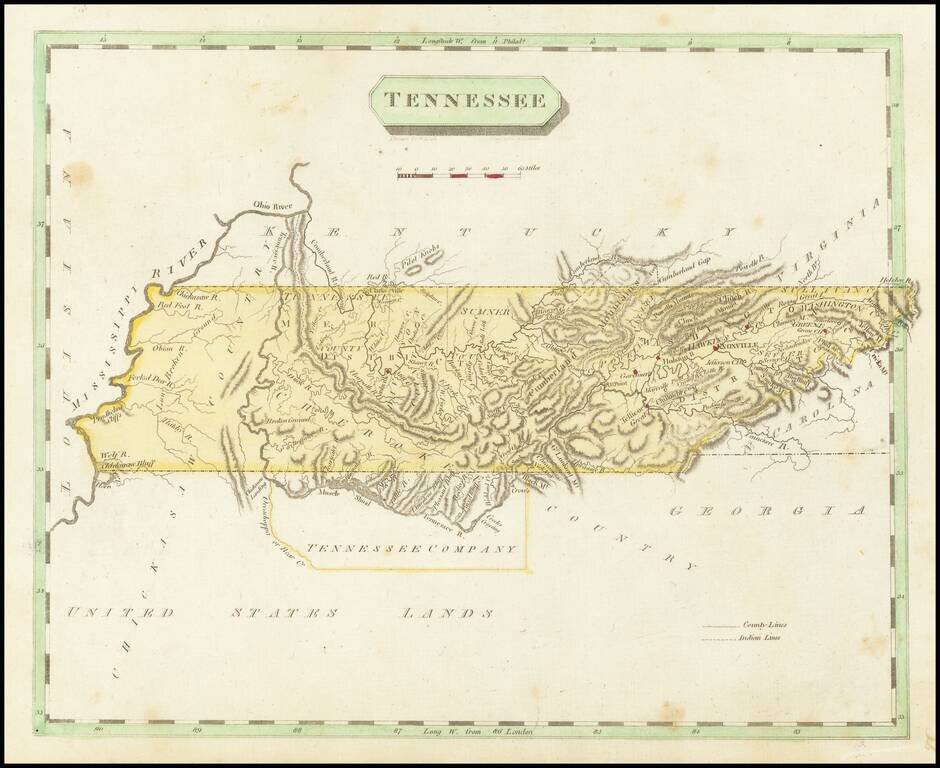
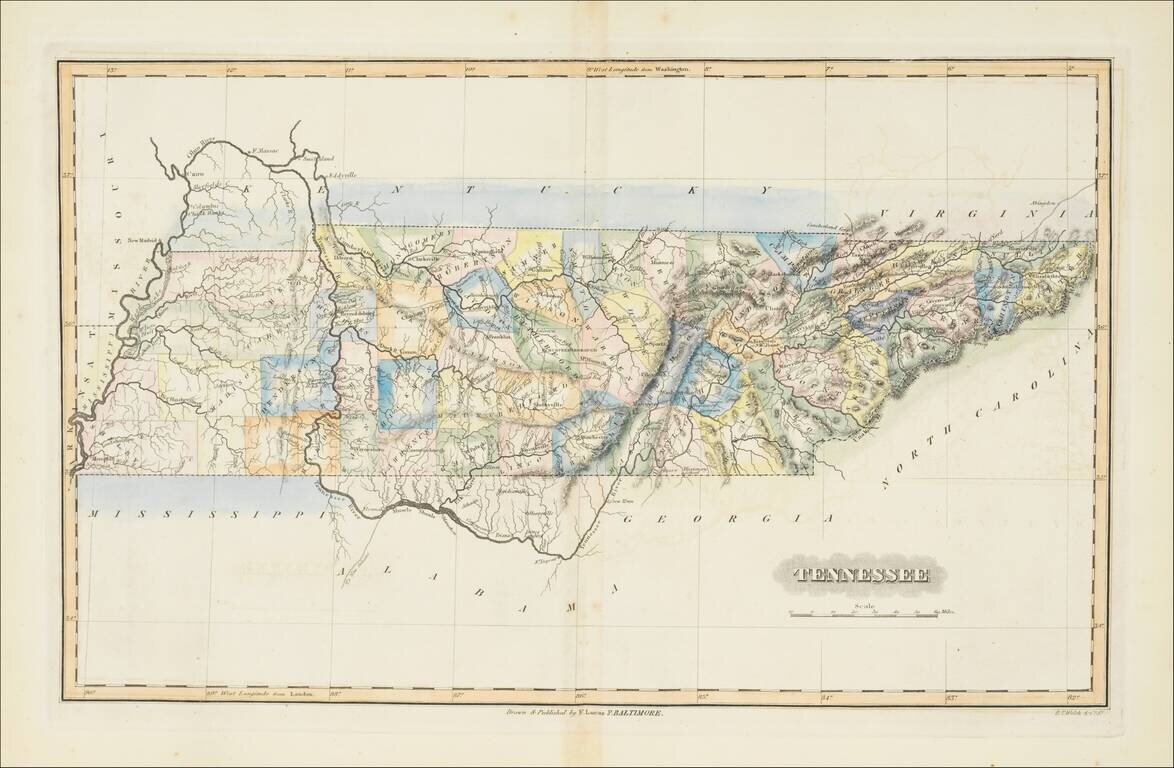
Early map of Tennessee, shortly after statehood. Includes counties, towns, rivers, and other features. Washington District still shown. South of the state are the United States Lands and Tennessee Company.
Nice example of Matthew Carey's early map of Tennessee. A highly detailed map, which includes towns, roads, rivers, mountains, and many other details.
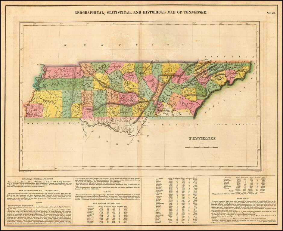
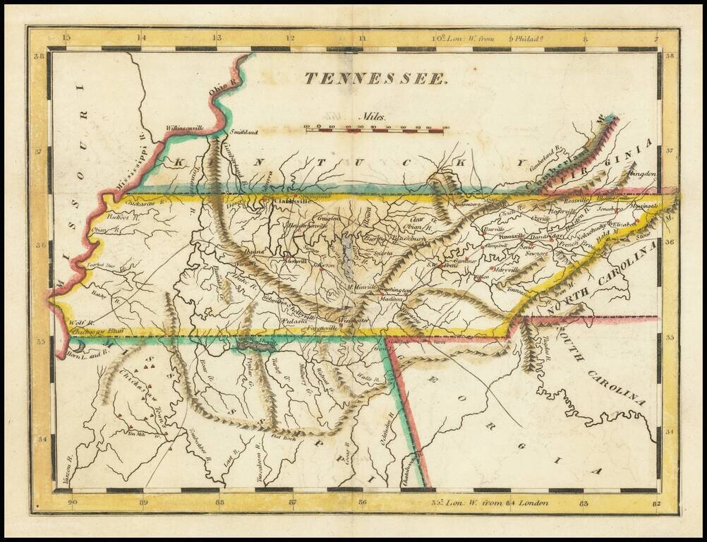
Old color example of one of the earliest obtainable maps of Tennessee, from the first edition of Carey & Lea's Atlas. Many counties still not formed. Size includes text below map, which includes wonderful contemporary details concerning the...
Striking map of Tennessee, colored by counties from Fielding Lucas' New Elegant General Atlas. A number of counties are still not shown, especially in the east. Undoubtedly one of the most attractive and sought after early 19th Century atlas maps of...
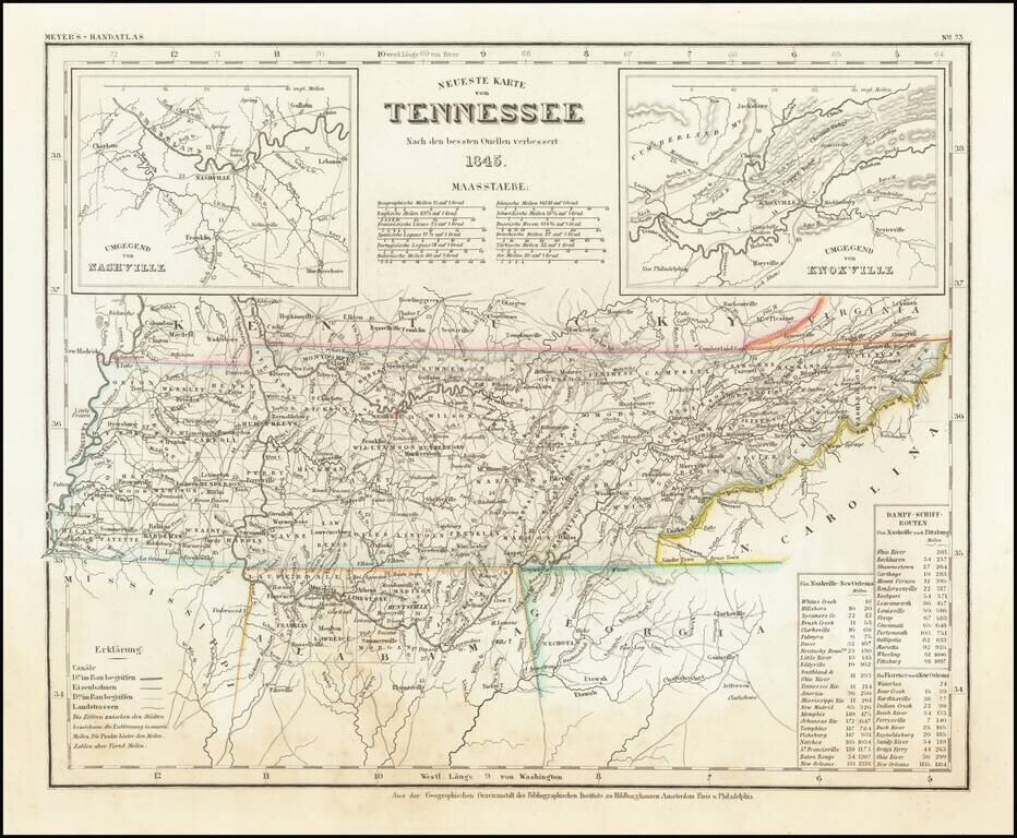
First state of Meyer's map of Tennessee. Elegantly engraved and detailed map of Tennessee, taken based upon Tanner's work in the early 1840s. Shows counties, towns, roads, canals, lakes, etc. Detailed insets of Knoxville and Nashville. While often...
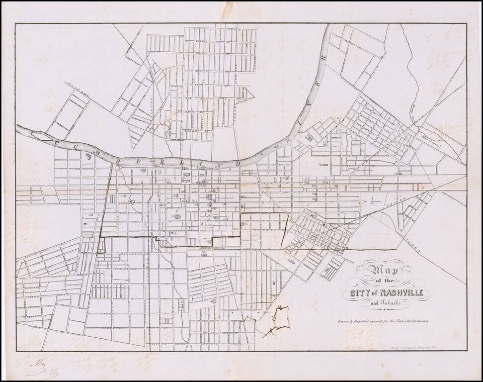
One of the Earliest Printed Maps of Nashville Rare Confederate Imprint Plan of Nashville Fine early plan of Nashville showing a detailed street grid and railroad. The map identifies prominent buildings, public spaces, waterways and suburbs. Shows...
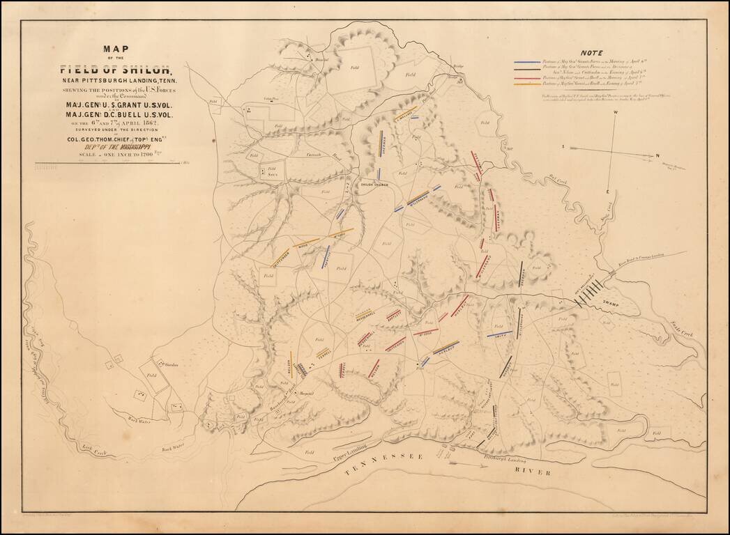
Rare St. Louis-Published First Edition of the Map of the Field of Shiloh. Important separately-issued hand-colored lithographed map of the Battle of Shiloh lithographed by Chas. Robyn & Co. of St. Louis, Missouri in 1862. This is the first...
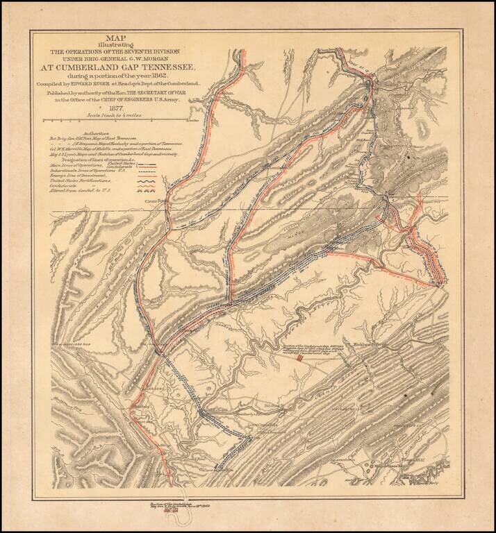
Interesting color-printed battle plan showing the operations of General G. W. Morgan in the Cumberland Gap, Tennessee. General Morgan's actions resulted in the capture of the Cumberland Gap for the Union. The Union occupied the Gap for three months....
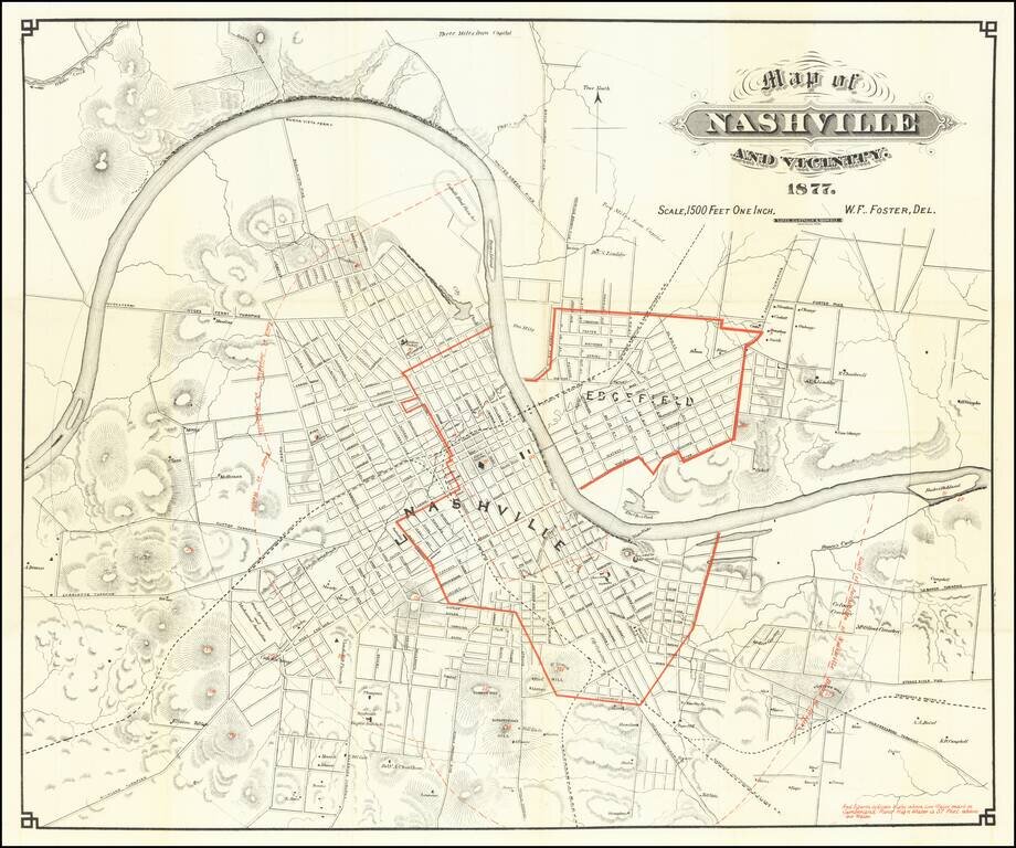
Showing Flooding Region of the Cumberland River Scarce early map of Nashville, with redlines illustrating the High Water Mark of the Cumberland River -- 57 feet above the low water mark. A highly detailed map of Nashville, showing streets, public...