
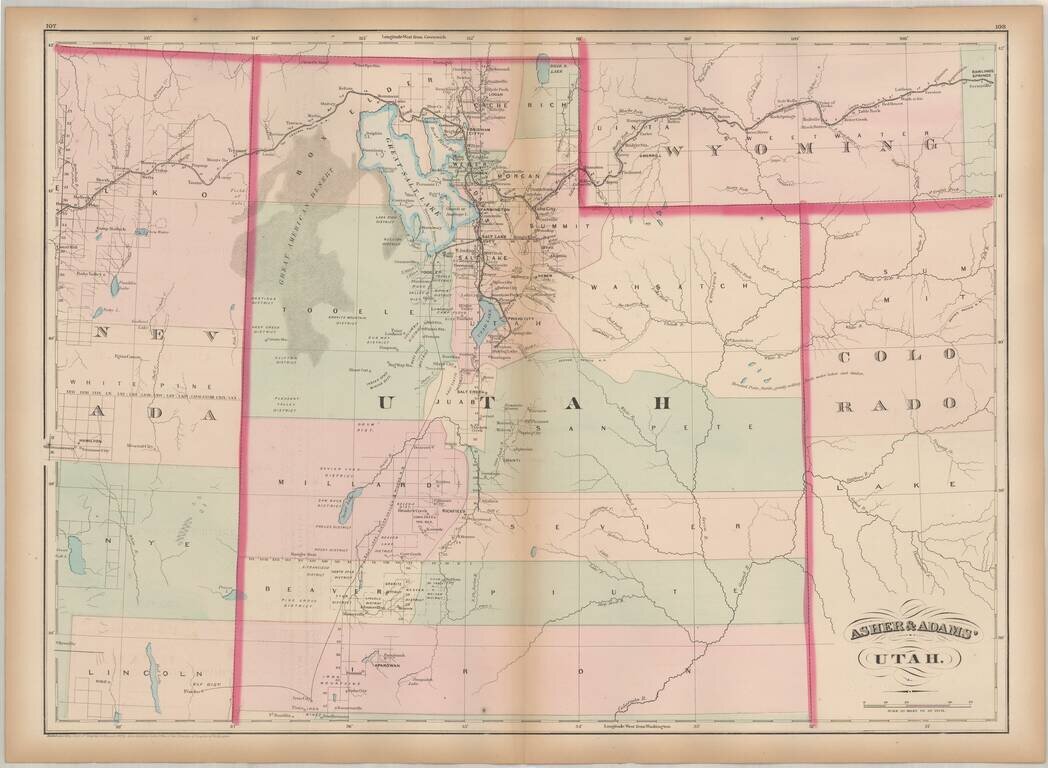
One of the earliest obtainable maps of Utah Territory. Asher & Adams map of Utah is among the earliest map of Utah Territory in its modern configuration to appear in a commercial atlas. The focus of the map is the railroad and related detail...
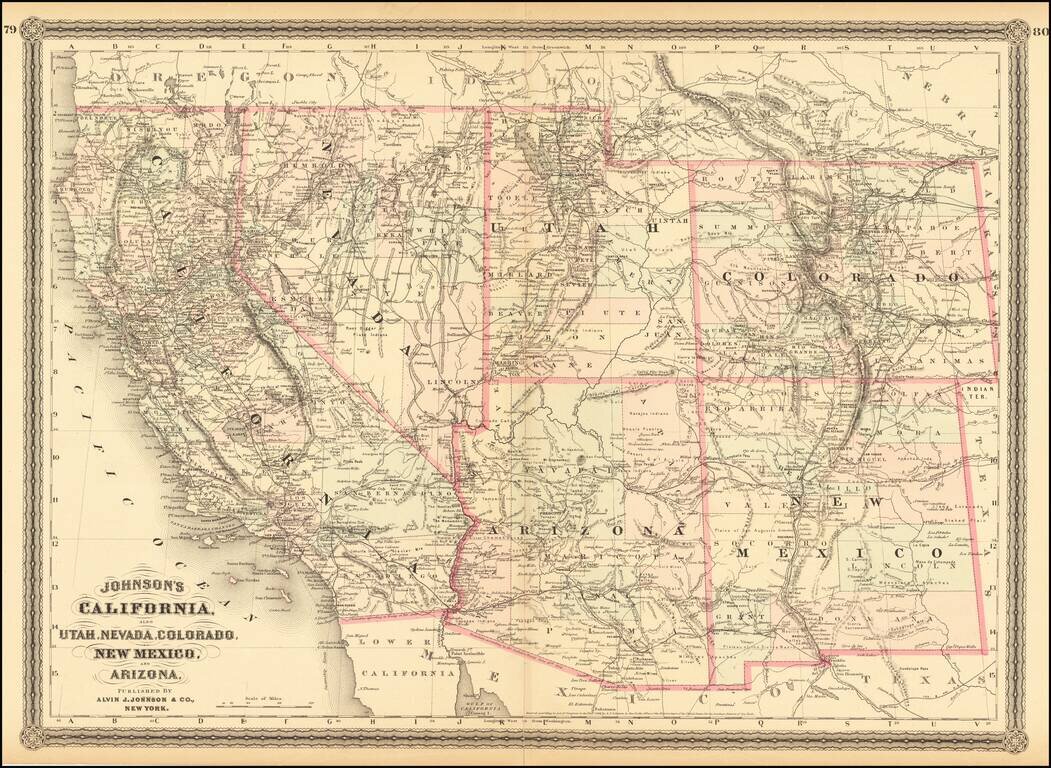
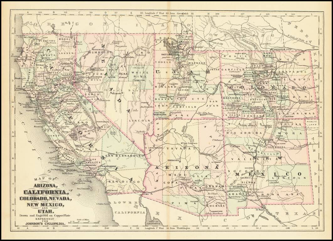
Interesting map of California and the Southwest hand colored by counties and showing a number of interesting territorial anomalies. Nevada has its lower corner truncated, leaving Las Vegas in Arizona. Utah extends approximately 1 degree too far to the...

Rare 1876 edition of Bancroft's map of California & the Southwest. The map is hand colored by counties and shows tremendous detail, one of the best maps of the Western United States published West of the Mississippi during the period. Early roads,...
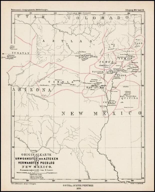
Scarce German map showing locating the major Indian Tribes of New Mexico and the Ancient Indian Regions, from Petermann's Geographishce Mittheilungen. Names of the regions of the old Aztecs settlements are given on the map: Aztlan, Tusayan, Cibola,...
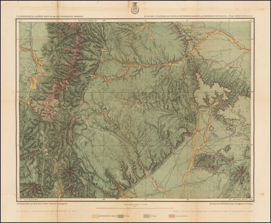
Detailed topographical map showing the region bounded by the Taos, New Mexico area in the southwest, San Luis, Colorado and Trinchera Peak in the northwest, Purgatory River and Trinidad Colorado in the Northeast and the area just south of Laughlin Peak...
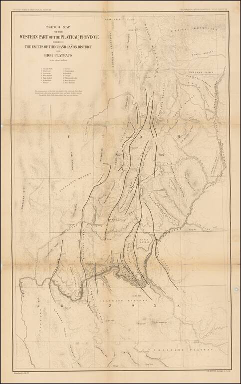
Finely detailed map of parts of Arizona and Utah, which appeared in the United States Geological Survey's At las To Accompany The Monograph On The Tertiary History Of The Grand Canon District By Capt. Clarence E. Dutton. The map provides a finely...
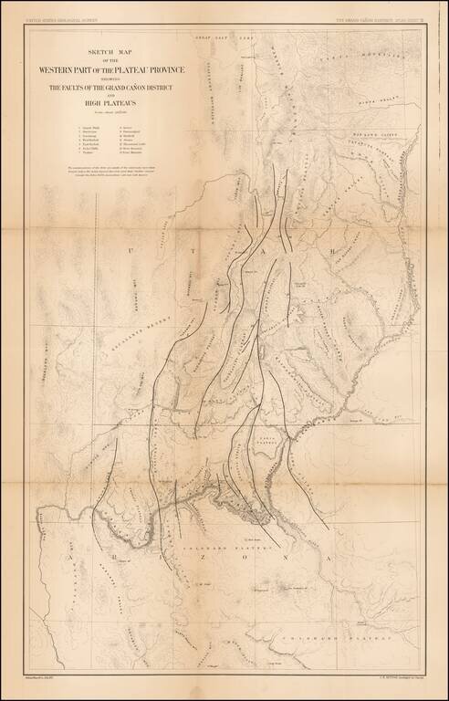
Finely detailed map of parts of Arizona and Utah, which appeared in the United States Geological Survey's At las To Accompany The Monograph On The Tertiary History Of The Grand Canon District By Capt. Clarence E. Dutton. The map provides a finely...

The Second Issue of Fremont's Map of the West--Issued Following the Discovery of Gold in California Nice example of Fremont's seminal map of the West, which focuses on California, Arizona, Utah and Nevada. Wheat dedicates 13 pages and 2...
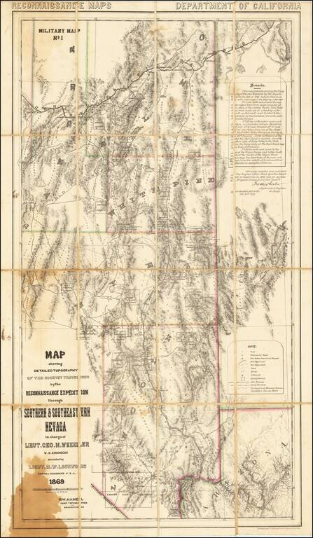
A Nevada & Grand Canyon Rarity -- The Foundation Map for Southern Nevada A remarkable map of the Eastern Half of Nevada, including Las Vegas, the Grand Canyon, Great Salt Lake and Sevier Lake (then called Preuss Lake), being the first scientific...
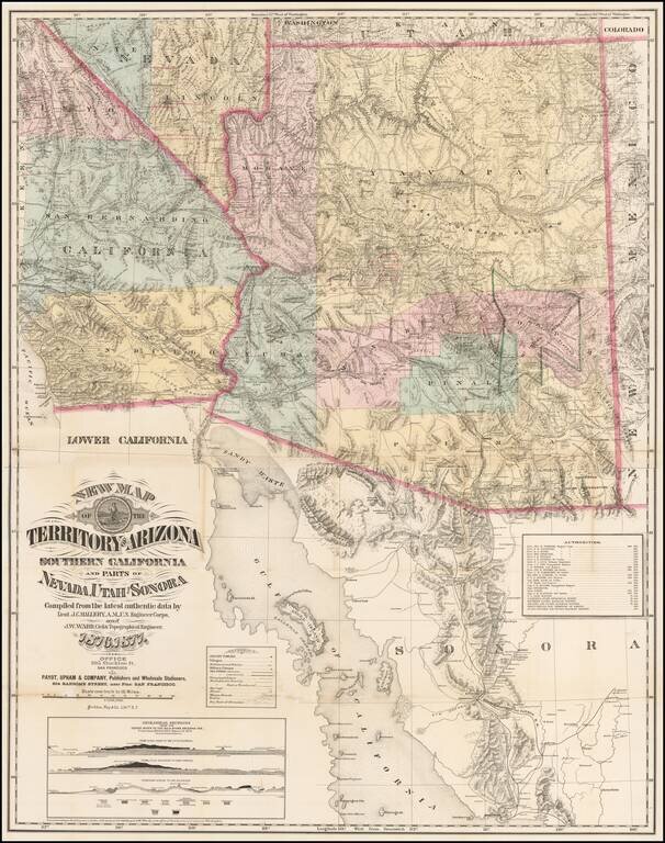
The Finest Large Format Map of Arizona, Southern California and Southern Nevada from the 1870s. Large and striking map centered on Arizona with pieces of the adjacent states and territories, at a time when Arizona was undergoing a mineral boom, and...
Detailed map of California and the Southwest, colored by Counties.
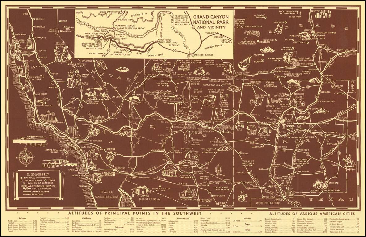
Scarce pictorial map of the American Southwest, published by Fred Harvey. The map provides a detailed pictorial image of the American Southwest, with an inset of the Grand Canyon. The verso includes a table of Indian Signs and Symbols, along with...
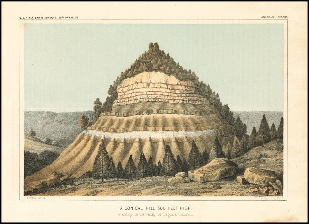
Detailed view of the Valley of the Kah Wee Yah River (Tulare River) and the Kings River. The expedition surveying the southern route along the 35th parallel, led by Lieutenant Amiel Weeks Whipple, explored from Little Rock, Arkansas, through Oklahoma,...
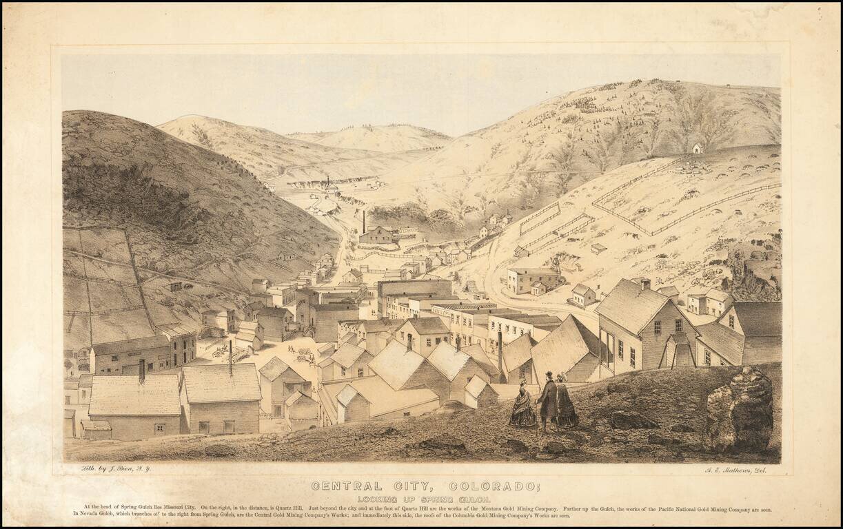
Nice example of this important early birdseye view of Central City, Colorado, from Alfred Edward Mathews Pencil Sketches of Colorado, published in 1866. The map shows Central City during its early boom period, looking toward Missouri City and Quartz...
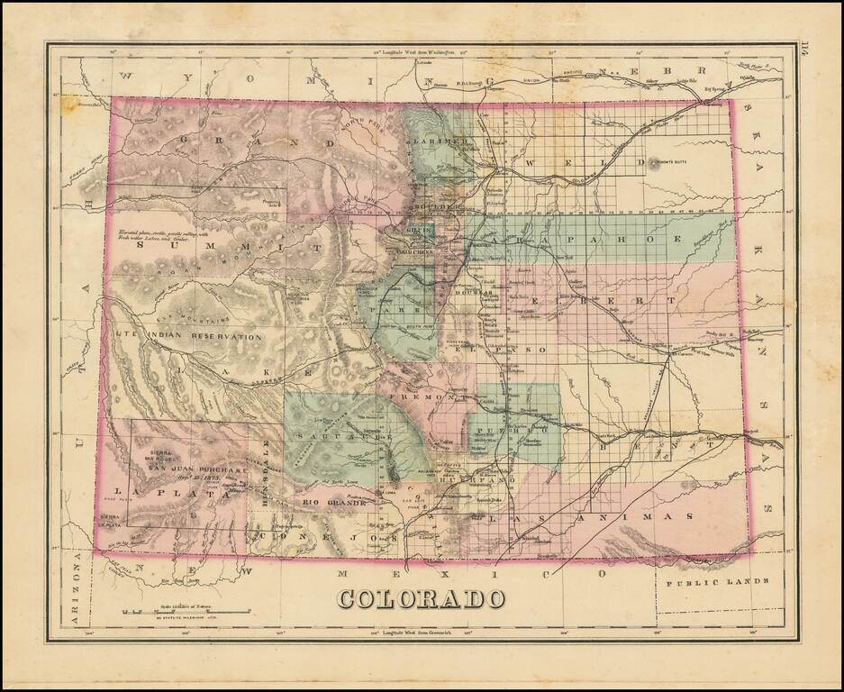
Interesting early map of Colorado, colored by counties. Shows towns, rivers, lakes, roads, mountains, and other details. In Southwestern Colorado, there is still no evidence of the coming mining boom which would be centered in areas such as...
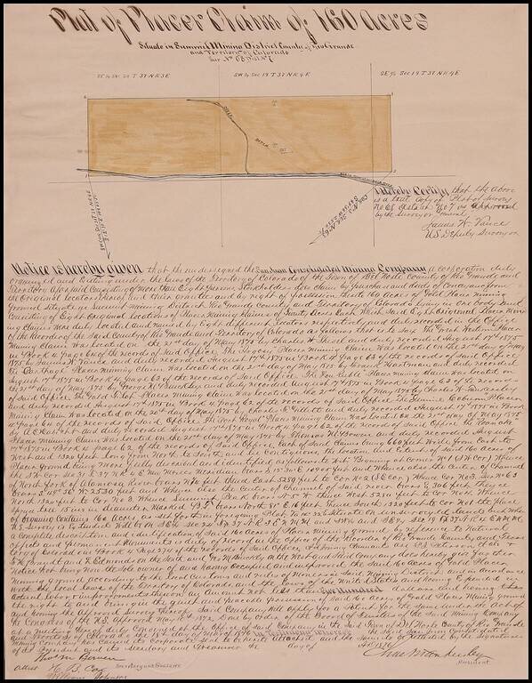
Fascinating manuscript survey issued by the San Juan Consolidated Mining Company, showing a plat of 160 acres north of the North Fork of the Alamosa River in Rio Grande County, Colorado Territory, signed by Thomas Meade Bowen, H.B. Cox and William...