
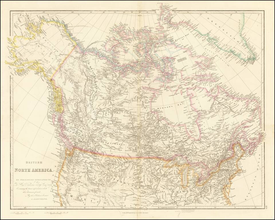
Detailed Map of British Possessions in North America—Rare Late Edition! Highly-detailed state of John Arrowsmith’s map of British possessions in North America, published in multiple editions between 1832 and 1859. This is a late edition, from the...
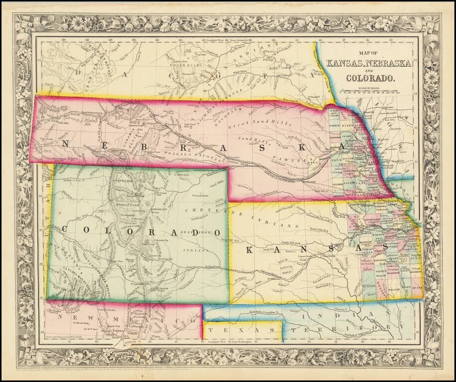
Excellent early map of the regional map of the Plains and Rocky Mountains, published by S.A. Mitchell Jr. Kansas counties cover only the eastern third of the state. Nebraska counties cover only a very small fraction of the state, which stretches all...
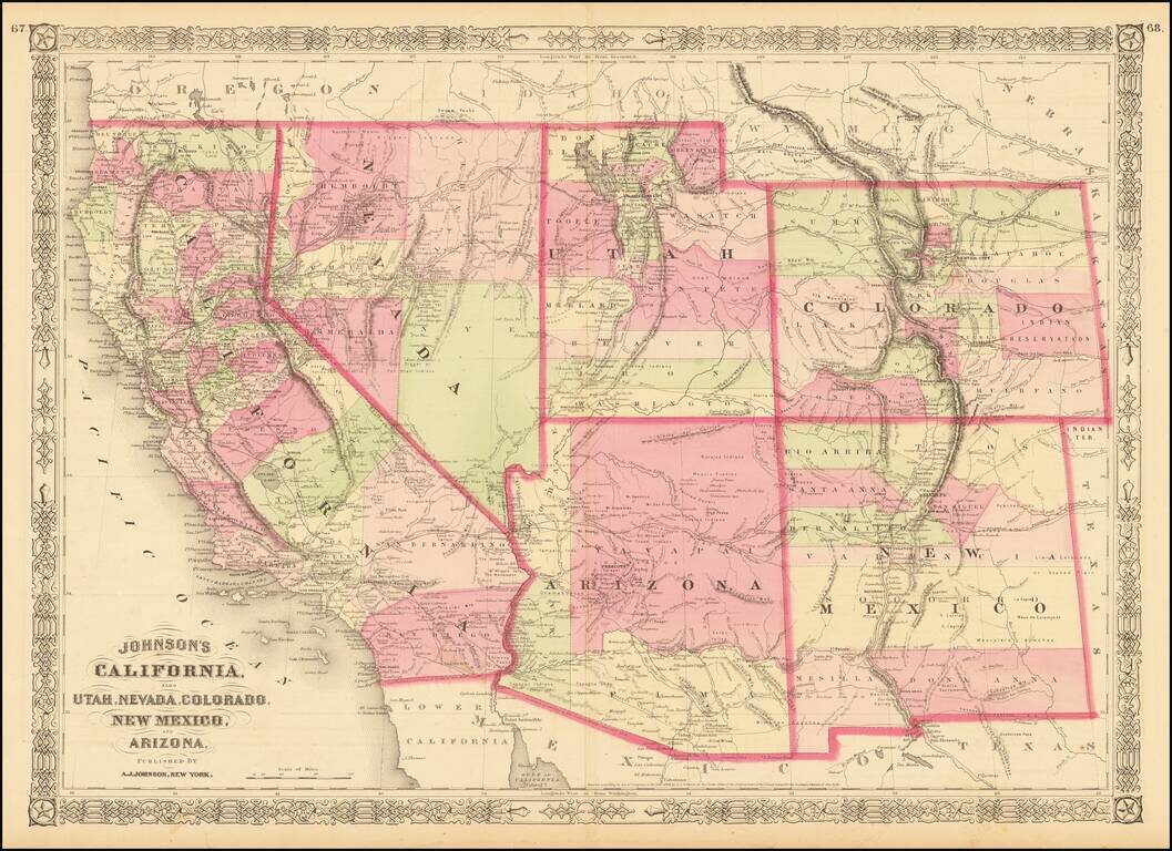
Interesting map of the southwest, hand colored by counties and showing a number of interesting territorial anomalies. Nevada has its lower corner truncated, leaving Las Vegas in Arizona. Nevada is truncated at the bottom. In each of the states and...
![Map showing the scene of General Hancock's operations in the Indian Country, the Forts, Military Stations, Pacific Railroads, etc. [Harper's Weekly. June 15,1867]](/map/small/70224.jpg)
Fine map of the Western United States, published in Harper's Weekly The map focuses on General Hancock's military operations against the Native Americans in Indian Territory. The map highlights the the forts, military stations, and railroads in the...
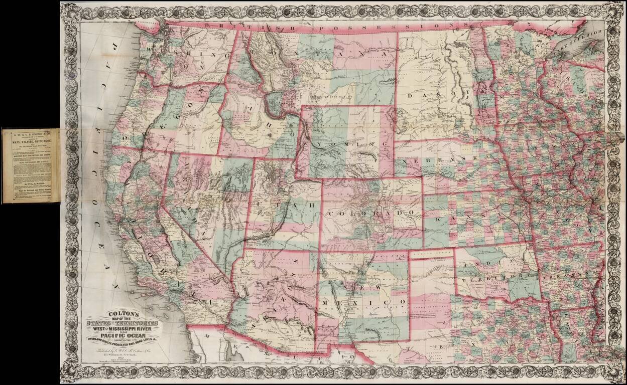
Large scale pocket map of the Transmississippi West. Fine example of Colton's large format map of the West, colored by Counties and focusing on the projected railroad lines west of the Mississippi River, shortly before the first appearance of...
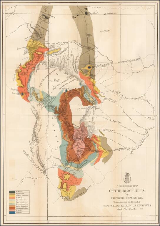
Important early geological survey map of the Black Hills region, undertaken by William Ludlow, while under the command of George Custer. In 1874, a large group of cavalrymen under the command of Lt. Col. George Armstrong Custer moved into the Black...
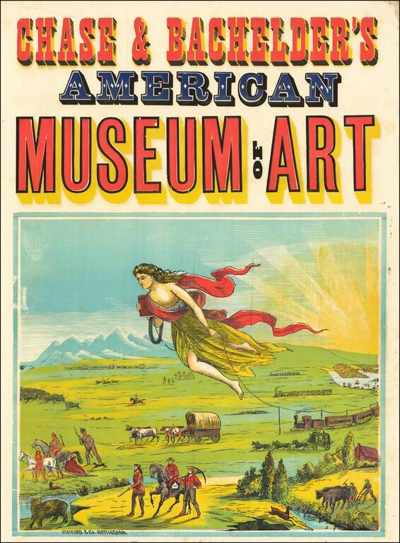
Fulfilling America's Manifest Destiny One of the earliest travel or travel-related posters ever created and also the wellspring of all future American travel images. An allegorical figure leads trains, covered wagons, coaches and prospectors across...
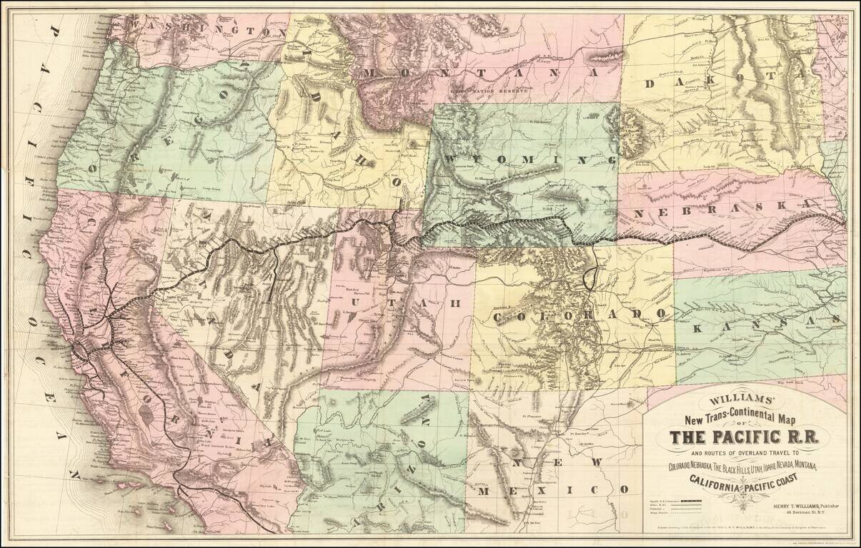
Rare first edition of this striking large format map of the West, published by Henry T. Williams, with handwritten notes, including a note relating to the notorious stagecoach robber, Black Bart, who operated in northern California and southern Oregon...
![[Union Pacific Railway Map]](/map/small/55008.jpg)
Fine large format map of the routes of the Union Pacific Railroad, published in May 1885 by Rand McNally & Company. The map is colored by counties and locates rail lines, stations and other details. The wide black lines locate the lines of the...
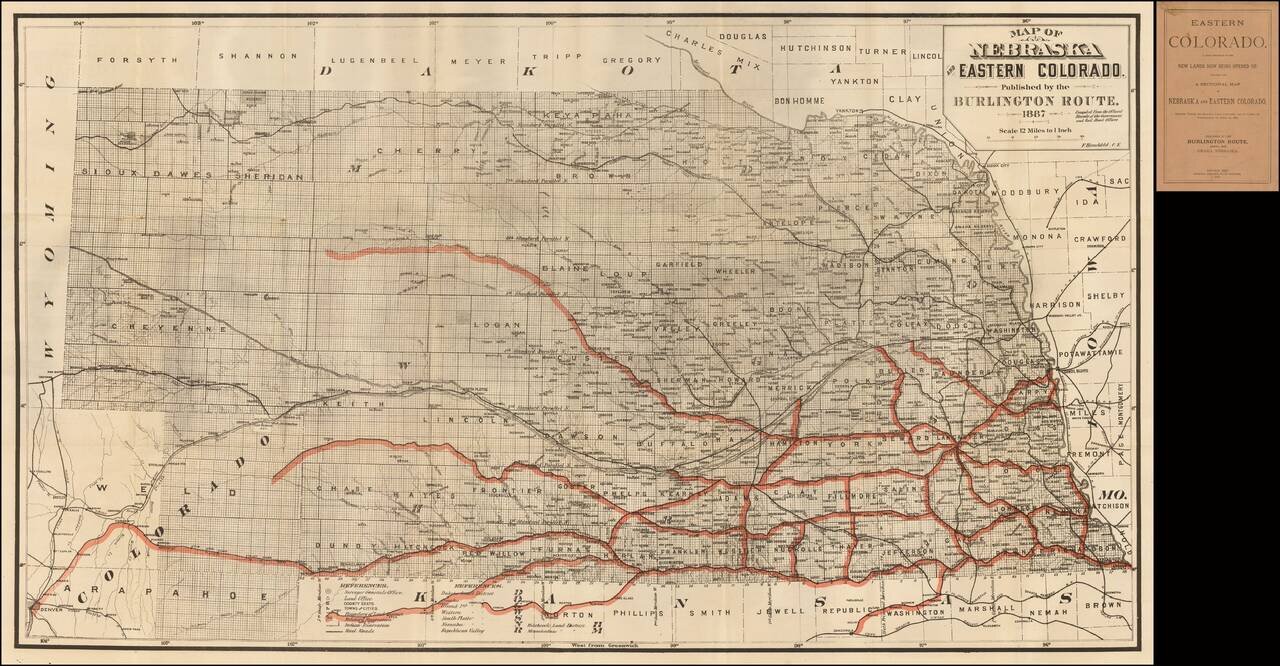
Fine railroad promotional map, stretching from Denver, Ft. Collins and Cheyene in the west to the Missouri River. Scarce promotional booklet for lands being opened up by the Burlington Route of the Chicago, Burlington & Quincy Railroad Company....
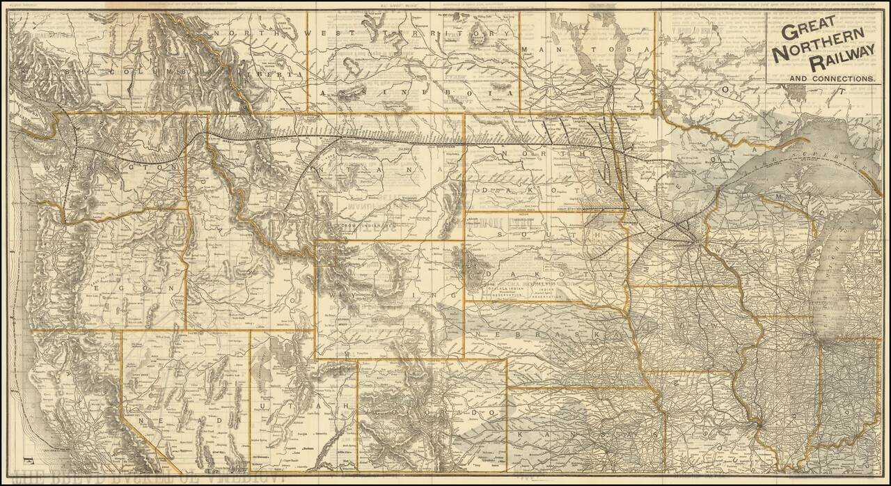
The Bread Basket of America! -- You Are Not Going To the Frontier! Fine large promotional map for the Great Northern Railway, promoting the Government lands available in the Red River Valley. The map shows the railroad lines of the Great Northern,...
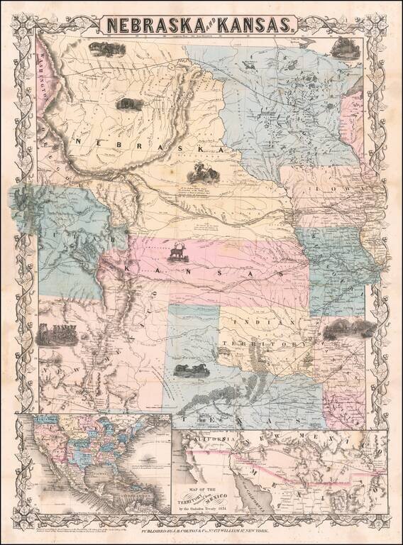
First edition, second state of this rare and important separately issued map of Kansas and Nebraska, published by J.H. Colton in New York. Colton's map is the first printed map to show the configurations of Nebraska and Kansas after the creation of...
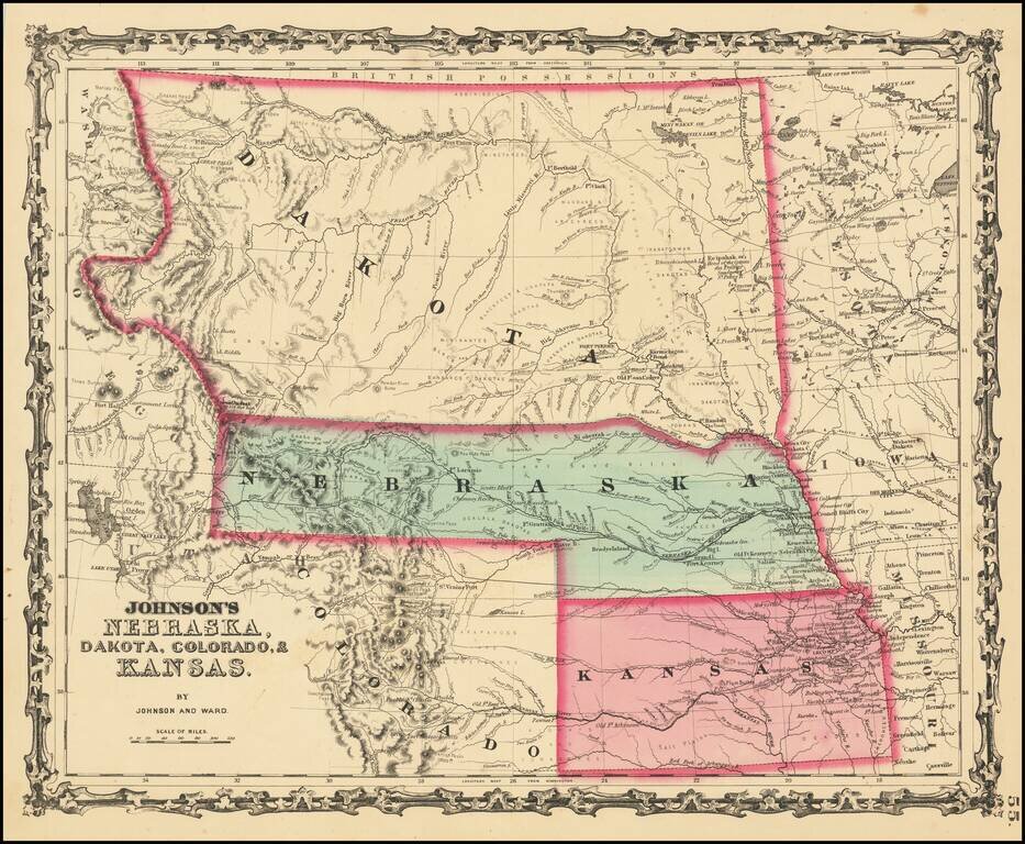
Massive Dakota Territory -- Pre-dating Wyoming and Montana. This is the third map in the series of Johnson's maps of this region and the first to include Colorado. Kansas gives way to Colorado, Nebraska is truncated by Dakota, but still extends to...
Excellent early map of the region, including an early appearance of Idaho Territory, one of the earliest appearances of this Territory (formed March 1863), on a printed map. Kansas counties cover only the eastern third of the state. Nebraska counties...
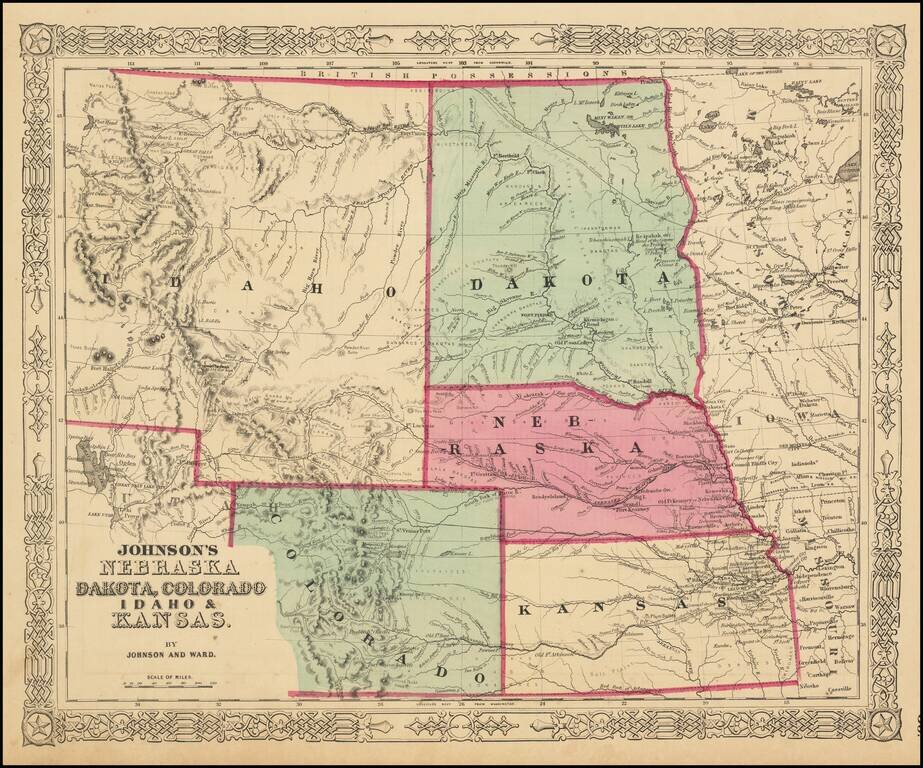
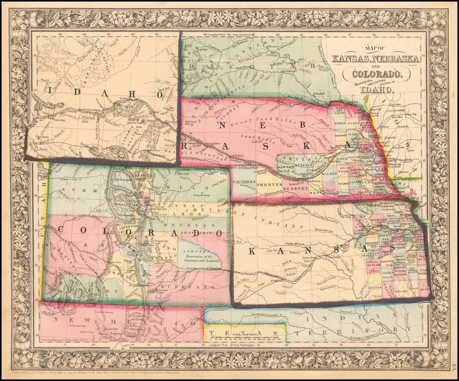
The Earliest Appearance of Idaho Territory--Including The Future Montana & Wyoming Territories Third in series of Johnson maps showing evolution of the mapping of these western territories. The most notable feature of the map is the massive...
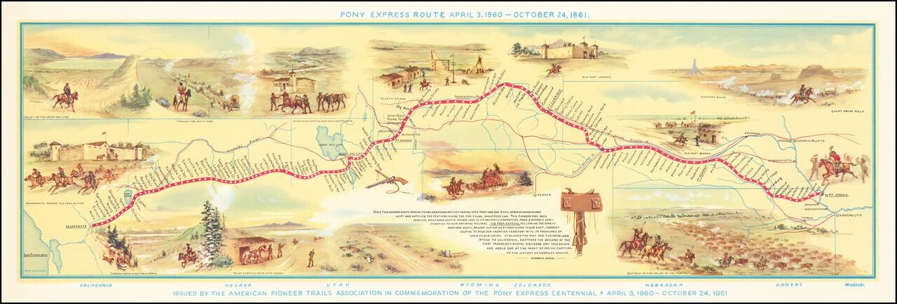
Fine pictorial map of the Pony Express Route, issued by the American Pioneer Trails Assocation in to commemorate the Centennial of the Pony Express. As noted by David Rumsey: Shows route of Pony Express with names and location of relay stations....