
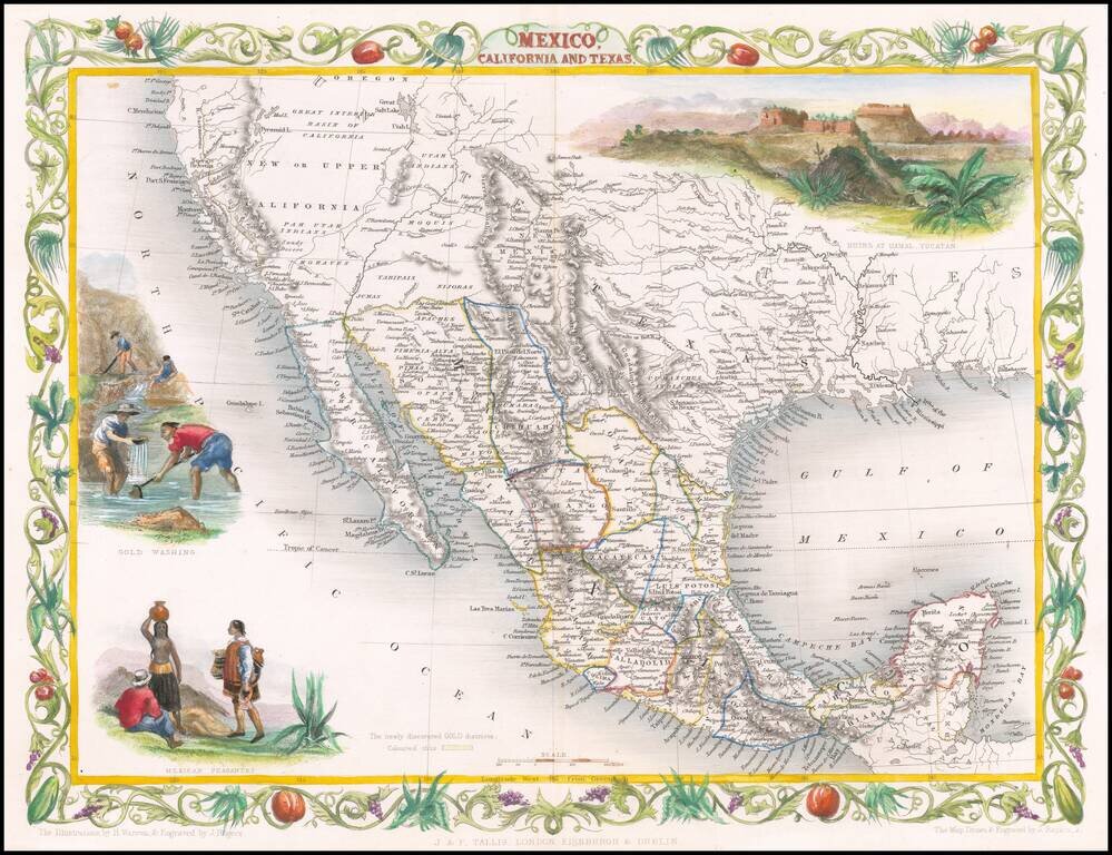
Decorative regional map of the Texas, California and the Southwest, featuring Texas in its Republic configuration, with Stovepipe reaching to Wyoming and Colorado. This is the second edition of the map, which includes the Gold Washing vignette not...
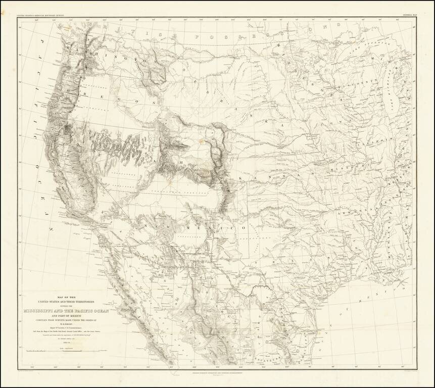
Emory's Map of the Transmississippi West. Marvelously detailed map of the Western Territorial US, published by W.H. Emory in his Report of the United States and Mexican Boundary Survey. The map is one of the fundamental post-Gadsden Purchase maps of...
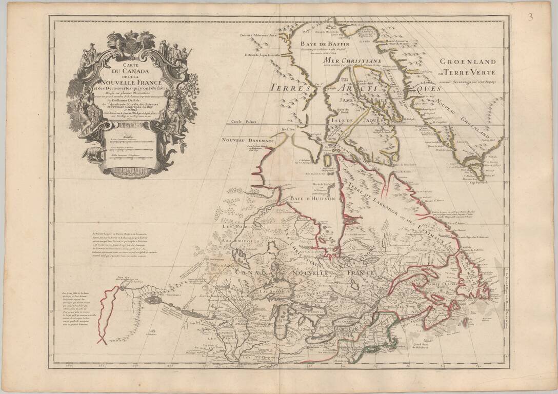
Seminal Early Map of Canada & The Great Lakes -- One of The First Maps To Reference The Rocky Mountains Nice example of Guillaume De L'Isle's map of Canada, the Great Lakes and Upper Midwest, one of the most important and influential maps of...
![Amer. Sep. No. 33. Partie De La Nouvelle Bretagne (Upper Missouri River, Lake Winnepeg, Lake of the Woods and Saskatehawan River]](/map/small/41687.jpg)
Large format map of the region, centered on Lake Winnepeg and showing Riviere Skatehawan ou Fleuve Bourbon in the Northwest, the Missouri River and Assinniboines in the Southwest, Nenawecouhen and Lake Pike in the Northeast and the Lake of the Woods...
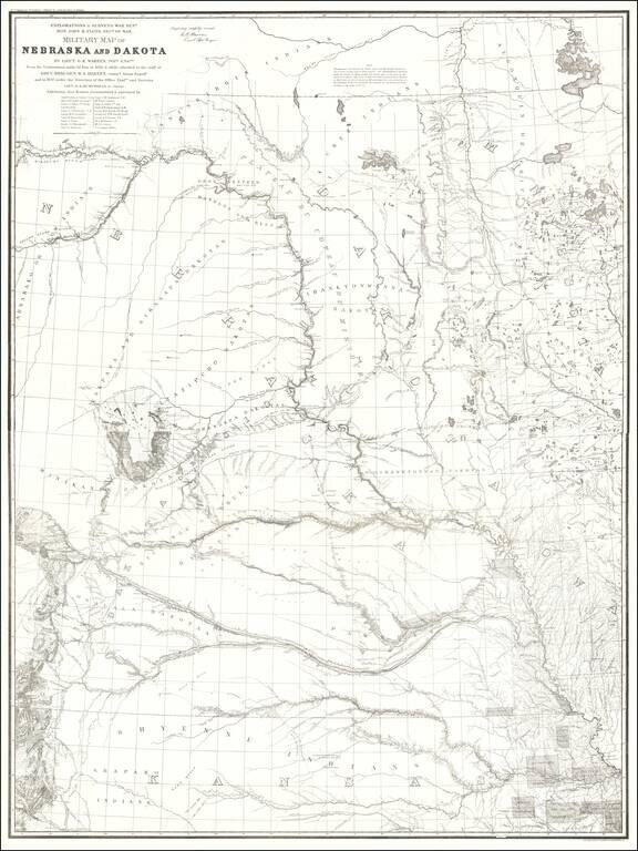
1875 Edition of Warren's Pivotal Map of the American Plains -- Early Reference To the Colorado / Kansas Gold Regions 1875 edition of Gouverneur Kemble Warren's large format map of Kansas, Nebraska, Dakota and part Colorado and Wyoming, based upon...
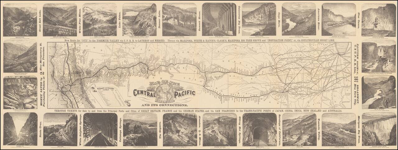
Decorative map of the route of the Central Pacific from the midwest to San Francisco, illustrated with 24 images of the west, primarily of California and Nevada. Decorative and highly detailed map, with vignettes of major points of interest in the...

Rare pictorial map of the Mormon Trail, published by American Pioneer Trail Association. The map includes lively historical vignettes focusing on the early history of the West, Mormon Battalion and Mormon Settlers. "Issued by American Pioneer Trails...
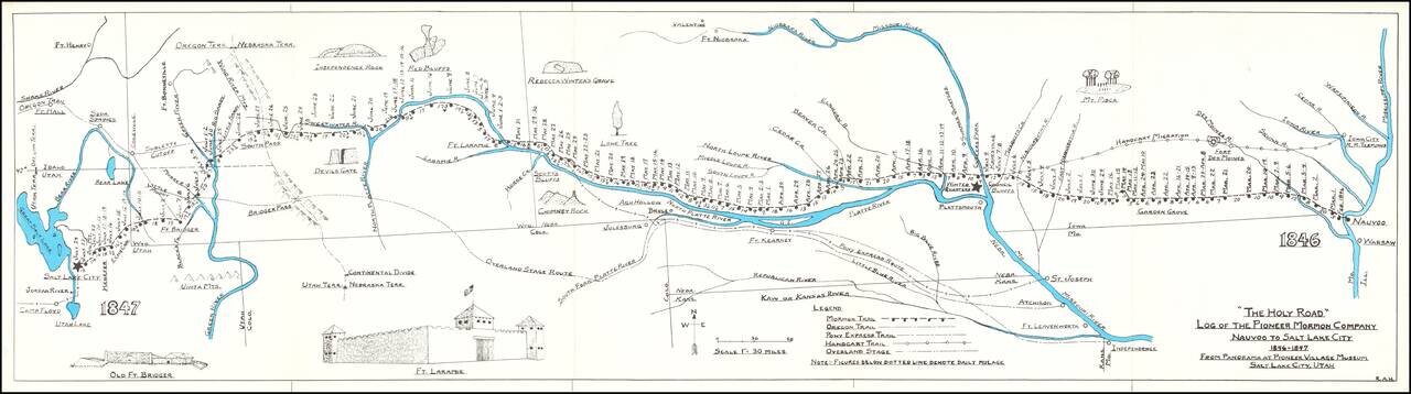
Rare historical / pictorial map of the Mormon Route from Navoo to Salt Lake, drawn by Robert A. Hanson. The map was likely published by the Western Cover Society, a California based society which published the Western Express. Hanson's maps were...
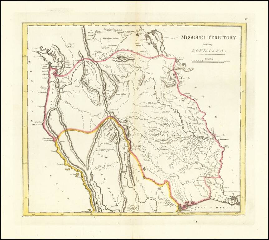
The First American Atlas Map of the Transmississippi West -- Based Upon Lewis & Clark's Reports Nice example of Mathew Carey's highly important map of Missouri Territory. Published shortly after the return of Lewis & Clark, Mathew Carey's...
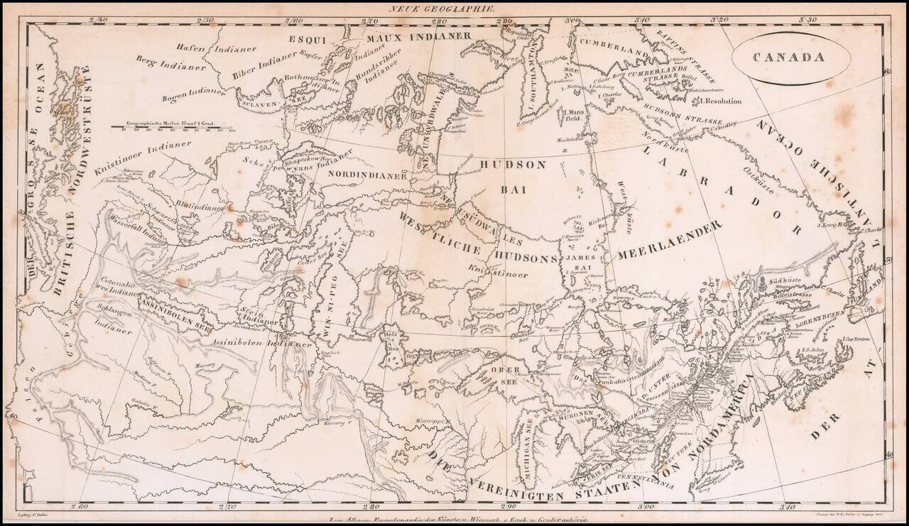
Rare early 19th Century map of Canada, from coast to coast, published in Germany. The map focuses on the drainages of the various rivers and lakes, centered on the Win-ni-peg See. Includes excellent treatment of the Lakes and Rivers. The map extends...
![[Western Territory]](/map/small/68666.jpg)
Antique Map of the Plains and Indian Territory, Extending the Rocky Mountains Rare and important map from the 1835 Dodge-Kingsbury expedition (only 500 copies printed). The map identifies place names as far west as Santa Fe New Mexico, Pike's Peak...
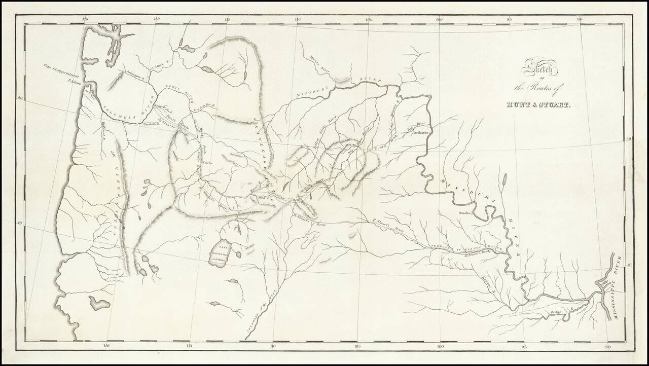
St. Louis to Astoria, Oregon in the 1810s—the Hunt and Stuart Expeditions Intriguing early map of the routes of Hunt and Stuart, two of the earliest American overland travelers, immediately following Lewis and Clark. The map illustrates Wilson...
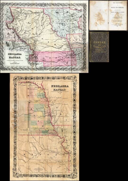
First edition of this fine early guide book to Kansas Territory and Nebraska Territory by Joseph F. Moffette, embellished with rare variant editions of two maps of Kansas and Nebraska, published by J.H. Colton & Company in New York. Pocket guide...
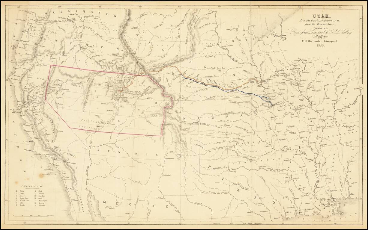
The Only Contemporary Map of the Mormon Trail. Rare hand-colored lithographed antique map of the American West focusing specifically on the routes by which Mormon's could reach Utah from points on the Missouri River. As such, it is the only...
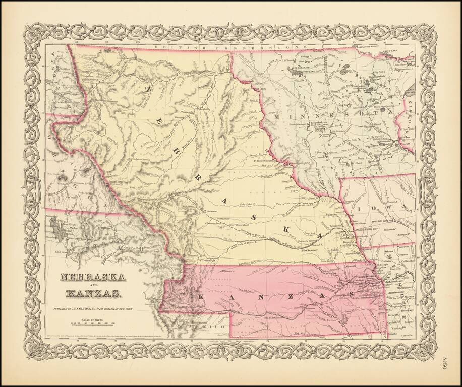
First State of Colton's Map of Kanzas and Nebraska Colton's highly sought after regional map of Nebraska and Kanzas, first published in 1855. Nebraska extends to Canada and the Rockies, taking up large portions of Montana, Wyoming and Utah. Kanzas...
![Territory of Nebraska [includes parts of Montana, Wyoming, Colorado and Dakota]](/map/small/66957.jpg)
Rare map of the Territory of Nebraska, from Rogers & Johnston's Atlas of the United States. Rogers & Johnston's map is the only commercial atlas map to show Nebraska Territory on a single map. The map was derived from the monumental and...