
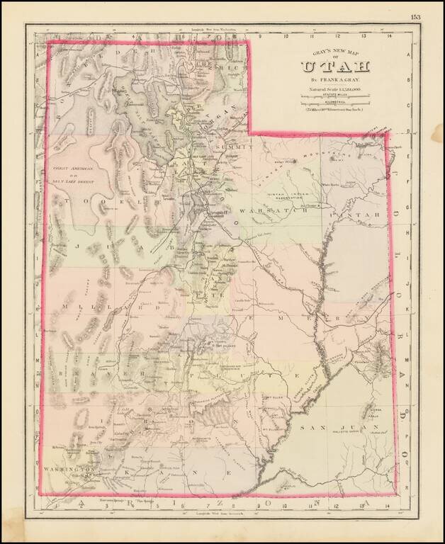
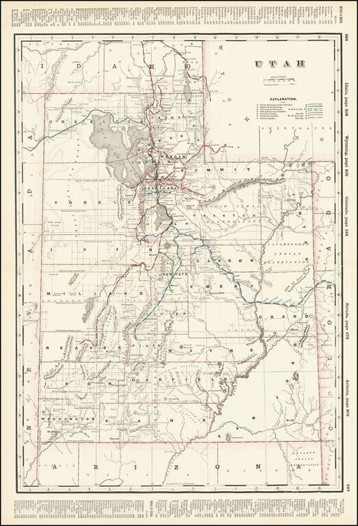
The First Atlas Map of Utah Territory in its Modern Configuration. Historically important early map of Utah, published by OW Gray. The map is colored by counties and showing early roads, rivers, mountains, railroads, mines, Indians, forts, etc....
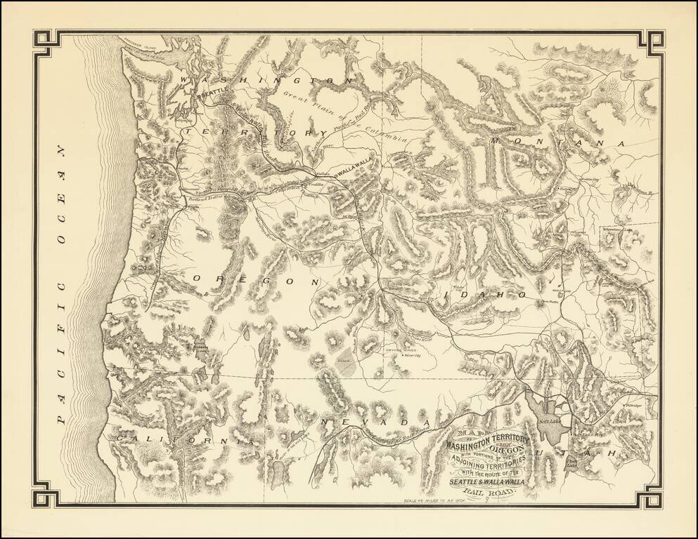
The First Map Printed in Seattle -- Seattle & Walla Walla Rairoad Map With Manuscript Corrections Likely In the Hand of the Maker Fine example of this rare map of the Pacific Northwest, illustrating the proposed route of the Seattle & Walla...
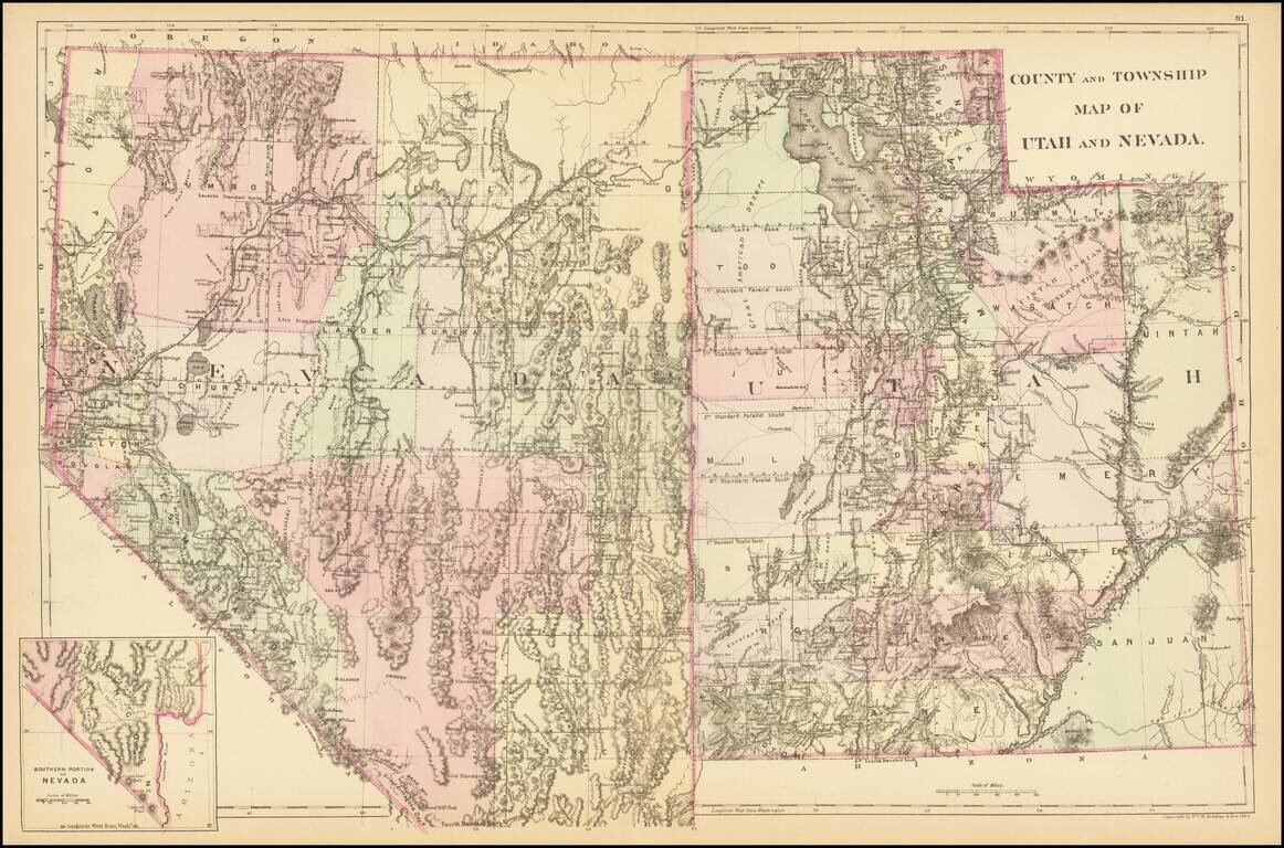
A detailed map of Utah and Nevada, colored by counties and showing towns, roads, railroads, rivers, lakes, and a host of other details. While earlier editions of the map include all of Utah but lack the southern tip of Nevada, this 1884 edition adds...
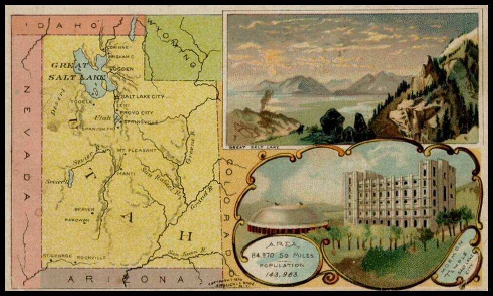
Decorative and unusual trading card map from this famous series. Map is surrounded by decorative vignette, showing Great Salt Lake and Mormon Temple. Includes population statistics.
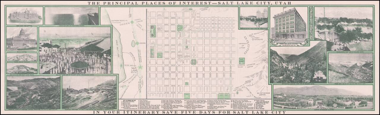
Decorative promotional map of Salt Lake City, published by the Wilson Hotel. The map includes an extensive promotional tract on the verso and a number of early photographs on either side of the map.
Detailed map of Utah, published in Rand McNally's Business Atlas. The map shows railroads, towns, cities mountain ranges. Includes significant progress in the General Land Office township surveys. A list of 8 railroads is shown at the top right.
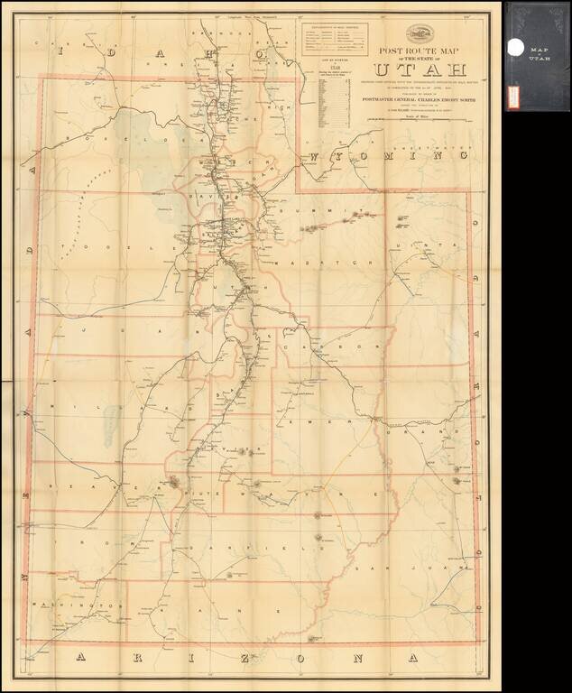
Highly detailed map of Utah, focusing on the post roads and postal details as of June 1899. All the post offices and discontinued post offices in Utah are noted. The routes on the map are color coded to note delivery schedules, including: Purple:...
![[Heavily Annotated] Great Shoshone and Twin Falls Water Power Company Map Showing Location of Power houses, Substations and Transmission Lines](/map/small/62919.jpg)
Heavily Annotated Blue Print Copy of One of the Earliest Large Scale Hydro-Electric Power Companies in Idaho Wall map of a portion of the Northwestern United States, centered on Twin Falls and Shoshone Falls, illustrating the area proposed to be...
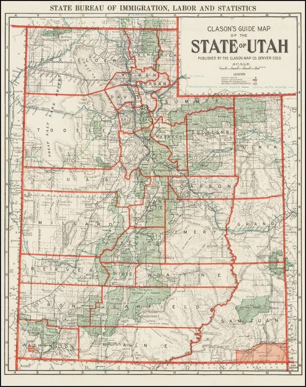
Rare Early Automobile Road Map of Utah Scarce map of the state of Utah, published by Clason for the Utah Bureau of Immigration, Labor and Statistics. The map shows County Seats, County Boundaries, Townships Unsubdivided and National Forest...
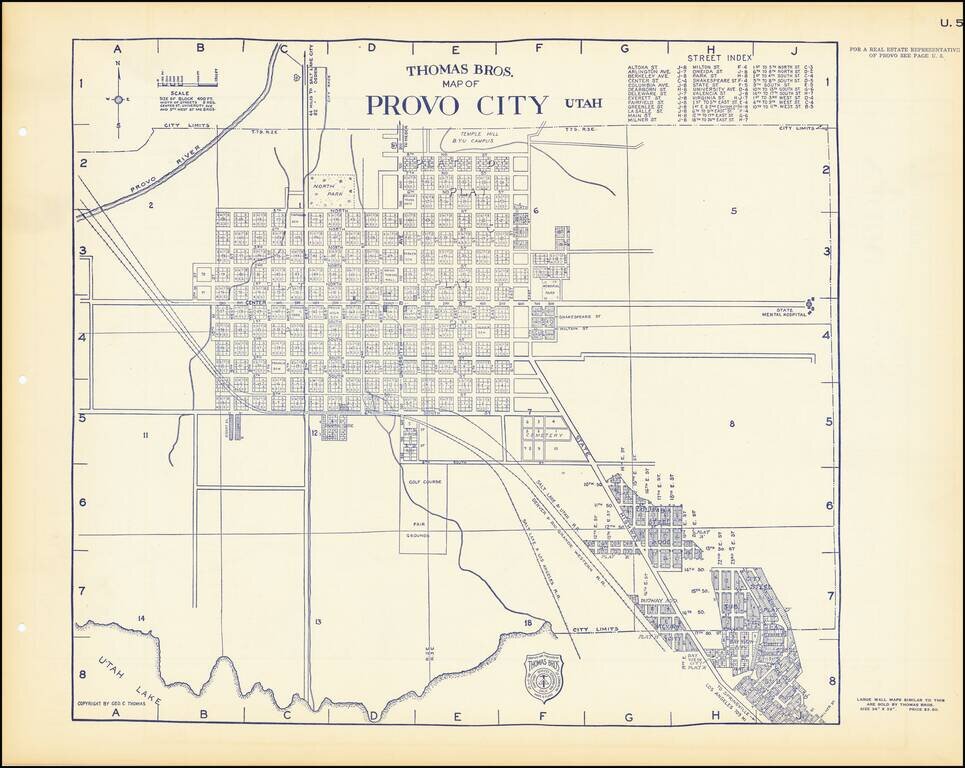
Detailed maps of Ogden and Provo, Utah, published by one of America's leading 20th Century map firms.
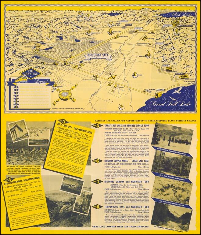
Fine promotional view map of Salt Lake, published for The Grayline. The Legend identifies 8 different tourism lines within the city.
Detailed map extending from Bridger's Pass in the north to New Mexico, centered on the Sawatch and Wasatch Mountains. Shows proposed railroad line through Bridger Pass in Northeast Utah Territory, including parts of present day Colorado and Wyoming...
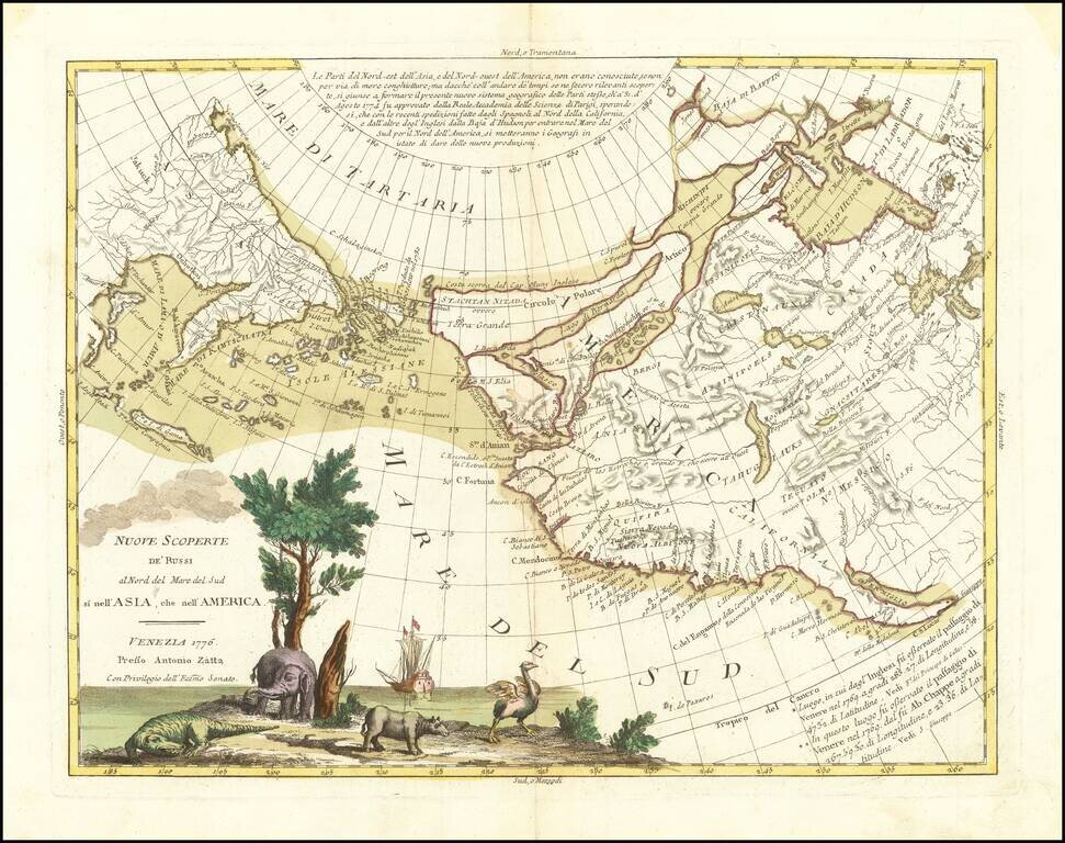
An Ostrich, An Elephant and the Northwest Passage! Striking example of Zatta's map of the northern Pacific Coastal regions and one of the best illustrations of a late rendition of the Northwest Passage, here illustrating two wide passages from the...
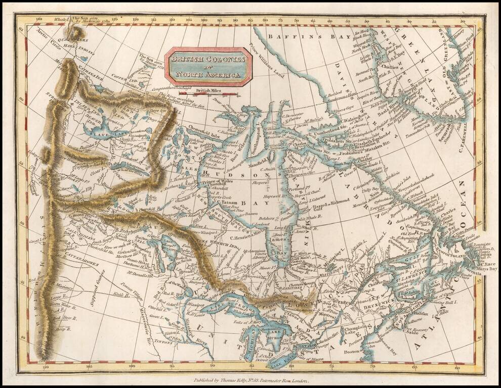
Scarce map of Canada, extending west to the Rocky Mountains and the MacKenzie River. Perhaps the most interesting feature is the depiction of the headwaters of the Missouri River. Here, the map incorporates the reports of Peter Fidler for the Hudson's...
![[Montana, Calgary, Edmonton, Saskatchewan] Amer. Sep. No. 32. Partie De La Nouvelle Bretagne](/map/small/54847.jpg)
Highly detailed map, extending from the area around Kalispell Lake and Flathead Lake, Montana in the southwest, to Calgary and Edmonton to the north and Prince Albert Saskatchewan in the northeast. The map includes a number of early factories of the...
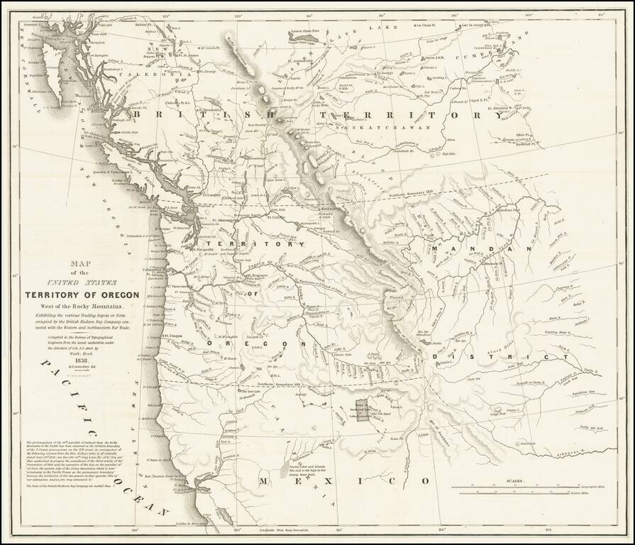
Important Map Showing Oregon Territory used during Congressional Debates about the Status of Oregon Country Hood's landmark map of the Oregon Country was integral to political debates about the area, its place in the growing United States, and its...