Map size in jpg-format: 33.5113MiB
Click to open in high resolution (open in new tab).

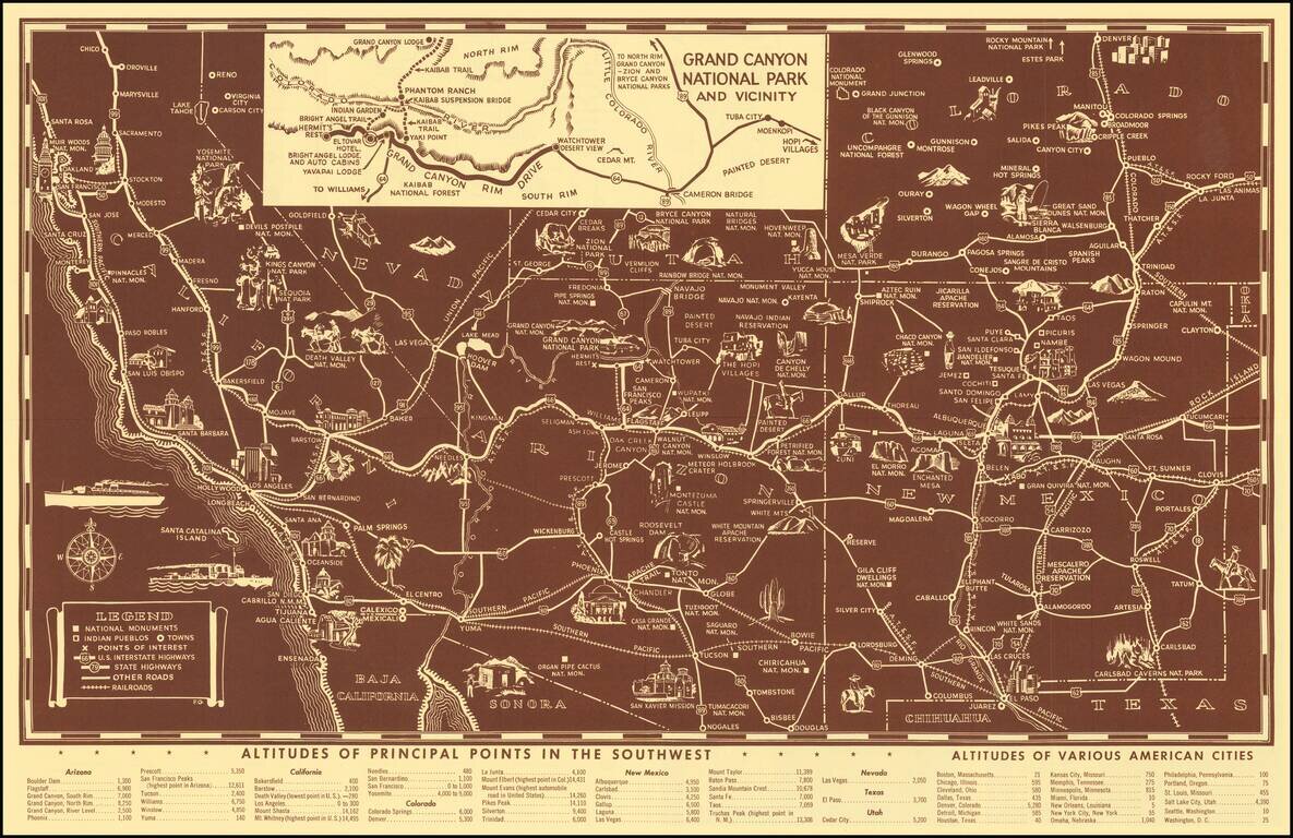
Scarce pictorial map of the American Southwest, published by Fred Harvey.
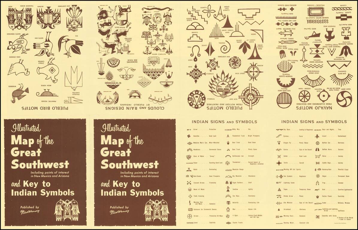
The map provides a detailed pictorial image of the American Southwest, with an inset of the Grand Canyon. The verso includes a table of Indian Signs and Symbols, along with pictographs showing:
Fred Harvey Company
British immigrant Fred Harvey approached the Atchison Topeka & Santa Fe in 1875, with an idea to open trackside eating houses along its expanding line. The novelty of serving fresh, edible food to travelers appealed to the AT&SF, which was ultimately looking to attract enough business to fund the line's expansion all the way to the Pacific Coast.
In 1876, the first Harvey House opened in the Topeka, Kansas train station to instant success. The eating house's popularity led to speculation that travelers refused to go farther than Topeka once they ate Harvey's food, thus necessitating more Harvey Houses down the AT&SF line. In reality, the railroad considered the eating houses as an advertising expense, and "Meals by Fred Harvey" became the slogan by which the small railway competed for transcontinental business. Through the 1930s, the AT&SF funded Harvey ventures throughout Kansas, Colorado, New Mexico, Arizona, and California, ranging from lunch counters to railway newsstands to luxury hotels.
Fred Harvey died in 1901, leaving his hospitality chain to his son Ford. An enthusiast of the southwestern landscape, Ford began making plans to build a hotel along the south rim of the Grand Canyon. His sister Minnie and her husband John Huckel encouraged Ford to incorporate the arts and culture of North American Indians living near the Harvey hotels and restaurants, to attract more travelers to New Mexico and Arizona. They established the Fred Harvey Indian Department in 1901, which hired Indian artist-demonstrators to weave blankets and make pottery and jewelry in an annex of the grand Alvarado Hotel in Albuquerque, New Mexico.
Although this practice is considered controversial, after the success of the Indian Building in Albuquerque, North American Indian artisans became central to Harvey and the AT&SF's advertising strategies. In 1905 they opened "Hopi House," advertised as an exact replica of a Hopi dwelling. On the grounds of the newly-opened El Tovar Hotel at the Grand Canyon, the attraction featured "Harvey Indians" who sat on display, making their crafts as tourists looked on.
The companies began offering Indian Detours in 1926, which took rail passengers in private "Harvey Cars", from rail stops in Albuquerque and Santa Fe into Indian Country, to see beyond the staged artist-demonstrators and into Indians' "real" lives. The all-female staff of tour guides wore the traditional Indian jewelry of squash blossom necklaces and silver concho belts, and the Detours' official logo was adapted from a New Mexico cave painting of a firebird.
If you are a student, write to us in telegram: @antiquemaps and indicate what material you need and for what work you need a map in high detail. We are ready to provide material on special terms. For students only!

![Mexique par Th. Duvotenay…1843 [Republic of Texas]](/map/small/67925.jpg)
